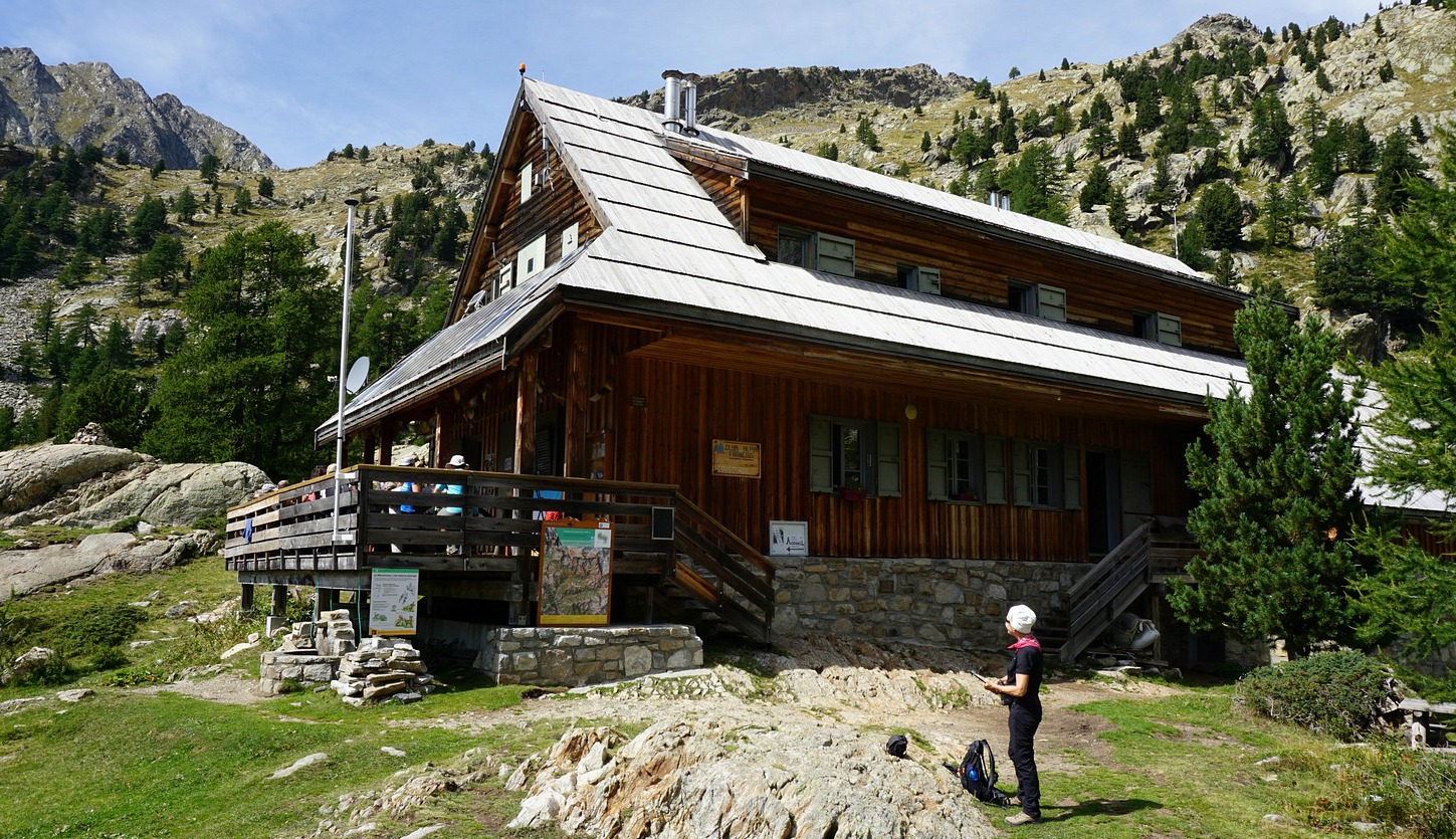
Mid-September, summer came back to the South of France. It seemed like a good idea to hike from Le Boréon above St-Martin de Vésubie to Refuge de Cougourde (2100 m). They serve lunch at the refuge till the end of September. All the supply is transported by donkeys from Le Boréon.
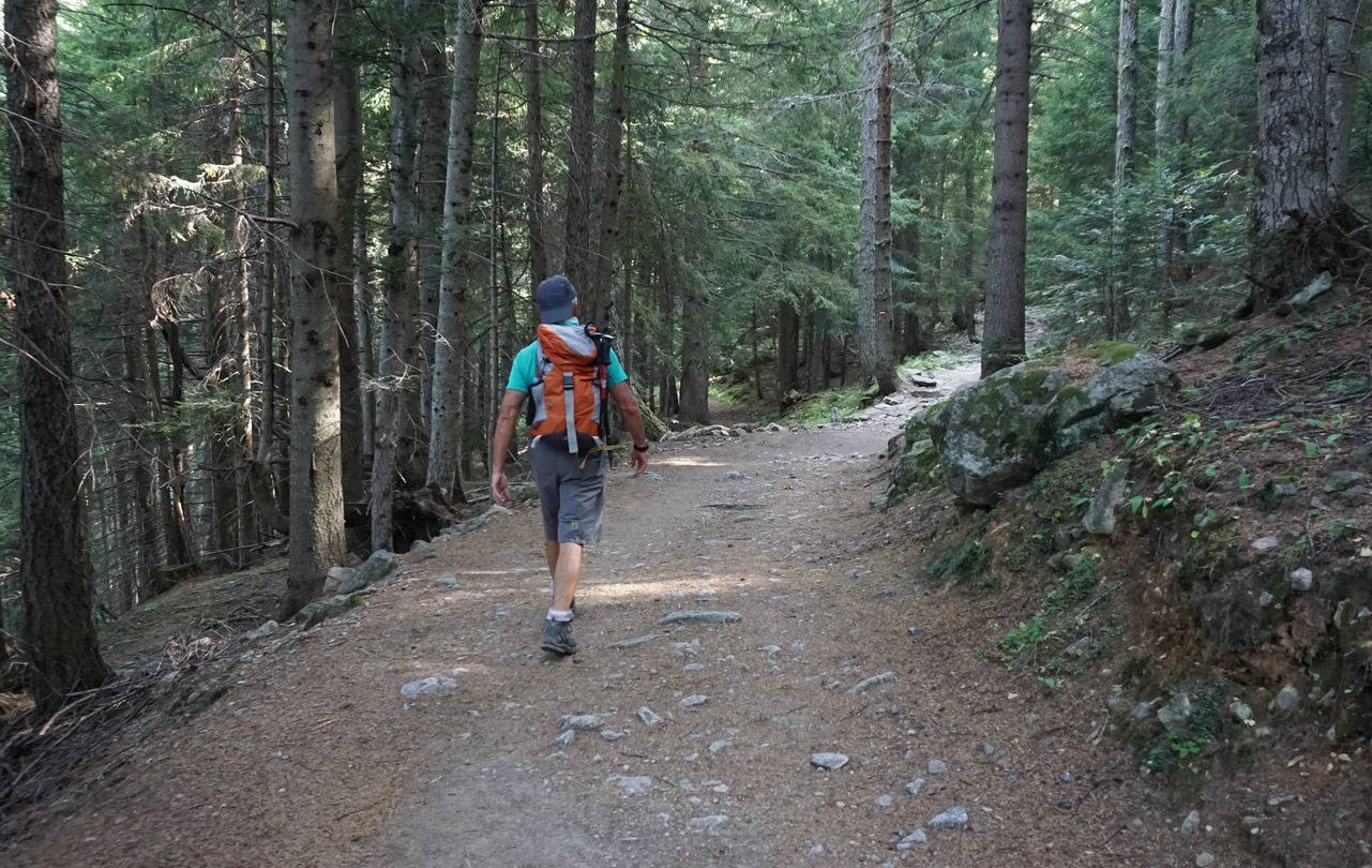
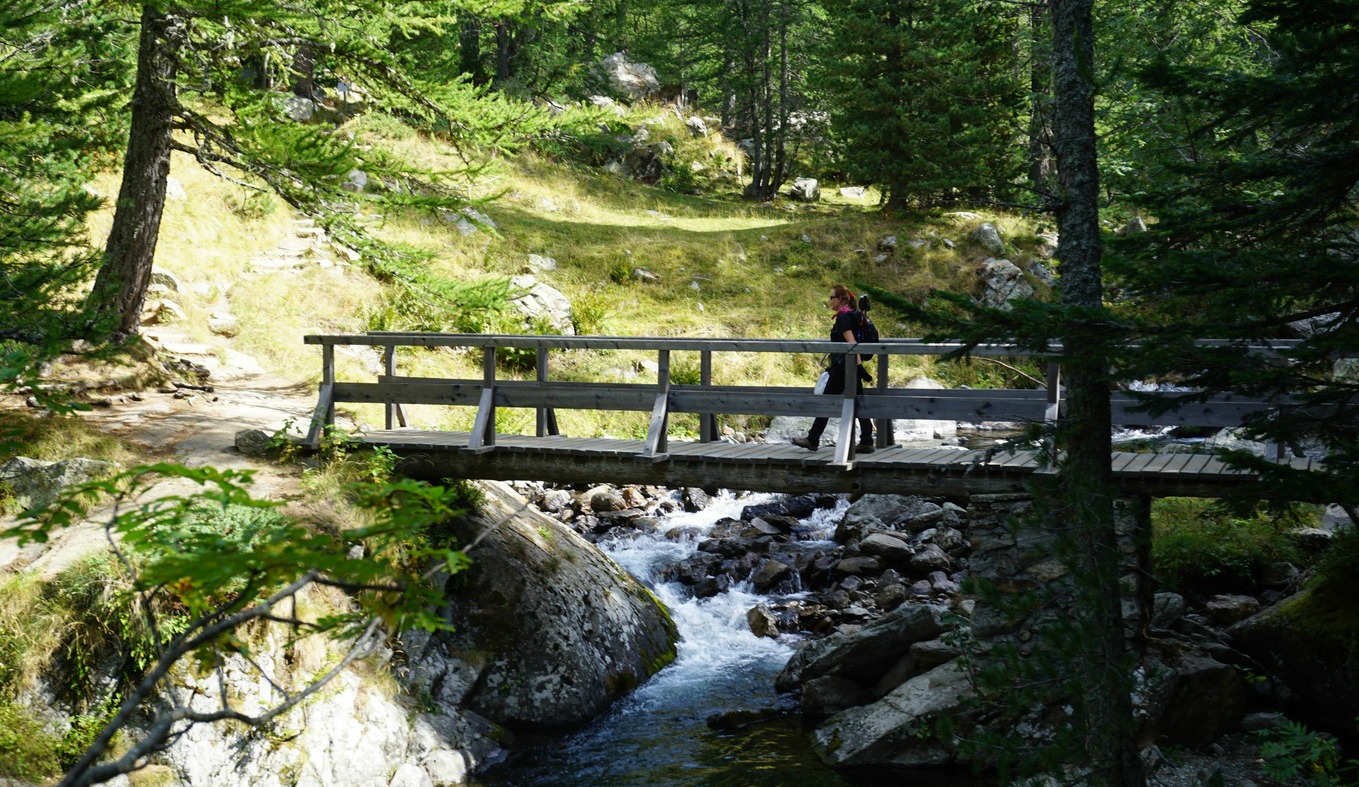
We drove to the upper parking of Le Boréon (1600 m) but had to find a spot a bit lower by the road as there was no space left. It was a gorgeous weekend. We ascended to the starting point of the trail which was also a GR52 itinerary as far as to signpost #425, hence well maintained and marked.
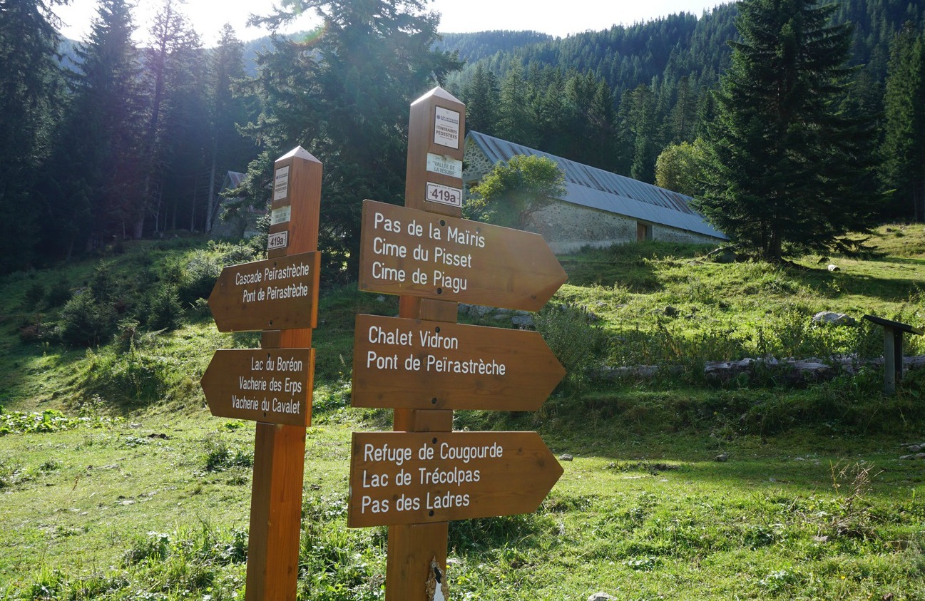
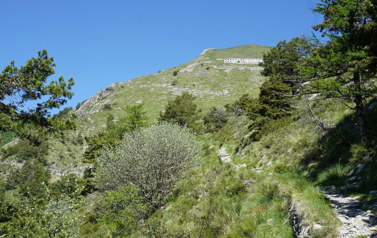
Ascending in the upper Boréon Valley, we passed familiar crossroads, first to Cime du Pisset and Piagu, then, higher up, the unmarked trail to the left to Lacs Bessons.
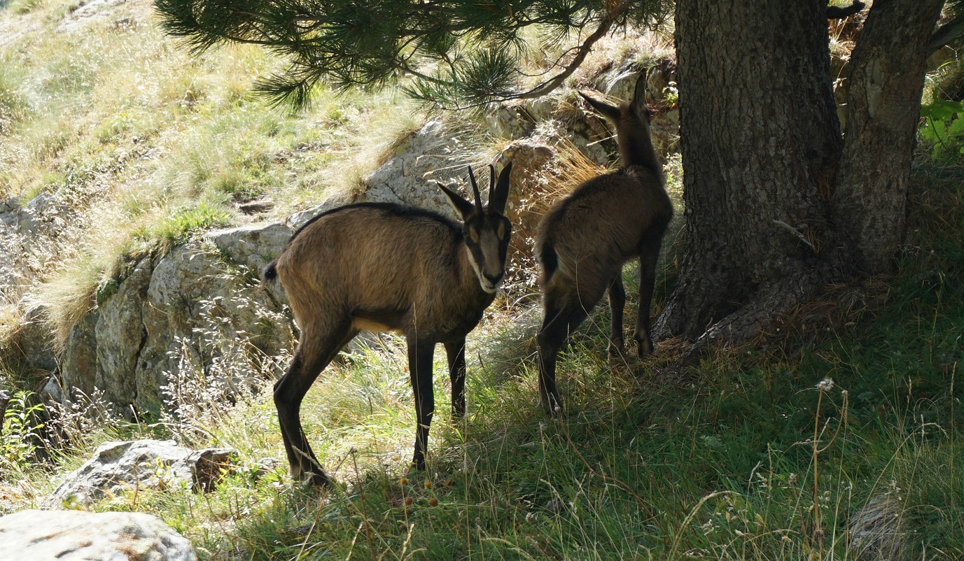
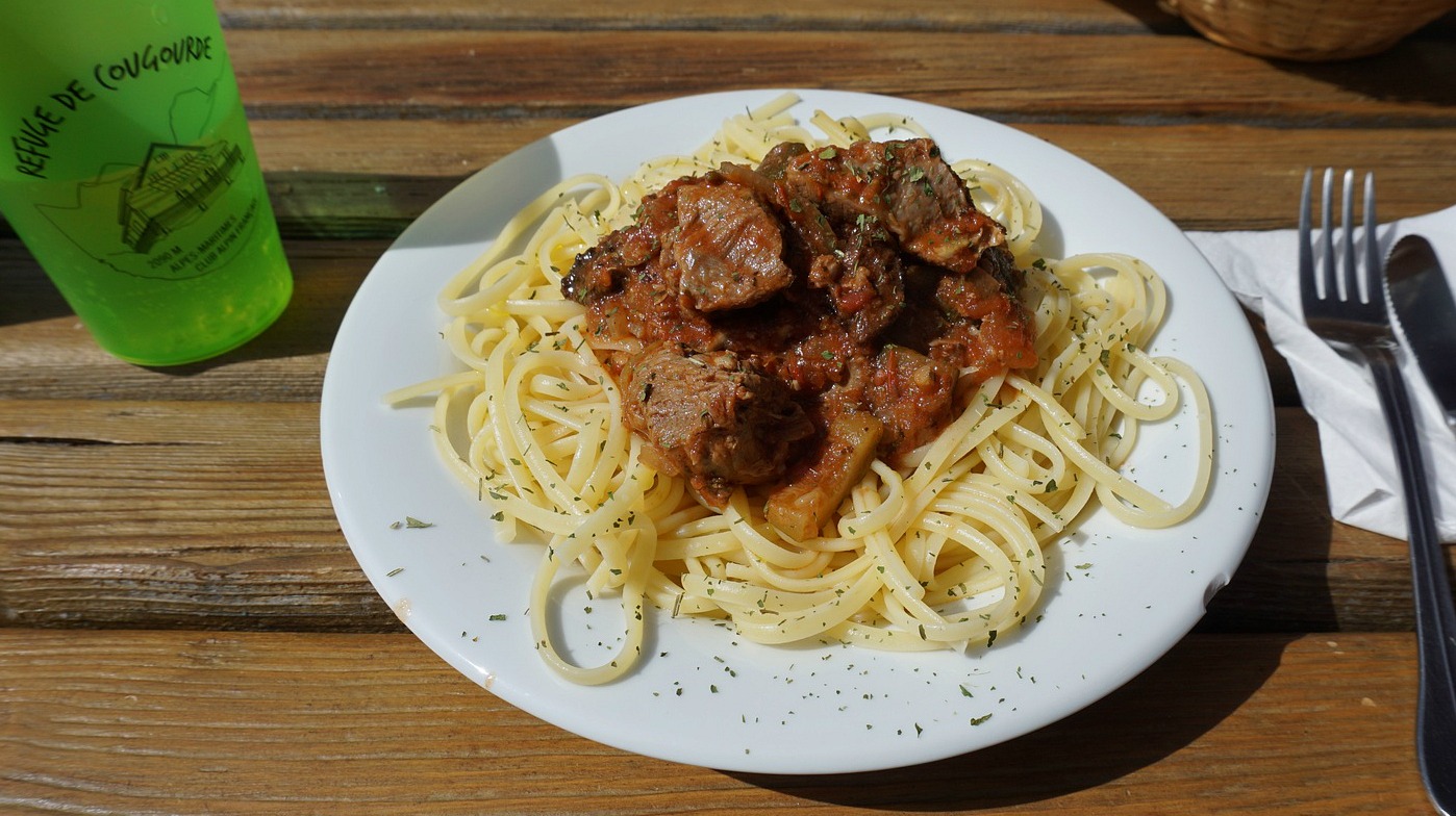
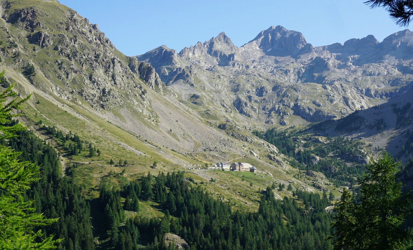
We reached signpost #425 and the crossroads to the refuge (forking left), and the GR52 to the Trécolpas Lake (right). From here, it took 25 minutes for us to reach the refuge. We saw several chamois that seemed to be quite used to hikers. It was lunchtime, and most tables on the terrace were already taken. Not surprisingly, the menu was limited but they served veal and pasta as plat du jour, which we opted for.
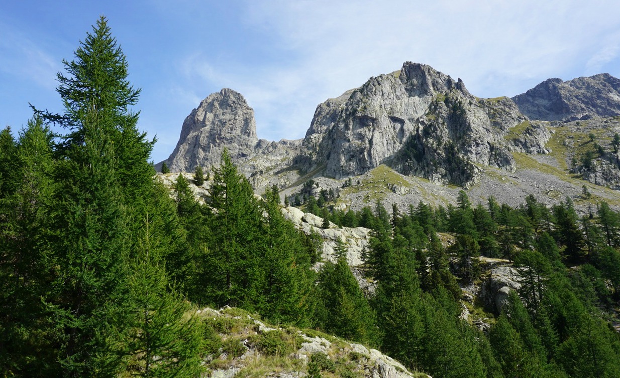
Surrounded by imposing peaks, the refuge is perfectly situated for a great high-mountain experience. Moreover, it can be reached with a moderate effort.
Climb: 500 m
Duration: 3h 10 active
Distance: 10 km
Map: IGN 3741 OT Vallée de la Vésubie

In the past, we have
made several good hikes from Madone de Fenestre (1820 m), such as Cime de la Valette de Prals. This time we wanted to make a shorter hike to the still
unexplored Mont Lapassé (2351 m). With a moderate effort, we were
rewarded by a super 360° panorama at the summit!
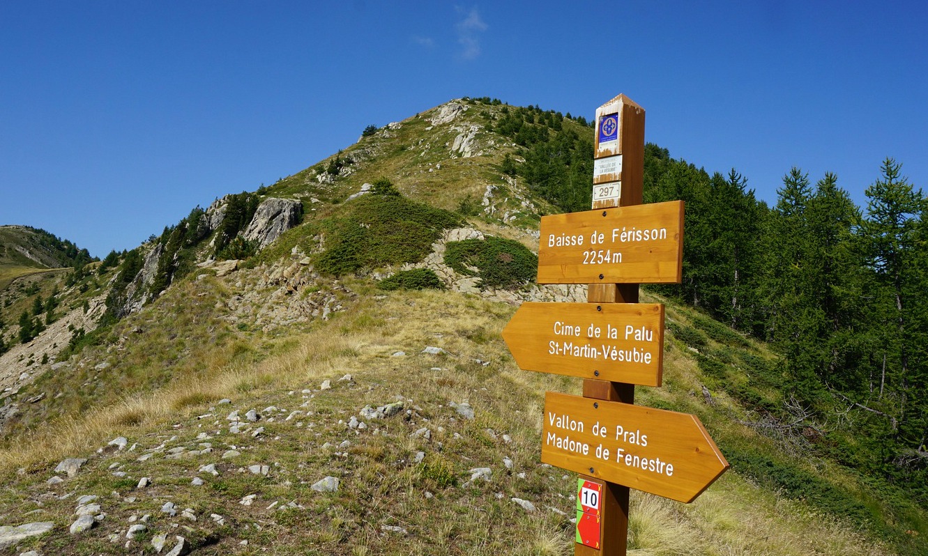
We started our hike from a small parking at 1790 m elev. by the M94 road, just below Madone de Fenestre. From here, we took a shortcut (140 m or so) directly to the main trail that went to Vallon de Prals. We crossed a stream along a wooden bridge and came to a crossroads at signpost #362. At this point we forked right, into the woods, heading to a mountain pass named Baisse de Férisson. The left-hand trail went up to the Prals Valley, to Lacs de Prals etc.
The ascent to Baisse de Férisson (2254 m) was a continuous 400 m climb from signpost #362. At the
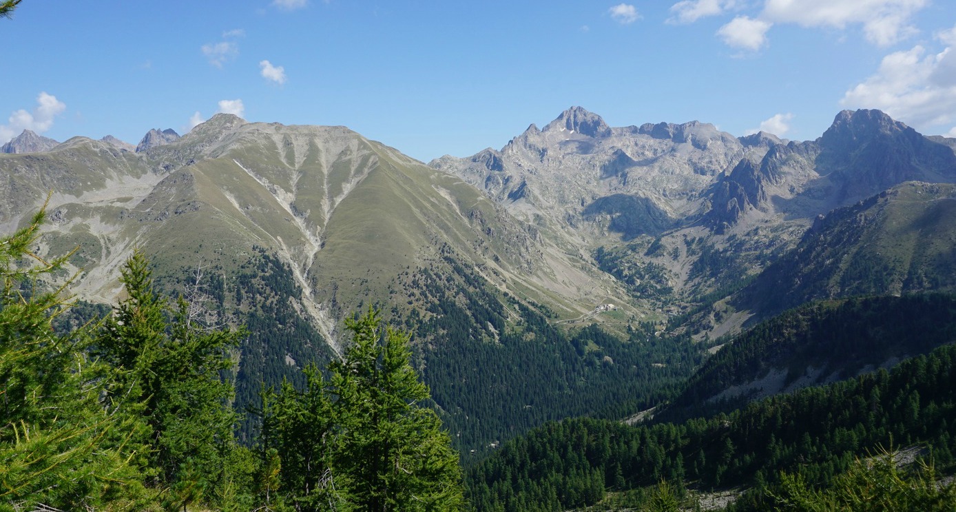
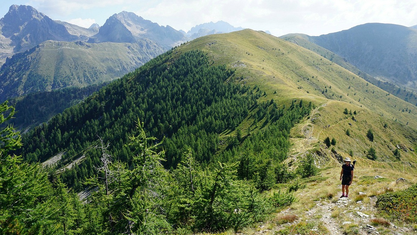
pass, we had today’s goal about 100 m above us. The marked trail to Cime de la Palu circled along the southern flank of Mont Lapassé. We climbed to the summit along an unmarked trail. The summit was marked with a cairn and a stick, in
fact two cairns very near each other.
Mont Lapassé is in the middle of a chain of mid-altitude 2000 m+ summits between the Madone de Fenestre and Gordolasque Valleys. In this region, it is possible to tailor make your hike shorter or longer, and ascend to several summits during one day if
you wish.
We returned back to the valley along the same trail
Climb: 560 m
Distance: 8 km
Duration: 3h (Climb 1h 45) active
Map: 3741 OT Vallée de la Vésubie


This tasty vegetable gratin is great with a simple chicken breast or a steak.
2 servings
1 aubergine
2 tomatoes
1 clove garlic
1 tsp dried Provençal herbs
Freshly ground black pepper
200 ml tomato sauce
Two handfuls of freshly grated parmesan
About 4 tbsp. olive oil
Preheat the oven to 180° C.
Oil a small gratin dish with 1 tbsp. of olive oil. Wash and dry the aubergine and tomatoes. Then slice them.
Place ½ of the aubergine slices in the bottom of the gratin dish and cover with ½ of the tomato sauce. Add the tomato slices and sprinkle with 1 tsp. dried Provençal herbs. Peel the garlic clove and press over the tomatoes. Grind over some black pepper. Then cover with the rest of the aubergine slices and spread the rest of the tomato sauce on top of the aubergine slices.
Grate about two handfuls of parmesan and cover the gratin. Sprinkle 3 tbsp. olive oil on top of the parmesan and bake for 45 minutes.

Many years ago, we tried to reach the summit of Cime de Marta (2135 m) starting from the village of la Brigue in the Roya Valley. On that given day, however, the village was en fête; full of people, Medieval spectacles, and police directing traffic, so we never found the starting point of the trail to Cime de Marta.
This time, we started the ascent from the Italian side from Rifugio F. Allavena at Colla Melosa (1545 m) in the Ligurian Alps.
We first drove to Ventimiglia, then took the SP64 road north, passing Dolceaqua then Pigna. After Pigna, we forked right to SP65. This road got very narrow with continuous hairpin bends but at least it was paved! At a place named Colla di Longan, we forked left to Colla Melosa.
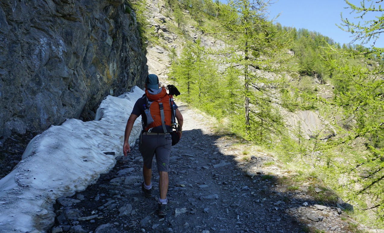
From Colla Melosa, we started along an old military track, then forked right to a path that went straight up to Rifugio Grai. It was a steepish ascent along a good trail. We came back to the military track, headed straight north along it, following the Franco-Italian border passing Col Bertrand (1979 m). We soon had Cime de Marta in sight, above the barrack ruins by the trail.
We continued along the dirt track a bit heading west, reached the ridge between Balcon de Marta and Cime de Marta where we forked right (east) and ascended to the summit hors sentier along the grassy western flank of the mountain. Wild orchids and violets decorated the alpine meadow but there were still large patches of snow on the northern slope. The summit was marked with a signpost (#254).
From the summit, we descended-again off-track-straight down to the barrack ruins and took the same route back to Colla Melosa.
The GPS track is shown below
Climb: 663 m
Distance: 11,3 km
Duration: 3h 30 (active)
Map: IGN 3841 OT Vallée de la Roya (the Italian side of the trail and Colla Melosa are visible on the French map)


The following simple recipe makes an impressive starter in late summer or early autumn when tomatoes are in season.
2 servings
1 red tomato
1 yellow tomato
1 black tomato
1 tbsp. olive oil
1 tsp red wine vinegar
Chopped chives
Freshly ground black pepper
A few basil leaves
A few shavings of parmesan
Wash and dry the tomatoes. Cut them in small pieces and place for ten minutes in a sieve to release extra liquid. Then place them in a bowl. Add the olive oil, vinegar, black pepper and some chopped chives. Mix and let marinate for a few minutes.
Divide the tartare on the plates with the help of a stainless-steel preparation circle. Decorate with parmesan shavings and basil leaves.

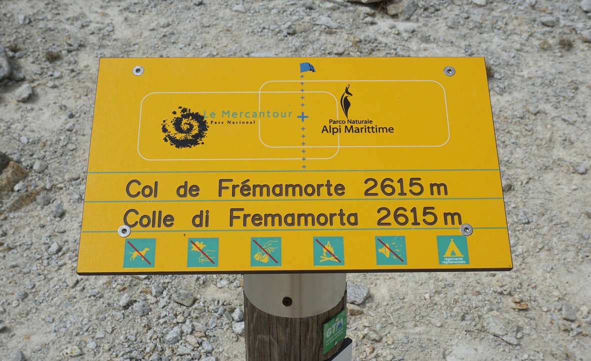
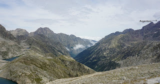
In Alpes-Maritimes, there are several renowned mountain passes on the Franco-Italian border that can be reached by hiking trails, such as Baisse de Druos, Col de Fenestre, Col de Cerise and Pas du Préfouns. This time we wanted to ascend to a lesser known pass above Le Boréon named Col de Frémamorte (2615 m).
Unfortunately, on our given day the weather was more clouds than blue skies. Nevertheless, we had good views down to Italy from the col.
From the Salèse parking (1665 m) above Le Boréon we started ascending along the GR 52 trail towards Col de Salèse (2031 m) which we reached in 1 h 10. From Col de Salèse, we descended a bit then forked right, leaving the GR52, and headed towards Lac Négre, Pas du Préfouns and Col de Frémamorte. We ascended along the popular trail in the forest. Most hikers seemed to continue to Lac Négre. At a crossroads called Camp Soubran (2270 m) and signpost 270, we forked right (east).
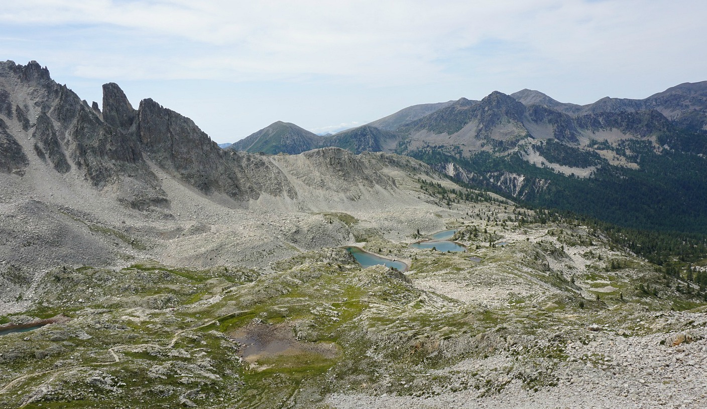
Heading east above the tree line, we passed several lakes (Lacs de Frémamorte). The scenery became high-alpine, and the trail rockier.
Approaching the col, we saw remains of a bunker and even an odd ibex. The last push was actually less steep than anticipated as the trail zigzagged in the incline.
In front of us, on the Italian side, we could view the western flank of the imposing Argentera Massif (at 3297 m the highest peak in the Maritime Alps), several lakes below us, and in the distance the lowlands near Cuneo that were covered with low clouds. From the col, one trail descended down to Italy, the other, looking a bit exposed, went up to the nearby summit called Cime de Frémamorte (2730 m).
We descended along the same trail back to our starting point.
Climb: 960 m
Distance: 17 km
Duration: 5h 45 active
Map: IGN 3741 0T Vallée de la Vésubie

When the plums are in season, we eat some dark plums every morning and I also use them in cooking. The following recipe can be made from pitted prunes when the plum season is over.
2 servings
3 tbsp. olive oil
4 organic chicken thighs, with skin
4 large dark plums or pitted prunes
1 small onion, chopped
1 clove garlic, minced
100 ml white wine
2 tbsp. pitted green olives, pref. organic
1 tsp. dried Provençal herbs
Freshly ground black pepper
A glass jar of 250 g cooked white beans
Chopped chives
Preheat the oven to 200° C.
Spread 1 tbsp. olive oil in the bottom of an ovenproof dish. Place the chicken thighs in the dish skin side up.
Arrange the onion, garlic, and olives around the chicken and pour in the wine. Add the black pepper and herbs and sprinkle with 2 tbsp. olive oil. Bake for 30 minutes.
Meanwhile wash the plums, halve them and remove the stones. Rinse the white beans under running water. Add the beans and plums in the dish around the chicken and continue baking for 15 minutes.
Decorate with chopped chives.

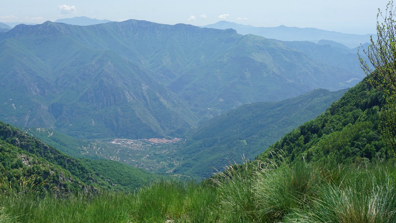
We have twice before tried to reach the summit of Mangiabo (1821 m) from Moulinet, but had to turn around because the weather turned bad.
Mangiabo which is situated inside the southern part of the Mercantour National Park, is only 18 km from the coast as the crow flies. It is also the southernmost major peak in the ridge that stretches south of Authion. Old military installations are omnipresent all along the route. It is possible to use the GR52 hiking trail that runs along the ridge, partly along dirt tracks, partly along good paths to reach Mangiabo. Compared with a route starting from Moulinet deep in the valley, the summit can be reached from Authion with much less vertical ascent.
On our third attempt the weather was favourable. We drove up to Col de Turini, then to Authion where we took the D68 road that circles counterclockwise the area. The road is paved but potholed, so proceed with care. We drove past Cabanes Vieilles and a cattle shelter and parked at the second sharp bend after the shelter.
We headed straight south along a wide dirt track (GR52) as far as to signpost #151 where we continued along a path in the woods marked with white and red i.e. GR colours. We followed the path to Baisse de Ventabren, took the GR52 trail that followed the eastern flank of Pointe de Ventabren to Baisse de la Déa. The ancient military track circles along the western flank, and we took it on the way back.
From Baisse de la Déa the trail ran along the western flank of the ridge, passing several bunkers. This part of the trail under Cime de la Gonella was a bit narrower and somewhat exposed. We passed signpost #142 and 143 and soon came to #144 from where we had an easy final ascent to the grassy summit marked with a cairn.
We had a super 360° panorama of the whole region. In spite of some haze, the Mediterranean, Cap d’Antibes etc were visible in distance, and of course the still snow-capped high peaks in the north.
We used the same itinerary back apart from the dirt track circling along the western flank of Pointe de Ventabren (see our GPS track below).
Total distance: 13 km
Total climb: 576 m
Duration: 3h 50 (active)
Map: IGN 3741 ET Vallées de la Bévéra et des Paillons