

Boréon: Cime de Piagu 2338 m

We had decided to conquer another easily accessible summit above Boréon. In this sector, we had previously hiked from the lower parking of Boréon to Cime du Pisset.
This time we wanted to explore the same beautiful ridge, now heading west as far as to Cime de Piagu (2338m).
The lower parking is the first one you hit (1,5 km) on the paved M189 road after the main concession building in Boréon. The road to the upper parking still seems to be potholed but driving there gives you a 50-60 m higher starting point.
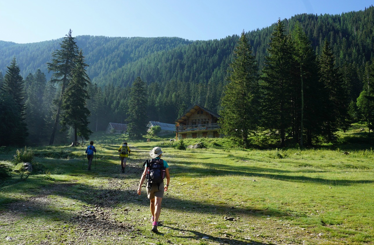


We started from signpost #419, walked past a small dairy and the upper parking where the wide main GR trail dove into the woods. After about 250 m, we left this trail, forked right at signpost #421 and started to climb in the Boréon Forest along a much steeper and rockier trail. We passed signpost #432 about halfway to the ridge.
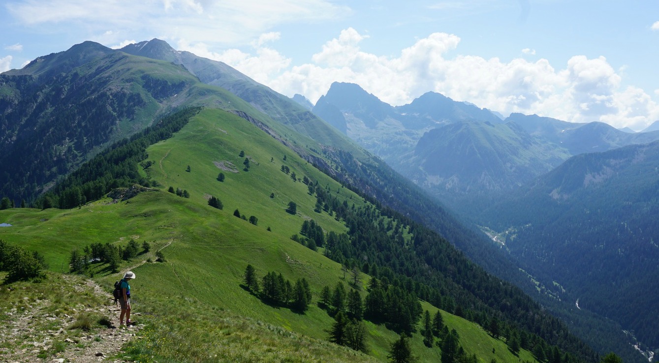
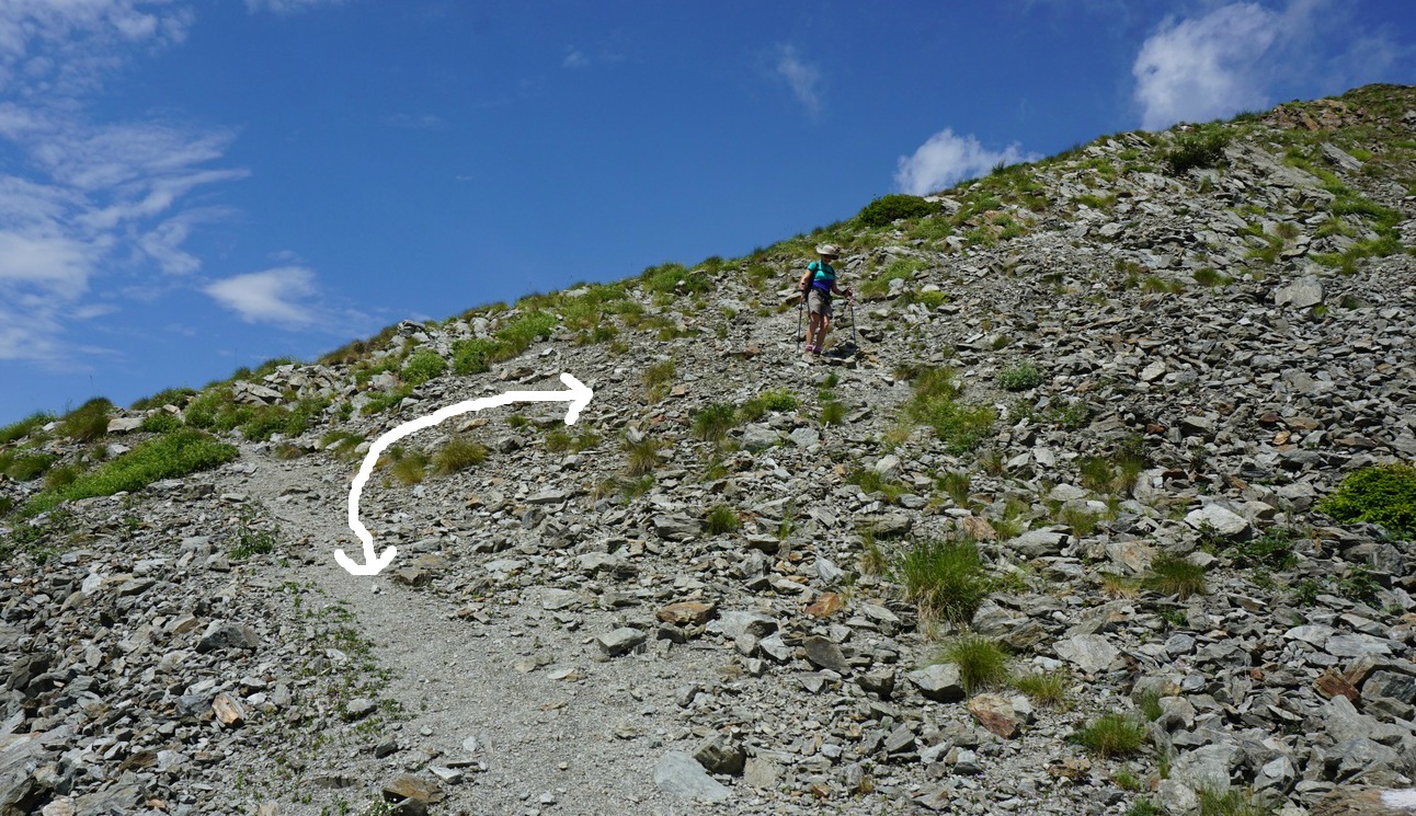
Eventually we came to a refuge (Refuge privé de la Mairis) and the vast mostly treeless ridge with undulating hills in both directions. At Col de la Mairis and signpost #431 (2124 m), we headed west. There were yellow marks here and there showing the trail. We saw our summit ahead and above us. Although navigation and progress were easy, there were many trails crossing the meadows. On the final push to the summit, we missed the direct trail to the summit, and instead followed a trail that circled the mountaintop. On the western side, the slope was grassy and we just climbed directly up to the top.
After a clear morning, high cumulonimbus clouds were rapidly growing in the east. Thunderstorms were forecasted for the afternoon. We descended along the eastern incline and had a short picnic break lower on the crest. We then descended rapidly back along the same trail well before any thunderstorms reached the area.
Most hikers follow the GR52 trail to Refuge de Cougourde and Lac Trécolpas. We saw only sporadic hikers on this trail. In fact, eagles (aigle royal) were more numerous! With the highest Mercantour peaks in the east and the St-Martin-Vésubie over 1000 m below the summit in the west, the views were super!
Elevation gain: about 700 m

Duration: about 4 h (ascent 2 h 20)
Distance: 11 km
Map: IGN 3741 OT Vallée de la Vésubie
Share story


0 comments:
Note: only a member of this blog may post a comment.