Rocca Sparvièra

Mont Ferion seen from Rocca Sparviera


The mountaintop above Coaraze (620 m) in the Nice hinterland has a Nissart name: Rocca Sparvièra (1110 m), or the sparrow hawk rock.

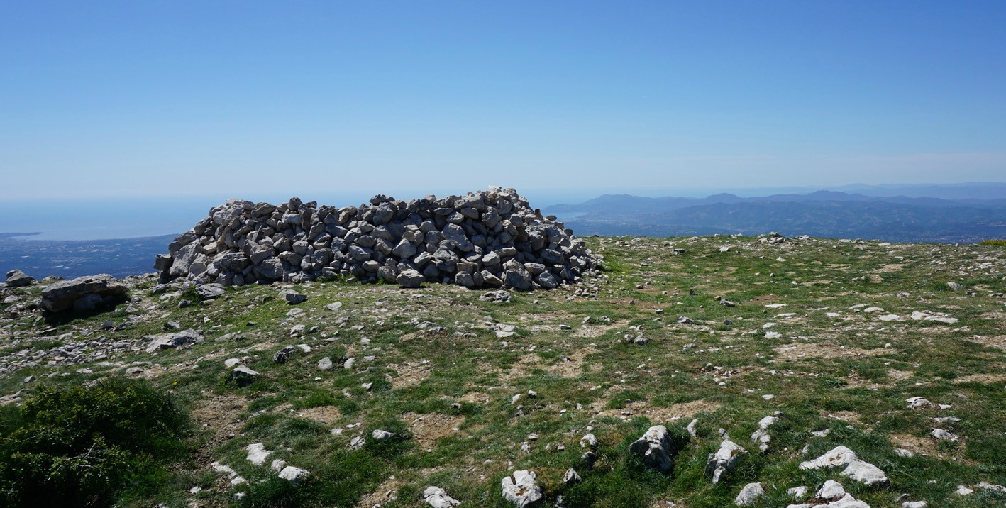
Around the summit, there are ruins of an abandoned village from the 17th century. The medieval village has a dark history; diseases, murders, and a series of earthquakes in the 16th and 17th centuries that preceded the demise of this isolated hamlet. Legend has it that Queen Joanna I of Naples was hiding in the village because she was accused of having her first husband murdered. On Christmas Eve 1357, she went for a mass in Coaraze. Once back, she found her children, nanny and chaplain killed. She cursed the village, burned her castle there, and never returned.

When we tried to hike to Rocca Sparvièra a year ago, the trail was closed for some reason, and we ascended to nearby Mont Férion instead.  Maybe there had been a landslide, we did not know. The trail is not recommended during or after heavy rain as a few narrow parts of the trail can become dangerous. In addition, the ruins of the village are fragile, and going under them should be avoided.


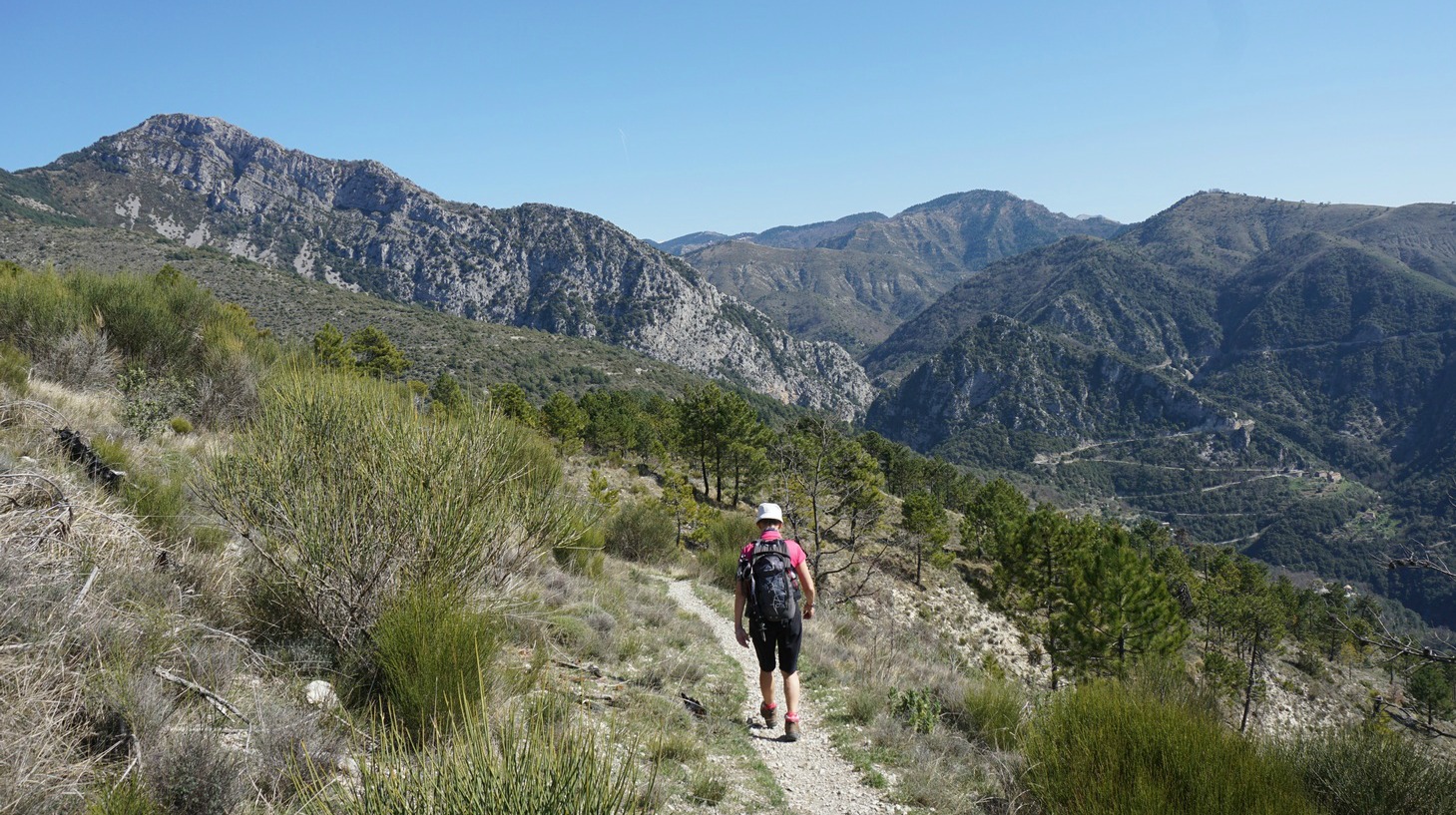
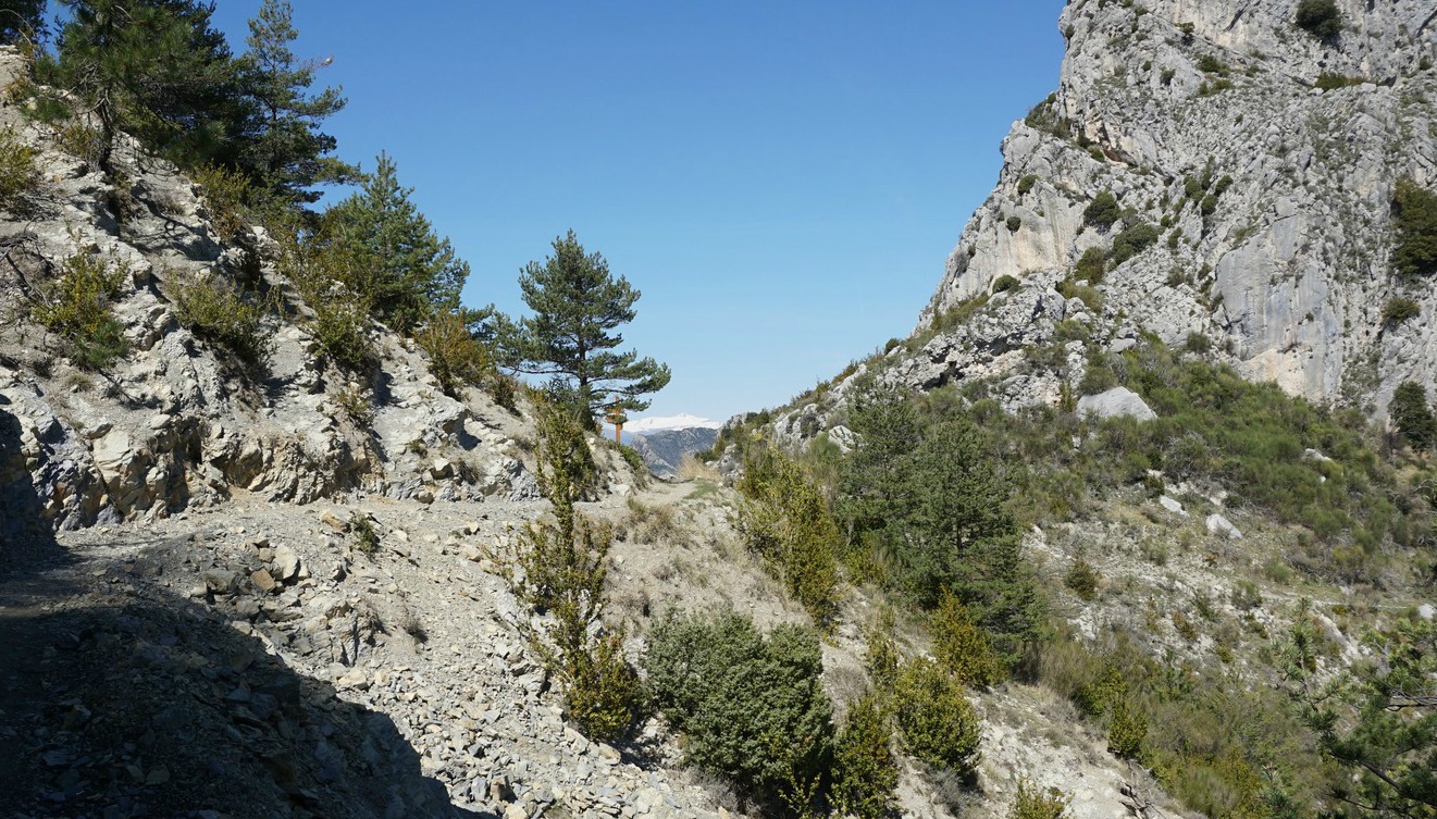
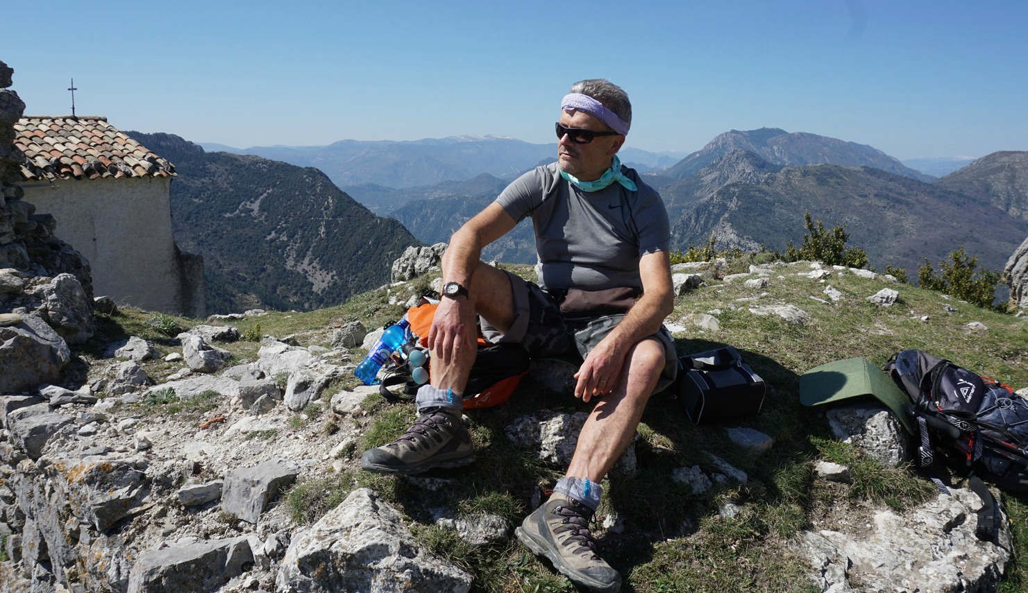
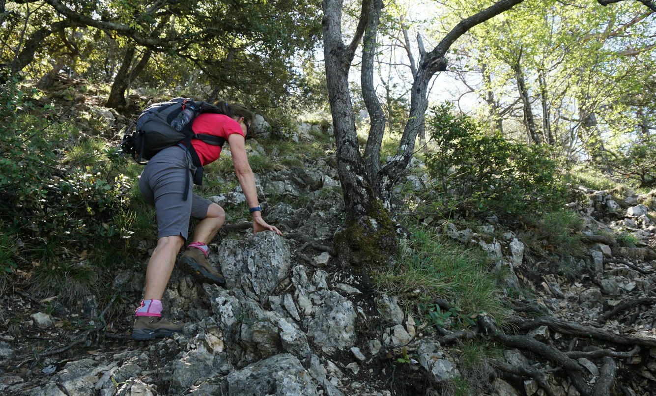
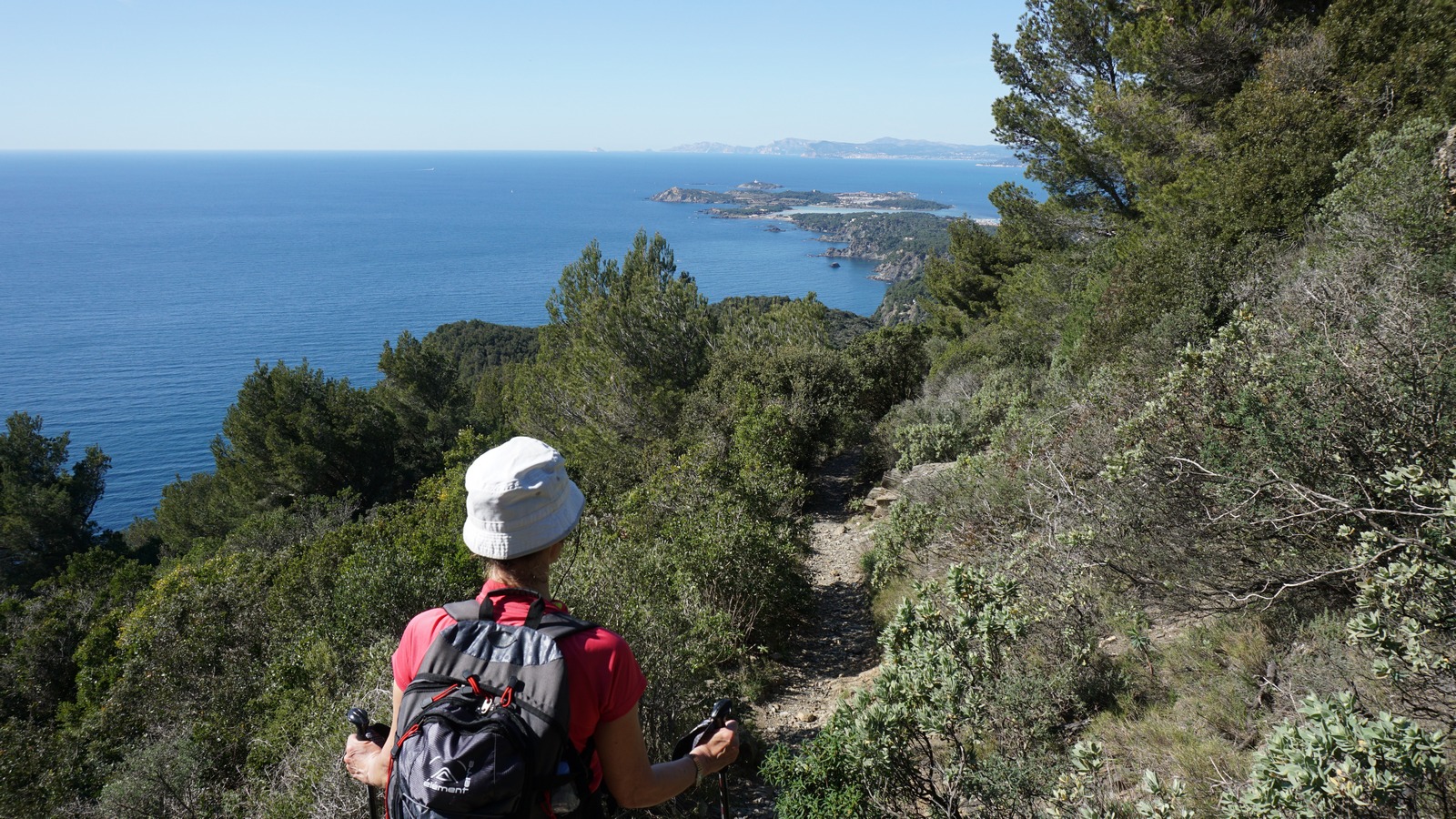
It was late March, temperatures soaring over 20°C with clear skies. We parked near the Coaraze entrance and ascended from signpost #200 by the RD15 road passing the blue chapel, then signposts #201 and 202. You can’t get lost on this trail. At signpost #203 we forked right and continued along a path straight north, circling above several gorges. Some parts were narrow, but nevertheless easy to negotiate. We even met some mountain bikers! We could nevertheless understand that on a rainy day the trail would be slippery. On the other hand, on a sunny summer day, it can get very hot during the ascent. We came to Col St-Michel (970 m), signpost #443 and a crossroads. Seen from here, the ruins of Rocca Sparvièra almost merged with the grey rock of the summit. The path to our goal circled the mountain’s steep western flank. It was said to be a bit aérien or precipitous, and some surefootedness was needed, but really nothing special. We reached Chapel Saint-Michel (1089 m) built in the 18th century, and the ruins of Rocca Sparvièra were just above us.

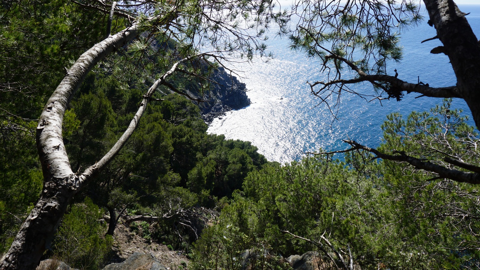
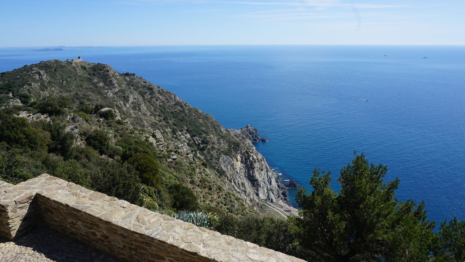
One wonders why people who built the village here in the middle ages chose such an isolated and steep mountain? Obviously one important reason was that it was easy to defend. However, it is not the only ghost village in the region. If you don’t like ruins, as there really isn’t that much to see, you will certainly enjoy the fantastic views from the trail and from the mountain top to Paillon and Vésubie River valleys and beyond.

Alternative routes up here start from Duranus in the Vésubie River Valley or from Engravin by the RD15 road above Coaraze.

We returned to Coaraze along the same trail.
At Rocca Sparviera

Duration : 3h 50

Climb: 500 m
Descending from Rocca Sparviera

Map: “Vallées de la Bévéra et des Paillons” 3741 ET

The French Randoxygène guide has a description of this hike
Spring flowers on the trail to Rocca Sparviera


Rocca Sparviera trail image


0 comments:

Note: only a member of this blog may post a comment.

Quinoa bolognese

Quinoa bolognese


Spaghetti Bolognese is a classic Italian dish known to everybody. But why not make a modern version of it by replacing the pasta with quinoa?

Quinoa is a gluten free and protein-rich seed. It is good for our hearts to eat as much as possible vegetable protein so that we can reduce animal protein in our diets.

4 servings

About 300- 350 g low-fat minced meat
2 tbsp. olive oil
2 shallots, chopped
2 cloves garlic, minced
50 ml red lentils
200 g good tomato sauce
2 tbsp. tomato purée
400 ml beef stock
2 tsp. provençal herbs
Black pepper
About 2 handfuls of grated parmesan
Parsley to decorate
For the quinoa:
About 200 g quinoa
About 1,2 l water

In a large casserole bring the water to the boil. Add the quinoa, cover and cook 20 minutes. Check the quinoa now and then; you may need to add some more water. When the quinoa is cooked, set aside and keep warm.

Meanwhile warm the olive oil over medium- high heat in a heavy casserole and start frying the minced meat. Reduce the heat to medium and add the shallots and garlic. Stir and cook for a few minutes.

Then add the red lentils, tomato sauce, tomato purée, beef stock, provençal herbs and black pepper. Bring to the boil, then cover and reduce the heat to slowly cooking. Cook for 20 minutes.

Divide the quinoa into bowls and top with Bolognese sauce. Sprinkle with grated parmesan and decorate with chopped parsley.


0 comments:

Note: only a member of this blog may post a comment.

Pic de Courmettes

Pic de Courmettes


We call them the twin peaks. Dominating the landscape northwest of Nice, Pic de Courmettes (1248 m) and Puy de Tourrettes (1268 m) are connected by a col. We have climbed to Puy de Tourrettes several times, from Tourrettes-sur-Loup and Courmes.

This time we wanted to hike to Pic de Courmettes, the peak nearer the coast. Its western flank towards the Loup River Valley is very steep, making it more impressive.

The Randoxygène guide has recently added this hike in the guidebook. However, their version comprises the ascent from Courmes (630 m) and taking the same trail back. As we knew the region, we opted for a more interesting loop hike that continued straight north from the first summit to the plateau of Puy de Tourrettes. In addition, the steep section before Pic de Courmettes is always easier to climb than to descend. In other words, we climbed our twin peaks during the same hike!

The narrow but paved D503 road connects Courmes with the D6 road that runs along the Loup River Valley. The village has a surprisingly spacious parking.


We started from signpost 88 right behind the parking, heading south along the GR51, gradually climbing along the wide trail. We came to a DFCI reservoir and a dirt road, and left the GR51 trail. We continued along the dirt track a bit, ascending to a clearing with nice views at about 940 m alt. Here, at signpost #80, we forked left (east) and climbed along the steep trail with sporadic yellow markings to the summit. In places, easy scramble was necessary. On a clear April day, we had great views down to the coast.

After a break, we continued straight north, with Puy de Tourrettes and its treeless southern face in front of us. We soon came to the saddle between the two mountains, and ascended along the well visible trail. Once on the summit plateau, the trail became less evident but you could walk almost anywhere. The summit was marked with a heap of stones. We did not go there, but headed NNW and soon came to the unmarked but frequently used trail that descended to the GR51 trail.

We continued along the GR51 south, and eventually came to a crossroads where we forked right, taking the signposted shortcut back to Courmes. The shortcut route then merged with the GR51 just before the village.
Puy de Tourrettes and the Mercantour summits

Duration: 4 h (walking time)


The saddle between Pic de Courmettes and Puy de Tourrettes


Total climb: 750 m -Note that the French guide claims that the climb to Courmettes alone is 730 m but in fact, as the climb from the village is continuous, the vertical climb to the summit is 620 m.
Courmes and Gorges du Loup


Map: IGN Cannes Grasse 3643 ET Côte d’Azur


Pic de Courmettes GPS track


0 comments:

Note: only a member of this blog may post a comment.

Hike in the Cap Sicié Peninsula


The eastern side of the Cap Sicié peninsula merges with Toulon’s suburb La Seyne-sur-Mer, while the southern end is in a natural state with high cliffs and forests.

The Chapel Notre-Dame du Mai was built in 1625 on the southern tip of the peninsula, and it is still a pilgrimage site. The 360° panorama from the summit (360 m) it simply stunning.


We started the hike from the little harbour of Le Brusc, ascending along the route to Mont Salva. The small road was first called Chemin de la Gardiole, then route de la Lèque. The trail was marked with yellow and white faded signs. There were sporadic “sentier littoral” signposts. The paved road changed to a dirt road higher up, and finally continued as just a path.

We reached a crossroads: The lower more “sportive” trail, and the higher “familial” trail that forked left. As this was still early March and the beginning of the season for us, we chose the easier trail. Even this one had a short steep section where easy scrambling was needed.

The weather was exceptionally warm with no wind. We stopped and changed into shorts, and the going was much lighter. We reached another crossroads on the ridge with no signposts, just a white sign painted on a rock. We headed east towards the chapel. The big telecom mast next to the chapel was already visible.

At the chapel, we were rewarded with a magnificent panorama. Needless to say, it was a perfect spot for our picnic. We used the same scenic route back to Le Brusc.
Chapel Notre-Dame du Mai
Toulon seen from Chapel Notre-Dame du Mai


There were several ascents and descents during the hike, hence our GPS recorded 480 m total climb. The registered distance was nearly 14 km of which some 6 km comprised paved streets or roads. Total hiking time was about 4 h.

0 comments:

Note: only a member of this blog may post a comment.