Chicken marinara


Chicken marinara


Chicken parmesan is a classic American- Italian recipe. Usually, chicken cutlets are beaded and fried first then covered with tomato sauce, mozzarella, and parmesan and baked until the cheese is melted and bubbly. 

I have somewhat simplified this American classic by leaving out the breading and parmesan and at the same time cutting out some calories. As there is no parmesan in my recipe, I prefer to call it chicken marinara.

I have made the tomato sauce from scratch using fresh ripe tomatoes, onions, garlic, dried Provençal herbs and freshly ground black pepper. This makes all the difference compared to even the best canned tomatoes and tomato sauces, and it doesn’t take long to make!

2 servings

2 chicken breasts

Olive oil

3-4 ripe tomatoes, chopped

1 tbsp. tomato paste

½ onion, chopped

1 clove garlic, minced

1 tsp. dried Provençal herbs

Freshly ground black pepper

4 slices Italian mozzarella

Basil leaves to decorate


Start making the tomato sauce. Warm 1 tbsp. olive oil in a frying pan over medium heat and sauté the onion and garlic for about 5 minutes. Add the tomatoes, tomato paste, herbs, and black pepper and continue cooking until the tomatoes are soft and you get a nice marinara sauce.


Preheat the oven to 200°C, roast.


In another frying pan, warm 1 tbsp. olive oil over medium heat. Sauté the chicken breasts 7 minutes on each side.


Transfer the chicken breasts in an oven- proof dish and generously cover with tomato sauce. Place 2 slices of mozzarella on each breast and drizzle with a little olive oil. Roast for 10- 12 minutes until the cheese is melted and bubbly. 


Divide the chicken breasts on the plates, decorate with basil leaves and serve with brown rice, quinoa, or whole wheat pasta.


0 comments:

Note: only a member of this blog may post a comment.

Roure: Mont Autcellier


Final push to Mont Autcellier


In search of new mid-altitude hiking trails in Alpes-Maritimes, we came across an interesting option above the village of Roure.

Although the trail to Mont Autcellier (2204 m) has been described and recommended by some French rando sites, both the trail and the mountain turned out to be less frequented than many other similar itineraries in the region.

One reason might be the access: The narrow and sinuous road which ascends from St-Sauveur sur Tinée (M30 then M130) first passing near the village of Roure then the Roure Arboretum above the village. There is a parking about 700 m from the Arboretum (La Barre; signpost #241 at 1373 m elev.).

Signpost #254 to Mont Autcellier

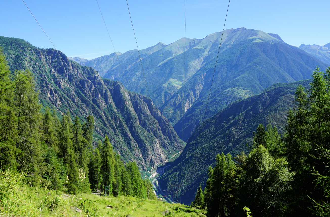
View down to Tinée Valley

Forêt de la Fracha Roure

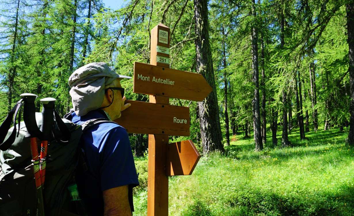
Signpost #251 to Mont Autcellier

Mont St-Sauveur
Mont St-Sauveur


We started along a dirt road (also part of the GR5) as far as to signpost #254 where we forked left, and ascended along a very soft forest trail. Beautiful larch forests in Alpes Maritimes are ubiquitous, but this particular forest -Forêt de la Fracha-exceeded our expectations.

The itinerary was straightforward. We passed signpost #251 showing the way to Autcellier. We reached a forested ridge (Crête de la Clouetta) and ascended along it, still heading northwest. The ridge already offered multiple great views.

View southeast from Crête de la Clouetta

Crête de la Clouetta higher up

Mercantour peaks seen from Autcellier southern flank


Alpine meadow before Mont Autcellier

Tête de Pommier and Roubion ski runs


Gradually, at about 2000 m elev., the forest gave way to alpine meadows, and we had Mont Autcellier in front of us. Its south-eastern flank was very easy to climb. On the grassy summit plateau, a cairn with a stick probably marked the highest point. The panorama had been praised by many hikers and they were right:  From Mont Mounier in the west to the snow-capped Mercantour summits further away in the east. The day was gorgeous but we only met one sole hiker and a few mountain bikers.  Two Canadair fire bombers flew back and forth over us. Apart from these, we were alone in the pristine nature.

We returned along the same trail.

Mounier seen from Mont Autcellier summit

Valberg viewed from Mont Autcellier

Southern Tinée Valley seen from Mont Autcellier

Climb: 830 m

Distance: 11,6 km

Duration: 4h 30 active

Map: « Moyenne Tinée » IGN 3641 ET


Mont Autcellier hike track


0 comments:

Note: only a member of this blog may post a comment.

Pollock on new potatoes and fennel


Pollock on new potatoes and fennel


The island of Noirmoutier is famous for its new potatoes. They are gathered before their maturity, 90 days after plantation, and are known for their good taste and very fine skin. 

The following carefree recipe is adapted from a news clip on the French morning TV, Télématin. The chef cooked outdoors pollock on a bed of Noirmoutier new potatoes and fennel. Instead of pollock you could use any tasty white fish.

My recipe is for indoors cooking using a heavy Le Creuset pot but if you have an outdoor cooking stove feel free to experiment. It looked fun!

2 servings

About 8 medium size thin skinned new potatoes

½ bulb of fennel

3 tbsp. olive oil

A small bunch of dill

150 ml white wine

Freshly ground black pepper

2 nice pieces of pollock fillet

Warm the olive oil over medium heat in a heavy pot. Wash the potatoes, cut them into halves or quarters and add to the pot. Stir now and again for a few minutes. Wash the ½ fennel, cut into sections and add to the pot. Stir again and cook for a few minutes. Pour in the wine, cover, and cook for about 15- 20 minutes until the potatoes are soft.

Add the pollock on top of the potatoes and fennel and grind over some black pepper. Cover and cook for about 8- 10 minutes until the fish is done. Divide on the plates and decorate with chopped dill.


0 comments:

Note: only a member of this blog may post a comment.

Levens to Colla Bassa


Levens and Mont Vial


Levens north of Nice is a good starting point for hikes. Even the tourist office has eight suggestions on their web site. We planned to do the loop called Circuit de Péloubié but on the day of our hike there were road works in St Claire south of Levens, just where our hike itinerary would have passed on the way back.

Instead of doing the loop, we decided to start along the first part of the hike from les Grands Prés (soccer and other fields 546 m elev.) next to the M19 road. We walked to signpost #261, forked right and ascended along Chemin de la Madone, then Chemin Pré des Cavaliers, passing some nice properties. We came to signpost #265 where the public road ended. There is a small parking (Les Mulières) which we had used before. In fact, on a hot day, we recommend to drive up there instead of walking along the streets from Levens.


Les Grands Prés Levens

Path after signpost#265 Levens

Mont Arpasse
Mont Arpasse


We continued towards Col de Travail (760 m), passing a crossroads and signpost #266. After a short descent, we crossed a small stream named Péloubié before ascending to Col de Travail (#281).

Heading to Col de Travail Levens

Crossing Péloubié
Crossing Péloubié

Mont Chauve and Cima

Colla Bassa
Colla Bassa

Rose bushes in Levens


Just after the Col, we forked left into the woods ascending to signpost #280 near Col de Rosa and further the Colla Bassa (881 m), our turning point as we had planned to do a moderate hike.  The path from Col de Travail to Colla Bassa runs in the woods, but we had nevertheless some views down to the valley and to the mountains in the west (Mont Chauve d’Aspremont, Mont Cima). Colla Bassa too was surrounded by woods and maquis, so no views from there.
We returned to Levens along the same path.

Duration: 4 h

Distance: About 12 km

Climb: 430 m

Map: 3741 ET Vallées de la Bévéra et des Paillons

Levens to Colla Bassa track


0 comments:

Note: only a member of this blog may post a comment.