Col de Vars and Refuge Napoléon

Refuge Napoléon


When Napoleon in 1815 returned from the Island of Elba, he received a particularly warm welcome in Gap (Hautes-Alpes) on his way back to Paris. In his final exile on St Helena, he wanted in his testament to remember Gap and Hautes-Alpes with private refuges carrying his name.

To satisfy his uncle’s wishes, it was Napoleon III who ordered the construction of eight refuges in Hautes-Alpes. At the end, six were built. Of these, four refuges at Col de Vars, Col de l’Izoard, Col du Noyer and Col de Mans still exist or have been rebuilt.

The D902 road over Col de Vars (2108 m) connects the Ubaye and Durance River Valleys. Refuge Napoléon (1987 m) is located about 2 km north of the mountain pass, and the Vars ski resort at Les Claux (1842 m) is further 2 km northwest.

During the summer season, the D902 road is packed with motorcycles, cyclists, camping cars etc. This year (2017), Tour the France will once again go over Col de Vars.

We have had lunch several times at Refuge Napoléon at Col de Vars when heading north. They have a decent plat du jour but service can sometimes be slow. The terrain on both sides of the road seemed to be perfect for walks, and in fact the IGN map shows numerous hiking paths of all grades starting from the Refuge, the Col, or from the ski resort.


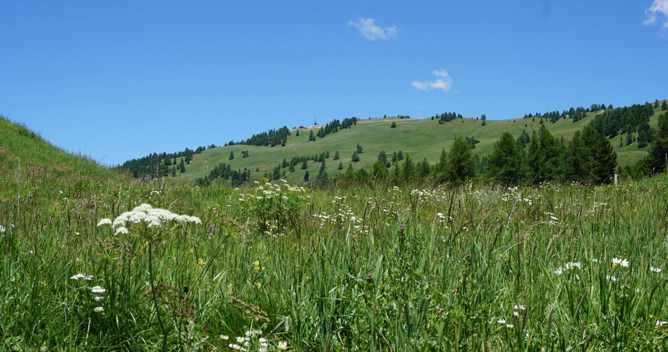
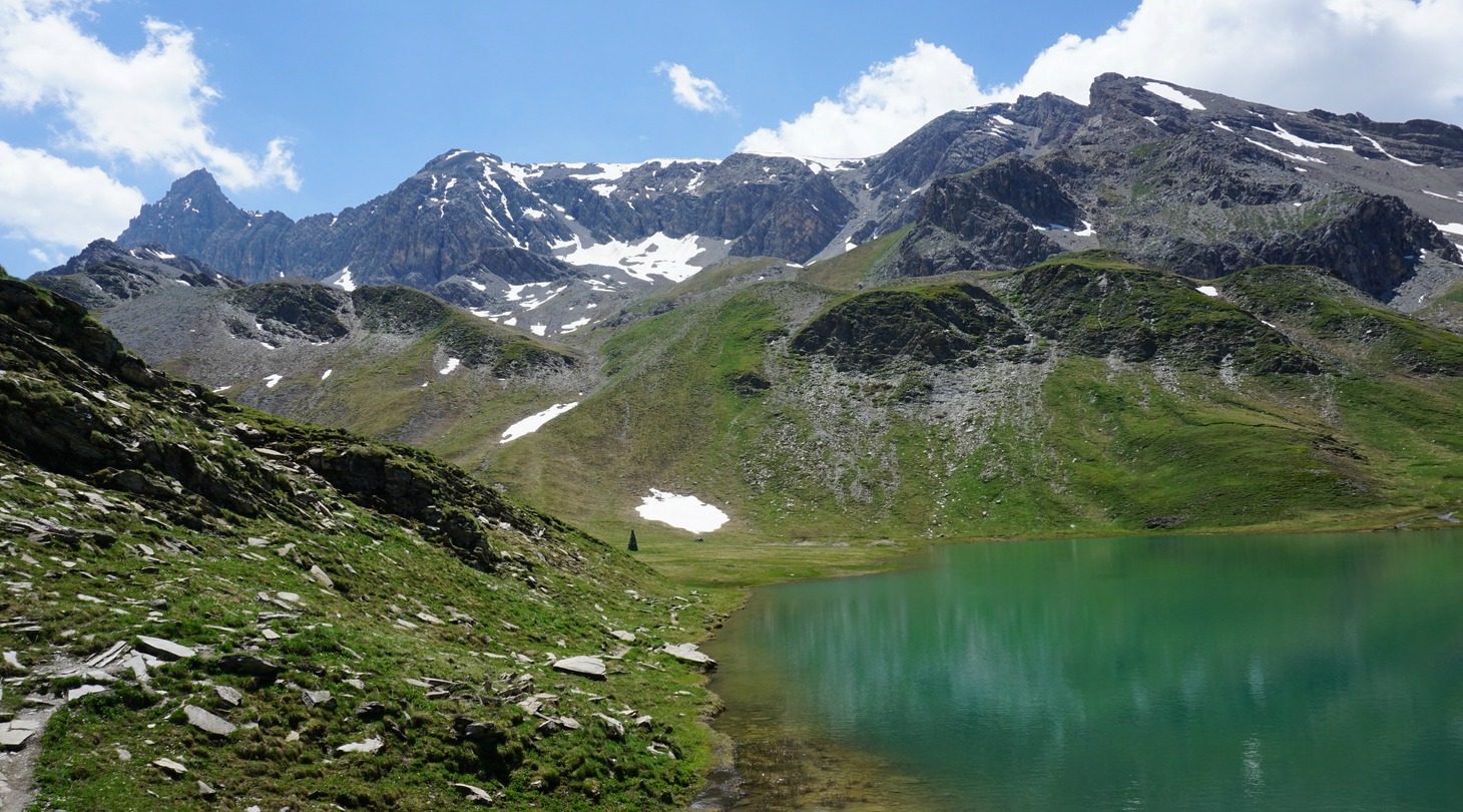
After lunch we headed to the summit of Peynier (2273 m), its telecom mast clearly visible. We took the signposted dirt road behind the refuge. Instead of using the road all the way, we opted for a shortcut along the alpine meadows and some larch woods. The scenery was lush and green.

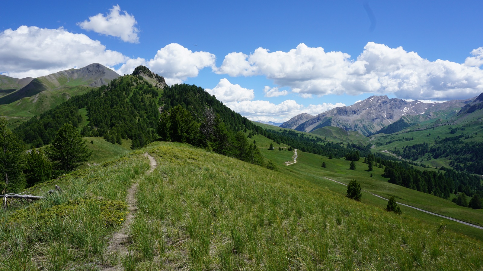
We, however, ended up a bit too much northeast than intended. We turned more sharply northwest and soon sighted the summit of Peynier. We continued towards a ridge slightly east of the summit, crossed the dirt road, and continued ascending a bit steeper in the alpine meadow. After a while we reached the ridge, found a good path and continued the last stretch along the path and the dirt road to the mountain top.

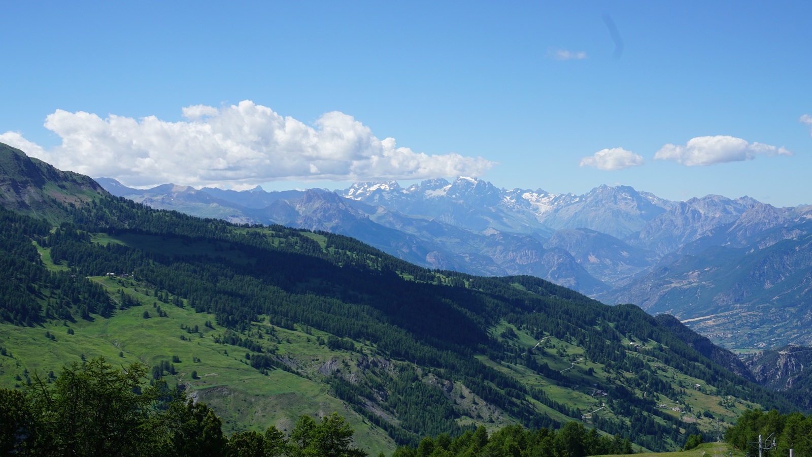
From the summit we had, as expected, a great view down to the Vars Valley, Les Ecrins massif further away in the west, La Mortice and its adjacent peaks in the east.

We took the dirt road back to the Refuge, this time without any shortcuts!

Vertical climb: 270 m
Peynier trail image

Distance: 7.9 km

Duration: about 2h15 (walking time)

Map: IGN 3538 ET


0 comments:

Note: only a member of this blog may post a comment.

Lentil-quinoa salad with shrimp

Lentil and quinoa salad


I recently read in the French magazine ELLE about the importance of fresh herbs for a glowing skin. Fresh herbs are packed with antioxidants, vitamins, and minerals which are important for our skin and for our health in general. In California, the new trend is to add more herbs and less fruit in smoothies to reduce the increase in blood sugar.

I have always preferred a light meal to a smoothie. When I saw an interesting recipe with fresh mint and basil on a package of green lentils I had to try it.

I have somewhat modified the recipe on the package by omitting cucumber, which is nutritionally mostly water, by replacing the lobster with shrimp, and by adding baby salad leaves. The recipe makes a tasty and light lunch. By all means serve the salad with lobster tails if you want to make a seriously luxurious salad. The recipe is gluten free.

2 servings

100 ml good quality green lentils, such as Puy lentils
100 ml quinoa
About 250 g cooked and peeled shrimp
1 green bell pepper, finely chopped
1 tasty tomato, finely chopped
Freshly ground black pepper
About 6 mint leaves, finely chopped
About 6 basil leaves, finely chopped plus some extra basil for decoration
2 tbsp. lemon juice
4 tbsp. olive oil
2 small handfuls of baby salad leaves

Cook the lentils for about 20 minutes in about 500 ml water until they are soft but not falling apart. Drain and transfer into a bowl. Do the same with quinoa and add to the bowl. Refrigerate until needed, can be kept in the fridge until next day.

Finely chop the green bell pepper and tomato and add to the lentil- quinoa bowl. Grind over some black pepper and mix.

Finely chop the mint and basil leaves and add to the bowl. Mix well. Save some basil leaves for decoration.

Make the dressing. Press 2 tbsp. lemon juice and mix with 4 tbsp. olive oil. Add the dressing to the lentil-quinoa- vegetable bowl and mix well.

Divide the lentil- quinoa- vegetable mixture on the centre of the plates. Arrange the baby salad leaves and shrimp on the side and decorate with basil leaves.


0 comments:

Note: only a member of this blog may post a comment.

Loop Trail to Lac des Cordes


The beautiful Lac des Cordes (2446 m) is a popular summertime hiking destination. Situated above the Cerveyrette Valley, it is walled by majestic peaks such as Pic de Rochebrune (3320 m).

This is a quasi-perfect loop trail offering a lot of variation; vast alpine meadows, some steep ascents and descents, one part even equipped with cable, and on the other hand calm pine and larch forests with easy and soft paths.

The Cerveyrette Valley is quite sauvage. While descending down from the lake, we even thought that we saw a glimpse of a wolf running fast below us in the woods.

To reach the Cerveyrette Valley, you first have to drive through the town of Cervières that can be reached from either Briancon or over the Izoard Pass. The narrow but paved D89T road climbs from Cervières to the valley.


We parked at the limited parking just after the hamlet of Les Chalps (1975 m), and walked along a soft forest road by the River Cerveyrette to the hamlet of Les Fonds (2040 m), where the D89T road also ends and where you can find a bigger parking.

From Les Fonds we first followed the main GR58 trail along a stream up to an alpine meadow where our trail forked right at a signpost (marked as a GR58 variant in the IGN map) whereas the main GR58 continued straight south towards Col de Péas. We continued climbing, crossing some streams. We reached another alpine meadow before the trail turned north, now climbing to Col des Marsailles (2601 m; the highest point of the hike) its southern flank still covered with some snow.

From here, the upper and smaller Lac des Maits was visible below us, and we followed the trail straight north, walking over some snow-covered parts and leaving the lake on our left side.

Lac des Cordes could now be seen, and the trail continued descending in a north-westerly direction to the eastern shore of the lake.

The trail back to the valley started right behind the lake descending rapidly in a north-easterly direction in the Gras Valley. Large areas were covered with rhododendrons in blossom. A bit lower, we dove in a larch woods. A short steep section was equipped with a cable for additional security. However, most of the trail was smooth and easy.

On the way back over the Izoard Pass, we stopped at Refuge Napoléon by the D902 road just under the highest point for excellent blueberry pies and coffee.
Start of descent to Cerveyrettes Valley

Duration: 4h15

Elevation gain: 642 m

Distance: 10,3 km

Map: IGN 3536 OT Briançon Serre-Chevalier Montgenèvre
Parking in Les Chalps


Lac des Cordes trail image


0 comments:

Note: only a member of this blog may post a comment.