Lunch at Auberge de la Madone and our Peillon classic walk


The terrace of Auberge de la Madone
Entrance to the restaurant of Auberge de la Madone

This hike from the perched village of Peillon (372 m), about 20 km north of Nice by road must have been one of the first hikes in the region that our family discovered almost 10 years ago. That is why we call it “Peillon classic”. In the Randoxygéne guide it is called Circuit de Lourquière.


First intersection on the trail just after Peillon

Today we didn’t start the hike from La Grave-de-Peille, but made a shortened walk from Peillon around the hill called Pointe de Lourquière (678 m), because we first wanted to have lunch on the terrace of hotel-restaurant Auberge de la Madone. This family restaurant has long been known for its great cooking following local traditions, and seems to get favourable reviews on Trip Advisor. We chose formule bistro, three courses for 25 €, and were not disappointed.

The trail after the bridge continues to Peille


The walk starts from the centre of Peillon, from the parking in front of Auberge de la Madone. Turn left after the fountain at the village entrance; ascend first along a narrow street passing the cemetery. You will soon find the signpost “
La Grave de Peille and Peille Village . The trail ascends gently in a beautiful valley. After about 30
min, a crossroads is reached. The trail north goes over a stone bridge to Peille. However our itinerary turns right ascending to a paved road and a nice residential area called plateau des Lacs (about 600 m alt.). Follow this road about 2 km south. The point where the trail forks right and leaves the road is clearly signposted. The whole trail is marked with yellow. It descends slowly to Vallon St-Martin before a final short ascent back to Peillon.
The trail of Circuit de Lourquière is good

Approaching Peillon


Image of the itinerary:
(Courtesy of Google Maps)


Total walking time when starting from Peillon: 2h 15 (Circuit de Lourquière about 4 h)
         
Ascent:                                                               270 m (Circuit de Lourquière 460 m)


0 comments:

Note: only a member of this blog may post a comment.

Authion today and 70 years ago

Cabane de Tueis seen from the GR52 trail


Redoute fortress at Point des Trois Communes

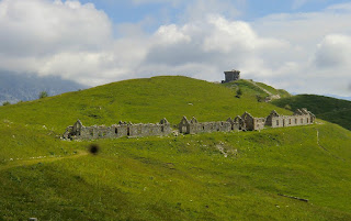
Authion comprises several about 2000 meter high mountain tops in the southernmost part of the Alps. The Mediterranean coastline is about 25 km away. The region is now part of the Mercantour National Park. Situated just above Col de Turini, Authion is easily reached by car. There’s a loop road permitting one-way counterclockwise traffic during the summer season. The most rewarding way to explore Authion is by foot. Most of the trails are easy and as you can start from a higher altitude not that much climbing is needed.
View towards Moulinet from the road to Cabanes Vieilles


Authion has been of great strategic importance for hundreds of years, and was part of the Maginot Line. Several ruined forts and casernes remind the visitor of the turbulent past. At the very end of WWII, Authion remained one of the last German strongholds. In April 1945, General De Gaulle ordered the French troops to attack these positions. A sole American-made Stuart tank was deployed and it can still be seen at Cabanes Vieilles. The battle raged for two weeks. The French lost 280 men and about 1000 were wounded whereas Germans lost about 100 men before withdrawing. The armistice was just a few weeks away.
The American built Stuart tank at Cabanes Vieilles


The walk starts at Cabane de Tueis (also called chalet Charles Alési, 1889 m), at signpost 244. The trail marked as GR 52 ascends along a ridge to 2065 m. The Redoute fortress (2080 m) at Point des Trois Communes is clearly visible from here. Signpost 410 which is just below the fortress is reached rapidly.

Our trail then leaves the GR 52, and descends in an alpine meadow to Plan Caval that is already visible.
Descending from Fort des Mille Fourches to the road of Authion
From here, you continue along the paved loop road as far as to Cabanes Vieilles (1780 m). The road has very little traffic. At Cabane Vieilles, you can see the tank used in the final battle in April 1945. From this point, the itinerary goes almost straight north passing some caserne ruins, then ascending quite steeply in a larch wood followed by an alpine meadow (The direction is evident but there isn’t really a path to speak of ) as far as Fort des Milles Fourches (2042 m).  A small descent then takes you to the loop road again.
Cabane de Tueis or Chalet Charles Alési

The route then climbs a little bit to Fort de la Forca (2078 m,) before continuing to the GR 52 trail used in the beginning of the hike. From the last intersection, the starting point can be reached in 15 minutes.
However, on the day of our hike, dense clouds descended from north when we were nearing Fort de la Forca making the visibility poor. We therefore decided to take the road directly back to Cabane de Tueis. The shortcut made the walk 30 min or so shorter, and we also climbed 100 m less.

Map: IGN 3741 ET Vallées de La Bévéra et des Paillons

Duration         3h 30

Climb:            450 m

Image of hike itinerary:

(Courtesy of Google Maps)


0 comments:

Note: only a member of this blog may post a comment.

Peach Melba recipe

Peach Melba with a modern twist


This is a modern, healthy twist of  Peach Melba. The classic Peach Melba is made from peaches, raspberry sauce and vanilla ice cream. The dessert was invented by the French chef Auguste Escoffier in the 1890s' in London to honour the Australian soprano Nellie Melba.

This version is less sweet and contains very little fat and is served in a glass, en verrine. This dessert is especially tasty when peaches are at their best. If you cannot find frozen raspberry sauce or grilled sliced almonds in your area, you have to start making these yourself. Otherwise this dessert can be put together in a few minutes.

2 servings

2 fresh and ripe peaches
2 tbsp raspberry sauce, coulis de framboises
4 tbsp low-fat fromage blanc or thick plain yoghurt
1 vanilla pod
Grilled almond slices

Defrost the frozen raspberry sauce and keep it in the fridge.

Half the vanilla pod lengthwise and scrape the seeds into the fromage blanc or yoghurt. Mix well and keep it in the fridge.

Wash and dry the peaches. Cut them into very small pieces.

Start filling the glasses with about half of the peaches followed by a layer of about half of the fromage blanc or yoghurt. Then again a layer of the rest of the peaches followed by a layer of fromage blanc or yoghurt. Top with raspberry sauce and grilled almonds. Serve at once.

0 comments:

Note: only a member of this blog may post a comment.

Picnic in the perfume garden of Grasse

May rose rosa centifolia


Grasse has been the capital of the perfume industry for more than two hundred years. In the centre of Grasse you can visit theVilla-Musée Fragonard. The villa has recently been beautifully restored, and was reopened this April. The International Perfume Museum  gives you a chance to discover perfume’s history.
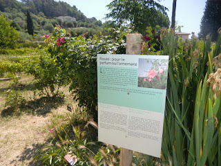
Information along MIP gardens olfactory route


Unfortunately not much perfume flowers are grown in these days in and around Grasse. Some rosa centifolia, May rose, is still grown in Grasse. Also some jasmine, tuberose, violet and mimosa are grown in the region. Grasse grows roses only for Chanel, Dior and Jean Patou.

Jasmine

The International Perfume Museum’s Gardens (The MIP’s Gardens) were created in Mouans- Sartoux to preserve the heritage of perfume flower growing. You can stroll through the gardens at your own pace.


“The Olfactory route” let’s you discover the fragrances and notes used in the perfume industry.You can place you hands on the fragrant foliage and smell the flowers that are near the path.
Scenic view in the MIP gardens

The May rose with its deep pink colour turned out to be my favourite flower in the garden. It was now early June, and the May rose was at the end of its flowering season. The scent of May rose was rich and sweet. It is harvested in May and early June.


Also some jasmine was still flowering and lavender was just starting to flower, but on the whole the garden looked tired and showed signs of the dry period. It seems that May is the best time for a visit when the May rose is in full flower. Its peak flowering season of course varies from year to year.
The MIP gardens picnic area
.


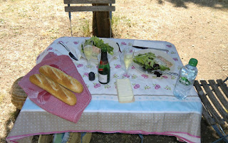
The picnic in the shade of the cypress trees was the highlight of the visit. We had prepared a picnic basket at home before leaving. On the menu we had salmon and scallop paté, duck paté, baby salad leaves, goat’s cheese, freshly baked baguette, chilled Kriter crémat (French sparkling wine) and chocolate mousse. All the tasty products were bought from our local supermarket. It turned out to be a perfect early summer picnic.
Our picnic table in MIP gardens


Opening hours of the MIP’s Gardens: Spring-summer from 10 a.m. to 7 p.m.

Regular price: 3€, during exhibitions 4€. Free parking.

Address: 979 Chemin des Gourettes, Mouans- Sartoux.


NB! If you cannot prepare your own picnic basket, ELLE Magazine recently recommended the restaurant Le Dit- Vin in Grasse
(lunch menu at 15 and 19€).  We can also recommend L’Amandier in Mougins (lunch menu 19€).

0 comments:

Note: only a member of this blog may post a comment.

Col de Turini


Hôtel des trois Vallées


The most magnificent forests in Alpes-Maritimes are situated around Col de Turini (1604 m), although the mythic mountain pass is better known from the Monte Carlo Rally. The special stage from la Bollène-Vésubie up to Turini is one of the most famous rally stages in the world. Drive the road yourself and you’ll get the feeling.
Easy descent from Col de Turini along GR52A

Today, however, we came here to explore the nature. The hike starts from the parking of col de Turini next to the Hôtel des Trois Vallées.


Several fallen trees on the trail created extra challenge
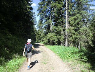
Start descending from signpost 195 along GR52A along a wide forest road. After 45 minutes, the trail leaves GR52A, forks left in the forest and starts ascending. The trail here is good, but was obstructed by several fallen trees. The mountaintop of Cime de Suorcas (1516 m) is reached in about 50 min. In spite of the “modest” altitude the views were great even though the coastline was not visible because of the haze.  After having visited this little summit the trail continues east along a forested ridge passing two mountaintops called Tête de Gaglio (1568 m) and Tête de Francha (1608 m). Near the latter peak, there was a short steep section where metal ladders and a rope had been attached to facilitate the climbing.

Approaching Cime de Suorcas

Hazy view to northwest from Cime de Suorcas


The trail continues east, passes a hut and crosses the D2566 road. The last ascent goes to Cime de la Calmette (1786 m) before descending back to the starting point along a good trail. Follow the path east (yellow marks) after passing an abandoned ski lift, then turn northwest to signpost 32 from where the starting point is reached in a few minutes. Our descent seemed to coincide with the cows’ descent back to col de Turini. They were on their own, and seemed to follow their internal clock!
Easy scramble near Tête de Francha


After the hike we enjoyed coffee and blueberry tart at the terrace of the Hôtel des Trois Vallées. Inside, you can find lots of pictures from the famous moments of the Monte Carlo Rally.
Our companions back to Col de Turini


This is a super hike in variable surroundings. In the excellent guidebook published by Rother: “Alpes Maritimes Les 50 plus belles randonnées”(In French) the hike is graded as easy. In fact, most of the trail does not pose any difficulties.  Even so, some parts were a bit steep and some scrambling was needed (pictured). We would classify the hike medium/red because of this. You also have the feeling of having climbed more than the 450 m
Coffee and blueberry tart at Hôtel des trois Vallées
as the trail had several ascents and descents!

Duration:          4 h


Vertical climb: 450 m


Map: IGN TOP 25 Vallée de la Bévéra 3741 ET


Image of the map (Rother Guide)


Map image courtesy of : Rother Guide de randonnées: “Alpes Maritimes Les 50 plus belles randonnées”

0 comments:

Note: only a member of this blog may post a comment.