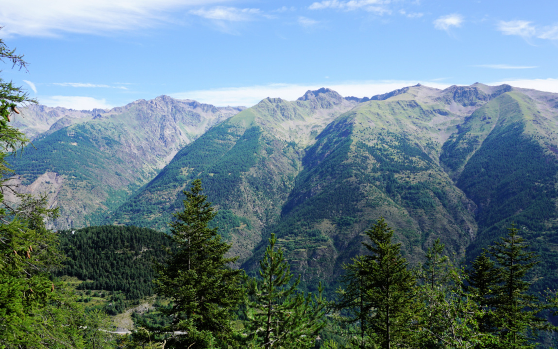
Loop hike in Auron


Col de Blainon view southeast


In addition to the usual summer activities such as mountain biking, the ski resort of Auron (1600 m) offers a network of hiking trails in the mountains above the village. The GR5 long distance trail runs through Auron.

It was exactly the GR5 we planned to use on the first part of our hike.


Because of a small golf court, there was a marked detour for the GR5 which we took near the Blainon chair lift. The chair lift was running, and many visitors took advantage of a free ride to reach higher terrain.


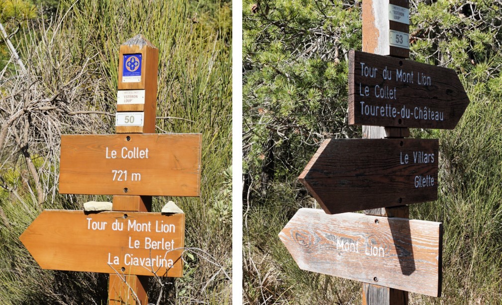
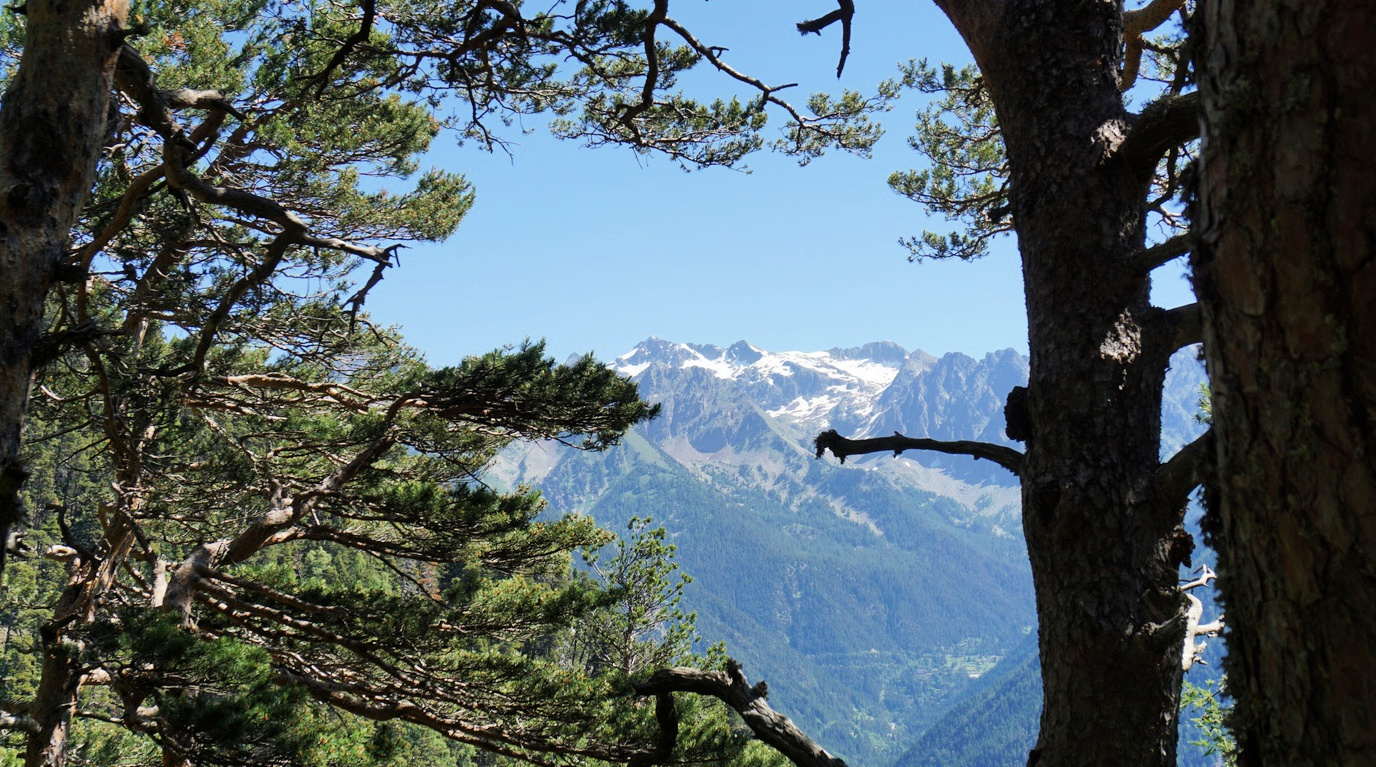
Starting from signpost #11, we walked under the chair lift, crossed a ski run and entered a beautiful larch forest. We passed signposts #12 and 12a, then a viewing point named Belvédère des Chamois (1810 m). The path crossed MTB/VTT trails a few times.


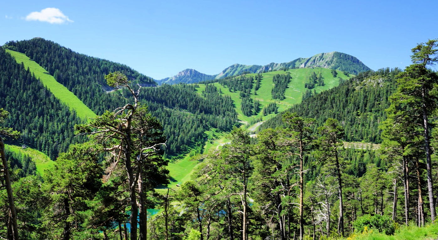
We reached Col du Blainon (2008 m; signpost #13a) on a picturesque ridge. The GR5 descended from here to the hamlet of Roya. We forked right (west), and ascended a bit more along a PR (yellow) trail to Baisse du Colombier (2070 m) near the chair lift upper station.


Our ambitious plan was to circle as far as via Col du Chavalet (2323 m), but the wind picked up, with some nasty gusts. We therefore opted for a shorter loop, and started to descend along a familiar ski run (dirt track in summer). We walked under the Las Donnas gondola (not in summer use), passed two chair lift stations where we forked right, and continued straight to Auron.


Distance: 9 km


Climb: 550 m


Duration: about 3h 15 active


Map: Haute Tinée 1 Auron 3639 OT


Auron loop hike track


0 comments:

Note: only a member of this blog may post a comment.

Chicken breast bruschetta with zucchini and pistou

Chicken breast bruschetta with zucchini and pistou


This very green bruschetta is a variation of the classic tomato bruschetta. Pistou is the French equivalent of the Italian pesto; there is no cheese nor pine nuts but a generous amount of fresh basil. 

Serve with a side salad and tomatoes for a healthy and balanced lunch.

2 servings

2 large slices of rustic country bread 
2 small organic chicken breasts
1 small zucchini
Olive oil
Freshly ground black pepper

For the pistou:
A bunch of basil
½ clove garlic, minced
Olive oil 
A pinch of salt
Freshly ground black pepper

With a peeler, cut the zucchini into very thin slices. Place in a bowl with 1 tbsp. olive oil and some black pepper. Set aside. Wash and dry the basil leaves.
Preheat the oven to 200°C roast.

Warm 2 tbsp. olive oil in a frying pan over medium heat and cook the chicken breasts until golden on both sides, about 15 minutes in all. Grind over some black pepper and keep warm.

In the same pan quickly sauté the zucchini. Keep warm.

Brush the bread slices with olive oil and roast for about 10 minutes until golden. Place on a cutting board.

Make the pistou by crushing the basil leaves with minced garlic, salt, black pepper, and olive oil with mortar and pestle. Add olive oil into a nice consistence.
Slice the chicken breasts. Divide the pistou on the bread slices, then the sliced chicken and top with zucchini.


0 comments:

Note: only a member of this blog may post a comment.

Mont Lion from Tourette-du-Château

Mont Lion summit


Mont Lion (1050 m) above the Esteron River Valley can be reached from Gilette or Tourette-du-Château (900 m). We have climbed to Mont Lion a few times from Gilette, and wanted to explore the shorter route from the perched village of Tourette-du-Château by the D27 road.


We walked past the church to signpost #45, descended to a wide track which led us straight south to a valley to signpost #50 at 721 m elevation (le Collet). Here you have the option to fork right and circle around Mont Lion, doing the Tour du Mont Lion as indicated in the signpost. It is a longer hike which we in fact did years ago in the summer heat.

We continued straight towards the mountain top, and started to ascend along its northern flank in a nice forest. We reached signpost #53 (950 m elev.) at a crossroads where the path from the east ascended from Gilette. This is also where you arrive if you hike around Mont Lion.

We headed south to the summit. The southern and southwestern flanks of Mount Lion are precipitous. The winter day was almost clear and we could admire the evergreen Esteron River Valley as well as the snow-capped Cheiron Mountain Range further away.

We returned back to Tourette-du-Château along the same trail. It was a short hike in distance but nevertheless included descents and ascents both ways, in other words gave us good interval training!

Distance: 6,1 km

Climb: 530 m

Duration: 3 h

Map: Vallée de l’Esteron Vallée du Loup 3642 ET

Mont Lion hike track


0 comments:

Note: only a member of this blog may post a comment.

Smoked salmon and egg toast on creamy spinach


Smoked salmon and egg toast on creamy spinach


This easy recipe makes a delightful and quick lunch. Serve it with a mixed side salad for a balanced meal.

2 servings

2 whole wheat toasts

Olive oil

120 g smoked salmon, preferably wild Alaska salmon

2 soft-cooked organic eggs

2-3 handfuls of organic baby spinach leaves

50 ml chicken stock

2 tbsp. crème fraîche or cream

Freshly ground black pepper


Preheat the oven to 200°C, roast.


Cook the eggs for 6 minutes. Peel and set aside.


Brush the toast on both sides with olive oil. Roast for 8- 10 minutes until golden brown.


Warm 1 tbsp. olive oil in a large casserole over medium heat. Add the spinach leaves. When the spinach is wilted after a couple of minutes, add the chicken stock and stir. Remove from heat, add the black pepper and crème fraîche or cream. With a handheld mixer, purée the spinach, then divide on deep plates.


Place the toast on spinach. Top with the smoked salmon and egg and grind over some black pepper.


0 comments:

Note: only a member of this blog may post a comment.

Mont Viroulet


Mont Viroulet


Mont Viroulet (1864 m), as shown in the image above, has a forested northern flank and a quasi-bare and grassy southern face. Located above the Bramafam Valley (Valdeblore), the mountain can be easily reached from several points in the valley. 

We chose to start from La Colmiane (1500 m) but the village of St-Dalmas Valdeblore (1290 m) is another popular option.

Peaks above Millefonts Lakes
St-Dalmas Valdeblore
At Col du Varaire

Argentera seen from trail above Col du Varaire


From La Colmiane, we hiked along the familiar trail to Col du Varaire (1710 m), passing signposts #94 and #98 where the trail merged with the GR5. We continued to Col de deux Caïres (1920 m) at the foot of Caïre Gros (2087 m). At the col, we forked right (west), and descended along a PR trail(yellow) to Col de la Madeleine (1736 m; signpost #97). We were at the foot of Mont Viroulet, and ascended along its partly forested eastern flank. The summit was actually a long ridge. We assumed that the highest point was marked with a large cairn partially hidden behind vegetation. We walked to the end of the ridge with great views to the west over the Tinée Valley as well as to the south.


We descended back to Col de la Madeleine where we forked left and descended further along a good and wide trail as far as to a dirt track. We headed east along it. The forest track ended near Col du Varaire but a path zigzagged the short remaining distance to the Col.


From Col du Varaire, we took the same trail back to La Colmiane.


Pic de la Colmiane and Gélas
Near Col des Deux Caïres
Near Col de la Madeleine
Col de la Madeleine
Col de la Madeleine

Caïre Gros seen from Col de la Madeleine
View south from Col des deux Caïres
Mont Viroulet summit

Distance: 14 km

Climb: 680 m

Duration: 5 h

Map: “Moyenne Tinée” 3641 ET


Mont Viroulet hike track


0 comments:

Note: only a member of this blog may post a comment.

Polenta, bell pepper, egg, and pistou salad

Polenta bell pepper egg and pistou salad


 Here in Nice, we are lucky to be able to buy ready-made polenta in nice slices. You only need to reheat them for about 10 minutes in the oven and they make a nice side to many recipes.

If you cannot find ready-made polenta slices, cook it according to the advice on the package, pour into a tray about 1 cm thick layer and let cool in the fridge. Then slice it and warm as above.

2 servings

4- 6 nice polenta slices

1 organic courgette

1 organic red bell pepper

2 tbsp. black pitted olives, pref. organic Kalamata olives

2 eggs

For the pistou:

A bunch of organic basil 

½ clove garlic, minced

Freshly ground black pepper

¼ tsp. salt

Olive oil


First make the pistou by crushing in a mortar with a pestle the basil leaves, garlic, salt, black pepper, and 2 tbsp. olive oil. Add more olive oil if needed to a nice consistence. Cover and keep refrigerated until needed.


Preheat the oven to 210° roast.


Cut the courgette into thin slices lengthwise and the bell pepper into nice pieces. Place 1 tbsp. olive oil in a plastic bag, add the bell pepper and shake. Pour in an oven tray and roast for 15 minutes. Meanwhile cook the eggs for 6 minutes. Peel and set aside.


Place the courgette slices in the same plastic bag and shake. Add to the oven tray, as well as the polenta slices. Continue roasting for 10 minutes.


Divide the polenta on the plates and add the courgette, bell pepper, and black olives. Place 1 egg in the middle and slice it. Drizzle with pistou and serve lukewarm.


0 comments:

Note: only a member of this blog may post a comment.

Another loop above Tourrettes-sur-Loup


Tourrettes-sur-Loup seen from trail to Pié Martin


Sometimes you can find new hiking itineraries even in well-explored areas by keeping your eyes open when hiking, and by studying maps. You can also find alternative routes on several good web sites, such as https://mercantour.info/ and https://www.visorando.com/


Besides being most charming, the village of Tourrettes-sur-Loup certainly ticks most boxes when it comes to hiking.


We have previously done a loop called Circuit de Pié Martin. In today’s option we used its descending trail for our ascent. 


Entrance to Tourrettes-sur-Loup
Start of trail to Pié Martin
Starting to Ascend to Pié Martin
Starting to ascend to Pié Martin
Start of path to Pié Martin
Chemin des Courmettes
Path from signpost#179
Holm oak wood after signpost#179


From the village centre, we first followed the Pié Martin trail from signpost#160, walked past chapelle St-Jean and several residences to signpost#181 where we forked right (The Pié Martin loop continued straight). The narrow street ended and we hit the ascending path at signpost#182.


We came to the panoramic plateau of Pié Martin, then hiked along a dirt track (Chemin des Courmettes) north. A delightful trail in the woods forked right from Chemin des Courmettes after 1,2 km (signpost #179). The trail ended at the paved Route du Caire next to a stable (signpost #174). We descended back to the village along it.


Distance: 8,6 km


Climb: 430 m


Duration: 3h 10 (active)  


Map: “Cannes-Grasse” Côte d’Azur TOP N°o 25 3643 ET


Another loop above Tourrettes-sur-Loup track

0 comments:

Note: only a member of this blog may post a comment.

Cod and spinach gratin


Cod and spinach gratin


This simple recipe is a great way to make fresh cod or other firm white fish more interesting.

2 servings

2 pieces of cod fillet, dos de cabillaud

Olive oil

½ medium onion, chopped

1 clove garlic, minced

2 handfuls of baby spinach leaves, pref. organic

2 tsp. Dijon mustard

Freshly ground black pepper

2 tbsp. dry bread crumbs


Warm 1 tbsp. olive oil over medium- low heat in a large saucepan and sauté the onion and garlic for about 10 minutes until soft but not browned. Add the baby spinach leaves and continue cooking until the spinach is wilted. Remove from heat and stir in the Dijon mustard and some black pepper.


Preheat the oven to 200° C, roast.


Lightly oil an oven- proof dish and place the cod in it. Cover with spinach mixture and sprinkle with bread crumbs. Drizzle 1 tsp. olive oil on top and transfer in the oven. Roast for 15- 20 minutes depending on the thickness of fish fillets.


Serve with new potatoes or blond lentils, roasted cherry tomatoes, and lemon wedges.


0 comments:

Note: only a member of this blog may post a comment.

La Colmiane: Hike to Baus de la Frema


The small ski resort of la Colmiane (1500 m) is not dormant during the summer season. There are activities such as a zip line, toboggan track, rock climbing etc. For hikers, there are lots of options ranging from leisurely walks to strenuous high mountain adventures. Further advantages of the resort are an easy access, large parking area, and cafeterias in peak season.


The nearest summit north of the resort is Baus de la Frema (2246 m), above the rock-climbing area. The itinerary to the summit is easy enough.


We started from signpost #91 next to the parking. We then walked about 15 min. along the road to signpost #91a where we forked right and ascended along a wide path to #91b where we joined the forest road. At signpost#89, we forked right and started to ascend steeply along a rocky and potholed dirt track.  We came to a crossroads with a cairn and yellow marks (barely visible) where we forked left to a nice soft path. The path ascended in a magnificent pine and fir tree forest. We re-entered the dirt track near the tree line and continued along it, with vast alpine meadows on both sides. The early summer greenery and views were impressive! Flowers such as rhododendrons, gentians and many others were in full blossom.


There were some shortcuts to Baus de la Frema but we used the marked trail to signpost#90 where we turned south and climbed to the summit. There was an orientation table showing most of the major peaks in the vicinity.


Descending back to la Colmiane, we took some shortcuts along the mountain’s eastern flank before joining our previous itinerary.


Climb: 740 m


Distance: 10 km


Duration: 4 h


Map: Vallée de la Vésubie 3741 OT


iPhigénie map capture of the itinerary:

Baus de la Frema track


0 comments:

Note: only a member of this blog may post a comment.