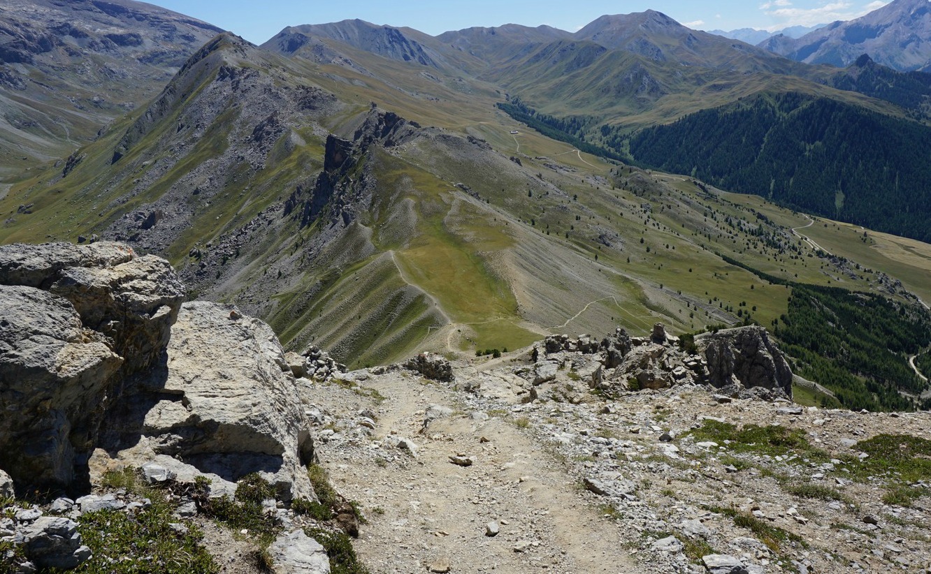
Magnificent ridge above Vars Valley

Trail following northern section of Crête de Vars


The impressive mountain ridge Crête de Vars northeast above the Vars Valley can be reached either from the village of Ste-Catherine or from Refuge Basse Rua in Val d’Escreins.

We chose to start from Ste-Catherine and hike clockwise as we had visited Val d’Escreins the day before. The ca 2.7 km long ridge reaches 2600 m, and the trail runs most of the time at about 2500 m elevation (highest point 2580 m). If you decide to hike anticlockwise, you’ll have the Les Ecrins Massif with its white mountain tops in your sight but either way, the views on the ridge itself and to the neighbouring mountains are remarkable!


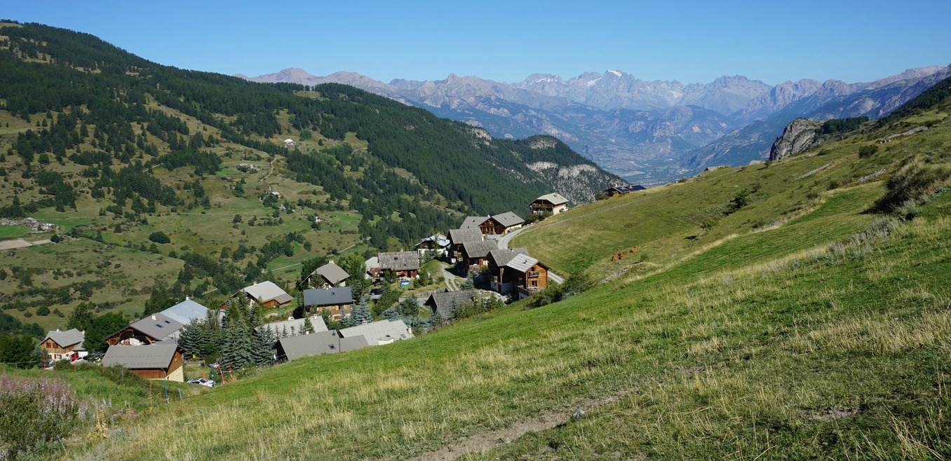
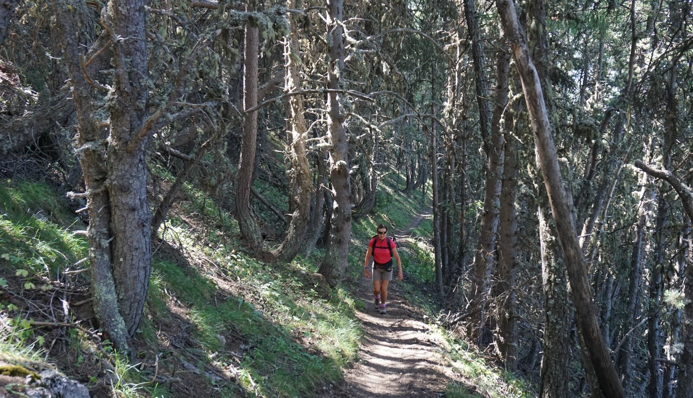
We used the parking in front of the local school in Ste-Catherine as described in the local guide booklet. The first part of the itinerary followed a narrow road, passing a saw mill south of the village before turning north.  The signposts showed the direction to Col de la Scie. After having passed a telecom mast, we forked left after a while leaving the dirt road, and continued the ascent heading north along a good trail in a magnificent forest called Bois de la Pinée. We felt that only at this point did the hike really start!

We reached Col de la Scie (2376 m) in about 1h 40 from the start. At the crossroads on the col, our trail along the ridge continued south-southeast while the other trail went down to Refuge Basse Rua. That trail seemed to be a steeper than the one we just had climbed.

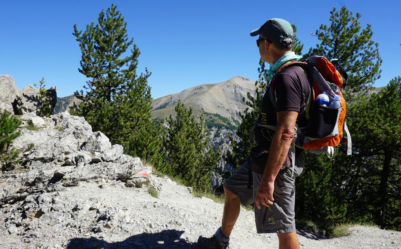
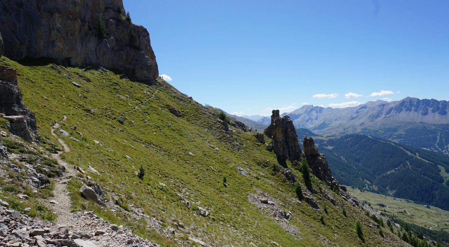
After a short and easy scramble from the col, we came to a beautiful part of the ridge with alpine meadows (title picture above) where we slowly ascended further before reaching the rockier part of the trail. The views down to Val d’Escreins in particular were dramatic as that side of the mountain ridge was precipitous, so stay on the trail!

We could have hiked on the picturesque ridge longer, but it came to a rather abrupt end as we saw next mountain pass, Col de la Coulette (2362 m) below us. We descended rapidly, minding the loose gravel on the trail. Col de la Coulette is another hiking trail crossroads. The trail to the left went down to Val d’Escreins while continuing straight would have taken you to Vallon Laugier. We forked right, and descended back towards Ste-Catherine. There were signposts here and there but the trail was marked with yellow, so it was easy to follow. We dove in the woods again, crossed dirt roads a few times, and eventually came to the saw mill again, but this time from a different direction, closing the loop.

Duration: 5 h
Crête de Vars trail

Elevation gain: 750 m


Distance: 12,8 km


Map: IGN 3537 ET Guillestre, Vars, Risoul


View to north from Crête de Vars


Crête de Vars southern end seen from La Selle


0 comments:

Note: only a member of this blog may post a comment.

Vars: Exploring Val d'Escreins

Crossing Torrent Rif-Bel Val d'Escreins


We had decided to explore Le Val d’Escreins on the first day of our three-day stay in Vars. A natural reserve situated between the Vars Valley and Queyras, it is called “little Canada” in the local guide because of its forests and steep impressive mountain ranges on both sides.

From the main D902 road, the valley can be reached along a paved although narrow road that goes as far as Refuge de Basse Rua (1760 m). The upper valley in the southeast is surrounded by 3000 m+ mountains, such as Pic de la Font Sancte (3385 m).

The Valley offers both easy trails for families and more demanding hikes that go over 3000 m. There are discovery trails where one can become acquainted with the local flora and fauna.

We planned an afternoon hike there, and chose to take the trail that went to the upper valley to an oratory, and to combine it with sentier des arbres remarquables, a path that ran parallel to the main trail for a while (marked as purple in the image).


We started from the parking at the refuge, and followed the trail (also a GR trail) to the oratory following the Rif Bel torrent (signposted and marked with purple signs). At about 2100 m elevation, we forked left (the GR trail continued southeast), and started to ascend more steeply, still mainly in the woods. The oratory came into sight just above the tree line at about 2300 m elevation.

On the way back, we took the right-hand trail a bit below the oratory signposted as arbres remarquables. The forest was beautiful as expected, but not exceptional. However, the path was better than the one we climbed on the way up. We soon joined the main trail again, and headed back to the starting point.


Elevation gain: About 560 m
Val d'Escreins trail

Duration: 2 h to the oratory, 1h 15 back.

Map: IGN 3537 ET Guillestre, Vars, Risoul

Distance: About 10,4 km

0 comments:

Note: only a member of this blog may post a comment.

La Merenda

La Merenda


La Merenda is a tiny restaurant in Vieux Nice that still serves authentic Niçoise cuisine. It all started in 1966 when Jean and Christiane Giusti opened the restaurant not far from the Cours Saleya. La merenda in nissart means a snack.

In 1996 Dominique Le Stanc, the famous 2-star chef from Negresco, took over. He brought his expertise to La Merenda respecting the culinary traditions of the region.

There are small wooden tables that can only be reserved by going there personally. No cheques or credit cards are accepted, and you cannot phone the restaurant. If Le Stanc’s bicycle is parked in front of La Merenda, it means that the restaurant is open. It is closed Saturdays and Sundays.


The menu features classic Niçois dishes: pissaladière, stockfish, pâtes aux pistou, sardines farcies, daube de bœuf à l’orange…The menu changes slightly according to the season. This is where you come when you want to taste beautifully prepared local cuisine.

We have visited Le Merenda before in summertime which is the best season for the cuisine du soleil of Nice. At quarter past 12 on a July Monday the tiny restaurant was already full. We were again just as impressed by the happy and simple atmosphere and great food with local wine.

For starters, we chose Tarte à la tomate and Beignets de fleur courgette. For main courses, we had Petits farcis et mesclun and Lentilles saucisses “Perugina”. Don’t worry about the French names of the dishes, they can explain them in English if needed.

And in La Merenda you can well order dessert because the portions are modest in size. We both had Salade de peches aux framboises. Delicious!

0 comments:

Note: only a member of this blog may post a comment.

Vars: La Selle Ridge

La Selle 2405m


We got inspiration for this hike called Les Crêtes de la Selle from a hiking booklet purchased from the Var tourist office.

It was our 3rd hiking day in Vars. As on the day before, this hike started from the charming village of Ste-Catherine (10 minutes by car from les Claux, the main resort in the Vars Valley). We used the same parking in front of the school (parking des écoles).

La Selle (2405 m) is actually a point on the ridge called Les crêtes de la Selle, and also the highest point of this loop trail.


We soon saw that this trail was much less frequented than the two previous itineraries. We hiked along a dirt road south-southeast till we crossed a bridge (Pont de la Salce) over the Chagnon Torrent, then continued along a good trail in the woods named Bois de Laver. There were yellow markings. Once over the tree line, we continued in the same general direction having the summit of Paneyron in front of us, and Peynier with its mast on the right-hand side. The landscape consisted of vast alpine meadows, with lot of animal-made paths.

Eventually we reached Cabane du Vallon, and a big flock of cattle nearby. At the hut, we turned 180° following the trail that still climbed towards the ridge. The markings were perhaps a bit unclear (and some markings had been toppled, the cows perhaps!) as we took the wrong trail. We soon saw the signpost at La Selle (pictured), hiked there, and could start our descent to the Chagnon Torrent Valley. Once there, we followed the torrent and descended back to the dirt road that we had used in the morning.

We didn’t see any other hikers (or herders) up on the ridge. Only on the way down, there was a couple enjoying their picnic by the torrent.
This was another almost clear day, and we could again enjoy the views to Les Ecrins in the north, La Mortice and Point Jean Rostand in the east.

Duration: 5 h

Climb: 660 m
La Selle hiking trail

Distance: 14,5 km

Map: IGN 3537 ET Guillestre, Vars, Risoul


0 comments:

Note: only a member of this blog may post a comment.