Exploring the Sainte-Baume Massif

Jouc de l'Aigle 1148 m


The mythic ridge of the Sainte-Baume Massif about 20 km from the Mediterranean Sea as the crow flies offers great views and extraordinary hiking. But the greatest attraction in this area is Maria Magdalena’s cave and the rather sombre chapels that were built around it. According to the legend, Maria Magdalena arrived first to Marseille and then to this remote cave where she lived for several years.


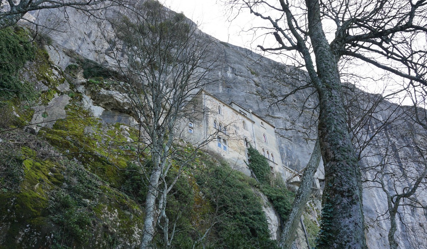
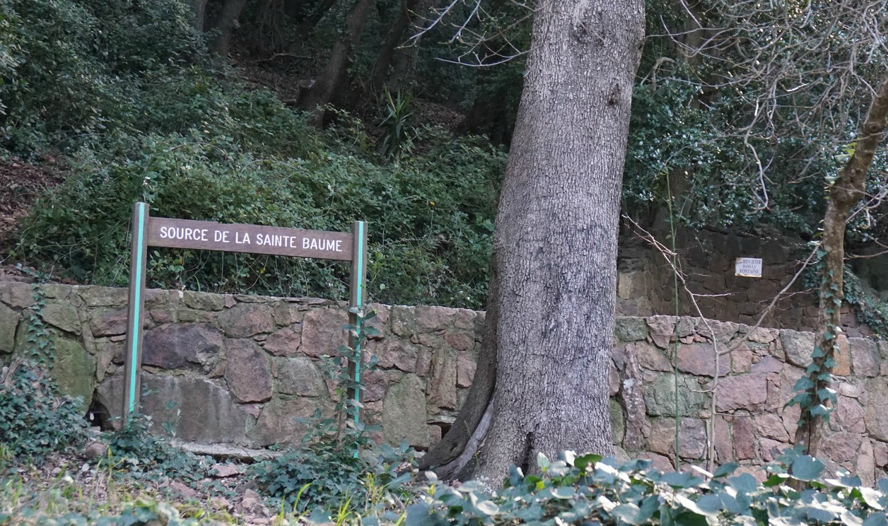
We started our hike from the Hôtellerie of Sainte-Baume (670 m), following the GR 9 trail which took us past a field before it dove into a magnificent forest (Foret Domaniale de la Sainte-Baume). We ascended along a wide trail to a crossroads where we forked right, making a detour to the cave and the chapels.

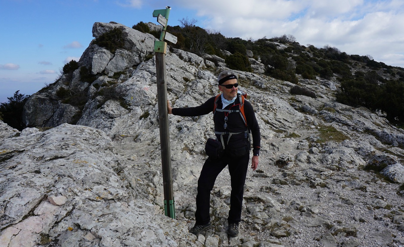
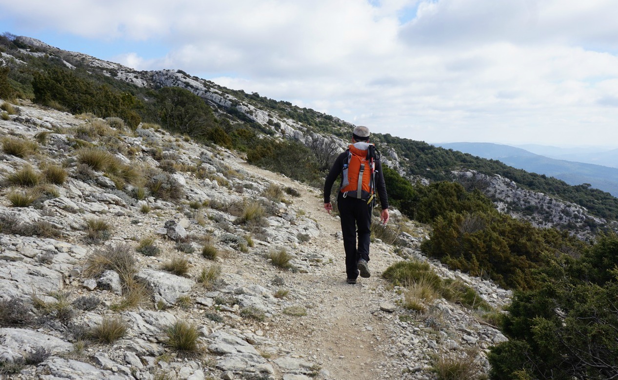
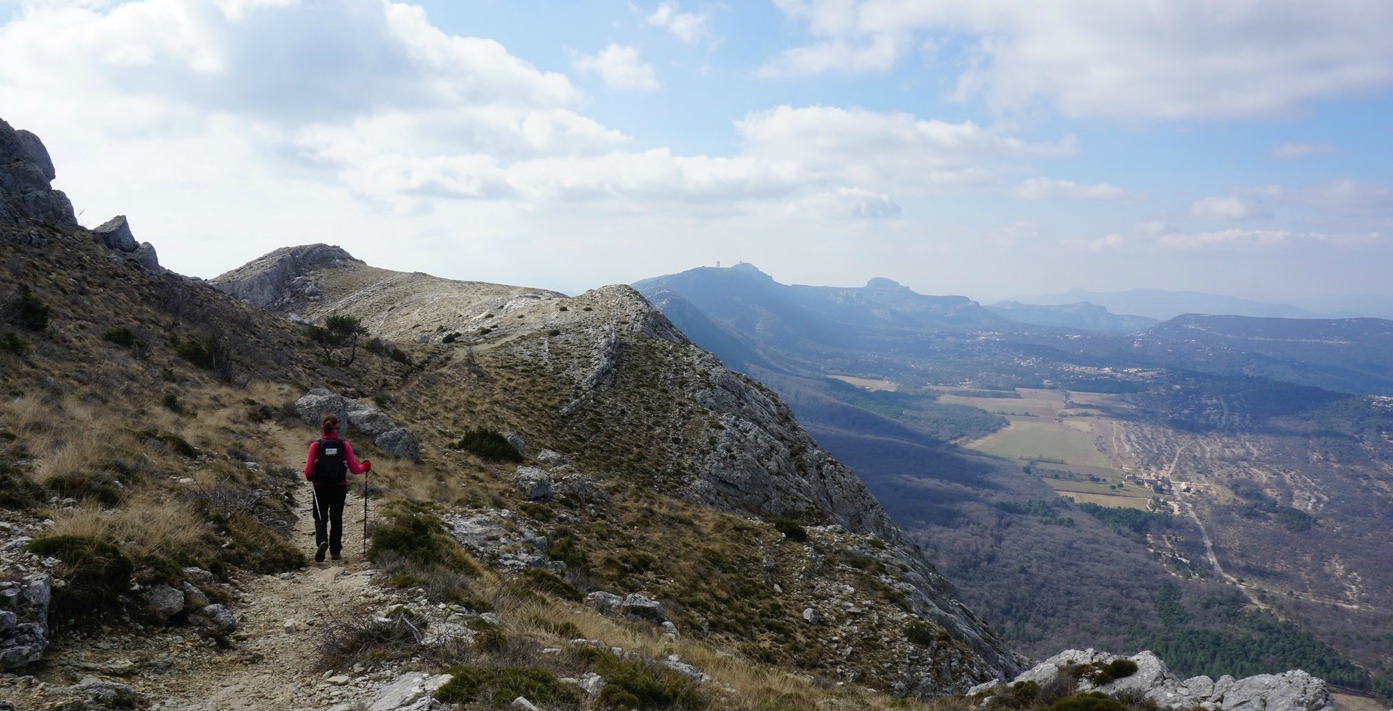
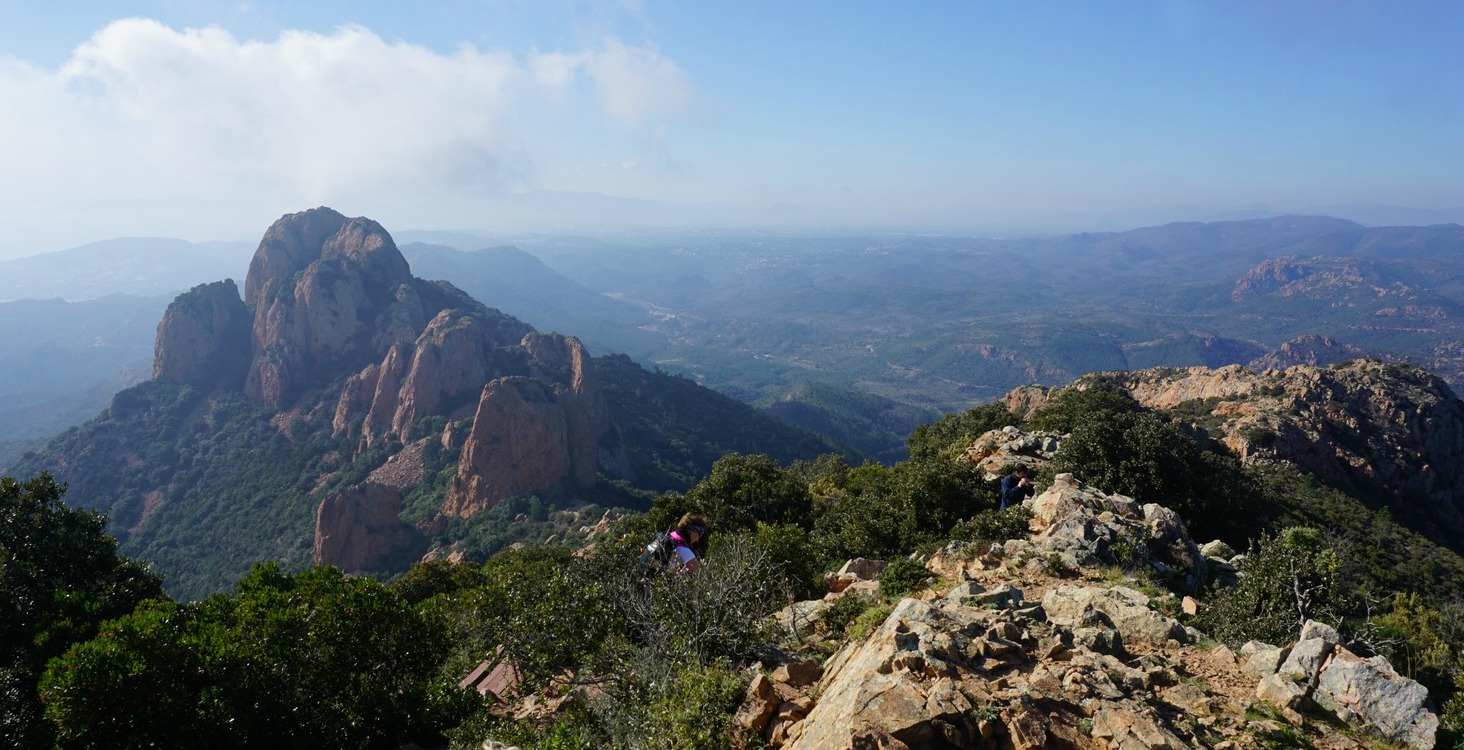
After the visit, we descended back a bit to follow the GR9 trail and ascended along it to Col du St-Pilon (953 m) on the ridge of the Sainte-Baume Massif. From here, the GR 9 trail runs to the east, following the ridge whereas to western part is marked as GR 98. We forked left as we had planned, ascending gently in a barren and rocky terrain. The trail was very well marked with white/red signs. The highest point of the ridge (1148 m) is in fact shared by two summits: Jouc de l’Aigle and Signal des Béguines, about 1,5 km further east.

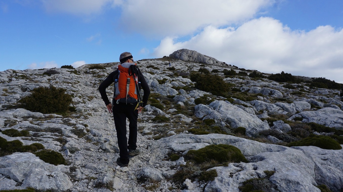
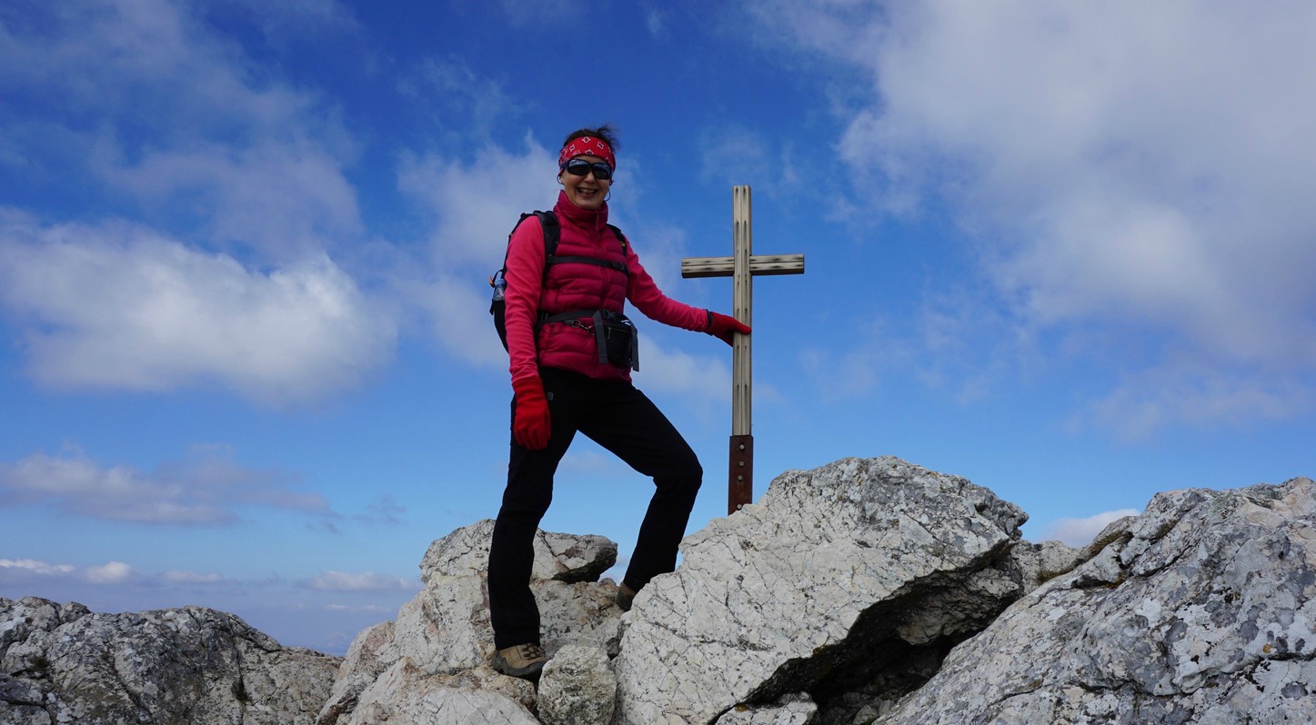
From Col du St-Pilon, the ascent to Jouc de l’Aigle was only about 200 m. Just before the summit, some easy scramble was needed. A cross was erected on the summit. In spite of the haze, we saw Mont Sainte-Victoire in the northwest and the Mediterranean Sea in the south.

We used the same trail back as far as to the crossroads below the cave. Here we took the wide right-hand trail which descended in the forest to “Trois Chenes”, then headed back to our starting point less than a km away.

Climb: 480 m

Duration: 3h 10

Distance: 9,7 km

Map: IGN 3345 OT Signes Tourves Massif de la Sainte-Baume

Our GPS track is shown below

Hike trail to Jouc de l'Aigle Sainte Baume

0 comments:

Note: only a member of this blog may post a comment.

Rabbit with black olives

Rabbit with black olives


Rabbit meat is farmed throughout the Mediterranean. In our supermarket in Nice, rabbit is sold as fillets, legs, and as a whole rabbit cleaned and cut into chunks.
The following recipe is a twist of a chef’s recipe in Nice Matin, the local newspaper. I have modified the recipe easier and quicker to make without sacrificing the taste. If you don’t find rabbit fillets in your area, you could use slices of chicken breast or duck breast without fat.

2 servings

4 rabbit fillets
10- 12 very small new potatoes
1 clove garlic, minced
250 ml veal stock, fond de veau
8 black olives, pitted
Olive oil
2 sprigs of fresh thyme
2 tbsp. thyme leaves
1 fresh bay leaf
1 organic orange, zest and juice

In a heavy casserole, warm 2 tbsp. olive oil over low heat. Add the thyme sprigs, bay leaf, and minced garlic and sauté for about 10 minutes.

Meanwhile wash and microwave the potatoes until cooked. Add to the casserole and sauté until coloured to light golden. Then add the olives, cover and keep warm.

At the same time sauté the rabbit fillets and cook the veal stock in a small saucepan.

Warm 2 tbsp. olive oil in a frying pan over medium heat and sauté the rabbit fillets 4 minutes on both sides. Zest the orange and press into juice. Add these to the frying pan and let reduce for about 5 minutes over medium heat, turning the fillets occasionally. At the same time reduce also the veal stock in the small saucepan, then pour to the frying pan over the rabbit.

Divide the potatoes and the rabbit fillets on the plates. Drizzle over the sauce and decorate with thyme leaves.

0 comments:

Note: only a member of this blog may post a comment.

Hiking in the southern Esterel Massif

Red Esterel Massif cliffs


This is a magnificent hike in the red Esterel Mountains offering great views to the Mediterranean Sea. We did this hike on a warm February Sunday. It also happened to be during school holidays and the trail was extremely popular.
The soil and rock of the Esterel Massif is of volcanic origin, hence the peculiar red terracotta colour.

The hike we did ran inside Réserve Biologique de l’Esterel in the southernmost part of the massif in the Var Department. We planned a loop hike with Pic du Cap Roux (453 m) as the highest point.


We started the hike from the parking called La Pointe de l’Observatoire on the D559 road between Theoule-sur-Mer and Agay.

We first ascended along a paved road about 2 km (closed for regular traffic) as far as to Rocher St-Barthélémy.  Here we exited the forest road, hit the trail proper and ascended along it to Col du Saint-Pilon. We then descended to Sainte-Baume where we passed a water source and started a long ascent along the northern flank of the mountain, passing the short side trail to a chapel.

Note that compared with most trails in Alpes-Maritimes, signposts here were sporadic or non-existent but the trails were marked with yellow and/or blue. So, we first missed the ascent from Sainte-Baume.

We reached the crossroads just under the summit of Pic du Cap Roux, climbed up to admire the views. The day was clear, but some coastal fog started to form during our picnic on the top, making the visibility somewhat reduced.

We then descended to Col du Cap Roux. Here we forked left, following the yellow-marked trail. At the next crossroads we again forked left (yellow signs, no signposts). We continued along the trail that ran in the southern incline of the massif, with the Med in sight. We forked left for the third time at the next crossroads, crossing a valley. At one point we thought we might end up too much east but no worries: we eventually reached a wider path not far from the main coastal road and the railroad, turned almost 180°, and headed southwest. We crossed the above-mentioned valley again, now lower, and soon reached our starting point.

Distance: 12 km

Climb: 610 m

Duration: 4h 20

Map: IGN 3544 ET Fréjus St-Raphaël Corniche de l’Esterel

Our GPS track in shown below. Just ignore the small marked detour at Sainte-Baume!


0 comments:

Note: only a member of this blog may post a comment.

Sauce Niçoise

Sauce Niçoise


Recently the local newspaper, Nice Matin, wrote about a 24-year old talented chef from Nice, Julia Sedefdjian, who only a year after opening her restaurant Baieta in Paris got a Michelin star. The menu in her restaurant reflects her roots in Nice. One of the dishes is her version of bouillabaisse; steamed fish served with sauce niçoise.

But what is sauce niçoise? Julia’s recipe is of course her secret so I googled sauce niçoise and it seems that there are several versions with different vegetables. I tried and modified different French recipes and settled with the following recipe which I think goes best with white fish fillets and at the same time reflects the choice of typical ingredients here in Nice.
By all means add some seafood to your choice of baked or steamed white fish fillets if you wish your dish reflect more bouillabaisse. You can also use more anchovy fillets if you like. I used them sparingly because I didn’t want them to overpower the delicate taste of fletan, halibut, which was my choice of fish. Serve your fish with some greens and new potatoes, lentils or grains. In the photo, the fish is served with wilted spinach and panisses, local chickpea cakes.

2 servings sauce niçoise

2 small and tasty tomatoes
1 shallot
1 clove garlic
4 anchovy fillets
4 black olives, pitted
2 tbsp. olive oil
Freshly ground black pepper

Dip the tomatoes into boiling water for 1- 2 minutes, then peel and coarsely chop them. In a small casserole, warm olive oil over medium- low heat. Peel and chop the shallot and peel and mince the garlic. Add them to the casserole and sauté for 10 minutes. Add the tomatoes, anchovies, olives, and black pepper. You can first soak the anchovies in water for 10 minutes to reduce the amount of salt in them.

Let all the ingredients simmer for 5 minutes. With a hand-held mixer, purée the sauce. It will be quite thick, you can add 1- 2 tbsp. of boiling water if you wish. Place the fish on the plates and divide the sauce around it.

0 comments:

Note: only a member of this blog may post a comment.

Walk above Théoule-sur-Mer

Théoule-sur-Mer


Théoule-sur-Mer (36 km from Nice) is a small coastal town between Mandelieu-La Napoule and Miramar. The landscape here is already more provençale and the Esterel mountains with their typical red colours add a special spice to the surroundings.

This easy walk called Circuit d’Aguille starts from the Esplanade of Charles de Gaulle in the town centre.


We walked along the paved promenade Pradayrol to Plage de l’Aguille where the trail forked uphill. We first ascended to signpost #515 and then descended to Pointe de l’Aguille. After admiring the magnificent pebble beach of Gardanne we took the same path back, continued to the coastal road RD6098, turned right, and followed it about 100 m. We then forked left and continued along rue de l’Allée des Pins then rue A.Ballif.

At signpost #518 (pointing to St Hubert, Théoule Supérieur) we forked right and followed another good trail to the highest point of this walk. Best views were to the north and east (The Napoule Bay and Cannes). The trail continued towards St Hubert above Théoule-sur-Mer, and we soon reached paved streets. We took Chemin de la Calade (steep stairs down), crossed the main RD 6098 road again before reaching our starting point.

We hope our GPS track shown below is useful, as well as the description in the Randoxygène guide (in French; link above)

Duration: about 1h 35

Distance: about 5 km

Elevation gain: about 200 m (includes detour to the Gardanne beach)

Map: 3544 ET Fréjus St-Raphaël Corniche de l’Esterel

Théoule-sur-Mer trail image
Signposts along the trail above Théoule-sur-Mer

0 comments:

Note: only a member of this blog may post a comment.