Veal escalopes stuffed with Parma ham


Veal escalopes stuffed with Parma ham

This classic Italian dish gets a different twist if you use basil leaves instead of sage leaves and add some good tomato sauce to the white wine sauce. Whole wheat pasta with parmesan and steamed green beans go well with the veal.

2 servings

2 thin veal escalopes, about 120- 150 g each

2 slices of Parma ham

4 basil leaves

2 tbsp. olive oil

Some wheat flour for dusting

150 ml white wine

2 tbsp. tomato sauce

Freshly ground black pepper


Place the escalopes between two sheets of aluminium foil and pound with your fist to make them thinner. Grind over some black pepper and place a slice of Parma ham on each escalope, followed by basil leaves. Fold over the escalopes to make a pocket and secure with a cocktail stick. Lightly dust both sides of the escalopes with flour.


Warm 2 tbsp. olive oil over medium- high heat in a frying pan. Cook the escalopes 2- 3 minutes on both sides until golden brown. Add the wine, tomato sauce, and some more black pepper. Increase the heat to high and let bubble until reduced by about half.


Drain the cooked pasta, divide on the plates and fold in some parmesan. Divide the escalopes surrounded with the sauce and steamed green beans on the plates.


0 comments:

Note: only a member of this blog may post a comment.

Esterel: Pic de l'Ours hike


Beachfront near Trayas station


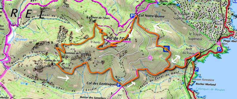
Pic de l'Ours hike track

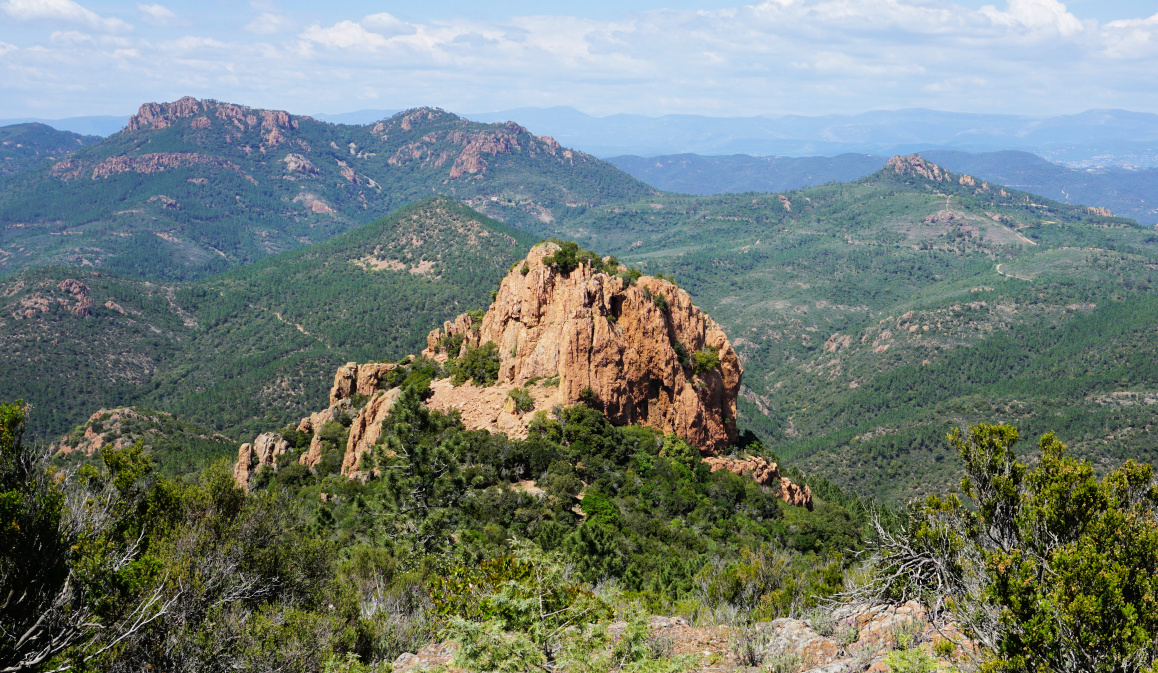
The Esterel Coastal Massif located both in Var and Alpes Maritimes Departments is of volcanic origin. The rock consists mostly of rhyolite, giving the hills a distinct red colour.

Numerous roads, some of them paved, crisscross the region. But there is a network of hiking and mountain biking trails as well, and some of them cross surprisingly rugged and sauvage terrain. The landscape is quite different from what you see elsewhere in Alpes-Maritimes. 

We decided to hike up to Pic de l’Ours (496 m), starting from the parking by the D559 coastal road, near the Trayas train station. Another option is to use the small parking next to the station.


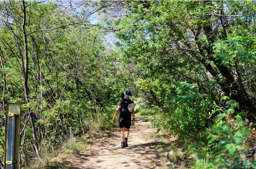
Trail behind Trayas station
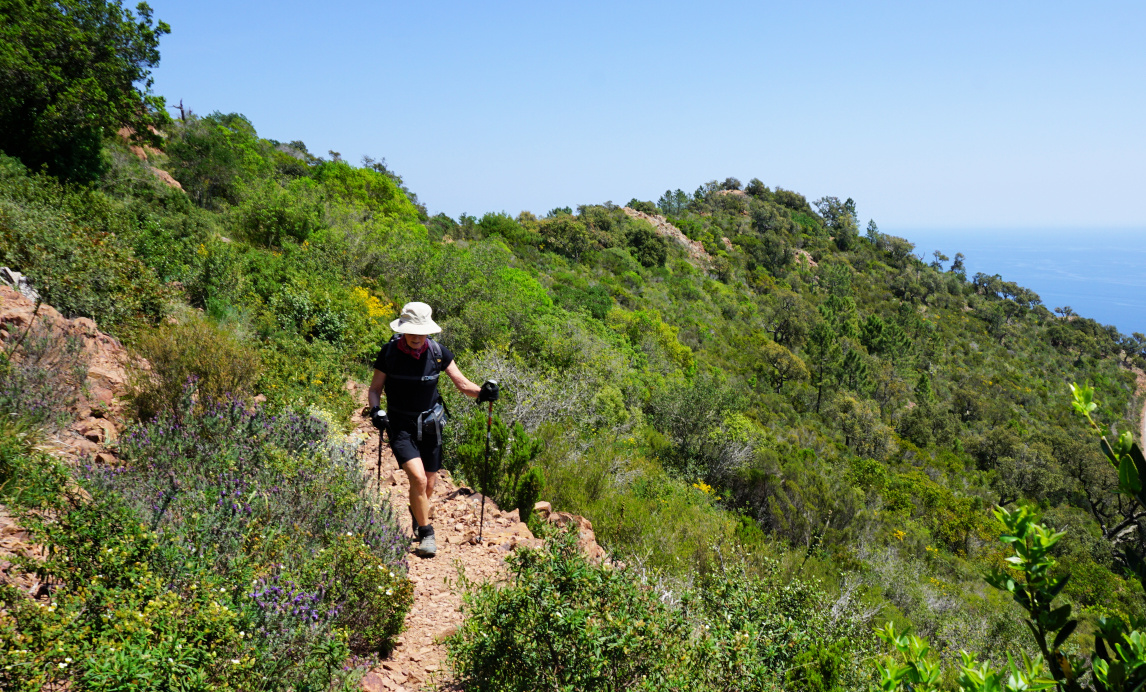
Rocky trail above Le Trayas
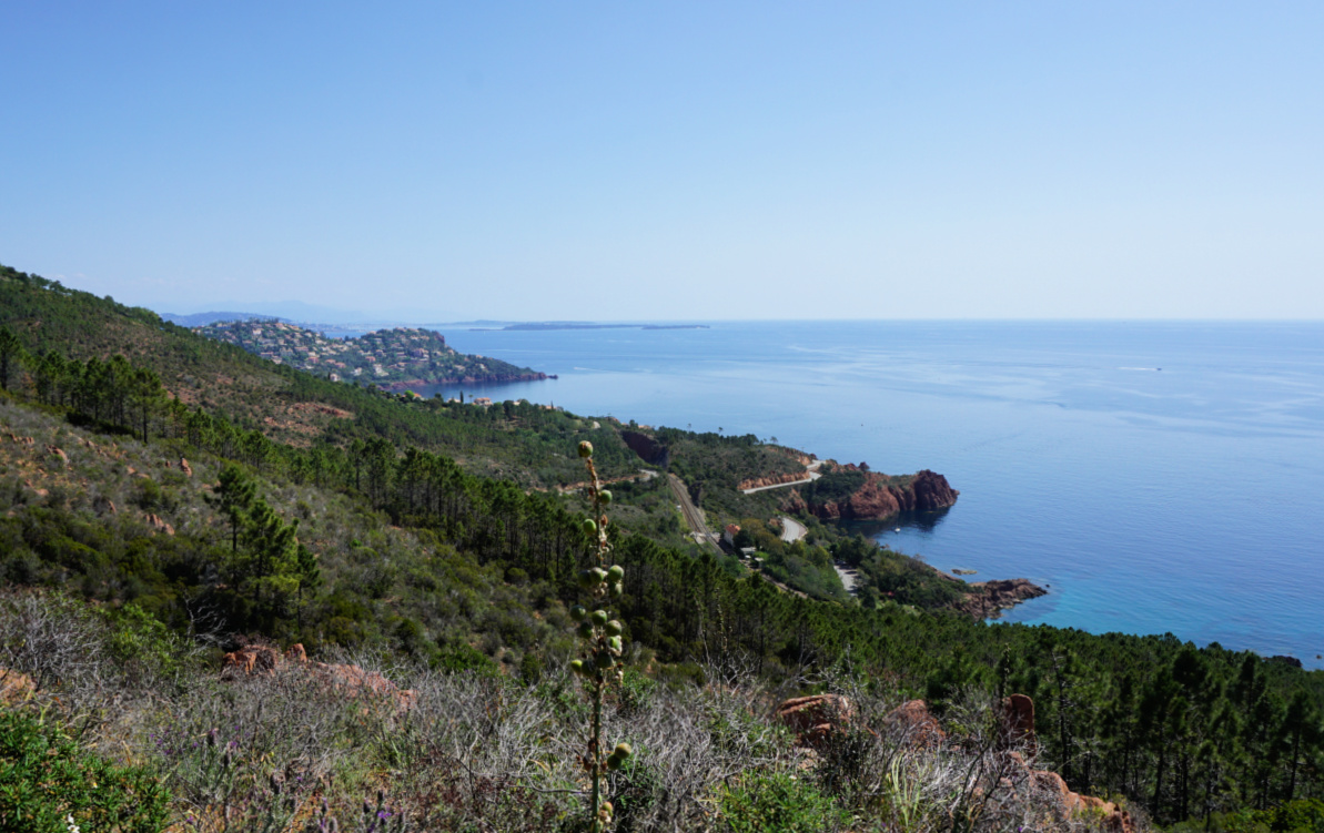
Le Trayas coast
Le Trayas coast
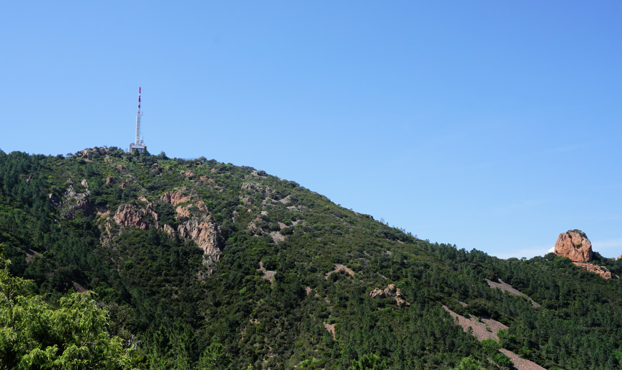
Pic de l'Ours
Pic de l'Ours


We walked up to the starting point behind the station (300 m), carefully crossing the road and the railway. We forked left and followed a wide dirt track about 370 m, then forked right and ascended along a rocky trail about 400 m before reaching a crossroads. We forked sharply right (if you miss this, you end up doing the hike clockwise!) now along a yellow-marked trail. We climbed, partly in the woods, to Col de Notre-Dame (324 m).


We now had Pic de l’Ours above us, and chose the direct route up to the summit. The trail (blue markings) was quite steep in places. The summit itself was a restricted area, with a large white/red mast and different other telecom antennas. The spring day was warm but a bit hazy. We had nevertheless great views towards Cannes and beyond in the east and Frejus in the west. 


Cannes seen from Pic de l'Ours
Dent de l'Ours
Dent de l'Ours
Pic du Cap Roux
Pic du Cap Roux
Path under Pic de l'Ours summit

After a picnic break, we continued along a yellow-marked trail which first circled under the summit then descended rapidly to Dent de l’Ours. Our trail continued to the south, then west making a large loop in the rugged terrain before turning southeast to Col de Lentisques. We then followed the yellow trail which descended above Ravine de Cazal de Beuf, where we passed the crossroads on the way up, then back to or starting point. 


The trails of this hike were good but very rocky. Good hiking shoes and poles are essential. It can be very hot during the summer months. Compared with Alpes-Maritimes, there are just sporadic signposts but the itinerary is well colour-marked and easy to follow. Study the itinerary on the map (digital or paper) before leaving. 


Climb: 490 m


Distance: 9,6 km


Duration: about 3h 45 active


Map: 3544ET Fréjus St-Raphaël Corniche de l’Esterel


0 comments:

Note: only a member of this blog may post a comment.

Spinach with pine nuts and golden raisins


Spinach with pine nuts and golden raisins


Spinach is a popular vegetable in all Mediterranean countries. I remember a trip to Rome one autumn when almost all small restaurants served only boiled spinach as a vegetable side.

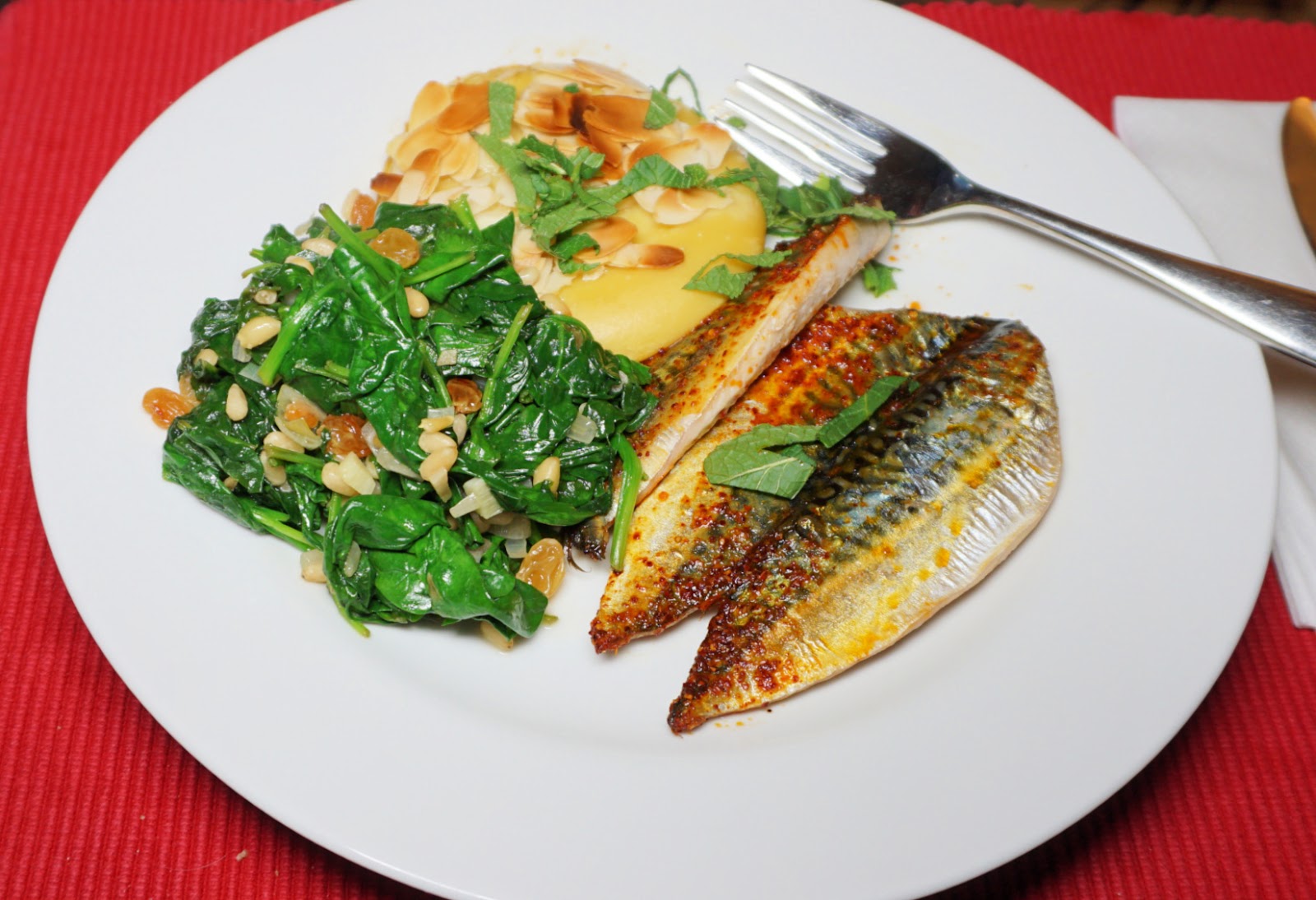
Spinach is said to have originated somewhere in Persia, and was brought into the Mediterranean countries by the Arabs. The following recipe with pine nuts and golden raisins suggests an Arab origin. This vegetable side goes very well with roasted mackerel fillets and panisses, South of France chick pea cakes.

2 servings

About 4 handfuls of baby salad leaves

2 tbsp. golden raisins

2 tbsp. pine nuts

1 tbsp. olive oil

2 shallots, chopped

1 clove garlic, minced

Freshly ground black pepper


Warm the olive oil in a large saucepan over medium- low heat and start sautéing the golden raisins and pine nuts. Add the shallots and garlic and continue sautéing for 10 minutes until soft.


Wash and dry the spinach leaves and add to the saucepan. Raise the heat to medium and sauté for about 5- 10 minutes until the spinach is wilted.


Serve with roasted mackerel fillets and panisses


0 comments:

Note: only a member of this blog may post a comment.

Vence: Loop from Plan des Noves parking


GR51 west of Plan des Noves


Today’s hike features a loop above Vence, starting from the popular Plan des Noves parking (780 m) by the D2 road. Having hiked here many times, we now wanted to try a new itinerary, first using tracks and trails west of the D2 road.

Track leaving GR51
Track leaving GR51
Mouton d'Anou
Mouton d'Anou
Oratory
Oratory
Puy de Naouri and Tourrettes


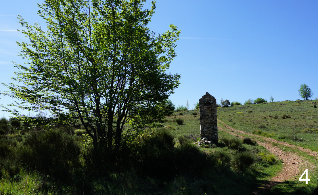
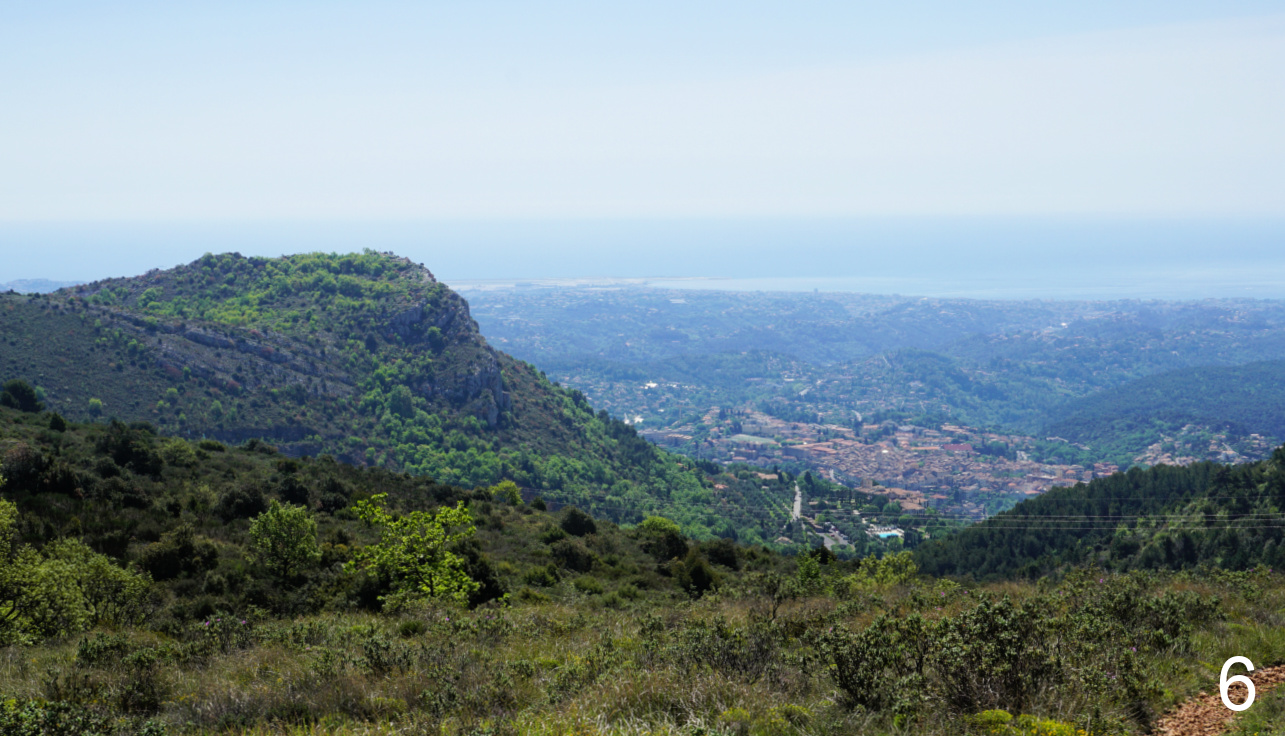
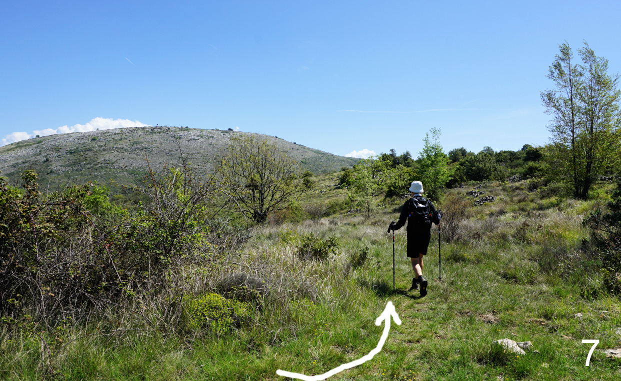
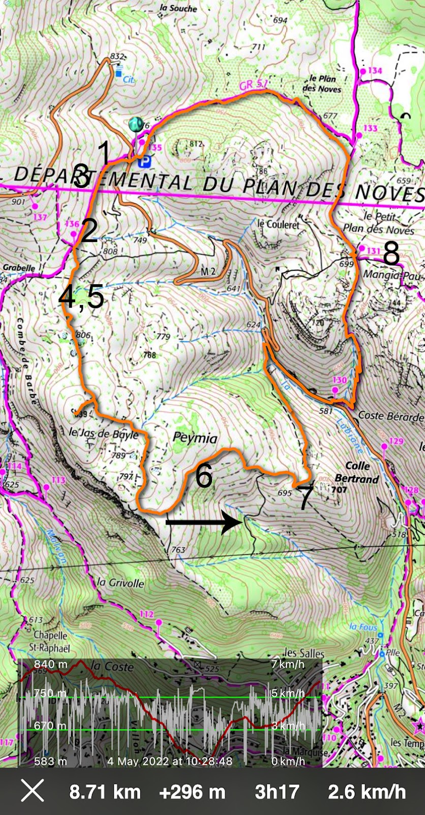
We crossed the road and headed west along the GR51 (images 1 and 3 ) as far as to signpost #136 where we forked left (2 ), leaving the GR trail (and marked hiking trails). We followed a wide track mainly to the south, passing an oratory (). We made a short detour to a hilltop (839 m) at Jas de Bayle with great views to the west, notably to Puy de Naouri and Puy de Tourrettes (). We continued along the dirt track (no markings but easy to follow) further south, then to the east (). Near Colle Bertrand we forked left () and followed a narrower trail which passed a solitary oak tree, then descended in a northerly direction towards the D2 road.


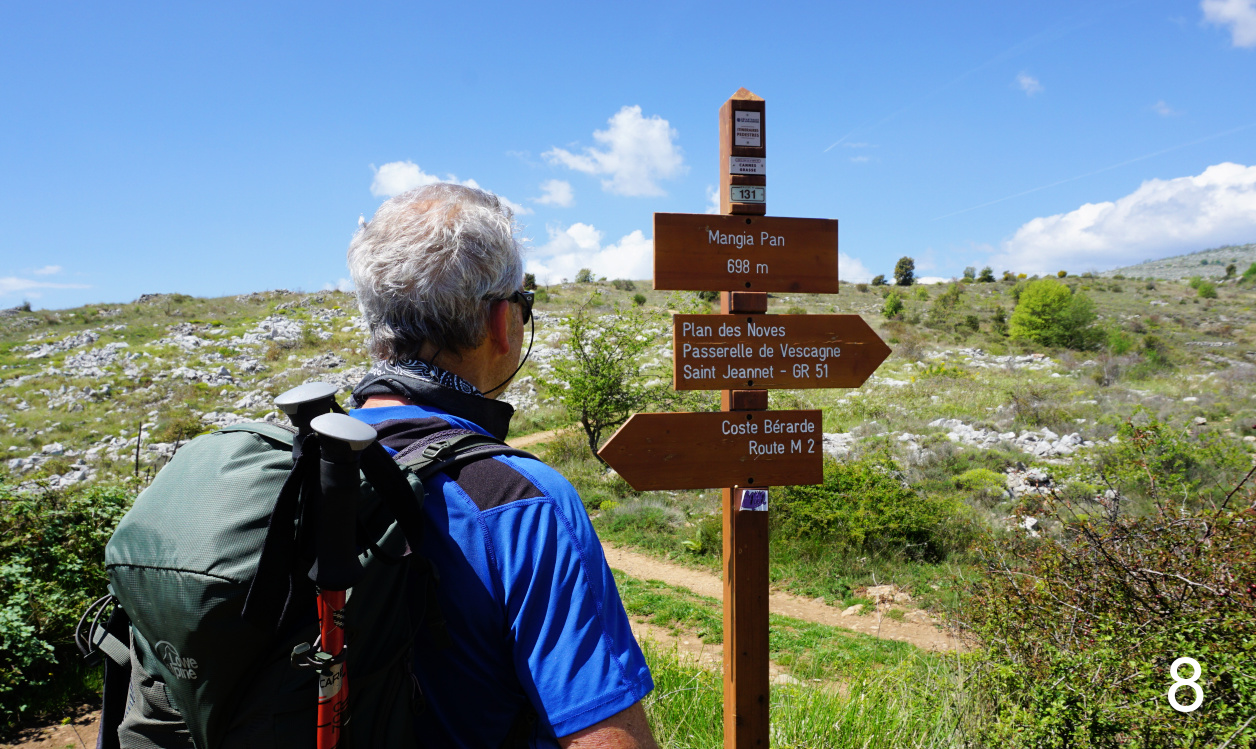
We soon reached the road, forked right and descended along it (carefully in a single line) about 500 m to signpost #130 (581 m), where we followed the trail up to Mangia Pan (699 m; signpost #131; image ).


We headed straight north to signpost #133 (at 678 m; marked as Plan des Noves) where we re-joined the GR51 trail and followed it back to our starting point.

Baou des Blancs and Vence
Crossroads near Colle Bertrand
Mangia Pan
Mangia Pan

It turned out to be a nice loop variant along easy trails. Only the trail descending back to the RD2 road was narrow in places and might become a bit overgrown in summer. 


Duration: 2h 45 active

Climb: 300 m

Distance: 8,7 km

Map: «Cannes-Grasse» Côte d’Azur No 3643 ET or Vallée de l’Estéron Vallée du Loup 3642 ET


Loop from Plan des Noves parking


0 comments:

Note: only a member of this blog may post a comment.