Le Chenaillet 2650 m above Montgenèvre

Viewing Mont Chaberton from Le Chenaille 2650 m


Le Chenaillet (2650 m) is a summit situated between the Valley of la Cerveyrette River and the village of Cervières in the south and Mongenèvre ski resort in the upper Valley of La Durance in the north.

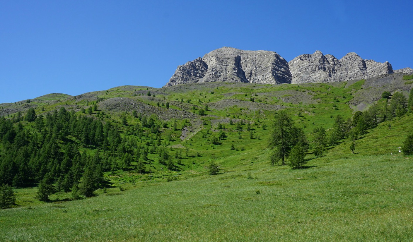
The Chenaillet Massif is volcanic, and as an example of Alpine oceanic crust it is geologically of great interest.

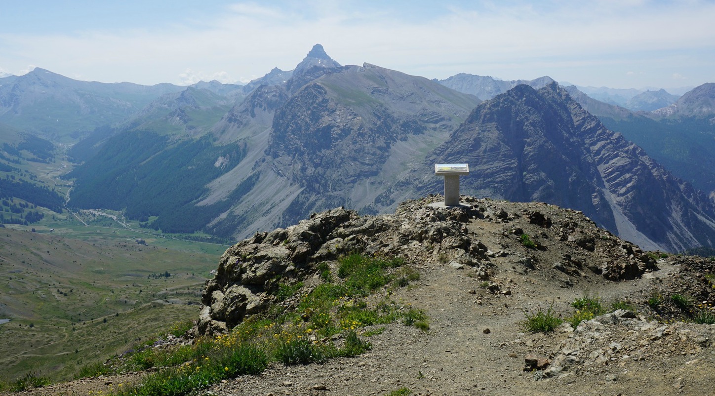
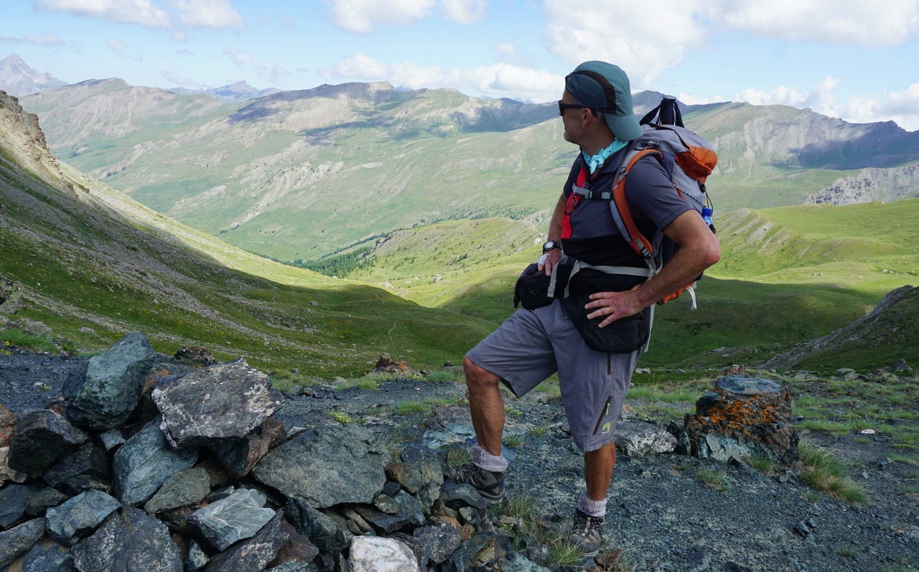
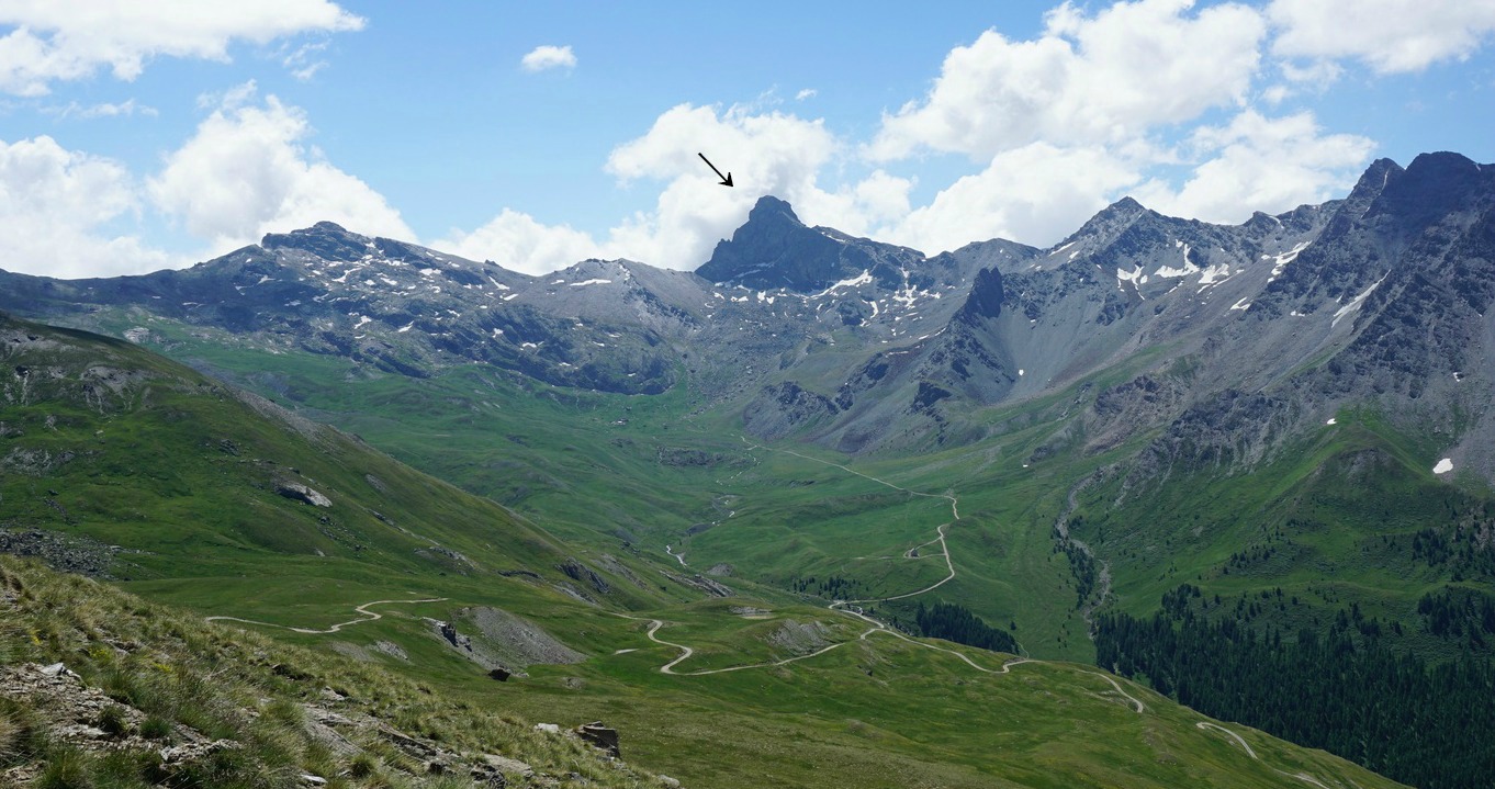
There’s a Sentier Geologique with information about the mountain’s geology. Even if you are not a geologist, the mountain and the hike offer a great panorama of the Cottian Alps and beyond. In the north, the nearby Mont Chaberton dominates the landscape.

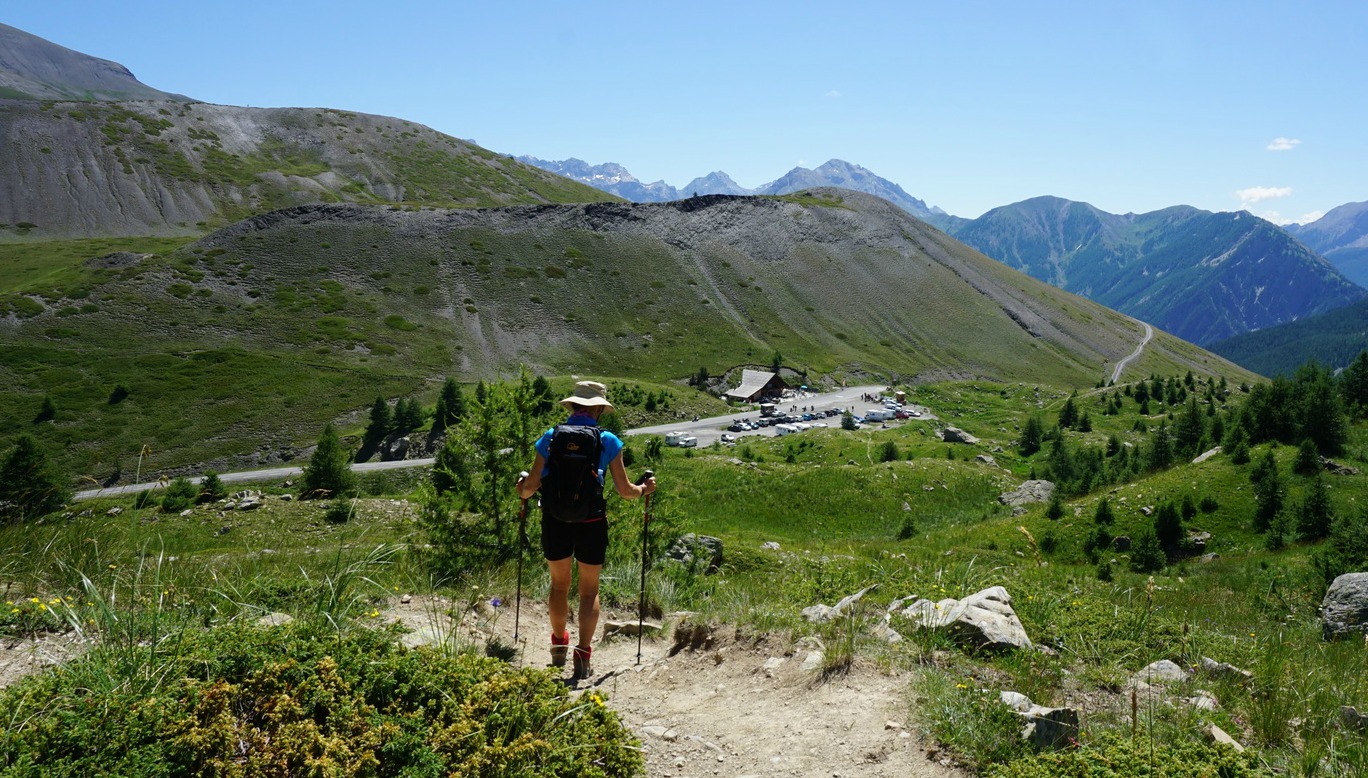
Several paths lead to the summit from both valleys. We opted to ascend from a parking named Les Aittes (1900m) a few km from Cervières along the narrow but paved D89T road. In fact, it is just a few hundred meters from the hamlet of La Chau (1904 m) and its parking by the road, so both can be used.


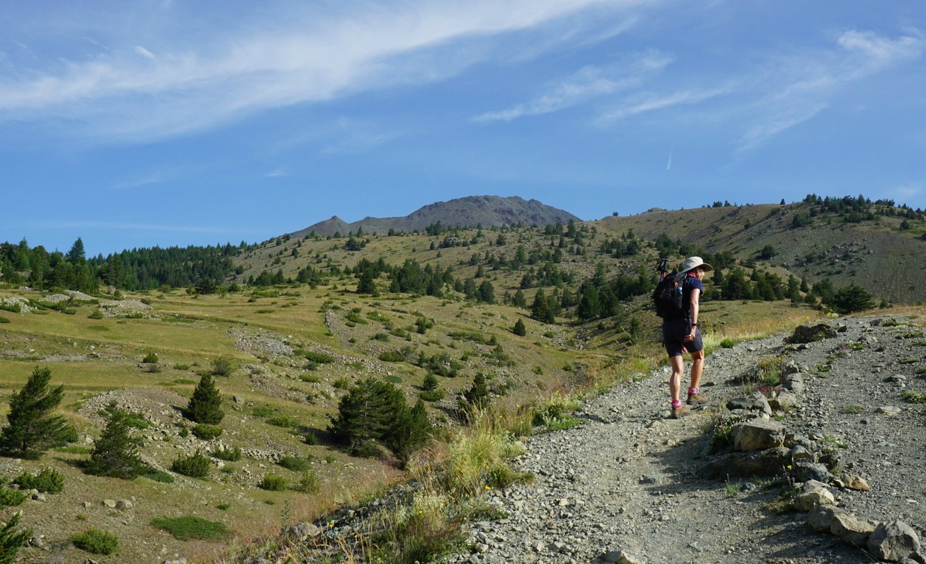
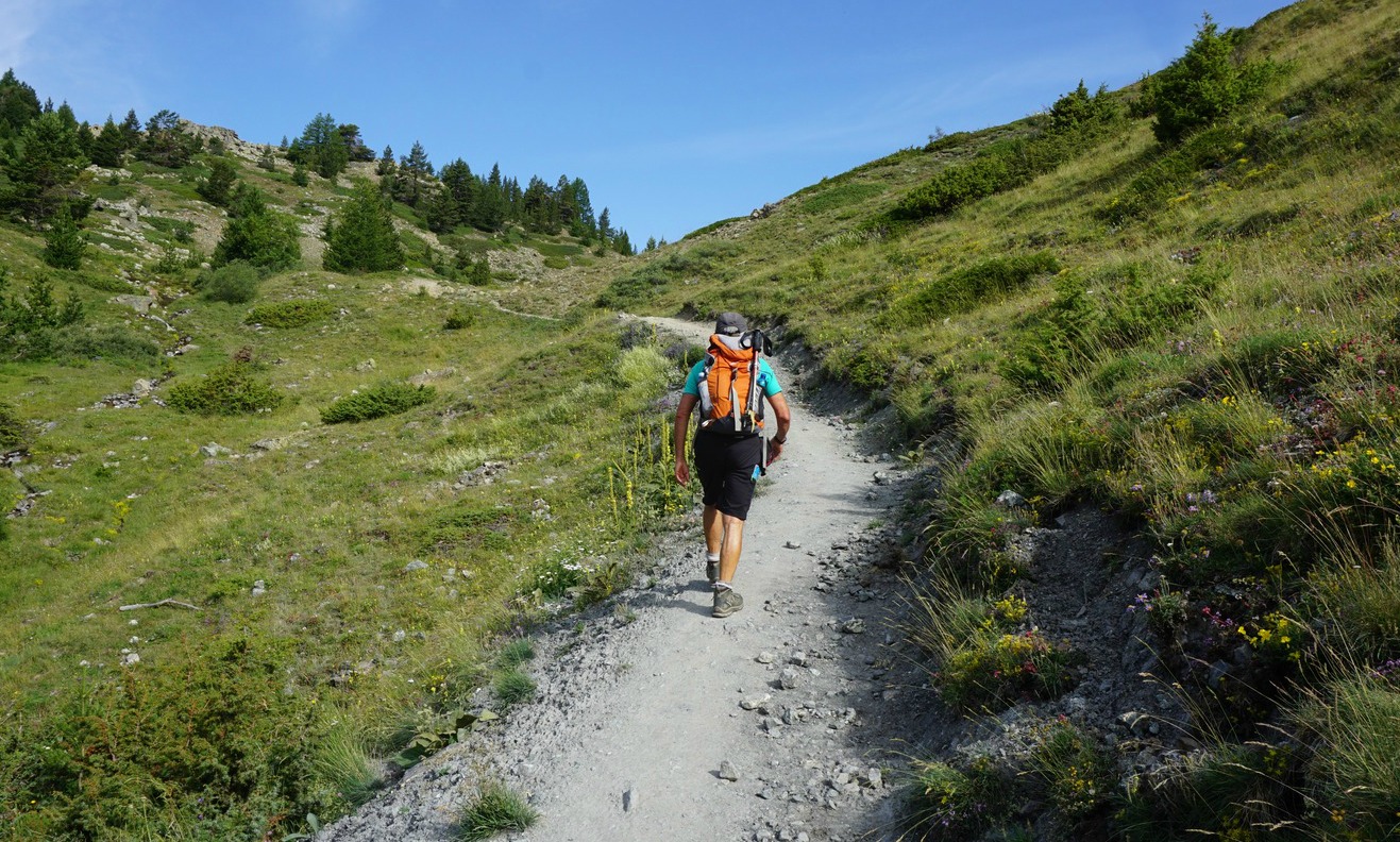
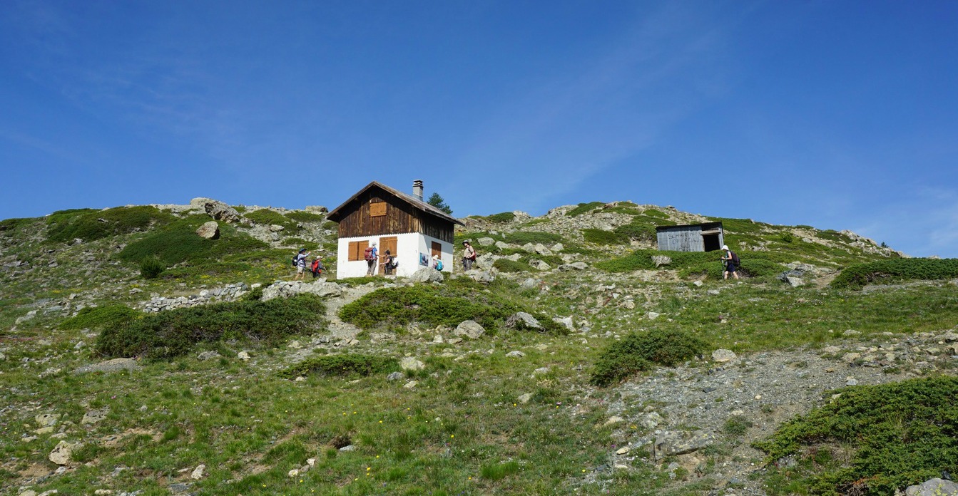
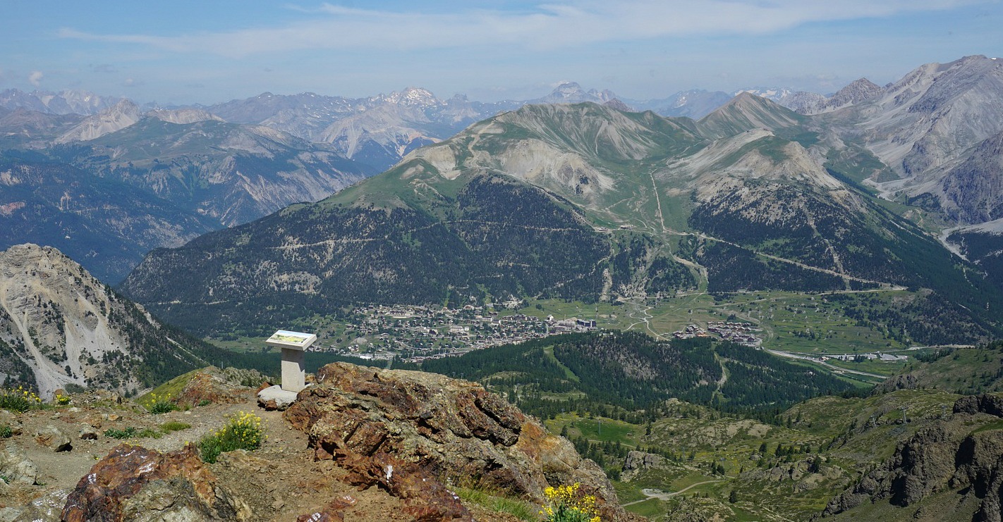
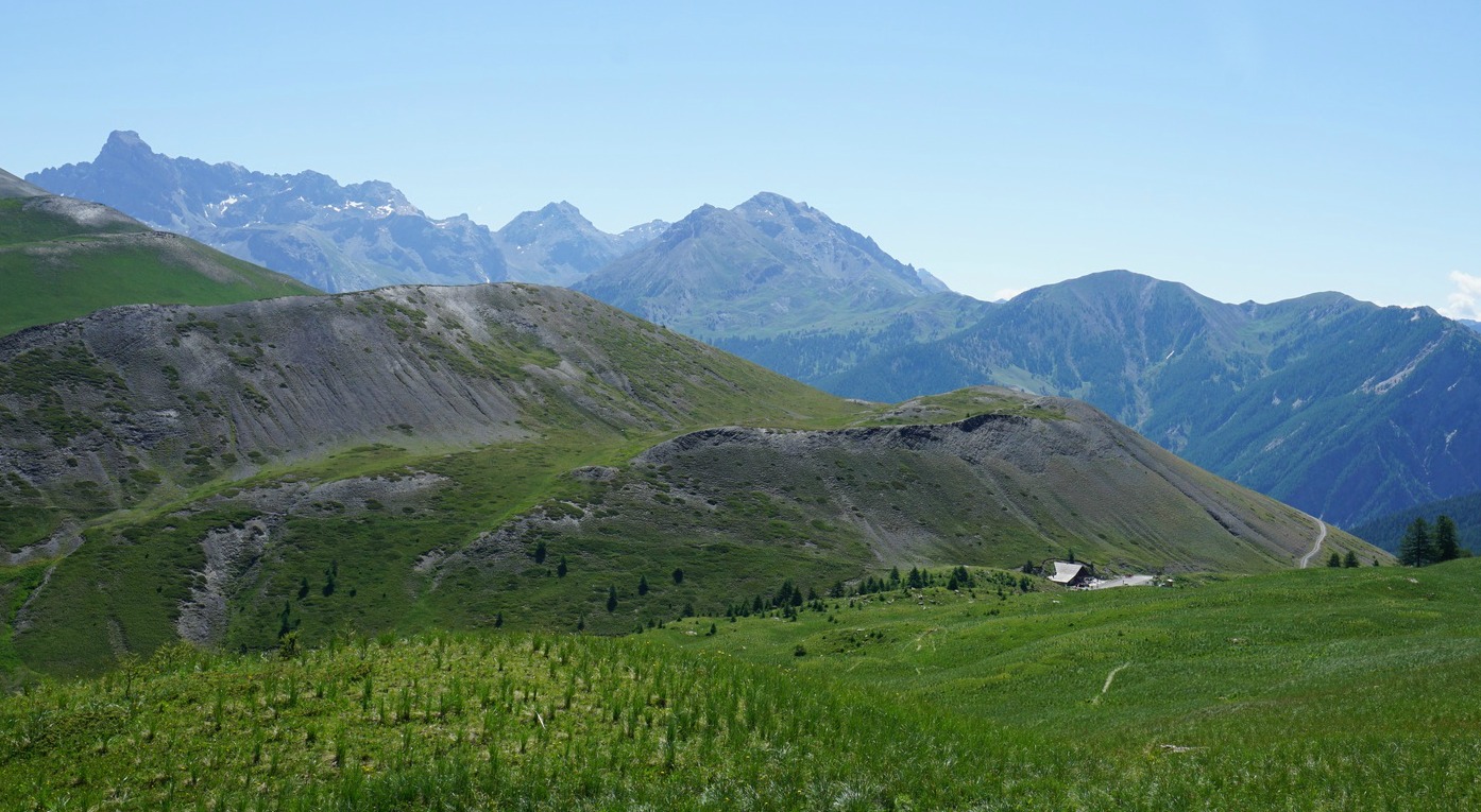
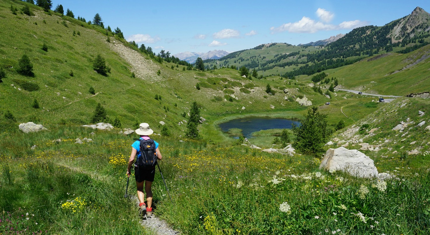
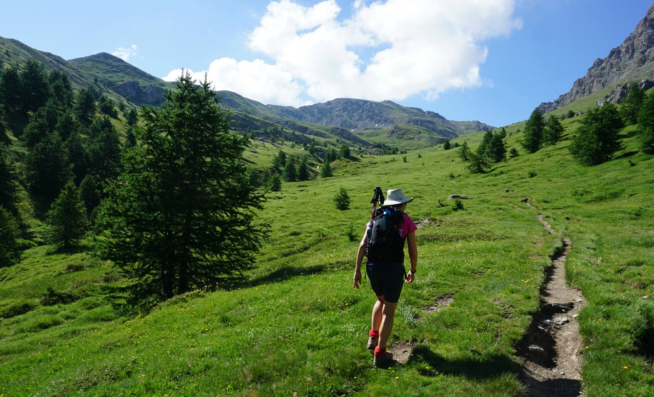
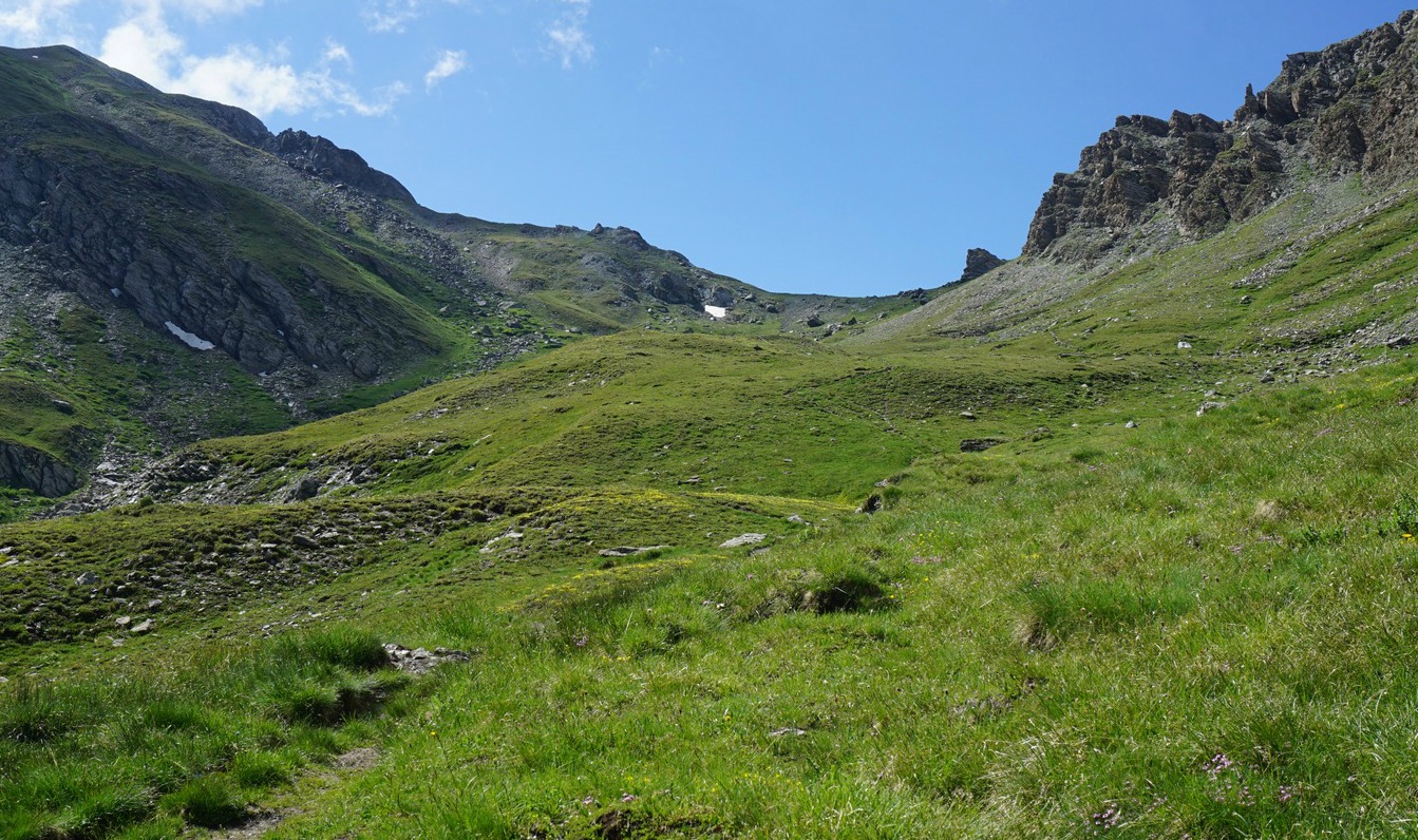
We started along the Sentier Geologique, a very well-maintained trail to Lac des Sarailles (2236m). A side trail circled the lake. From here, we ascended rapidly to Cabane des Douaniers between Sommet des Anges (2459 m) and Le Chenaillet. We were on a ridge that connected these two mountains. At the crossroads and a signpost, we continued east, along the trail that went to Le Chenaillet. It was still marked as part of the geological trail and Montgenèvre trail running itinerary. Eventually the terrain became rockier and the trail steeper. Some sections were a bit exposed.

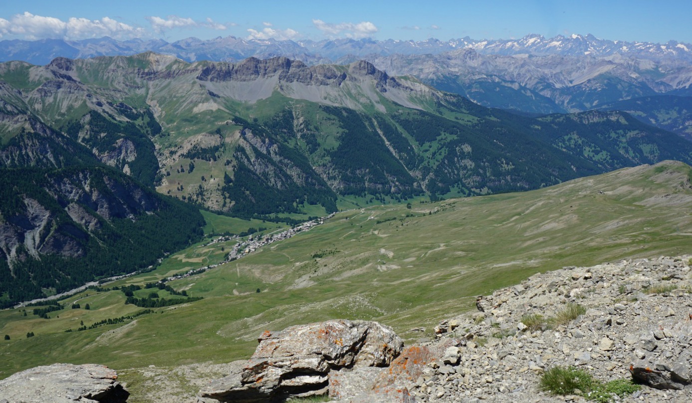
On the summit, there were viewpoint indicators to help recognize the surrounding peaks.

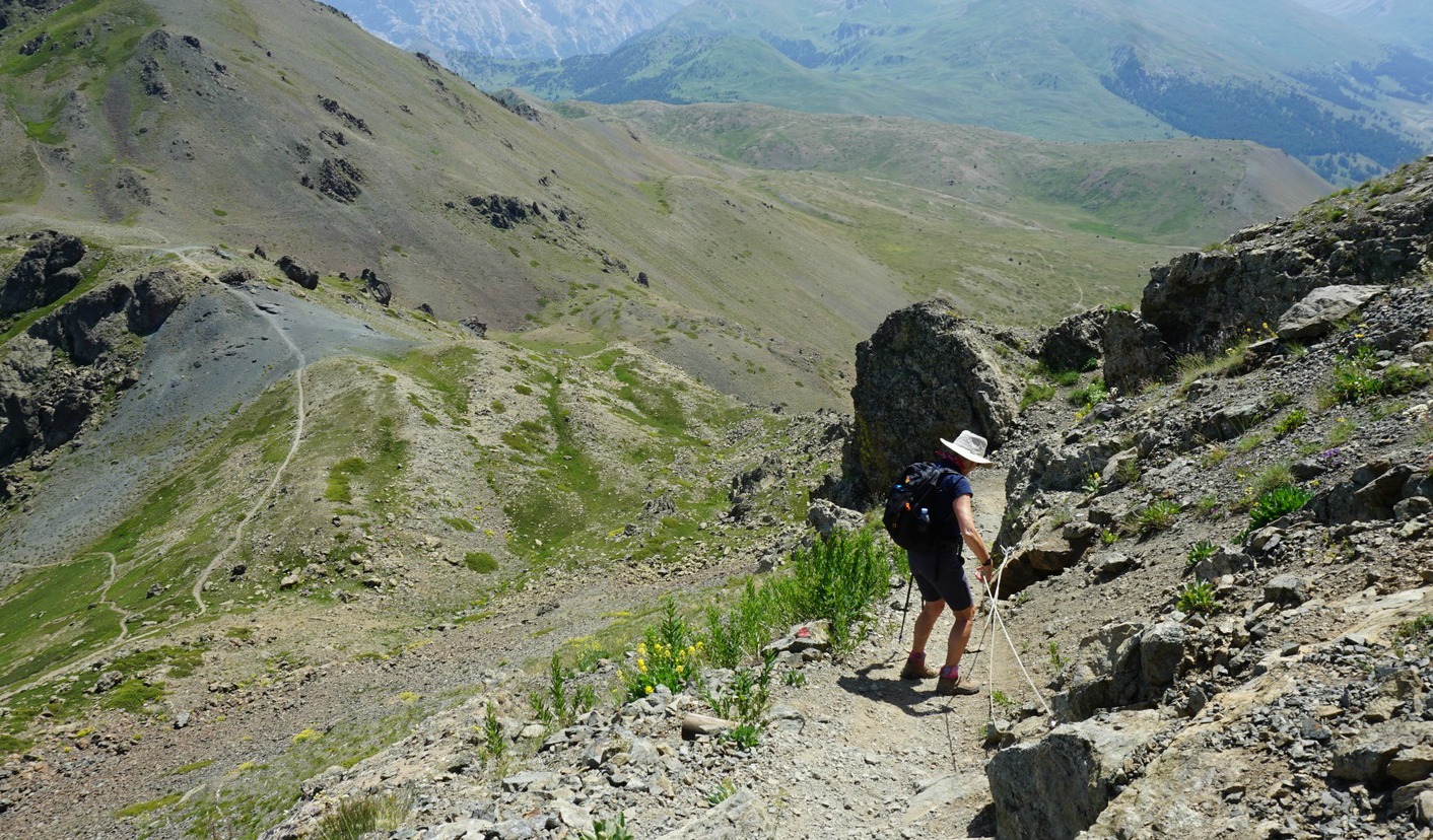
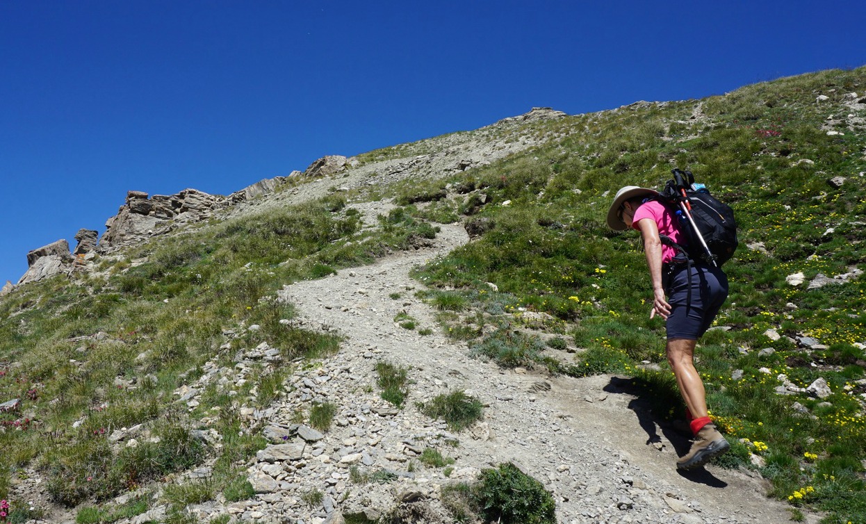
As we had planned a loop trail, we headed east, descending along a steep and rocky trail (signpost at the summit pointing towards le Col Vert). For extra security, one short section was equipped with a cable, not difficult at all in dry summer weather.

We came to a clear col (2519 m), albeit unnamed, and a trail intersection. Le Col Vert was about 500 m further to the north at the Italian border. We forked right, heading south towards La Cerveyrette Valley.

The initial descent was steep so walking poles were of great help. The trail temporarily levelled off, then descended steeply again several times. There were several other paths en route. We followed the one with yellow markings, indicated with red colour in maps.

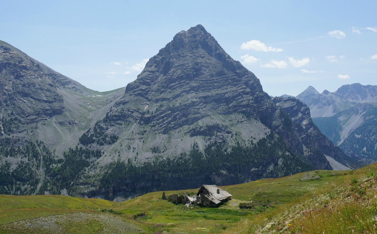
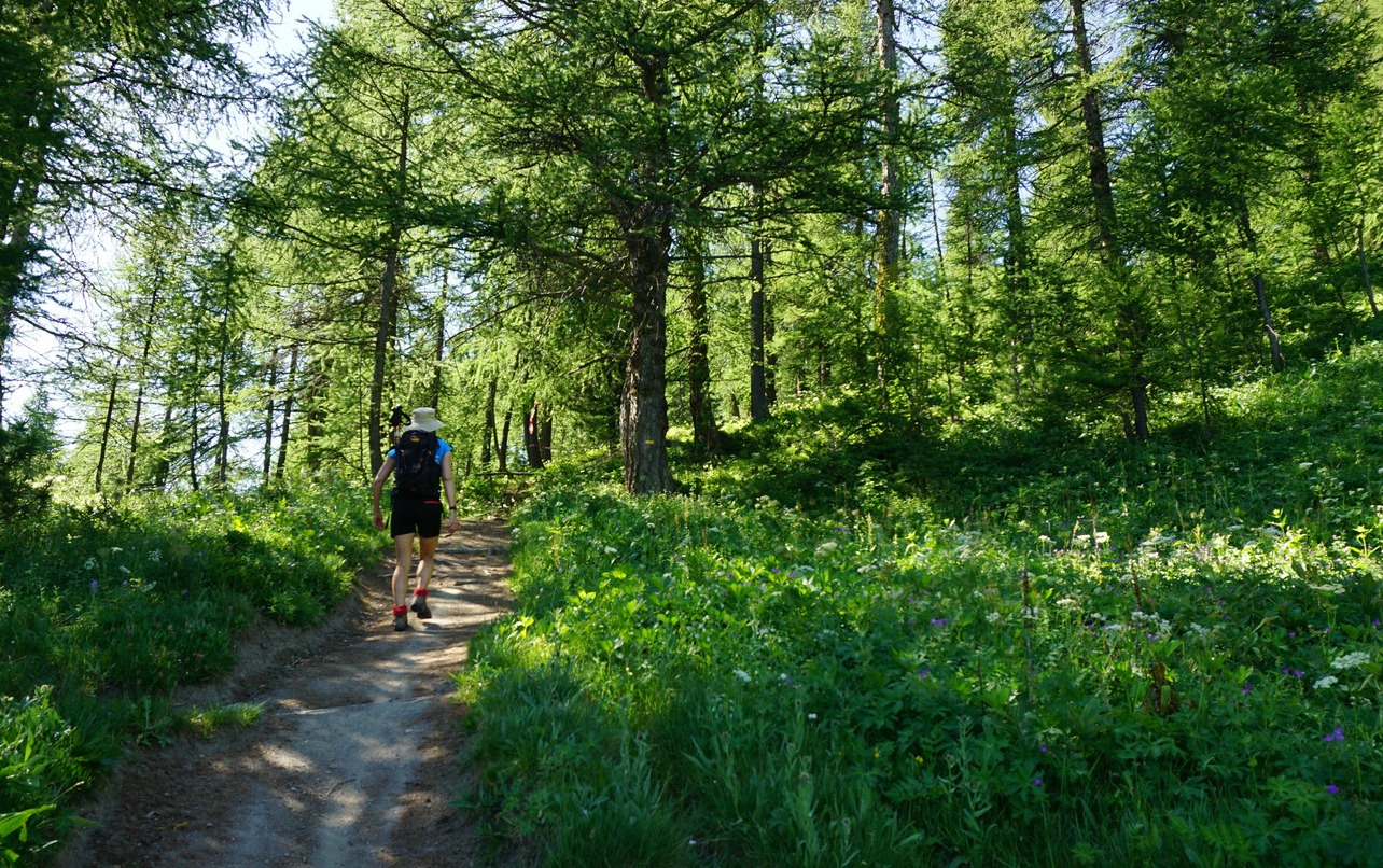
We passed Lac Noir (2261 m), then abandoned bergerie ruins called les Franches. From here, we descended further to la Chau, a derelict hamlet where nevertheless a few houses were being restored. We walked to the D89T road and to our starting point.

Distance: 11,3 km

Climb: 750 m

Duration: 4h 30 active

Map: 3536 OT Briançon Serre-Chevalier Mongenèvre

Chenaillet loop trail track


0 comments:

Note: only a member of this blog may post a comment.

Heatwave bowl

Heatwave bowl


As one more heatwave hit our region this summer, I have tried to invent tasty and healthy dishes that require minimal cooking. The following recipe ticks all the boxes; you only need to cook quinoa at some point.

2 servings

About 200 ml cooked quinoa, pref. three different colours
About 3 tbsp. olive oil
120 g wild Alaska smoked salmon, chopped
A small package of mini mozzarella
1 large spring onion, chopped
1 green salad paprika, chopped
A jar of Italian artichokes in olive oil
100 ml frozen peas, defrosted
Fresh herbs, chopped

Divide the cooked quinoa into two bowls and mix in some olive oil. The rest of the quinoa can be kept in the fridge for next day’s meals.

Divide the salmon, mozzarella, spring onion, green paprika, artichokes, peas, and the herbs into the bowls and mix.

Serve the bowls followed by gazpacho and a green salad for an antioxidant- and mineral- rich dish during heatwave.


0 comments:

Note: only a member of this blog may post a comment.

Scenic loop trail in Vars

View to northeast from trail above Vars


Several hiking trails start from Vars winter sport resort. Some of them cross the ski runs where maintenance work is often conducted during summer months. We have previously made several good hikes from Vars, using our car to the starting point. This time we wanted to start right from the village centre.

This great and beautiful circuit runs from the upper part of Vars, les Claux , to Col de Vars and back, avoiding the alpine ski area. There’s no need to use your car if you stay in the village.


From our hotel, we ascended to the big parking by the main D902 road. Our trailhead (first image) was just above the parking at 1930 m elev.

We forked right, following the good trail into the woods. The left-hand trail was for our return. The trail soon turned south southeast, first in the larch woods, then, above 2100 m, in the alpine meadows. The Eyssina Mountain Massif dominated the landscape on our right-hand side. In front of us, we had the familiar shape of Paneyron and further away to our left, several 3000 m+ peaks such as la Mortice and Pic des Houerts.

We hiked past Cabane l’Ecuelle, at 2222 m elev. and crossed a stream. We started to descend, and had Col de Vars (2110 m) in sight. At the Col, the restaurant was very busy on this sunny July day. After a light lunch, we headed back along the lower trail that followed the road, past a helipad then crossed livestock pasture area. The return trail undulated partly along meadows, partly in larch woods. Most of the time the main road remained hidden below us.

We came back to our first signpost and walked down to the village.

Duration: 3h 30

Climb: 371 m

Distance:  10 km

Map: IGN 3538 ET "Aguille de Chambeyron Cols de Larche et de Vars"

Col de Vars trail track

0 comments:

Note: only a member of this blog may post a comment.

Pic de Château Renard 2989 m

Summit of Pic de Château Renard 2989 m


Pic de Château Renard (2989 m) is one of the classic ascents from Saint-Véran (2050 m), a famous village in Queyras.

We, however, chose to ascend from Fontgillarde in the l’Aigue Agnelle River Valley. This valley connects with Italy over Col Agnel (2744 m).

From Molines-en-Queyras, we took the D205T road towards Italy, passing the hamlets of Pierre Grosse and Fontgillarde.

We started from a place named Pont de Lariane (2024 m) with a large parking by the D205T road and the river, soon after the hamlet of Fongillarde.


We crossed the bridge and headed southeast. The first part of the trail ran in a larch forest. At about 2300 m elevation, the forest gradually gave space to vast alpine meadows. Our goal, Pic de Château Renard and its ridge were still high above on our right-hand side.

Just before Col de Longet (2701 m), the trail became steeper and rockier. From the Col, we had the vast verdant St-Véran Valley below us. We now descended a bit (60 m or so), heading west, and saw the dirt road zigzagging to the observatory of Pic de Château Renard in front of us.

Having reached the dirt track, we ascended along it to the observatory (2931 m). The summit was now visible, and we climbed there along a well visible albeit a bit steep and rocky trail. The day was sunny and warm, and we had gorgeous 360° panorama views of the region. The space at the summit was quite limited, and the north face towards Fontgillarde was a precipice of several 100 m, so we opted for a picnic break a bit lower.

We returned along the same trail via Col de Longet. The itinerary was truly beautiful and very variable from green forest and alpine meadows to a rocky high summit.

Distance: 17 km

Duration: 5h 50 (active)

Climb: 1020 m

Map: IGN 3637 Mont Viso

0 comments:

Note: only a member of this blog may post a comment.

Ratatouille with fresh tomatoes


On our way to the mountains, we once had lunch in Guillestre, a small town in the crossroads to the Queyras region in the Southern Alps.  The restaurant served a version of ratatouille, ratatouille façon sauce vierge, with cooked aubergine and courgette cubes and chopped fresh tomatoes in different colours which were marinated in olive oil. The vegetables were mixed as in ratatouille and sprinkled with pistou, basil and olive oil purée.

The dish was so fresh on a warm summer day that I wanted to try it at home. The following recipe is my version of the restaurant ratatouille.

Wash and coarsely chop 1 aubergine and 2 courgettes. In a heavy casserole, warm about 2 tbsp. olive oil over medium heat and sauté the vegetables for about 10 minutes. Add 1 chopped onion and 1 minced clove of garlic. Mix, reduce the heat somewhat, cover and simmer for about 45 minutes until the vegetables are soft.

Use about 1/3 -1/4 of this vegetable mixture for 2 servings, the rest can be frozen in batches.

2 servings

About 1/3- ¼ of the above vegetable mixture
1 red tomato, coarsely chopped
1 yellow tomato, coarsely chopped
1 tbsp. olive oil
Freshly ground black pepper
About 2 tbsp. pistou

Place the chopped tomatoes in a colander for about 10 minutes so that they release some of their water. Then place in a bowl and mix with olive oil and black pepper. Let marinate for about 10 minutes.

Meanwhile make the pistou. Grind a generous handful of basil leaves with 1- 2 tsp. olive oil, a pinch of salt, and ¼ clove of pressed garlic into a nice purée. This is best done by hand with a pestle and mortar, the purée doesn’t need to be completely smooth.

When you are ready to serve your vegetables, with some meat or chicken for example, mix the marinated tomatoes with the cooked aubergine and courgette cubes. Sprinkle with pistou.

In the photo, the vegetables are served with turkey escalopes and panisses, chickpea cakes.

0 comments:

Note: only a member of this blog may post a comment.