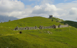
Authion today and 70 years ago
Authion comprises several about 2000 meter high mountain tops in the southernmost part of the Alps. The Mediterranean coastline is about 25 km away. The region is now part of the Mercantour National Park. Situated just above Col de Turini, Authion is easily reached by car. There’s a loop road permitting one-way counterclockwise traffic during the summer season. The most rewarding way to explore Authion is by foot. Most of the trails are easy and as you can start from a higher altitude not that much climbing is needed.
Authion has been of great strategic importance for hundreds of years, and was part of the Maginot Line. Several ruined forts and casernes remind the visitor of the turbulent past. At the very end of WWII, Authion remained one of the last German strongholds. In April 1945, General De Gaulle ordered the French troops to attack these positions. A sole American-made Stuart tank was deployed and it can still be seen at Cabanes Vieilles. The battle raged for two weeks. The French lost 280 men and about 1000 were wounded whereas Germans lost about 100 men before withdrawing. The armistice was just a few weeks away.
The walk starts at Cabane de Tueis (also called chalet Charles Alési, 1889 m), at signpost 244. The trail marked as GR 52 ascends along a ridge to 2065 m. The Redoute fortress (2080 m) at Point des Trois Communes is clearly visible from here. Signpost 410 which is just below the fortress is reached rapidly.
Our trail then leaves the GR 52, and descends in an alpine meadow to Plan Caval that is already visible.
From here, you continue along the paved loop road as far as to Cabanes Vieilles (1780 m). The road has very little traffic. At Cabane Vieilles, you can see the tank used in the final battle in April 1945. From this point, the itinerary goes almost straight north passing some caserne ruins, then ascending quite steeply in a larch wood followed by an alpine meadow (The direction is evident but there isn’t really a path to speak of ) as far as Fort des Milles Fourches (2042 m). A small descent then takes you to the loop road again.
The route then climbs a little bit to Fort de la Forca (2078 m,) before continuing to the GR 52 trail used in the beginning of the hike. From the last intersection, the starting point can be reached in 15 minutes.
However, on the day of our hike, dense clouds descended from north when we were nearing Fort de la Forca making the visibility poor. We therefore decided to take the road directly back to Cabane de Tueis. The shortcut made the walk 30 min or so shorter, and we also climbed 100 m less.
Map: IGN 3741 ET Vallées de La Bévéra et des Paillons
Duration 3h 30
Climb: 450 m
Image of hike itinerary:
(Courtesy of Google Maps)


0 comments:
Note: only a member of this blog may post a comment.