

Hike to Col de Frémamorte above Le Boréon

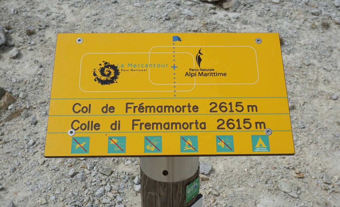
In Alpes-Maritimes, there are several renowned mountain passes on the Franco-Italian border that can be reached by hiking trails, such as Baisse de Druos, Col de Fenestre, Col de Cerise and Pas du Préfouns. This time we wanted to ascend to a lesser known pass above Le Boréon named Col de Frémamorte (2615 m).
Unfortunately, on our given day the weather was more clouds than blue skies. Nevertheless, we had good views down to Italy from the col.


From the Salèse parking (1665 m) above Le Boréon we started ascending along the GR 52 trail towards Col de Salèse (2031 m) which we reached in 1 h 10. From Col de Salèse, we descended a bit then forked right, leaving the GR52, and headed towards Lac Négre, Pas du Préfouns and Col de Frémamorte. We ascended along the popular trail in the forest. Most hikers seemed to continue to Lac Négre. At a crossroads called Camp Soubran (2270 m) and signpost 270, we forked right (east).
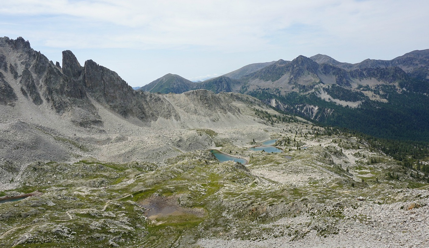
Heading east above the tree line, we passed several lakes (Lacs de Frémamorte). The scenery became high-alpine, and the trail rockier.
Approaching the col, we saw remains of a bunker and even an odd ibex. The last push was actually less steep than anticipated as the trail zigzagged in the incline.
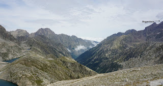
In front of us, on the Italian side, we could view the western flank of the imposing Argentera Massif (at 3297 m the highest peak in the Maritime Alps), several lakes below us, and in the distance the lowlands near Cuneo that were covered with low clouds. From the col, one trail descended down to Italy, the other, looking a bit exposed, went up to the nearby summit called Cime de Frémamorte (2730 m).
We descended along the same trail back to our starting point.
Climb: 960 m
Distance: 17 km
Duration: 5h 45 active
Map: IGN 3741 0T Vallée de la Vésubie

Share story


0 comments:
Note: only a member of this blog may post a comment.