Saint-Sauveur sur Tinée to Rimplas

Snow-capped Mont Mounier viewed from Rimplas


This trail is part of the first day trek of a 4-day itinerary named Via Alpina 2, which starts from St-Sauveur-sur-Tinée (500 m) and ends in Sospel. Several years ago, we made a shortened version starting from St-Martin Vesubie.

We have since made great day hikes from both St-Sauveur-sur-Tinée and Rimplas (1000 m) so this time we wanted to explore the GR 5 between these villages.

The trail was well marked but not much frequented. We even saw a snake in the middle of the trail. After google search, it turned out to be a rather harmless western whip snake. In fact, we rarely have spotted snakes during our hikes in the South of France.


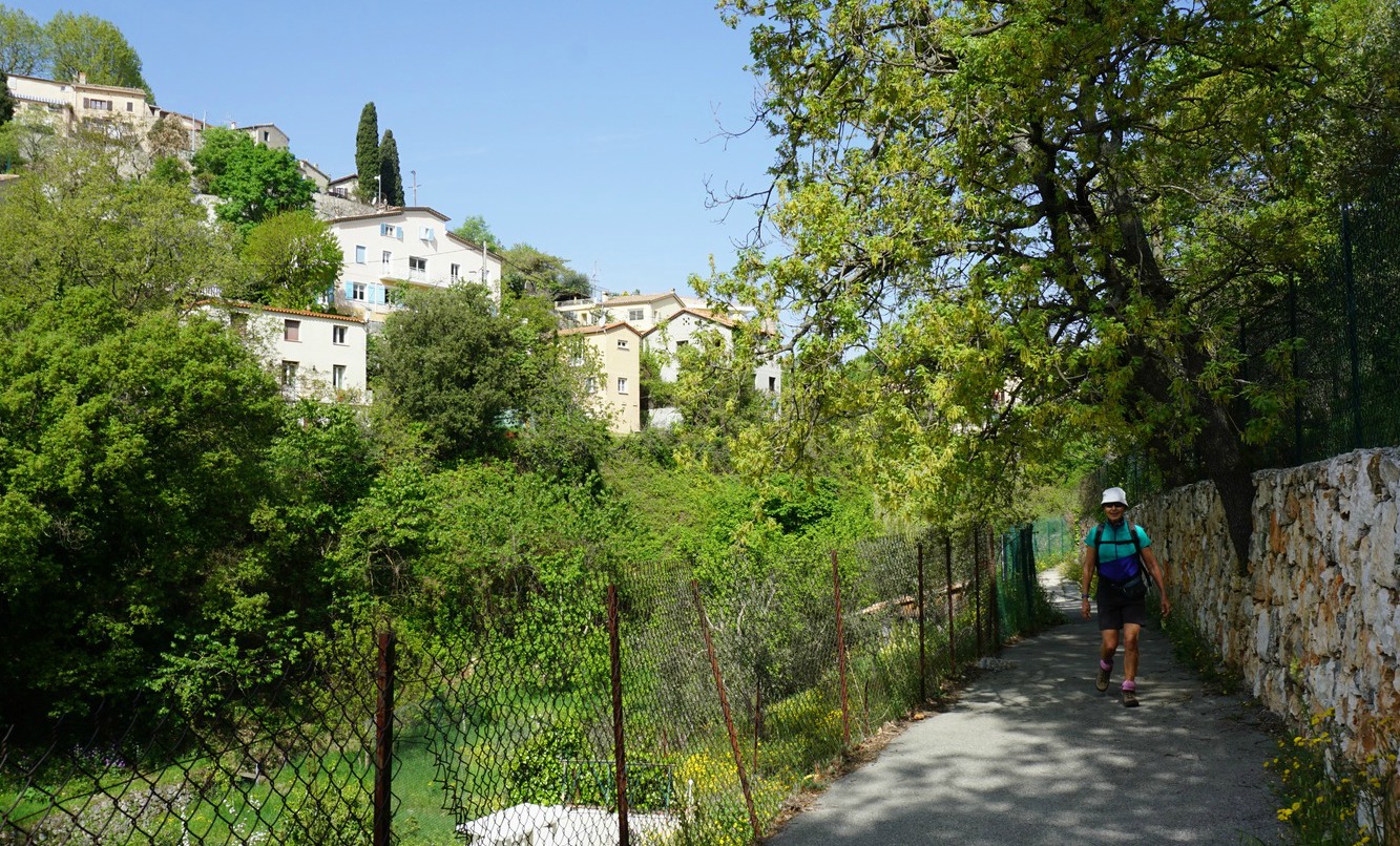
From the spacious parking next to the Tinée River in St-Sauveur-sur-Tinée, we followed the GR markings heading south along the main street/M2205 road. After about 300 m we forked left at signpost # 167 and followed a paved road to Chapel St-Roch. 

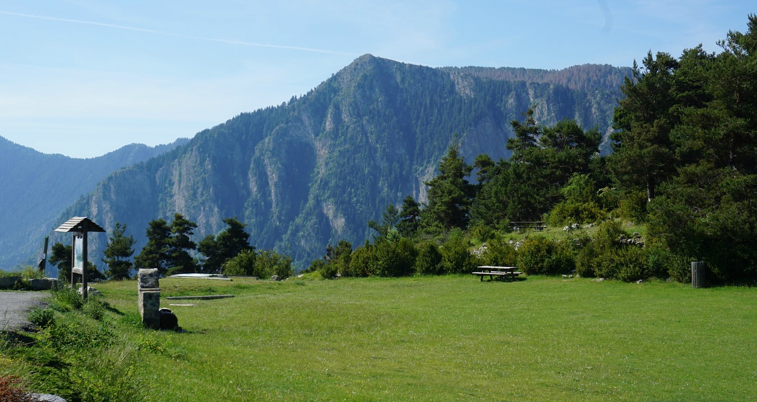
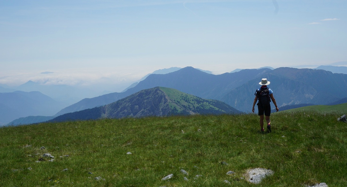
The hiking trail ran partly in the woods, following the paved road. Behind the chapel, the GR5 continued a bit along a cemented track, then along a good path. The ascent was continuous but never steep, i.e. an easy itinerary. Gradually higher, we had great views of the verdant Tinée River Valley and the still snow-capped peaks in the north.

Approaching Rimplas, the trail became wider, following a steep mountain flank. There were some small rockslides on the trail just before Rimplas. Keeping a very moderate pace, we reached Rimplas in 1h 50.

After a brief break and picnic, we descended along the same trail. Even our snake was still on the trail!

Climb: 530 m
Duration: 3h 20 (active) 

Distance: 11,9 km


GR5 trail between St-Sauveur sur Tinée and Rimplas


Chickpea and spinach stew with burrata

Chickpea and spinach stew with burrata


Burrata is a fresh Italian cheese. The outer shell is solid mozzarella, while the inside contains stracciatella and cream giving it a soft runny texture and making it a great cheese to top vegetables.
The following recipe makes a tasty lacto-vegetarian and super healthy lunch.

2 servings

About 3 tbsp. olive oil
1 organic onion, chopped
1 clove garlic, minced
1 tsp powdered ginger
½ tsp Piment d’Espelette or other mild chilli powder
1 bag organic baby spinach
1 jar chickpeas, pref. organic
10- 12 halved organic cherry tomatoes
1 burrata

Heat 2 tbsp. olive oil over medium heat in a large skillet. Add the onion and garlic and sauté for about 5- 10 minutes. Add the ginger and chilli and cook about 1 minute more. Add a bit of water and stir.

Rinse and drain the chickpeas and add to the pan. Wash and halve the cherry tomatoes and add to the skillet. Simmer for about 5 minutes, stirring occasionally.

Add the spinach and cook for a few more minutes until the spinach has wilted. With a fork mash some of the chickpeas for a thicker texture.

Drain and halve the burrata and place on top of the vegetables. Sprinkle a little olive oil over the cheese.  Serve the stew with some good rye bread.


Exploring the southernmost leg of GR5 from Aspremont

Aspremont


The mythic GR5 footpath starts in the Netherlands and ends in Nice. During this day hike starting from the village of Aspremont, we followed the trail south.

The trail proper ends in a picnic parc called l’Aire St-Michel, and after that the GR5 follows streets down to Nice, with white-red markings.

We had not hiked along this part of the GR5 before. It seemed to be popular among local hikers, trail runners and mountain bikers.


The trail from Aspremont is very well marked and signposted. From the village, we first descended a bit, crossed the M14 road (Route de Nice), and climbed along a paved street passing a school. We soon forked right near some tennis courts and continued along the western flank of Mont Chauve d’Aspremont. The trail soon levelled off, heading south. After the crossroads to Mont Chauve, the GR5 trail ran along Crête de Graus towards Nice, slowly descending. The best views were mostly down to the Var Valley and beyond, and to Nice. The trail ran along the western flank of the ridge, not on the top. The vegetation on both sides was mostly dense shrub land, maquis.

We hiked to the end of Crête de Graus, our planned turning point. There was a ruined house surrounded by pines, and from here the trail started to descend to l’Aire St-Michel and to the Gairaut neighbourhood in northern Nice. We used the same trail back to Aspremont.


Distance: 11 km       
Crete de Graus GR5 trail image

Duration: 3h 50

Climb: 410 m

Map: « Nice Menton » Côte d’Azur 3742OT


Cod with tomatoes and parmesan

Cod with tomatoes and parmesan


This recipe reflects summer flavours: ripe tomatoes, olive oil, garlic, shallot and basil. The cod is covered with chopped tomatoes, then shallot and garlic lightly cooked in olive oil, and topped with parmesan. It is then baked in the oven.
Serve the fish with cooked green lentils and rocket. The peppery taste of rocket compliments well cod and tomatoes.

2 servings

2 nice pieces of cod fillet
2 ripe tomatoes
1 shallot
1 clove garlic
Olive oil
Freshly ground black pepper
A handful of grated parmesan
100 ml green lentils
A handful of rocket
Lemon wedges

Start by cooking the green lentils in 500 ml water for about 25- 30 minutes. When the water has evaporated and the lentils are tender, cover and set aside until needed.

Warm 1 tbsp. olive oil in a small pan over medium heat. Peel the shallot and garlic clove. Chop the shallot and mince the garlic. Sauté for about 10 minutes until soft.

Preheat the oven to 200° C.

Place the cod in an oven- proof dish. Wash and chop the tomatoes and place on the fish. Grind over some black pepper. Divide the shallot and garlic on top of the tomatoes, then top with grated parmesan. Sprinkle 1- 2 tbsp. olive oil over the cheese. Bake in the oven for 20- 25 minutes depending on the thickness of the cod fillet. The fish should be just done and opaque, but not overcooked.

When the cod is done, divide it on the plates. Gently mix the rocket with lentils and divide on he plates. Serve with lemon wedges.

Guggenheim Exhibition in Hôtel de Caumont Aix-en-Provence

Hôtel de Caumont Aix-en-Provence


Hôtel de Caumont was a prestigious private mansion built in 1715-1745. The ownership of the property changed several times, and in the beginning of WWII it had completely lost its former glory. It had been divided into several apartments and was run by a lady who belonged to the French resistance. She bravely sheltered many Resistance fighters at the mansion before it was seized by the authorities.

In 1964 the building was sold to the city of Aix-en-Provence and became a conservatory of music and dance. In 2010 Culturespaces became the new owner, starting the renovation work in 2013. In May 2015 the Caumont Centre d’Art opened its doors. Every year, its hosts two temporary exhibitions as well as concerts and musical performances.


This summer’s exhibition (1 May-29 September 2019) features Masterpieces from the Guggenheim Foundation, New York.  The works are from the Justin Thannhauser Collection presenting paintings and sculptures by the masters of impressionism and post-impressionism from Manet to Picasso. Thannhauser was a personal friend of Picasso. For the first time, about 50 works from this collection are presented in Europe in an exhibition that started in the Guggenheim museum in Bilbao.

We were really impressed by the high quality of this exhibition. After all, masterpieces of several famed artists were displayed simultaneously in a relatively small museum. The beautifully renovated building is a piece of art itself.

Lauvet d'Ilonse

Northern flank of Lauvet d'Ilonse


A very narrow paved road that runs through the villages of Ilonse and Pierlas connects the Tinée and Cians River Valleys. The highest point, Col de la Sinne (1438 m) is the starting point of our hike to Lauvet d’Ilonse (1992 m).

Situated deep in the Nice hinterland, Ilonse is one of the most sparsely populated communes in Alpes Maritimes. The road up to the village at 1200m, and 3 km further to Col de la Sinne is an experience itself.


We started from signpost #220 at the col, and headed straight north along a good trail initially in the woods. Passing signposts #221 and 222, we exited the woods and continued the slow ascent along the eastern flank of the mountains. After about 1h 30, the trail turned west, now continuing along alpine meadows, following the northern flank of Lauvet d’Ilonse. We came to signpost #308 (1850 m). From here, the incline directly to the summit was a bit steep, but mostly covered with grass. We reached the summital plateau in about 20 min. It is possible to use a longer but less steep trail shown on the IGN map. Because of the terrain, one can walk almost anywhere on the summit.

For this hike, we followed the guidebook written by Reinhard Scholl (Alpes Maritimes; Rother Guide des Randonnéés). We walked off piste straight west from the summit as instructed. There were not any marked trails. The descent gradually became steeper. The Baisse de Tavarières intersection and the dirt track running on the western side of the mountain were soon visible below us. We descended along the less steep part of the slope, came to the track and headed straight south along it.

The track eventually turned east, and we passed a lamb hut where the livestock happened to be on both sides of the track. And the dogs guarding them, too. We feel that dogs guarding the flocks have become more numerous, bigger and more menacing probably because of the wolves in the region. Herders were nowhere to be seen. Normally, when you meet a flock and dogs you should make a detour or wait till they have crossed. In this situation neither option was possible. So we walked on, and when one of the dogs just still approached, we stopped, and faced the leading dog. Finally, he got the message.

We came to signpost #117, forked left leaving the dirt track. After a short ascent we continued towards signpost #221, and came to the path used in the beginning of the hike. From here, we descended rapidly back to our starting point.

Instead of doing a loop hike as described above, you can always use the same trail back.

Vertical ascent: 630 m
Trail image Col de la Sinne to Lauvet d'Ilonse

Duration: 5 h

Map: Moyenne Tinée 3641 ET


Pasta fresca with chicken

Pasta fresca with chicken


I can’t remember where I got the inspiration for this simple but tasty pasta dish. It must have been somewhere in the US because dry whole wheat pasta is used in the recipe, and not fresh pasta. Fresh pasta in Italian is pasta fresca.

My twist is to add cubed and sautéed chicken to the pasta. The dish makes a perfect spring lunch or light supper if the usual chopped fresh tomatoes are replaced with broccoli florets. Summertime when tasty tomatoes again are available by all means use them in the recipe.

2 servings

300 ml whole grain dry pasta (any shape)
300 ml broccoli florets
2 small organic chicken breasts, cut into cubes
3 tbsp. olive oil
1 shallot, chopped
1 clove garlic, minced
Freshly ground black pepper
Chopped parsley
8- 10 black olives, sliced
A handful of grated parmesan

Cook the pasta in boiling water according to the instruction on the package. When cooked, drain and place in a large bowl. Mix with 1 tbsp. olive oil.

Warm 2 tbsp. olive oil in a sauté pan over medium heat. Add the cubed chicken breasts, chopped shallot and minced garlic. Sauté stirring now and again for 10- 15 minutes.

Microwave the broccoli florets and add to the bowl with pasta. Grate the parmesan, chop the parsley and slice the olives.

When the chicken is cooked, add to the bowl and mix. Add the olives, parmesan, and parsley and mix. Serve immediately.

Circuit hike above Le Broc

View from trail Le Broc Bezaudun


Here’s another great hike from the village of Le Broc (450 m). In spite of its proximity of the French Riviera, only about 15 km from Promenade des Anglais as the crow flies, this trail in the hills and mountains above Le Broc has a feeling of a wilderness. It is mostly barren and rocky brush land with sparse woods here and there.

Our trail passed some pastures during the ascent. The livestock may or may not be there. On the day of our hike, the was a flock of lambs not far from the trail. The guarding dogs approached us viciously, luckily the herder was on-site and commanded them back.


We started from signpost #1 in the centre of the village and followed the same itinerary (signposts #3,5) as on the previous hike to Mouton d’Anou as far as to signpost #137. Here we forked right heading towards Bézaudun along a forest track. It was still partly covered with ice and snow.

We came signpost #135 by a paved road not far from Bézaudun. We turned right, heading north east. We descended, passing a small community named Les Combes. The paved road ended soon, and we continued along a dirt track about 3 km, passing signpost #109. We came to a crossdoads and signpost #22 where we forked right and ascended to signpost #5, thus completing the loop.

Signpost #22 actually instructs you to fork left to reach Le Broc, which is the other option (a dirt track then narrow paved streets) passing the neighbourhood of Saint-Germain above Le Broc. Relevant signposts are shown in the GPS track below.

Distance: 13,7 km

Climb: 601 m

Duration: 4h 15 walking time

Map: 3642 ET Vallée de l’Estéron Vallée du Loup

Loop trail track above Le Broc