Pic de Château Renard (2989 m) is one of the classic ascents from Saint-Véran (2050 m), a famous village in Queyras.
We, however, chose to ascend from Fontgillarde in the l’Aigue Agnelle River Valley. This valley connects with Italy over Col Agnel (2744 m).
From Molines-en-Queyras, we took the D205T road towards Italy, passing the hamlets of Pierre Grosse and Fontgillarde.
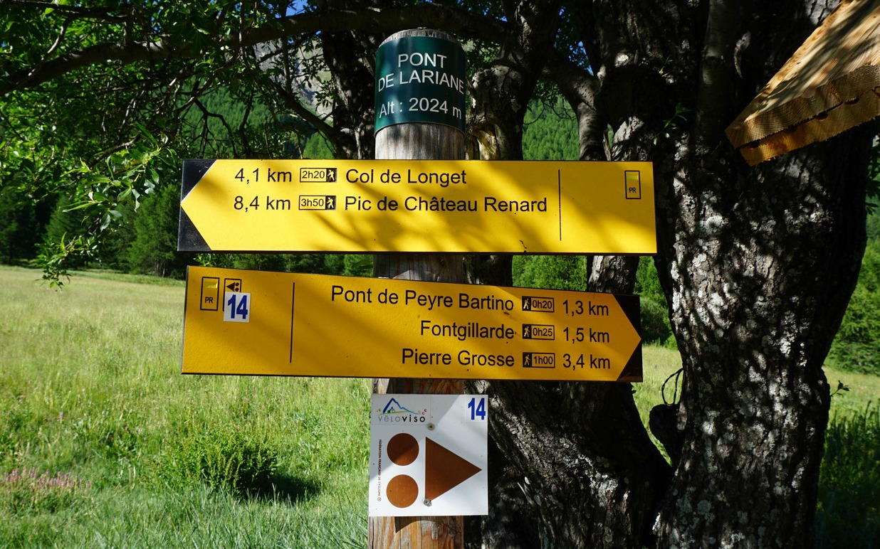
We started from a place named Pont de Lariane (2024 m) with a large parking by the D205T road and the river, soon after the hamlet of Fongillarde.
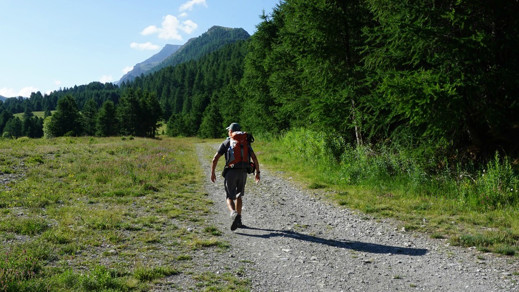
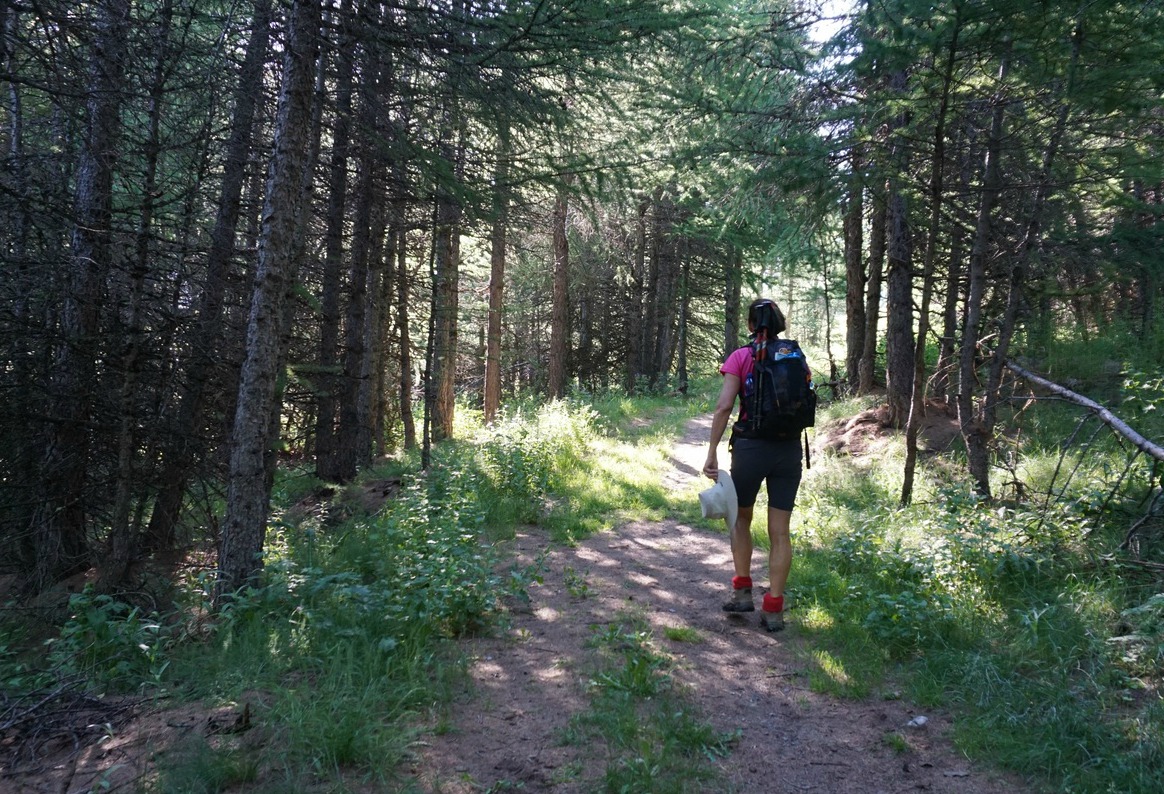
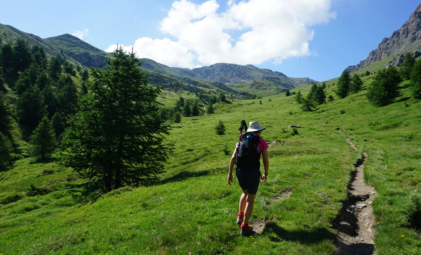
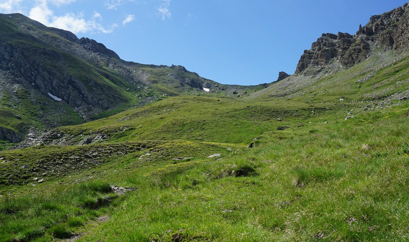
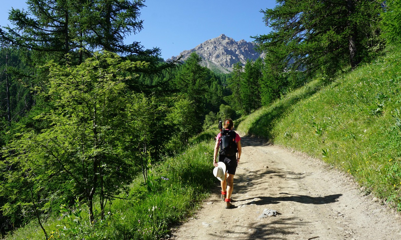
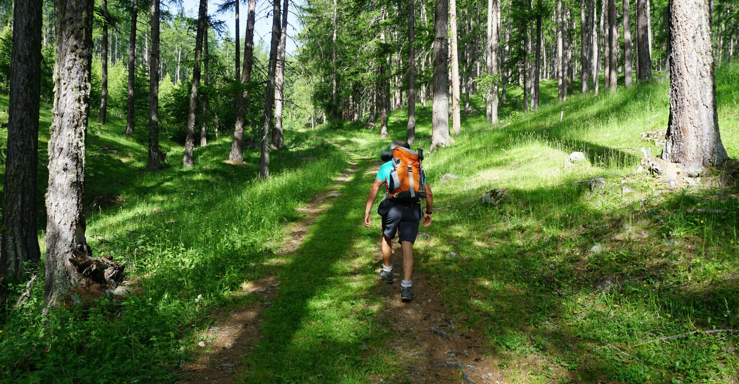
We crossed the bridge and headed southeast. The first part of the trail ran in a larch forest. At about 2300 m elevation, the forest gradually gave space to vast alpine meadows. Our goal, Pic de Château Renard and its ridge were still high above on our right-hand side.
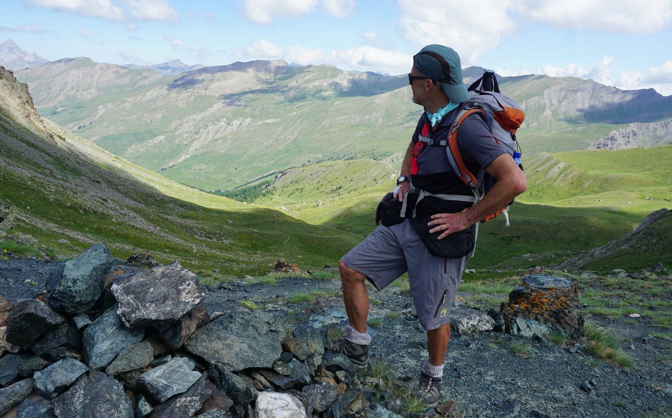
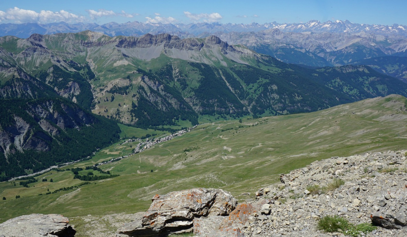
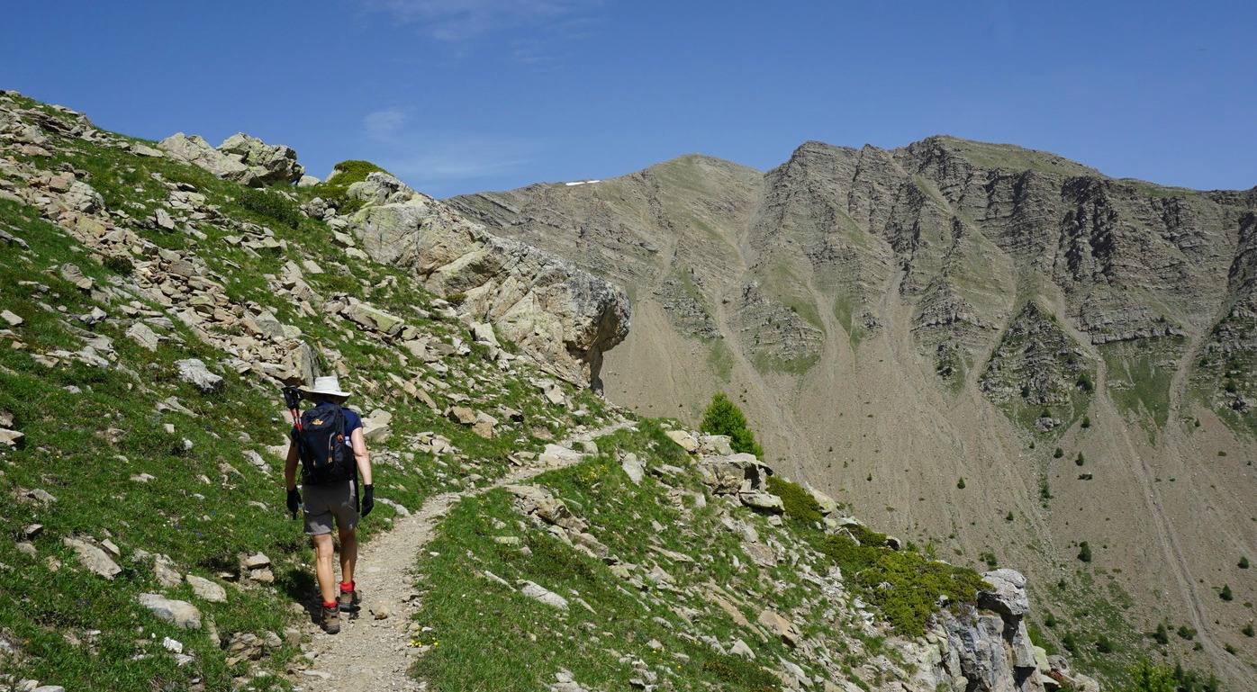
Just before Col de Longet (2701 m), the trail became steeper and rockier. From the Col, we had the vast verdant St-Véran Valley below us. We now descended a bit (60 m or so), heading west, and saw the dirt road zigzagging to the observatory of Pic de Château Renard in front of us.
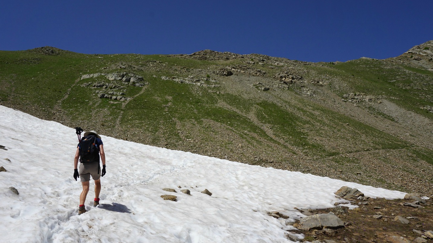
Having reached the dirt track, we ascended along it to the observatory (2931 m). The summit was now visible, and we climbed there along a well visible albeit a bit steep and rocky trail. The day was sunny and warm, and we had gorgeous 360° panorama views of the region. The space at the summit was quite limited, and the north face towards Fontgillarde was a precipice of several 100 m, so we opted for a picnic break a bit lower.
We returned along the same trail via Col de Longet. The itinerary was truly beautiful and very variable from green forest and alpine meadows to a rocky high summit.
Distance: 17 km
Duration: 5h 50 (active)
Climb: 1020 m
Map: IGN 3637 Mont Viso


On our way to the mountains, we once had lunch in Guillestre, a small town in the crossroads to the Queyras region in the Southern Alps. The restaurant served a version of ratatouille, ratatouille façon sauce vierge, with cooked aubergine and courgette cubes and chopped fresh tomatoes in different colours which were marinated in olive oil. The vegetables were mixed as in ratatouille and sprinkled with pistou, basil and olive oil purée.
The dish was so fresh on a warm summer day that I wanted to try it at home. The following recipe is my version of the restaurant ratatouille.
Wash and coarsely chop 1 aubergine and 2 courgettes. In a heavy casserole, warm about 2 tbsp. olive oil over medium heat and sauté the vegetables for about 10 minutes. Add 1 chopped onion and 1 minced clove of garlic. Mix, reduce the heat somewhat, cover and simmer for about 45 minutes until the vegetables are soft.
Use about 1/3 -1/4 of this vegetable mixture for 2 servings, the rest can be frozen in batches.
2 servings
About 1/3- ¼ of the above vegetable mixture
1 red tomato, coarsely chopped
1 yellow tomato, coarsely chopped
1 tbsp. olive oil
Freshly ground black pepper
About 2 tbsp. pistou
Place the chopped tomatoes in a colander for about 10 minutes so that they release some of their water. Then place in a bowl and mix with olive oil and black pepper. Let marinate for about 10 minutes.
Meanwhile make the pistou. Grind a generous handful of basil leaves with 1- 2 tsp. olive oil, a pinch of salt, and ¼ clove of pressed garlic into a nice purée. This is best done by hand with a pestle and mortar, the purée doesn’t need to be completely smooth.
When you are ready to serve your vegetables, with some meat or chicken for example, mix the marinated tomatoes with the cooked aubergine and courgette cubes. Sprinkle with pistou.
In the photo, the vegetables are served with turkey escalopes and panisses, chickpea cakes.

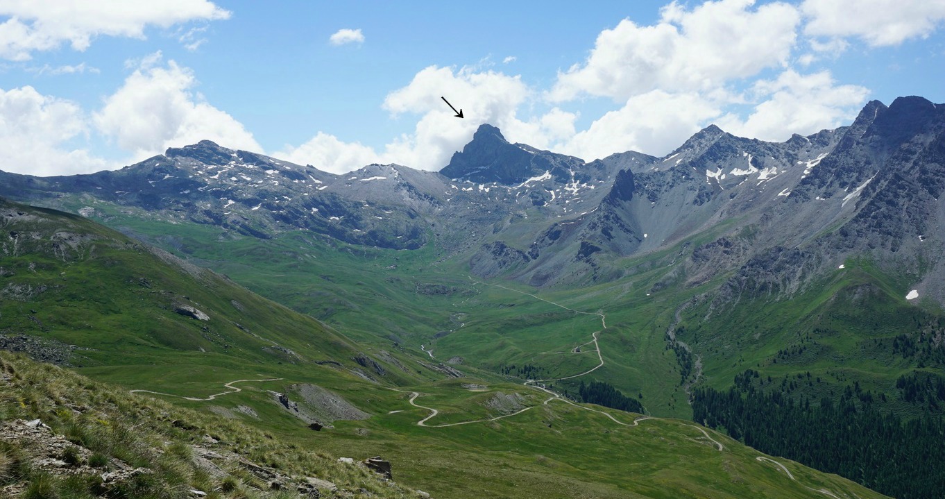
A few years ago, we climbed to Pic de Caramantran (3025 m) from St-Veran. The summit is one of the easy 3000m+ peaks in the region.
This time we ascended from the valley above Molines-en-Queyras. The forecast, however, for our first day was not good: rain and thunderstorms in the afternoon. We therefore planned a shorter hike, starting from the spacious parking at 2625 m, not far from Col Agnel (2744 m) at the Italian border.
Early in the morning, we took the D205T road from Molines-en-Queyras. After a downpour on the way, the clouds fortunately broke temporarily when we reached our starting point.
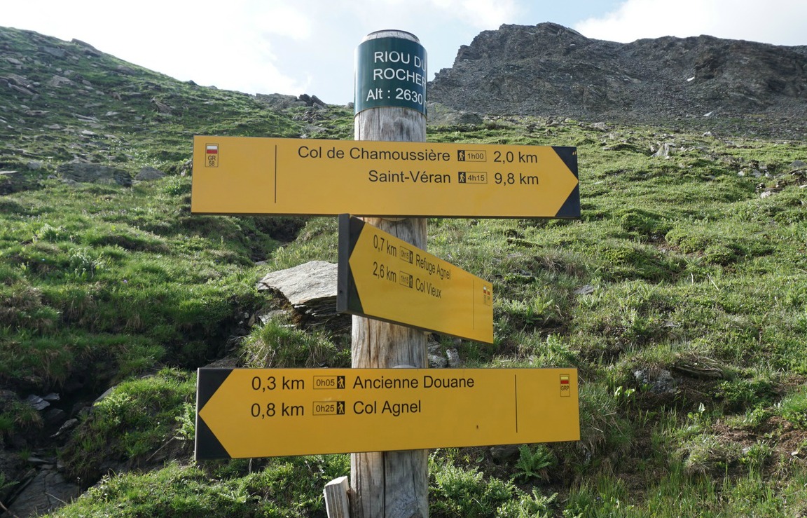
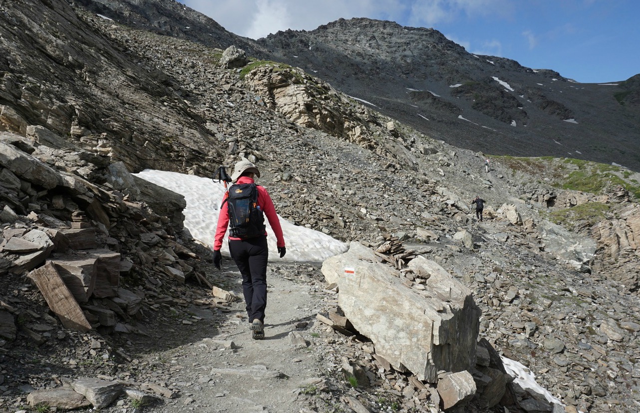
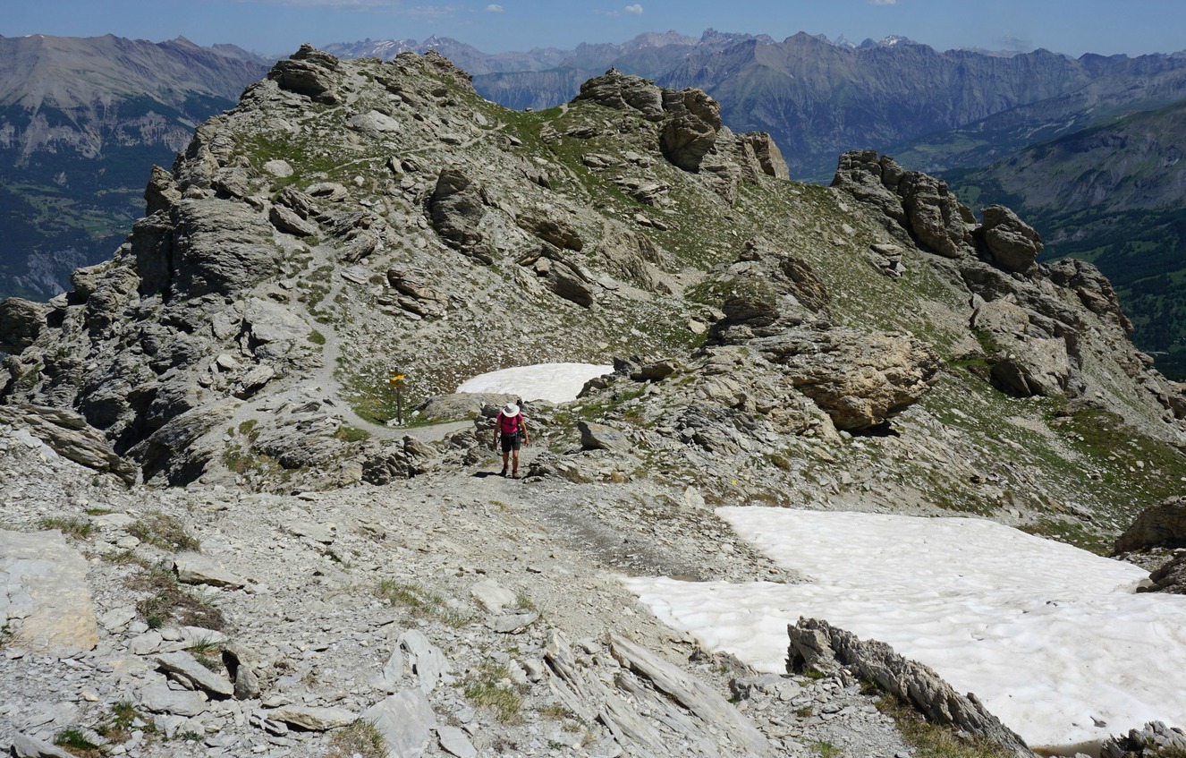
A new nature trail (a 30 min. loop), called Nebbia, begins from the parking. We started along it clockwise. At a signpost named Riou du Rocher Long 2630 m, we joined the main GR 58 trail that leads to Col de Chamoussière (2884 m). We ascended along the rocky trail with Caramantran’s steep north face on our left-hand side.
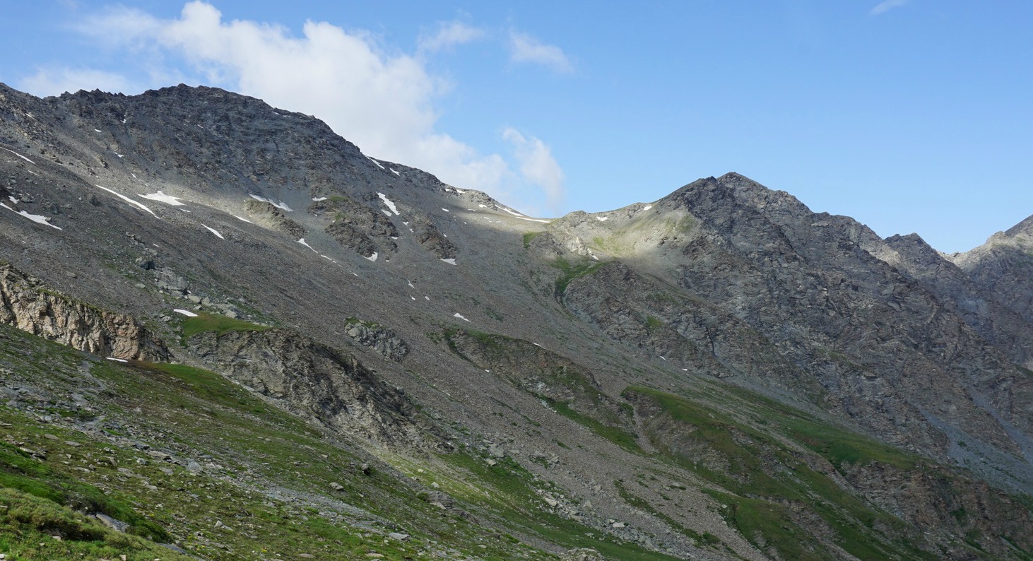
At Col de Chamoussière, we left the GR58 and forked left along a trail that first zigzagged along a steep incline, then levelled off a bit. There were no signposts, only cairns and yellow markings. Just before the summit, on a ridge, the yellow-marked trail continued straight south while we forked left to the nearby summit with two big cairns. We were on the Franco-Italian border.
By that time, we had a full overcast and heard distant thunder. As on our previous hike! We descended quickly back to the parking along the same trail, just in time before a heavy downpour started.
Climb: 400 m
Duration: 2h 30
Distance: 6.5 km
Map: 3637 OT Mont Viso

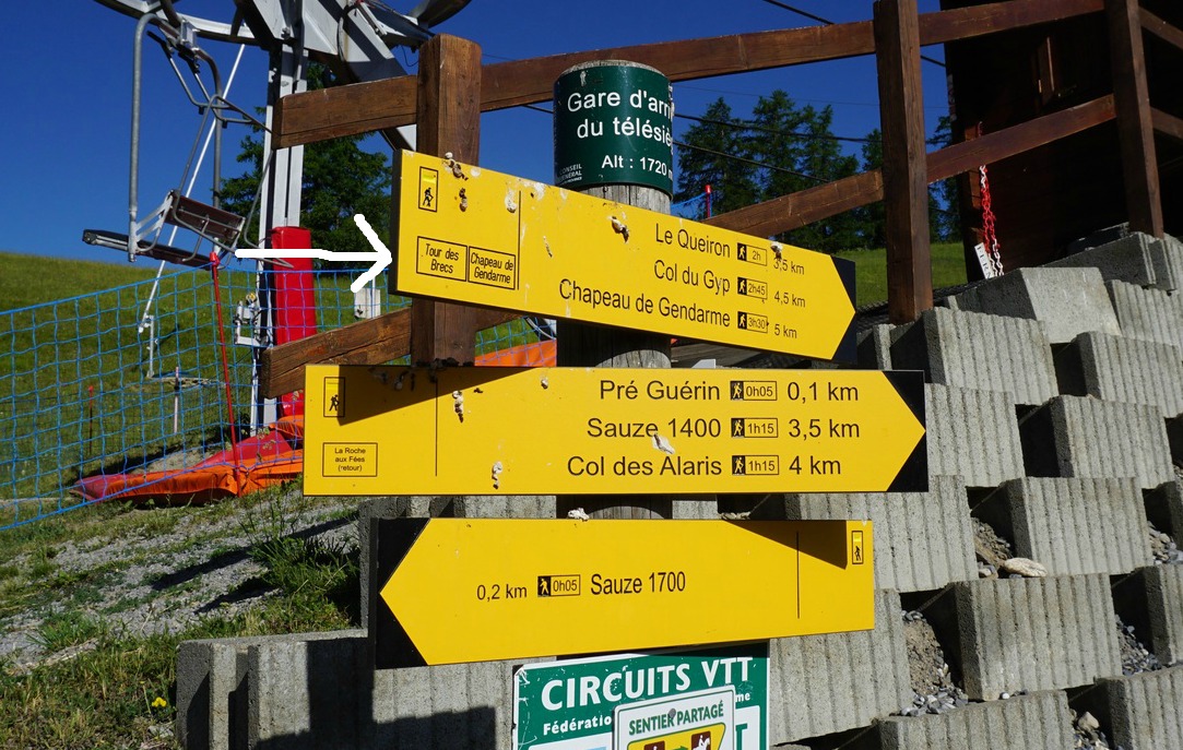
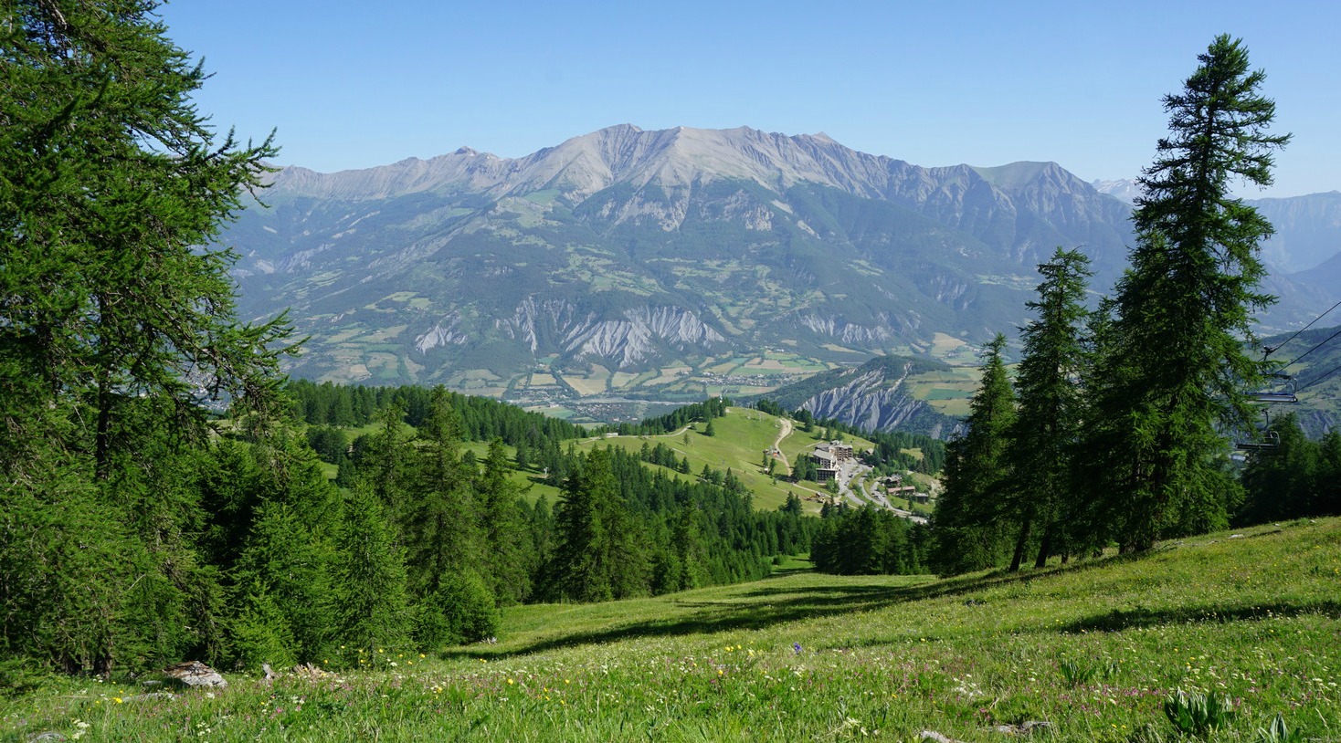
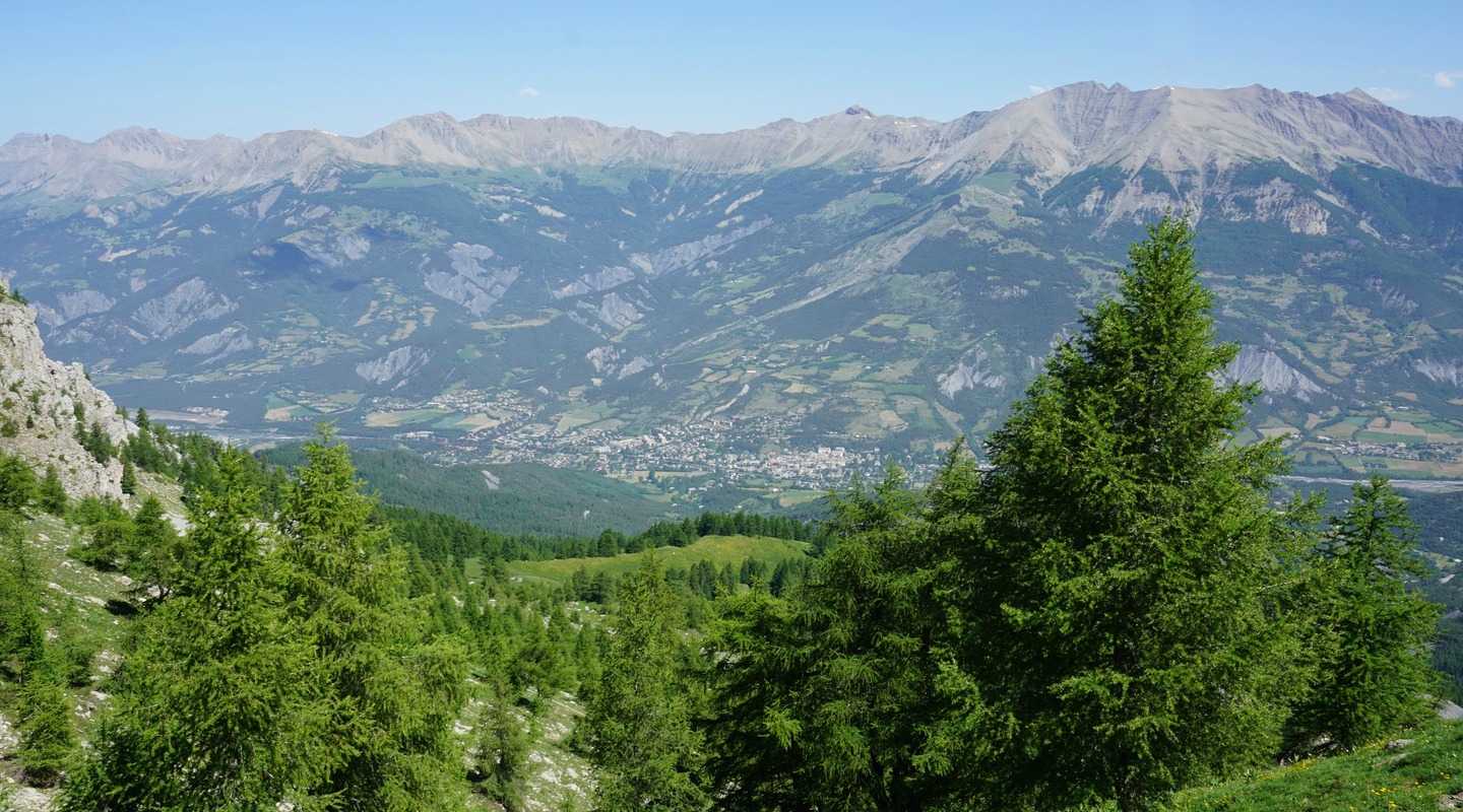
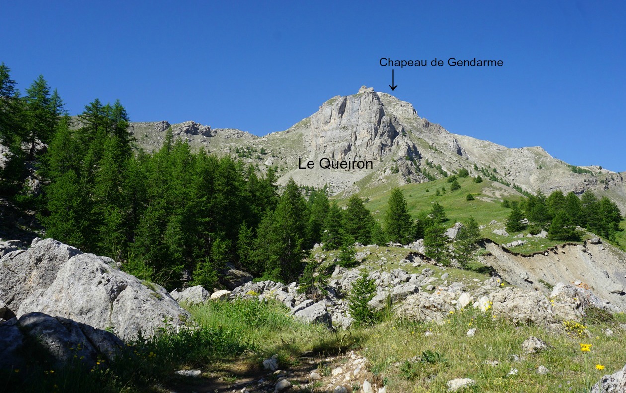
The ascent to Chapeau de Gendarme (2682 m) is a classic hike in the Ubaye Valley. The mountain gets its name, the gendarme’s hat, from its particular form that is well visible from the Valley. The summit offers great 360° panorama views over the region.
We ascended to the summit using the standard and also shortest route along comfortable paths. It is a straightforward and well-marked itinerary.
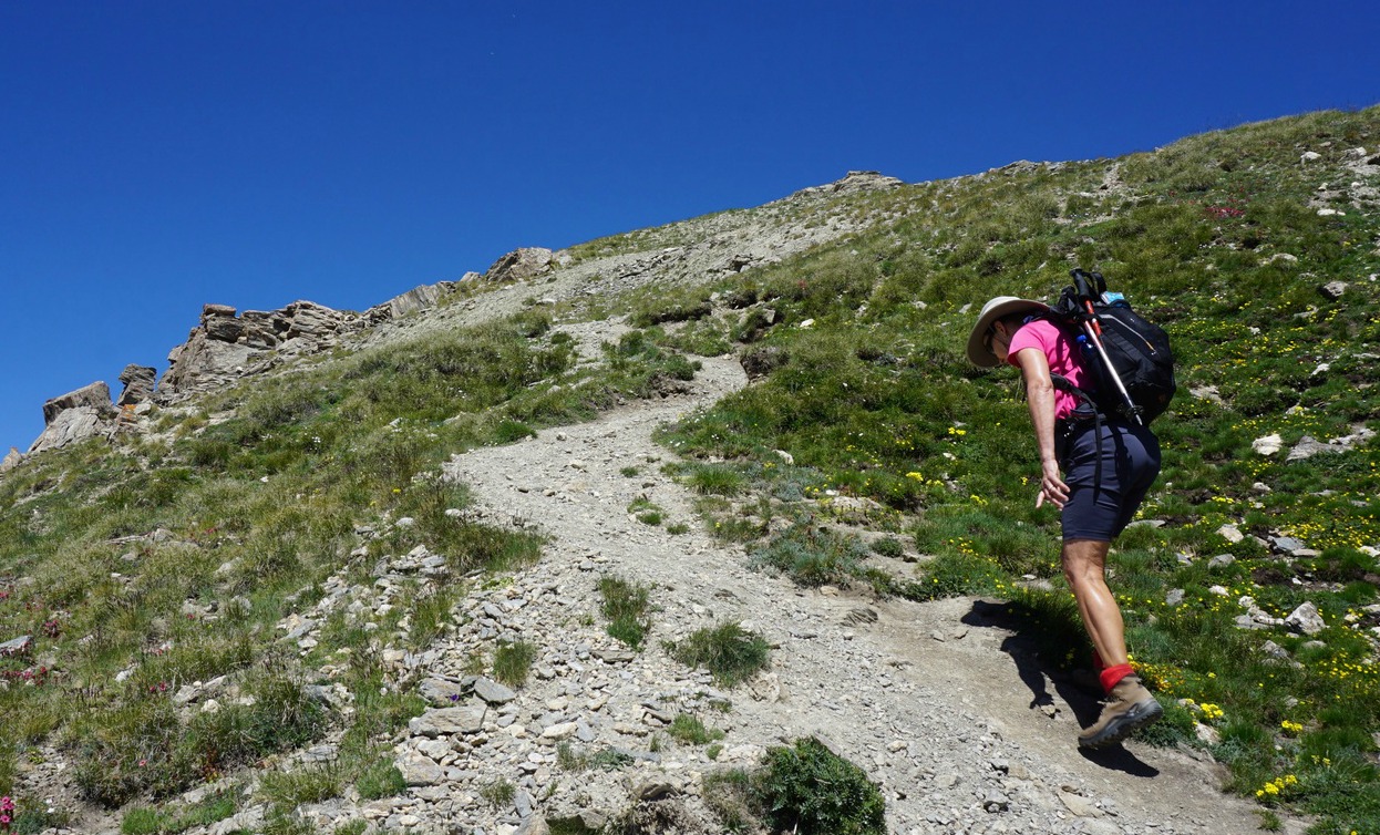
We drove up to Super Sauze ski resort (1700 m asl). We located our first signpost on a nursery slope and took a dirt track uphill (south), following it about 1 km. We then forked left along a trail, re-joined the dirt track heading first east, then southwest in a larch forest, crossing the Brec ski lift. After about 1,8 km from start, we forked right along a path that took us past a spring (la Goutta).
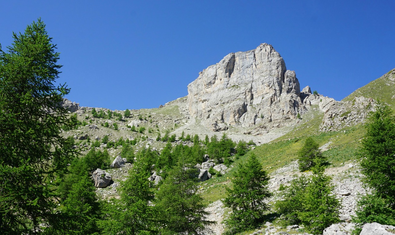
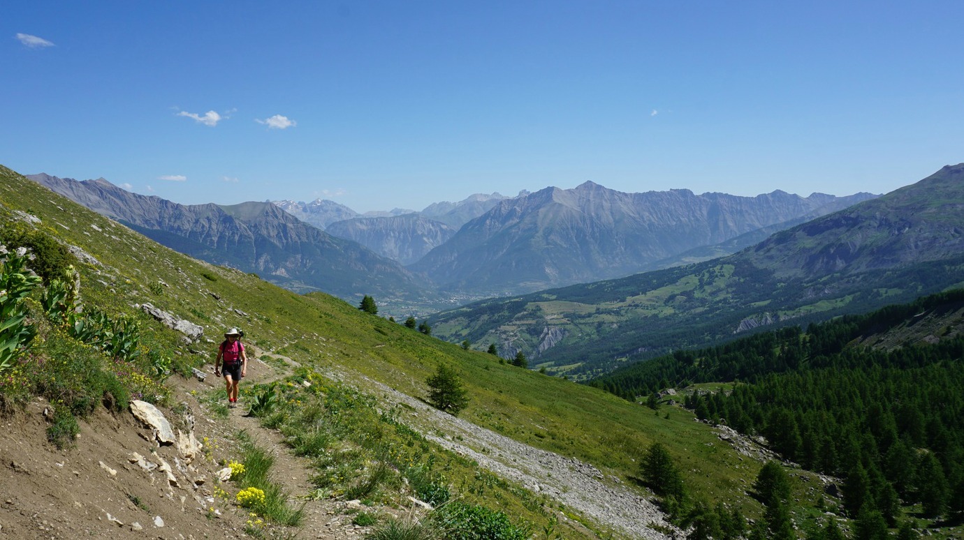
We climbed further above the tree line, passed an immense vertical rock wall (Le Queiron) at about 2300 m elev. We had the sharp figure of Brec Second (2596 m) and Col du Gyp in front of us. At the crossroads, the direct trail continued to Col du Gyp. We forked right, and ascended along the rocky and steep east face of Chapeau de Gendarme. Markings of the trail were yellow, occasionally with other colours. There was a signpost at 2670 m just under the geographical summit.
The heatwave continued in France, and it was unusually hot even at the summit on this clear and almost windless day. Needless to say, we had packed extra bottles of water and sport drink in the morning!
We took the same trail back.
Duration: 5 h
Elevation gain: 980 m
Distance: 12 km
Map: IGN Barcelonette 3540 OT


Confit de canard is the traditional way to preserve and prepare duck legs. My recipe is a modern version made from fresh duck legs and with less salt and duck fat.
Serve your duck legs with melting new potatoes and some greens. In the picture, they are served with French style peas.
2 servings
2 fresh duck legs
1 onion
1 clove garlic
5- 8 new potatoes
2 tbsp. olive oil
Black pepper
A pinch of salt
200 ml water
Parsley to decorate
Preheat the oven to 210°C.
Spread 1 tbsp. olive oil in the bottom of an oven proof dish. Peel and slice the onion and place in the dish. Peel and mince the garlic clove and scatter over the onion.
Prepare the duck legs by cutting away the extra fat on the side of the legs. Place the legs on top of the onions. Sprinkle with a pinch of salt, black pepper, and olive oil.
Wash the new potatoes and cut into smaller pieces. Place them in the dish around the duck legs. Pour 200 ml water in the dish.
Roast in 210° C for 15 minutes, the reduce the temperature to 180° C and continue roasting for 60 minutes. Baste now and again with cooking juices and cover after 30 minutes. Add a little water if it starts looking a bit dry.
Decorate with chopped parsley and serve with some greens.

Mont Guillaume (2550 m) offers magnificent views over Embrun, Savines-le-Lac and the Serre-Ponçon Lake in the Durance River Valley.
In February 1897, a Swedish-born Lt Charles Eric Widman of the French Alpine Hunters climbed to the summit of Mont Guillaume from Embrun (1681 m vertical climb!) with skis on his shoulder. He skied back down in 1h 30. As a Swede, he was a strong advocate of implementing skiing instead of snowshoeing for the French military. The main trail to the summit carries his name.
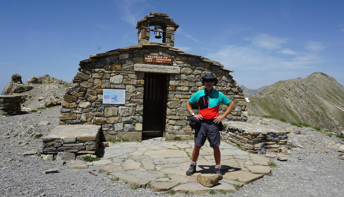
On the summit, a new chapel was built on the ancient ruins in the 1990s. There’s an annual pilgrimage to the summit in July.
We used the Sentier Widman on our hike. The trail started from the spacious Parking de la Forêt (1587 m) which we reached from Embrun along a narrow but paved road initially named Route de Caléyère/D465.
Several itineraries start from the parking. The Widman Trail is clearly marked. We forked left, then immediately right along a path that ascended through a livestock pasture in the larch forest. The trail then continued either along dirt tracks or good paths, still in a verdant forest. Signposts showed the itinerary to Séyères and Mont Guillaume. A place named Pré-Clos was left on the right-hand side.
At Séyères (2056 m), about halfway to the summit, we walked past a chapel and a spring. We continued along the north-eastern flank of Mont Guillaume in an increasingly alpine environment. Wild rhododendrons were starting to blossom by the trail. Some parts of the trail were still covered with snow.
Once on the mountaintop, we first met the rebuilt chapel and a large cross facing it. The geographical summit was about 100 m to the west from the chapel.
Our hike coincided with the heat wave that hit France in late June. The day was cloudless but very hazy.
Climb: 960 m
Duration: 5 h (active); ascent 2h45
Distance: 12 km round trip
Map: IGN 3438 ET Embrun