

Aspremont to Croix de Cuor and Mont Inarte

After having hiked to Mont Cima and Mont Chauve several times from Aspremont (490m), we wanted to explore a new itinerary in this well-known hiking area. The village of Aspremont lies only about 10 km north of Nice as the crow flies.
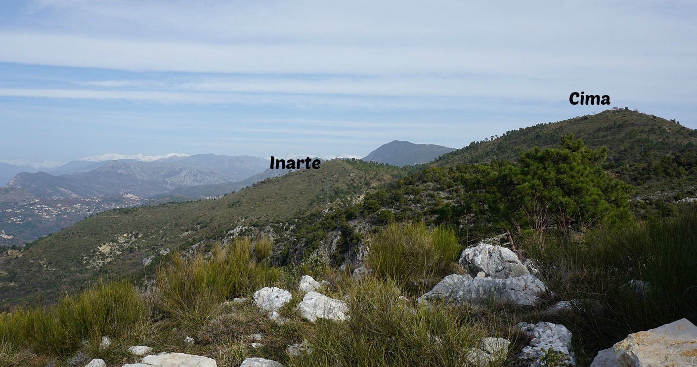
Mont Inarte (801 m) is situated immediately northwest of Mont Cima (879 m). While you can’t quite beat the views from the summit of Mont Cima, this easy and leisurely hike follows good trails along Mont Cima’s western flank, offering views down to the Var River Valley and beyond.


- >


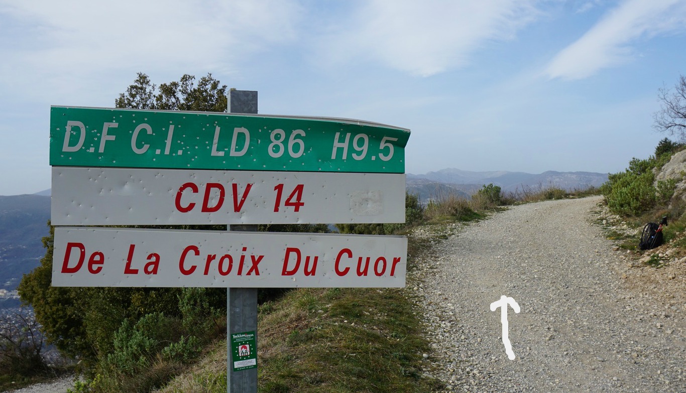
We started along the GR 5 trail north, ascending through the Les Salettes neighbourhood (streets and footpaths) as far as to a dirt track marked “CDV 14 De La Croix du Cuor” where we forked left, leaving the GR trail, and continued along it, heading northwest. At the next hiking signpost, we forked left making a short detour to a viewing point at la Croix de Cuor (744 m), a cliff above Castagniers and the Var River Valley. The scenery from here was great, practically 360°.
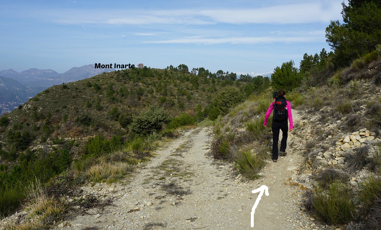
We then headed northeast along a path to the nearby Collet de l’Eurier (736 m), then straight north following a wide dirt track that ran along the western flank of Mont Cima. After about 600 m, we forked right and continued along a footpath whereas the dirt track started to descend. Our goal, Mont Inarte, was visible all the time. There were no markings nor signposts, but the itinerary was easy to follow. We came to a crossroads of some trails in the woods, and took the one that went northwest to Mont Inarte.
We used the same itinerary back to Collet de l’Eurier, where we forked left and soon reached the GR5 which we followed back to Aspremont.
Climb: 350 m
Distance: 8.1 km
Duration: About 2h 30 active
Map: 3742 OT «Nice-Menton Côte d’Azur »

Share story


0 comments:
Note: only a member of this blog may post a comment.