

Mont Macaron above Nice

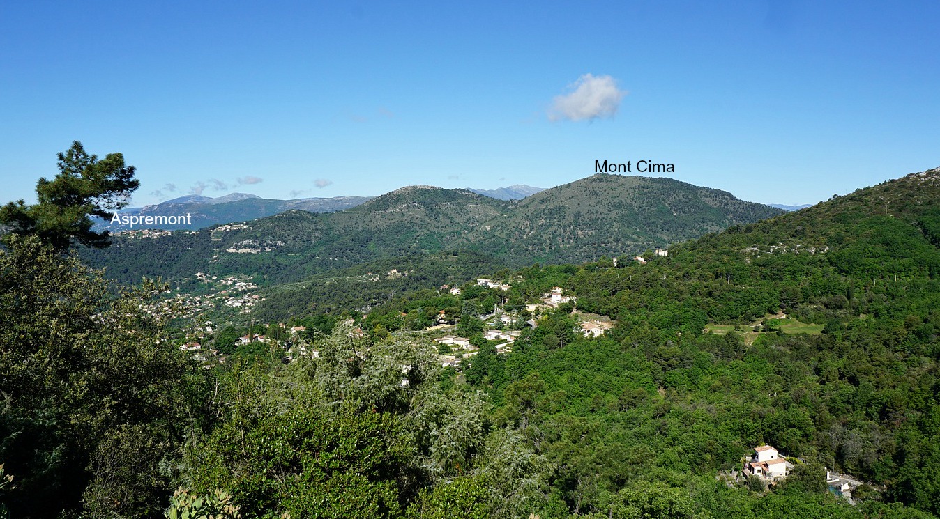
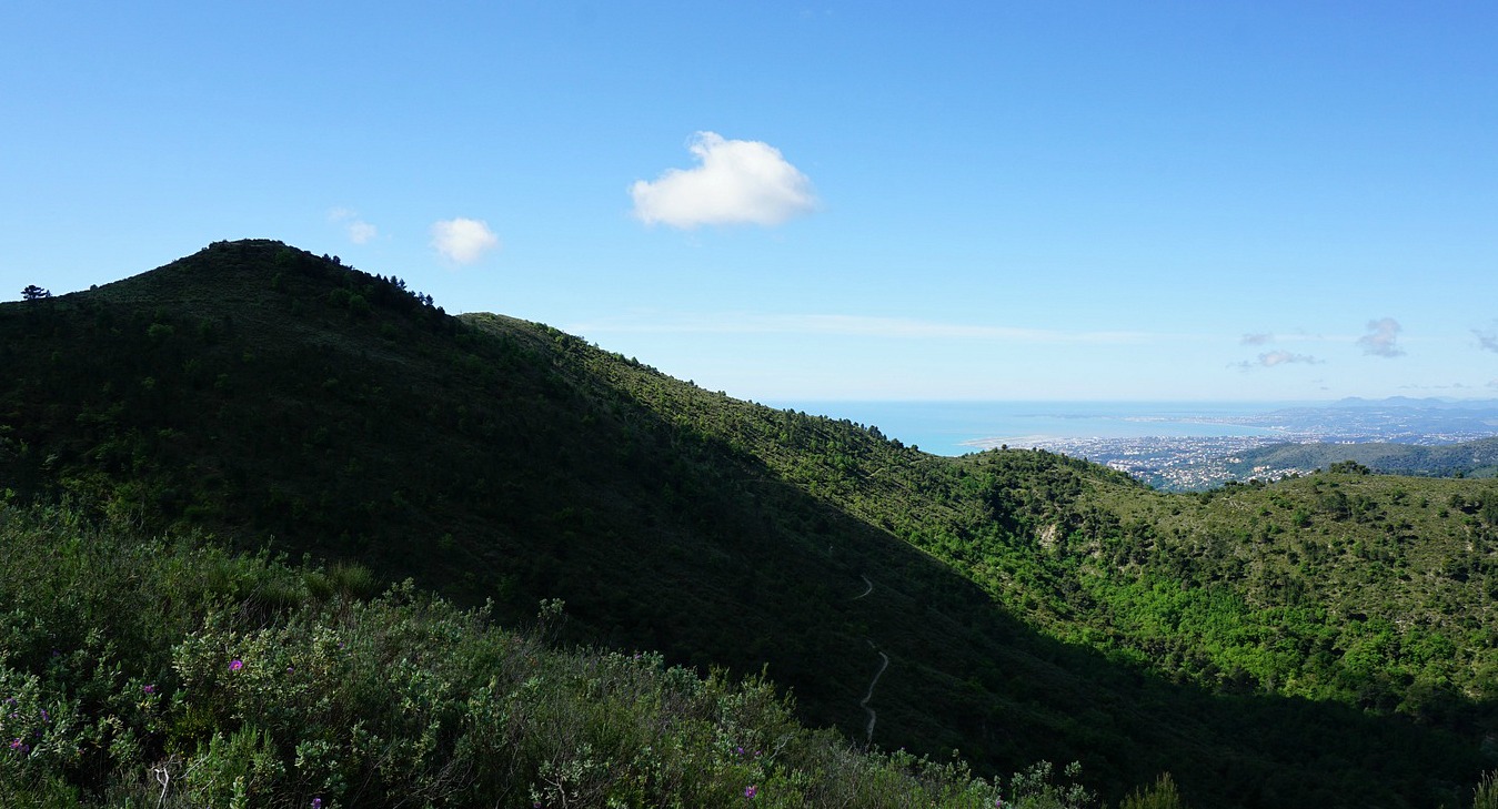
Both the northern (806 m) and southern (797 m) summits of Mont Macaron, about 11 km northeast of Nice offer a magnificent 360° panorama in spite of their rather modest elevation. From both summits, one can admire the city of Nice, Baie des Anges as well as the Mercantour peaks in the north. Not surprisingly this is a very popular hiking area.
Both summits are situated on Crête du Mont Macaron, between the towns of Tourrette-Levens and Contes. There’s a vast parking at Col de Châteauneuf (626 m) by the D815 road. It’s here we headed after an almost two-month long COVID-19 lockdown.


- >


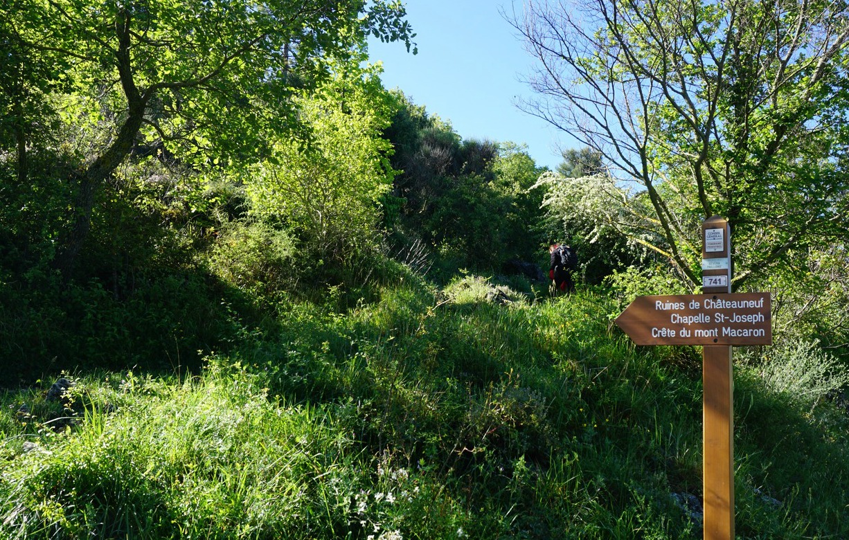
From the parking, we started following a small road south and after 100 m forked left (signpost#741 indicating Crête du Mont Macaron) into the woods. We ascended along a path passing the ruins of medieval Châteauneuf, leaving them on our left-hand side. The ruins are perched on a hilltop (750 m) about 500 m south of the col.
We soon reached a clearing where the restored Chapel St. Joseph was located. The potholed road from the main road ended here.
From the chapel, we continued southeast then south, ascending gently towards the ridge, where both summits were visible. We took a small shortcut from the main path directly to the northern summit, then re-joined the path which lead to the southern summit just 400 m away.
After a break, we descended southwest to signpost #744 at Baisse du Macaron (666 m) where we turned north, and hiked back along the western flank of Crête du Mont Macaron along a good path first to Chapel St. Joseph then to our
starting point.
Climb: 280 m
Distance: 7 km
Duration: 2h 40 (active)
Map: “Nice-Menton Côte d’Azur TOP 25 n°0 3742 OT

Share story


0 comments:
Note: only a member of this blog may post a comment.