

Tête de Chien above Monaco

Tête de Chien (550 m) is a well visible landmark above Cap d’Ail and Monaco. From some angles the mountain resembles dog’s head, hence the name. A fortress was built on the summit in the 19th century, today there’s a telecom research centre (CNET).
The previous day’s weather front with rain, wind and low clouds was replaced by clear skies on the morning of our hike, and the night’s breeze had cleaned the air making the visibility unusually good.
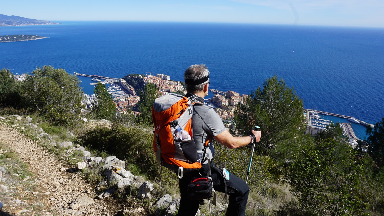
The hike called Tour de la Tête de Chien offers magnificent views towards Cap Ferrat, Cap d’Antibes and even the St Tropez peninsula further away in the west, and Cap Martin, Menton and the Italian coastline in the east. The views down to Monaco and Beausoleil are dramatic as the they are straight below you. We were even lucky enough to see the mirage of Corsica above the horizon.


We parked at the centre of Cap d’Ail (80 m) and started ascending along a narrow street called Chemin des Mimosas. We crossed the RD 6007 road (la moyenne Corniche) at a pedestrian crossing (traffic lights), and followed a narrow street (chemin romain) before entering the trail proper. The signposts showed the itinerary, and we followed “Tour de la Tête de Chien” signs and yellow markings. On the way up, we had to cross the RD 37 road three times before heading east towards the mountain top. We passed a rock climbing wall and met a few trail runners. The trail was well maintained, climbing steadily but there were no steep or difficult parts.
After a break at the mountaintop, we continued straight north a few hundred meters along a paved road coming from La Turbie. We forked right (east) at the signpost and came to the other side of the ridge from where the trail back started. Signposts here were recently renewed. While descending, we had pretty dramatic views of the Principality below us. Even the high-rises, including the new Tour Odeon looked so small!
We descended rapidly towards Cap d‘Ail, and reached soon the first fancy villas of the Bautugan neighbourhood. We came to RD 6007, crossed it again and continued back to our starting point along the same route.

Duration: 3 h (walking time)
Climb: 500 m

Map: IGN 3742 0T Nice Menton Côte d’Azur
Share story


0 comments:
Note: only a member of this blog may post a comment.