Tanneron ridge hike


Mimosa


The village of Tanneron (~400 m elev.) has become the unofficial capital of the mimosa. From January to March, the mimosa colours yellow the hill flanks above Mandelieu-la-Napoule. Not part of the original flora, the mimosa tree was originally imported from Australia and thrives in Côte d’Azur.

Several families in Tanneron now cultivate mimosa and export flowers to all France and beyond. Numerous varieties of the mimosa exist which explains the long flowering season.

Lots of visitors come to the small village to admire the yellow flowers in mid-winter, and many wish to take advantage of shorter or longer hiking routes in the surrounding hills.

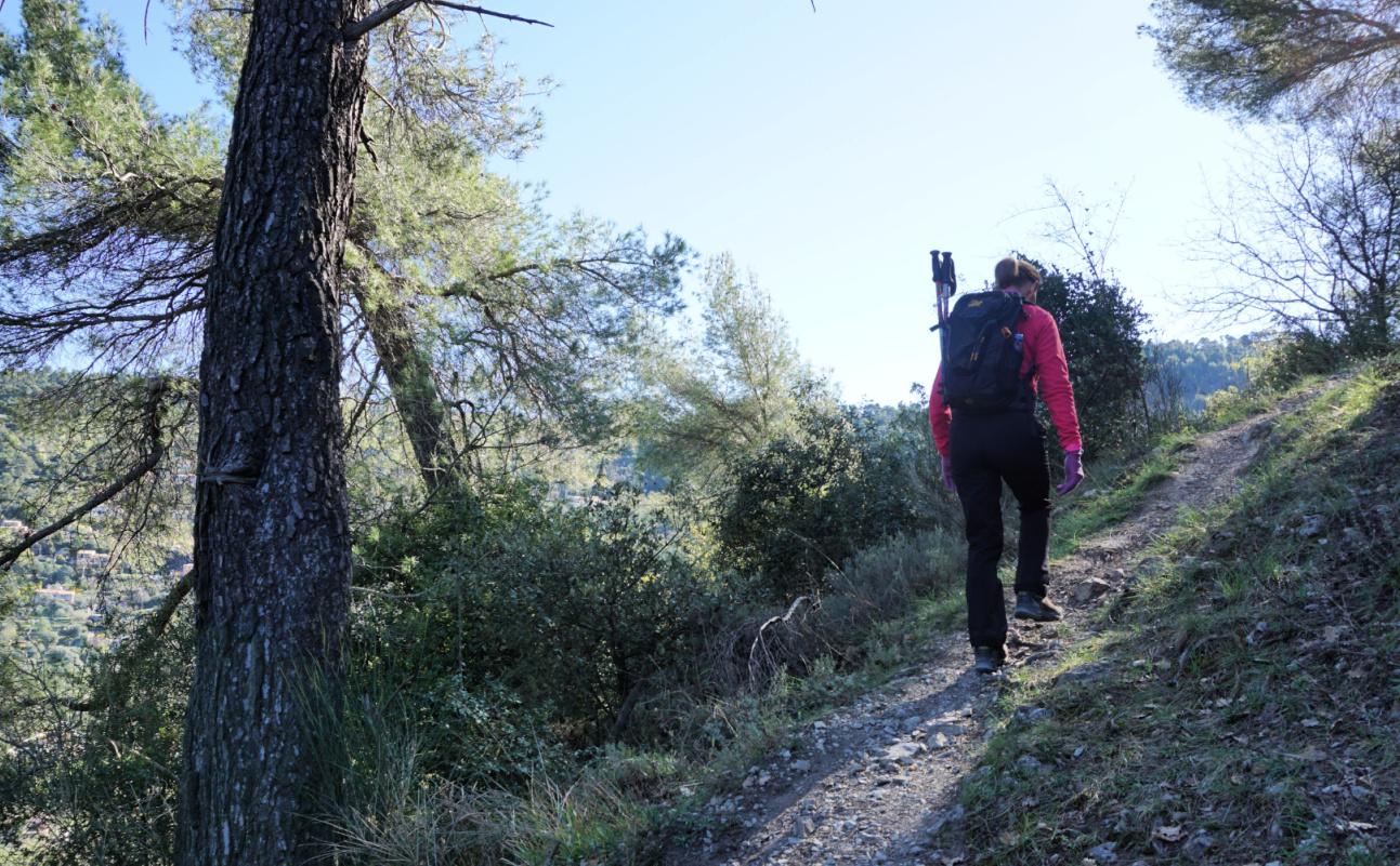
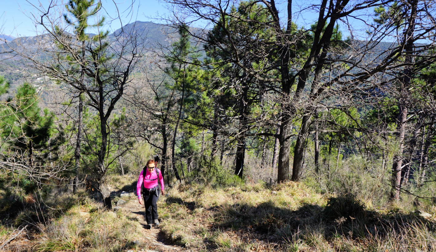
We made the long (16+ km) but very popular Ridge of Tanneron (Circuit Les Crêtes de Tanneron) loop hike on a pleasant February day.

Tanneron Village
View north from Tanneron
Hills below Tanneron
Tanneron hike signpost


We used the village as our starting point. We descended, using a shortcut passing the fire station to the signpost (pictured) below the village showing the itinerary. Once deep down in the valley, we followed the Aubarie stream, crossing it a few times. 


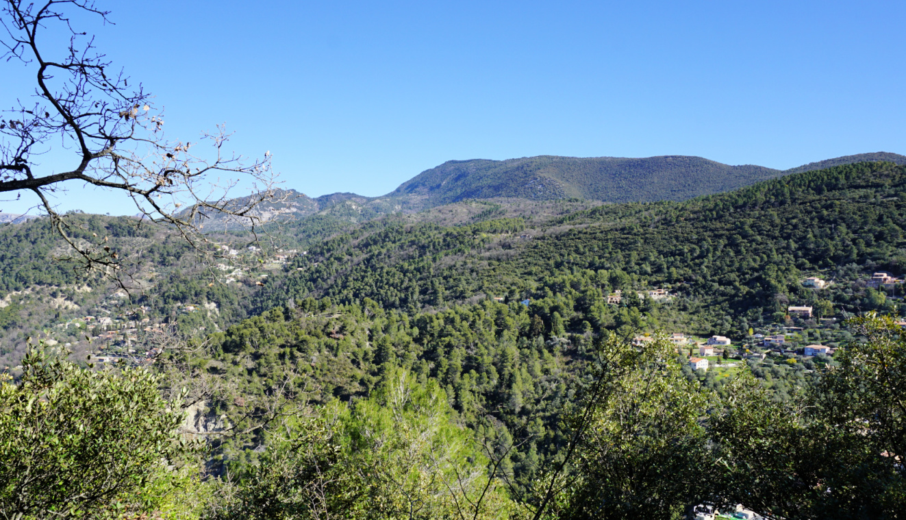
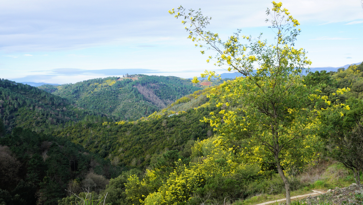
We came to a bend by the D38 road at about 150 m elev., walked along the road about 70 m before starting to ascend gradually in the woods, in a southerly direction. Once higher up, the scenery changed and when we reached the ridge there were blossoming mimosa trees by the trail in abundance. We had unobstructed views to Grasse and beyond. We passed some mimosa cultivations and came to the neighbourhood of les Farinas (about 470 m elev.) with some nice properties. Here, we continued along a paved road (Chemin des Farinas), heading mostly east. The yellow-marked trail follows the road. We took a 700 m detour near les Grailles along a nice unmarked trail, and re-joined the paved road after a steep descent.


Trail to Auberie Valley
Ascent from Aubarie Valley

Trail on Tanneron Ridge
Grasse hinterland viewed from Tanneron
View from Tanneron Ridge


We descended further along the road to a crossroads where we forked left and followed a wide DFCI dirt track as far as to Vallon de la Verrerie where we again forked left (west). After about one km we crossed the stream in the valley and climbed back to Tanneron, first passing a parking at Touordam, next to the tennis courts. 


Climb: 570 m


Distance: 16,7 km


Duration: 4h40 active walking time


Map: 3543 ET Haute Siagne

Detour on Tanneron Ridge


Mimosa tree by trail Tanneron


Tanneron hike track


White fish à la Coral Gables


White fish à la Coral Gables


Some time ago, we had a delightful lunch on the terrace of an Italian restaurant in Merrick Park, Coral Gables. The fish was a prized South Floridian red snapper, lightly flowered and pan-fried. It was served on an olive oil-tomato-caper sauce with potato gratin, Gratin Dauphinois, and green beans. The dish was colourful and traditionally Italian.

My recipe is inspired by this lunch. I use fillets of cod, breaded and oven-roasted. The sauce is traditional French sauce vierge with added capers. For the recipe, you could use any fresh tasty white fish fillets such as cod, monkfish, sea bass and so on.

2 servings

2 pieces of cod fillet, about 120 g each

2 tbsp. bread crumbs

Olive oil

For the sauce vierge:

50 ml tasty organic extra virgin olive oil

Juice of ¼ lemon

A dash of pressed garlic

Freshly ground black pepper

1 ripe medium tomato

2 tsp. small capers

Chopped basil or parsley


Preheat the oven to 200°C, roast.


Chop the tomato into very small pieces and place in a bowl. Add the olive oil, lemon juice, pressed garlic, black pepper, and capers and mix. Let the tomato marinate while you prepare the fish. Just before serving, mix with chopped fresh herbs.


Coat an oven-proof dish with olive oil and pace the fish fillets in it. Cover the fillets with breadcrumbs and drizzle over some olive oil. Roast for about 10 minutes, depending on the thickness of the fillets.


When the fish is done, divide the sauce vierge on the plates and place the fish on top. Serve with potato gratin and microwaved green beans.


Mont Razet revisited


Baisse de Scuvion and Mont Razet


On one of our recent hikes from Col de Castillon (signpost#135 at 706 m), we saw a temporary sign on the Baisse de Scuvion (1154 m) mountain pass indicating a direct path up to the nearby summit of Mont Razet (1286 m). On today’s hike we wanted to explore this option. The route was not shown on the normal hiking map, but interestingly the OpenStreetMap shows a trail between the Baisse de Scuvion and Mont Razet.

The mountains above Menton have an extensive network of trails, and we have become quite familiar with them. We have circled Mont Razet many times and climbed to the mountain top along the marked itinerary from la Pierre Pointue (1168 m; signpost #93a).

Mont Razet consists of a ridge where its northernmost point just above the Baisse de Scuvion is 1 m higher (1287 m) than the main peak. 

Trail crossroads near Biatonéa
Heading to Baisse de Scuvion
Col de Castillon viewed from trail
Near Baisse de Scuvion

From Col de Castillon, we walked straight north, passing the Biatonéa neighbourhood to a trail crossroads (signpost #137), and ascended to the Baisse de Scuvion (signpost #92).


It was a cloudless February day and it had not rained in several weeks. Trails were therefore dry and easy to negotiate. The temporary sign we had seen at the Baisse earlier had disappeared, but the trail was clearly visible. It turned out that the path was marked with red dots (for trail runners?). Some steep stretches needed easy scramble, but all in all the trail enabled a rapid access to the summit. We first reached the Mont Razet ridge south of the highest point on the map (1287 m), continued southeast towards the main summit a few hundred meters away, still following the red dotted trail.

Shortcut to Mont Razet
Near Mont Razet ridge
Near Mont Razet Ridge
Mont Razet ridge
Mont Razet ridge
Mont Razet summit seen from north
Mont Razet summit
Mont Razet summit

After admiring the great views and absorbing the solitude, we continued to la Pierre Pointue, passing remnants of several Maginot-era bunkers, then continued to signpost #93 where we forked left and descended to Biatonéa, thus completing the loop. 


Climb: 580 m

Distance: 8 km

Duration: 3h 30

Map: Nice-Menton Côte d’Azur 3742 OT

Bunkers on Mont Razet ridge


Trail track to Mont Razet


Spring risotto

Spring risotto


This spring risotto recipe is my twist of a lunch we had one beautiful day in May on the terrace of a restaurant in Nice. The green asparagus and small purple artichokes, artichauts violets, are much appreciated local spring vegetables in the South of France. 


2 servings

For the risotto:

120 ml carnaroli or arborio rice

Olive oil

150 ml white wine

1- 2 shallots, chopped

1 clove garlic, minced

About 700 ml chicken stock (you may not need it all)

About 2 handfuls of grated parmesan

For the vegetables:

4 small purple artichokes, artichauts violets

8 cherry tomatoes, halved

4 green asparagus

Juice of ½ lemon

8 black olives, pitted

About a handful of fresh basil leaves

Olive oil a pinch of salt


First prepare the vegetables and keep them refrigerated until needed.


Prepare a very green herb sauce by crushing the chopped basil leaves and a pinch of salt in a mortar with a pestle. Add olive oil into a nice sauce consistence, then cover and keep in the fridge.


Prepare the artichokes by cutting away the tops of the leaves and about 1 cm from the stems. Remove all the tough outer leaves. Bring a large saucepan of water to a boil and add the lemon juice. Cook the artichokes for 8 minutes. Remove from the saucepan, cut into quarters and remove the fuzzy centre with a teaspoon. Place the artichokes in a bowl, cover and keep refrigerated.


Peel the green asparagus and cut away the tough stems. Cut them into about 3- 4 cm long pieces and microwave for a few minutes until soft. Place them in the fridge. 


Cook the risotto the classic way. Warm 2 tbsp. olive oil over medium heat in a heavy cocotte, such as Le Creuset, and sauté the shallot and garlic for 5- 10 minutes. add the rice and stir until well coated with the oil. Cook for 25 minutes adding the liquid, first the wine then the stock, ladle by ladle stirring continually. The rice should be al dente, cooked but firm to the bite. Remove the cocotte from the heat and stir in the parmesan.


Just before the risotto is ready, warm 1 tbsp. olive oil in a frying pan. Quickly sauté the cherry tomato halves and warm the artichokes, asparagus, and black olives for a few minutes.


Divide the risotto into bowls and place the vegetables on top. Surround the risotto with the green basil sauce.


Loop hike from Ste-Agnès


Ste-Agnès viewed from Pas de la Piastre


One February not long ago, we hiked to Mont Ours from Ste-Agnès. We now decided to do a loop hike passing through three cols above the village: Col de Verroux (935 m), Col des Banquettes (736 m) and Pas de la Piastre (935 m). It turned out to be another great winter experience in the mountains so near the Mediterranean coast.

As before, we parked at the village entrance (about 600 m elev.) and headed towards Col de Verroux along the well-signposted (#441, 442, 444, 445) trail. After a brief descent to Peyre Grosse (a few houses), we ascended above Ravin de Verroux eventually joining an ancient military track before the Col.


View to east from Ste-Agnès
View east from Ste-Agnès
Trail leaving Ste-Agnès


 From Col de Verroux (signpost #446), we forked left and followed a quasi-horizontal dirt track on the southern flank of Mount Ours and Pic de Garuche, heading west. We had super views as far as to the Mediterranean, Cime de Baudon, Bausson, and Ste-Agnès.


We reached a crossroads at signpost #472 and merged with the trail from Mont Ours. We descended along the rather steep trail towards Col des Banquettes, passing the bunkers located just above the Col. Last year, we hiked back to Ste-Agnès along the narrow but paved Route du Col des Banquettes, the shortest option. This time we ascended to Pas de la Piastre, a more interesting option. The old hiking signpost at the col had disappeared but the start of the steep trail was well visible between two dirt tracks. The trail was marked with yellow signs and was easy to follow in the woods to Pas de la Piastre.

   
Pointe Siricocca and Mont Ours
Trail after signpost#443
Ravin de Verroux
Ravin de Verroux
Old military track near Col de Verroux
Col de Verroux
Col de Verroux

From Pas de la Piastre under Cime de Bausson (1087 m), we had a great view down to Ste-Agnès, with a glimpse of the coastline at Menton. From here, we descended rapidly back to our starting point.


Distance: 9,5 km


Climb: 605 m


Duration: 3h 45 active hiking time


Map: “Nice-Menton” Côte d’Azur 3742 OT


Cime de Baudon
Cime de Baudon

Path south of Col des Banquettes

Hike track from Ste-Agnès


Stuffed chicken escalopes

Stuffed chicken escalopes


For this recipe, you will need very thin chicken or turkey escalopes. Thin; store- bought escalopes should be placed between two sheets of aluminium foil and rolled to make them even thinner.

If possible, choose grilled and salted pistachios for the stuffing. Peeled pistachios can also be grilled in a dry frying pan with some salt added.

2 servings

2 very thin chicken or turkey escalopes

Olive oil

100 ml white wine

A handful of peeled pistachios and pine nuts

1 shallot, chopped

1 clove garlic, minced

½ small courgette, finely chopped

A handful of baby spinach leaves

Freshly ground black pepper

½ tsp. dried Provençal herbs

Kitchen string


Preheat the oven to 180° C, roast.


In a mortar, crush the peeled, grilled and salted pistachios and pine nuts with a pestle. Chop the courgette into small pieces.


Warm 2 tbsp. olive oil in a frying pan over medium heat. Sautè the courgette, shallot, and garlic for about 10 minutes until soft. Add the pistachios, pine nuts, and some black pepper. Add the spinach and continue cooking for a few minutes until the spinach is wilted.


Divide the stuffing on the escalopes and roll them. Tie the rolls with string.


Heat 1 tbsp. olive oil in a frying pan over medium heat and fry the rolls on both sides until golden. Place the rolls in a small oven- proof dish and pour the white wine around them. Transfer to oven and cook for 20 minutes. 


Serve with rice mix and green beans.


Mont Cima from St-Blaise


View from Mont Cima


In search of new, less visited routes, we wanted to explore the possibility to ascend from the village of St-Blaise (320 m) to Mont Cima (878 m). We have previously climbed to Mont Cima  along the popular trail from Aspremont (500 m).  

The north face of Mont Cima and Inarte is mostly forest-covered. There are both marked and unmarked trails on the slope. We had studied the area on maps and it should be possible to find a route to Mont Cima.


Starting from the village centre, we ascended along stairs, crossing the main road M14 three times. We walked past a small Eco museum by the road and first climbed along Chemin d’Amandier, then along a trail to signpost #826 where we took the right-hand path (Le Castel; La Gipasse) and ascended further to signpost #825. We forked right almost 180° and soon came to le Castel, ruins of a small castle perched above St-Blaise. The signposts from St-Blaise do not directly guide you to Mont Cima.

Still continuing along a marked trail (yellow), we now headed south west in the woods, quasi horizontally, along a very good path which merged with dirt track that runs along the mountain slope. We forked left, and walked along the dirt track about 500 m to a bend (arrow on the map; image). Here, we forked right and started to ascend along an unmarked trail. The trail had nevertheless some markings for mountain bikers. We climbed quite steeply to a crossroads under Mont Inarte, turned left and came to a small clearing east of Inarte. We continued southeast, and soon reached the familiar hiking path to/from Mont Cima.

You never get tired of the panorama from Mont Cima. It is 360°, from the Riviera coastline to Mercantour summits. There are orientation tables on the mountain top.

We descended along the same trail. There are many spots on this trail that offer great views to Nice hinterland as well as high peaks in the distance.

Climb: 600 m

Distance: 8.2 km

Duration: 3h 50 active time

Map: 3742 OT Nice Menton Côte d’Azur  

Mont Cima hike track