

Pic de Garuche

Pic de Garuche (1089 m) above St Agnès is one of the many mountains where Maginot Line fortifications were built in the 1930s. Situated southeast of Mont Ours (1236 m), an artillery observation post was erected there. Having hiked to both Mont Ours and nearby Pointe Siricocca (1050 m) before, we had not explored this peak before.
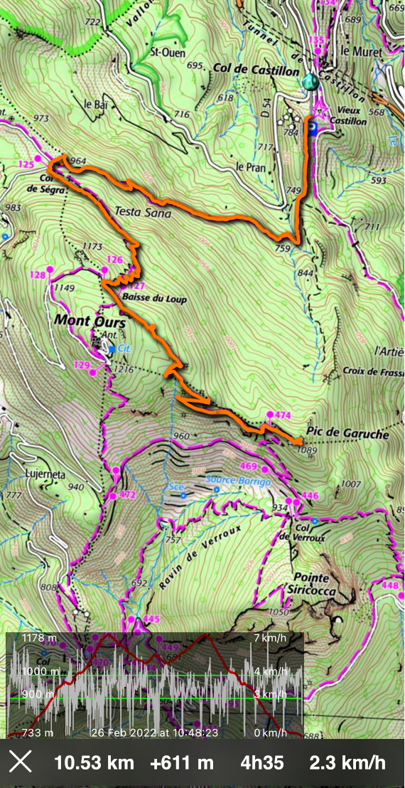
On a clear and crispy winter day, we decided to ascend there from Col de Castillon parking (730m) along the trail which passes near the summit of Mont Ours. Another good option is to start from St Agnès (600 m) or Col des Banquettes (736 m).
 |
| Trail start from Old Castillon |
 |
| Trail to Col de Ségra |
 |
| Mercantour peaks |
From the parking, we first headed south, then west ascending along the forested north-eastern flank of Mont Ours to Col de Ségra (963 m); signpost #125. At the col, we forked left (southeast) and climbed to signposts #126 and 127, the latter at Baisse de Loup (1171 m) just under the summit of Mont Ours. We continued straight (Col Verroux, Ste Agnès) along a wide apparently ex-military trail.
 |
| Mont Razet and Grammondo |
 |
| Near Baisse du Loup |
 |
| Col Verroux |
 |
| Military trail to Pic de Garuche |
 |
| Menton coastline |
 |
| Pic de Garuche summit |
We descended along it to a crossroads and signpost #474 under Pic de Garuche and climbed to the summit. Being an ancient observation post, we had great views towards the coast at Menton (only 6,5 km away) as well as the snow-capped Mercantour peaks.
We returned along the same trail.
Distance: 10,5 km
Climb: 610 m
Duration: Active hiking time about 4 h
Map: Nice Menton Côte d’Azur 3742 OT


0 comments:
Note: only a member of this blog may post a comment.