

Carros: Sommet du Broc

On a late February day with clear skies we again found ourselves at the parking of Carros Village.
This time we had decided to do an extension from the New loop trail above Carros Village to Sommet du Broc (895 m).


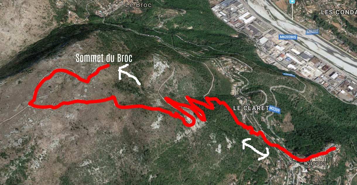
From signpost #32 which marked the highest point of the loop trail (about 700 m), we forked right and climbed along a wide but rocky trail. We came to a plateau and crossroads with a signpost showing the direction to Sommet du Broc. The summit was not very evident, but by the help of the map we were able to pinpoint it almost under a big power line. There was a cairn on the top. We were inside the Prealpes de Cote d’Azur Regional Park. The scenery here was mostly rocky, barren shrub land. The land is used by lamb farmers. On the day of our hike, we observed a lone eagle, no other animals nor hikers.
This is a great hike to test your fitness level before planning longer and more strenuous adventures, as it’s a continuous ascent of about 500 m from the starting point.
Obviously this trail can be quite hot in summer.
Duration : 3h30
Climb : 530 m
Map: IGN 3642 ET Vallée de l’Estéron Vallée du Loup
Share story


0 comments:
Note: only a member of this blog may post a comment.