

Alpine trail above Saint-Dalmas-le-Selvage

We got inspiration for this hike from a French guide (Mercantour Alpes du Sud Le Guide Rando: by Patrick Mérienne). In the book, there was also an excellent description of how the vegetation changes with altitude.
Saint-Dalmas-le-Selvage (1500 m) is a commune and a village in the northern part of Alpes-Maritimes. Two thirds of the commune are inside the Mercantour National Park. It is known as a cross country skiing and a snowshoeing resort in winter, and as a hiking centre during the summer months.
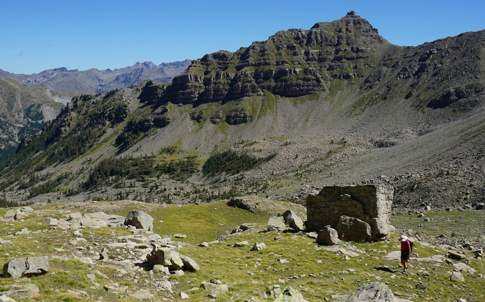
We drove through the village of Saint-Dalmas-le-Selvage, and continued about 6 km along the now narrower D63 road that went to Col de la Moutiére. We parked at 1960 m altitude, not far from the Refuge de Sestrière and signpost #57 which was our starting point. This part of the road was paved, but there was a warning of an unpaved section higher up. The starting altitude was subalpine dominated by larch woods, but also some pines, wild rhododendrons and blueberries. Some larches in this area are said to be over 700 years old. Above 2200 m the vegetation became more alpine with both smooth meadows and rocky areas. Sporadic larches were seen as high as at 2500 m.


The trailhead at signpost #57 was also the entrance to the Mercantour National Park. There were several parking spots by the road, although the one at the signpost was very small.
Thanks to excellent markings by yellow the trail was easy to follow. We crossed a torrent along a footbridge and ascended in the magnificent larch woods for about 40 min before reaching a bigger clearance with Cabane de Braisse by the trail. The trail levelled off a bit, then continued ascending, following a stream, and passing the last larch woods. We came to a section of alpine meadows before the final steeper ascent to the mountain pass where signpost #59 was located. Just below the mountain pass, one trail continued to Col de Sanguiniere nearby, and further to Estenc in the upper Var Valley. The other trail forked north, towards Col de la Moutiére.
We took the same trail back to our starting point.
Vertical ascent: 640 m

Duration: 3h 30 (walking time)
Map: IGN 3639 OT Haute Tinée 1
Driving time from Nice: 1 h 55


Share story


Subscribe to:
Post Comments (Atom)


0 comments:
Note: only a member of this blog may post a comment.