

Hike from Col d'Allos

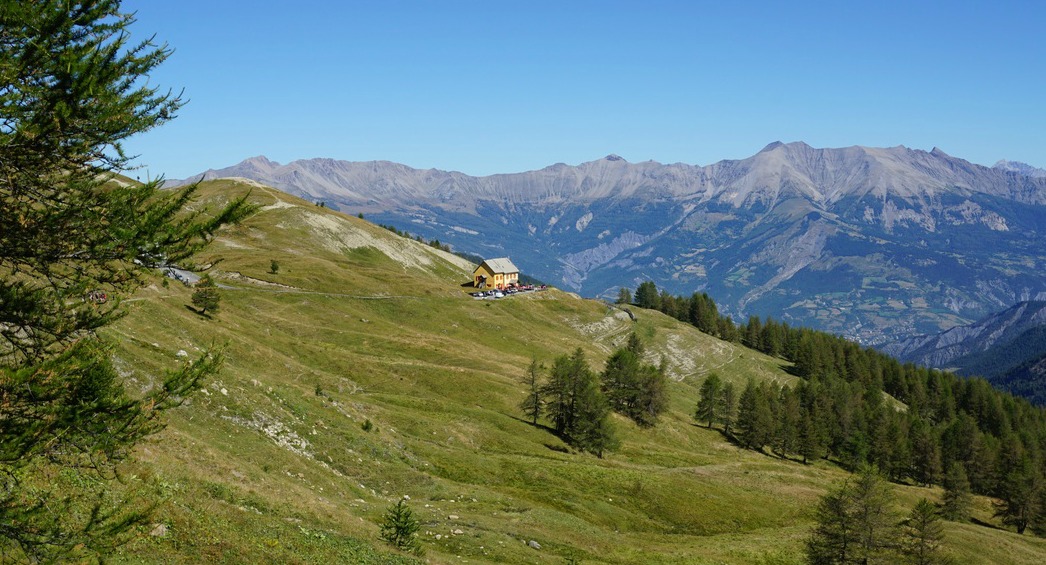
The D908 road that goes over Col d’Allos (2250 m) connects the Ubaye and Verdon Valleys. Just below the mountain pass, there’s a refuge which is open during the summer months. The GR56 hiking trail goes over the col, making it an excellent starting point for some good hikes. There’s a potholed parking at the col proper. The parking at the refuge is reserved for the clients. The mountain pass is extremely popular during the summer peak period as many stop there just to admire the stunning views, and to experience the alpine atmosphere. The winding road up to the pass is very narrow, so be careful. Compared to this, the road over Col de la Bonette feels like a highway!
The drive from Nice to Col d’Allos is long, about 2h 50 but there are some villages along the road where you can stop for a coffee and snack. We can recommend Entrevaux and Allos Village which both made nice stops.
Because of the distance, it made sense to make a shorter walk from the col as we did not plan to stay overnight. To explore the region better, we’d recommend to book an accommodation for a few nights.


Here we describe a panoramic and easy walk from Col d’Allos to Rochegrand (2409 m) and back which takes only about three hours.
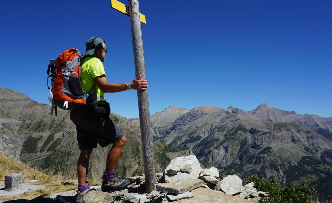
We headed south along the GR56 trail, ascending to Baisse de Prenier (2402 m). Just below this point, we left the GR56 trail and forked right. The trail continued in a very nice alpine meadow further south, rolling along a gentle mountain ridge, croupe de la Montagne de Cheiroueche. The summit of Rochegrand could be seen in front of us most of the time. We reached the summit after about 1h 30. The southern face of Rochegrand was steep and rocky. We had the village of Allos right under us. Some of the nearby summits worth mentioning include Mont Pelat (3050 m), Le Cimet (3020 m) and the peculiar Grande Séolane (2909 m).
We returned to Col d’Allos along the same trail.

Duration: 3 hours

Vertical ascent: 340 m
Map: IGN 3540 OT Barcelonnette
Image of trail courtesy of Google
Share story


0 comments:
Note: only a member of this blog may post a comment.