

Cime de Rocaillon above Lucéram
 |
Cime de Rocaillon (1444 m) is a less visited mountain top in Nice hinterland, moyen pays, about 24 km from Nice seafront as the crow flies.
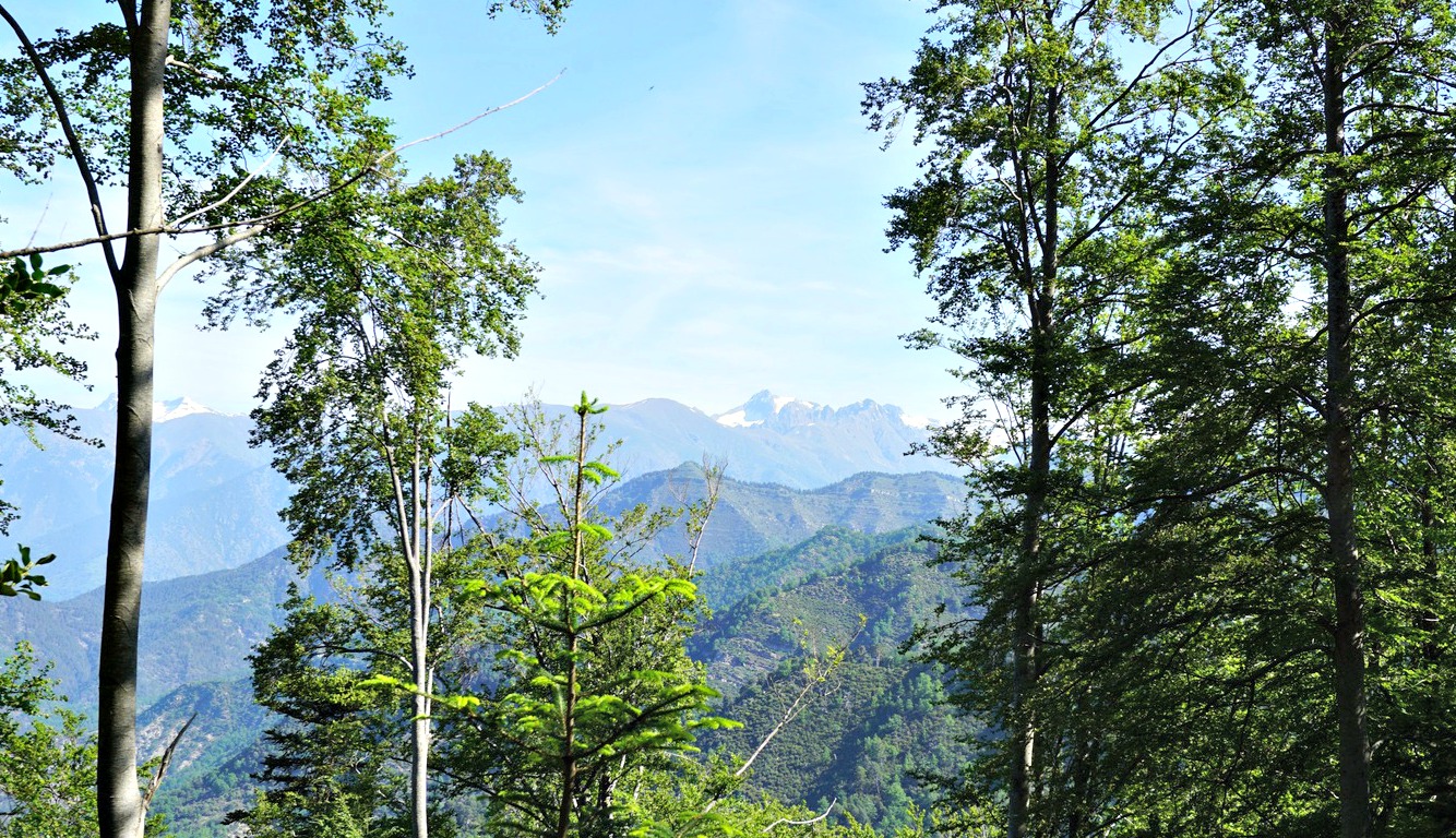
The views south and southeast do not disappoint. The medieval village of Lucéram (650 m) is clearly visible deep down in the Paillon River Valley.
From Nice, we drove to Luceram along D2566, and further to Col St-Roch where we took the D73. We parked at Col de la Porte (1057 m) which was the highest point of the road; 35 km from downtown Nice. From Col de la Porte, the summit can be reached with a very moderate effort. Starting from Lucéram is a good option if you wish to do a longer hike but that requires more than twice as much climbing.
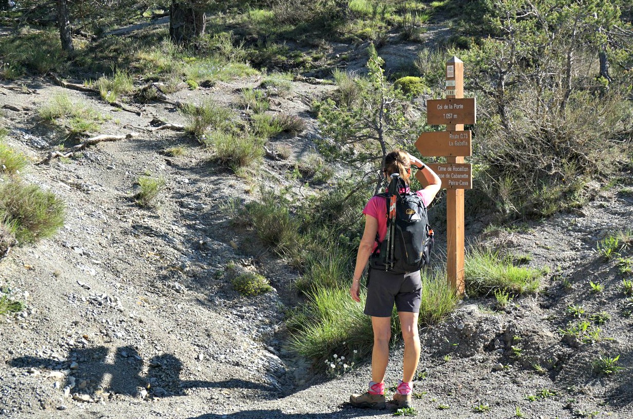


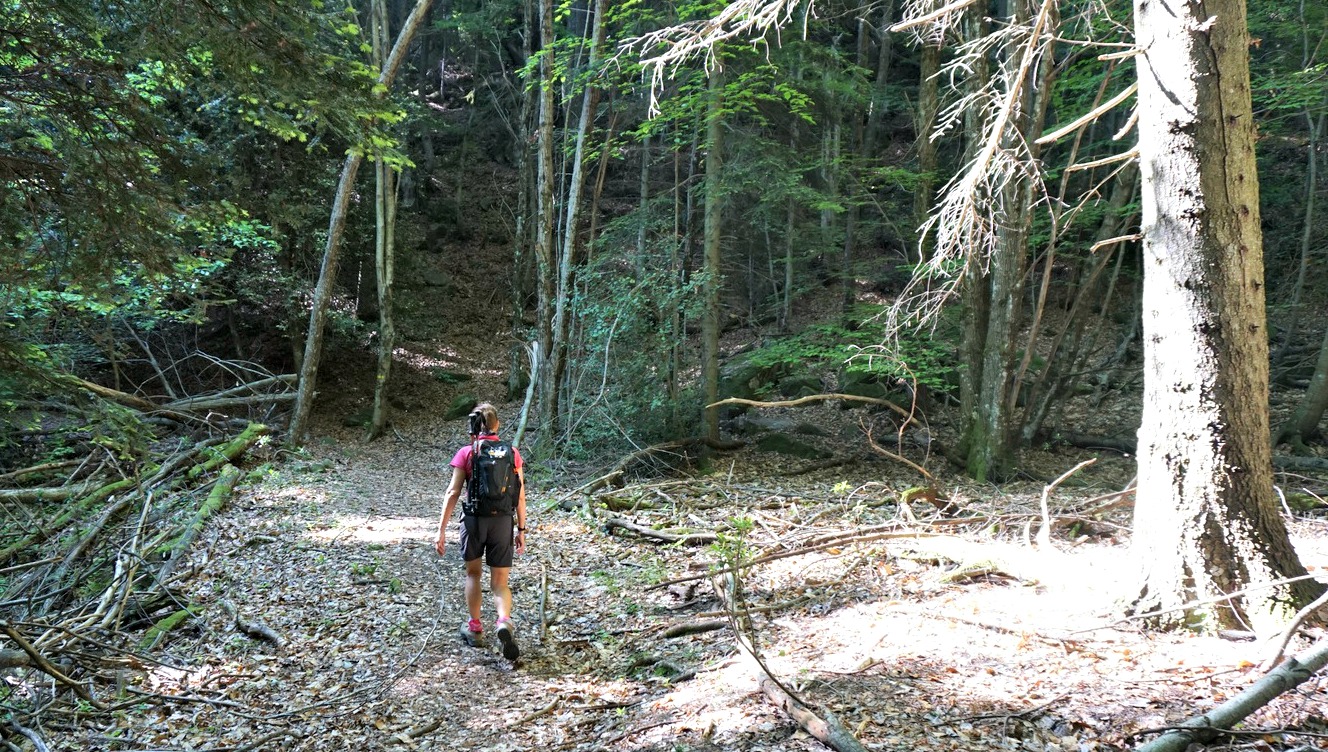


From Col de la Porte, we started from signpost #189, and ascended gradually along a nice and soft forest trail. The direction of the trail soon turned to south-southeast. We ascended more steeply, reaching the D2566 road and signpost #193. We crossed the road and found our trail that now became narrower, running in an easterly direction along a grassy ridge to Cime de Rocaillon. At some points the trail was almost ingrown but don’t worry, you won’t get lost if you just stay on the ridge.
On this super spring day, we had the summit and the great forest trail all for ourselves! We can definitely call it an off the beaten track. In short, it was a great half-day itinerary with super views, a pleasant forest trail with a moderate ascent!
Distance: 5.9 km
Climb: 390 m
Duration: 2h 30 active
Map: Vallées de la Bévéra et des Paillons TOP 25 N°o 3741 ET


0 comments:
Note: only a member of this blog may post a comment.