

Boréon: Mont Archas

The 15th of August, L’Assomption, is a public holiday in France. We knew that large crowds would head to the mountains as the weather forecast was favourable, and August is the peak season for mountain activities.
To be able to find a parking spot in Le Boréon, we tried to leave early. When we arrived, the Salèse Valley parking was almost full. In addition, we saw that there was a fête patronale in Mollières, now a ghost village on the other side of Col de la Salèse. There was a lot of car traffic apparently heading there as the track that normally is closed had been opened for this event. So, the normally quite tranquil Salèse Valley was very busy that morning!
We had chosen to do a hike “off the beaten track”, first towards Lacs des Adus, then up to Mont Archas (2526 m) via Col de la Valette des Adus (2356 m) as we knew that most hikers would head to Lac Negre, Col de Cerise etc where chamois may be spotted.


We started from signpost #434 at the parking, crossed the stream to signpost 397, and followed the trail that climbed steeply in the woods. We then passed a private refuge and Lacs des Adus. Most of the lakes were dry. We met only sporadic hikers and a few trail runners. We continued the ascent towards Col de la Valette des Adus, now above the tree line. The trail followed the border of the Mercantour National Park. From the col (signpost #394), we continued east along a well-marked trail towards Mont Archas already well visible in front of us. The yellow markings along the trail were new as the route is used by the trail runners.
After a break at the saddle between Cime de la Valette and Mont Archas we were ready for the last 160 m climb to the summit. There were many trails, and we followed the one with yellow markings. The summit itself was marked with a large cairn. The 360° panorama view was quite stunning: Argentera, Cime du Gélas, you name it! The town of Saint-Martin-Vésubie was 1500 m below us.
From the summit, we started the descent heading east, still using the trail runners’ itinerary. The initial descent was steep and rocky along a ridge, so our respect for trail runners increased even more!
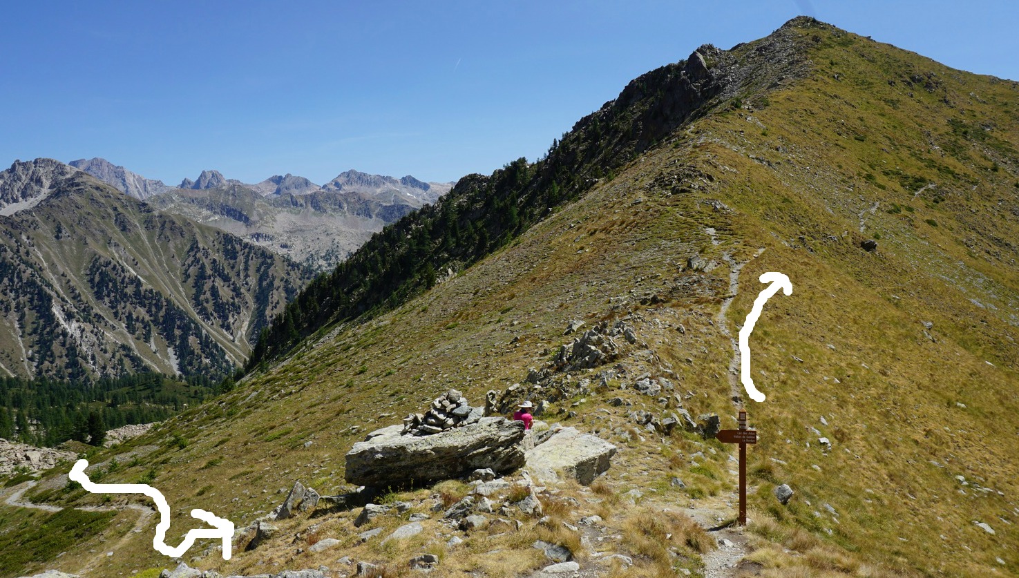
Eventually we came to a crossroads at signpost #393 and forked left to Les Adus, the area which we passed in the morning. At signpost #396, a little below the private refuge mentioned above, we closed the loop and headed back to our starting point in the Salèse Valley.
Parts of the trail were rocky and hence more strenuous. The ascent from the valley was more or less continuous. However, navigation was easy as the signposts and marking were new.
Elevation gain: 882 m (Our log)
Distance: 14 km

Duration: 5h 30
Map: 3741 OT Vallée de la Vésubie
Share story


0 comments:
Note: only a member of this blog may post a comment.