

La Turbie to Monaco

In spring, during the Monte Carlo Open Tennis tournament and Monaco Grand Prix, it is difficult to reach the Principality of Monaco by car, and to find a parking.
So why not park in La Turbie? The hiking trail down to Monaco is superb offering great views. We have done the hike a few times. The itinerary recommended by the randoxygène guide (called Trophée d’Auguste, starting from Monaco) makes a loop. It is a good option, partly following an ancient Roman trail, but runs more along paved streets. We decided to use the same trail both ways, staying more in the nature.


Leaving La Turbie (470 m), we walked through the old village along its narrow streets and came to the familiar signpost showing the way to Monaco, Cap d’Ail, and CNET on the top of Tête de Chien. We followed the trail (GR51B) that descended to a crossroads where we forked left down to Monaco.
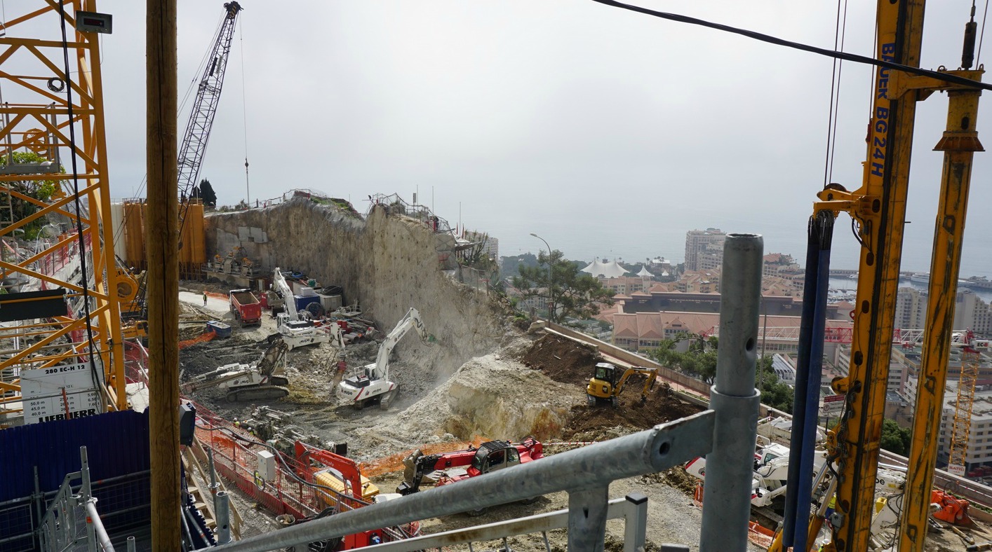
We now descended more steeply following signposts down to Beausoleil and Monaco. We eventually reached a small yellow tower (a transformer) on a narrow but paved street. Here the new white and red GR signs advised to fork right (west) to Jardin Exotique. We vaguely remembered forking left towards the Monaco railway station at this point along Chemin de la Turbie Supérieur. This time, however, we decided to follow the newly painted GR signs. We soon reached Moyenne Corniche, crossed it, and found ourselves passing several not very nice construction sites, following temporary signs for pedestrians.
We eventually reached La Condamine neighbourhood near the harbour and took the stairs to the Rock and the old town of Monaco. We passed the Palace and headed to the U Cavanagio restaurant for lunch. It was just as enjoyable as before!
After lunch we decided to take the old trail from the railway station back to La Turbie. The trail still followed the same route as before: After passing through the railway station it ascended along the Avenue d’Alsace, then Chemin de La Turbie (stairs). No signs were visible until we reached the stairs, where we saw an old red and white GR sign.
We passed the yellow transformer tower again, and after that it was uneventful ascent back to La Turbie.
In short, we recommend taking the old, not very well marked trail down to the railway station thus avoiding the construction sites. It is a more tranquil route at the moment. The transformer tower by the road is the critical point (image)!
Incidentally, the French randoxygène guide (at least the on-line version) still describes the itinerary to and from the Monaco railway station whereas the map on the same page shows the new version to Jardin Exotique.
Duration: 3h30
Elevation gain: 580 m (includes detours en route plus the climb to the old town of Monaco)
Distance: About 11 km (includes detours and strolling in Monaco)
The upper image shows our itineray, the lower is our recommendation.

Map: 3742 OT “Nice-Menton” Côte d’Azur

Share story


0 comments:
Note: only a member of this blog may post a comment.