In search of new, less visited routes, we wanted to explore the possibility to ascend from the village of St-Blaise (320 m) to Mont Cima (878 m). We have previously climbed to Mont Cima along the popular trail from Aspremont (500 m).
The north face of Mont Cima and Inarte is mostly forest-covered. There are both marked and unmarked trails on the slope. We had studied the area on maps and it should be possible to find a route to Mont Cima.
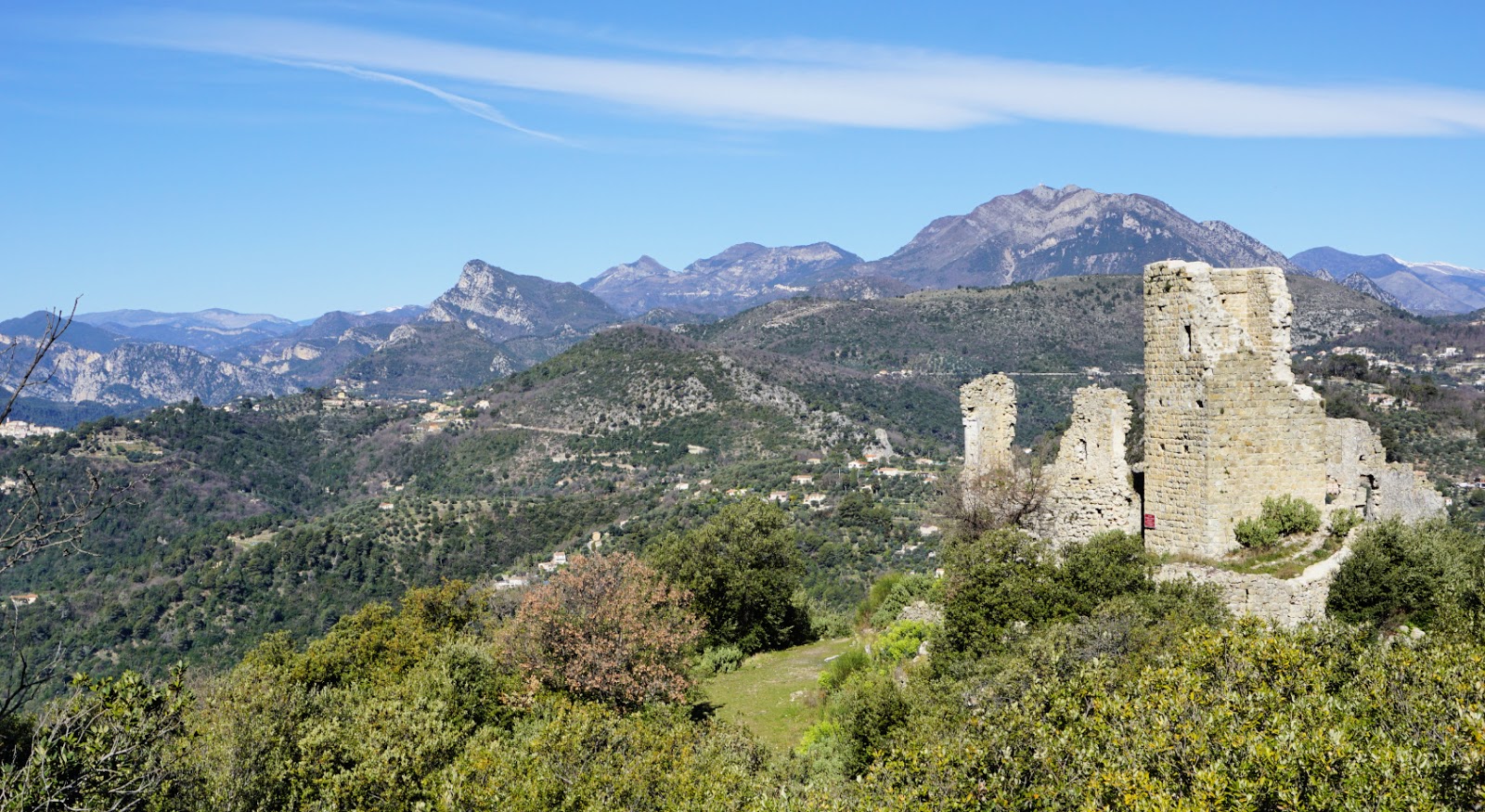
Starting from the village centre, we ascended along stairs, crossing the main road M14 three times. We walked past a small Eco museum by the road and first climbed along Chemin d’Amandier, then along a trail to signpost #826 where we took the right-hand path (Le Castel; La Gipasse) and ascended further to signpost #825. We forked right almost 180° and soon came to le Castel, ruins of a small castle perched above St-Blaise. The signposts from St-Blaise do not directly guide you to Mont Cima.
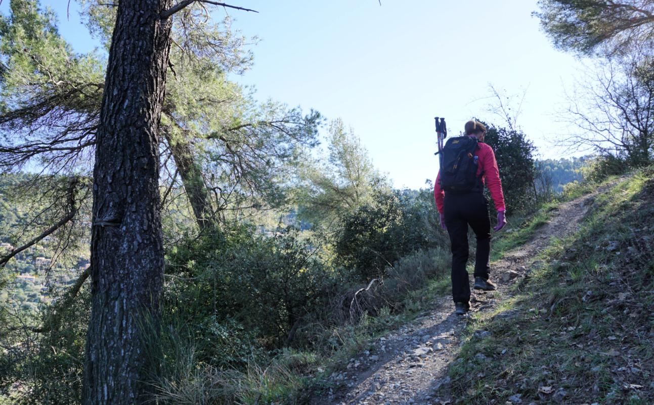
Still continuing along a marked trail (yellow), we now headed south west in the woods, quasi horizontally, along a very good path which merged with dirt track that runs along the mountain slope. We forked left, and walked along the dirt track about 500 m to a bend (arrow on the map; image). Here, we forked right and started to ascend along an unmarked trail. The trail had nevertheless some markings for mountain bikers. We climbed quite steeply to a crossroads under Mont Inarte, turned left and came to a small clearing east of Inarte. We continued southeast, and soon reached the familiar hiking path to/from Mont Cima.
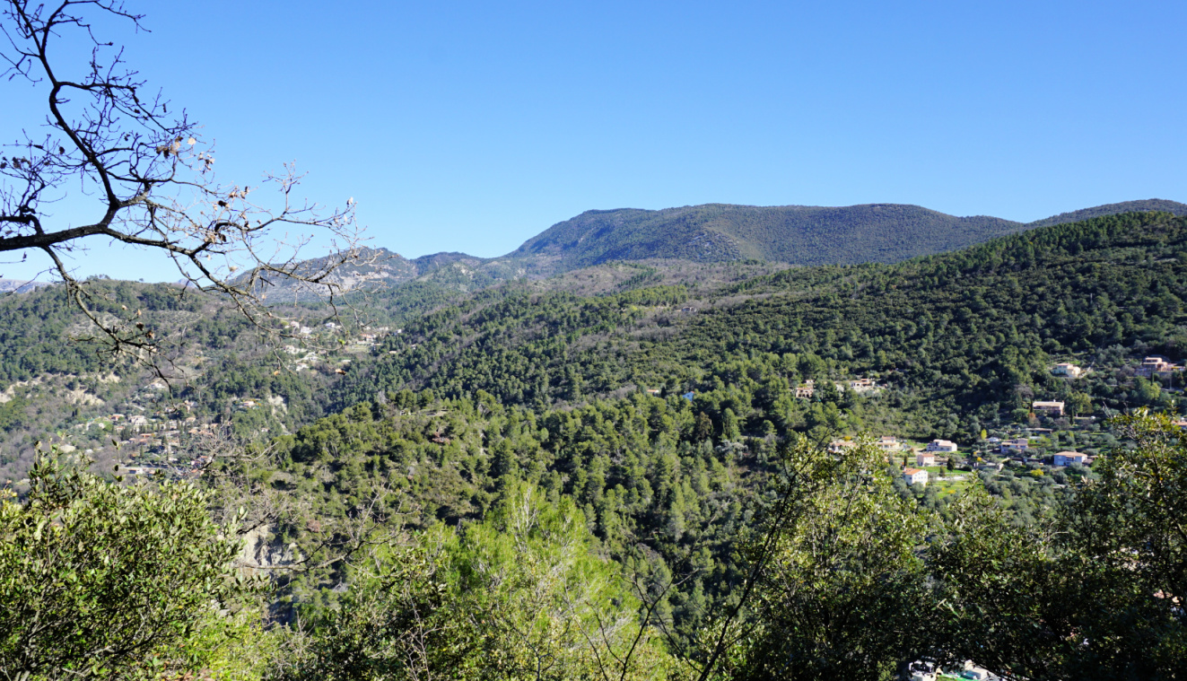
You never get tired of the panorama from Mont Cima. It is 360°, from the Riviera coastline to Mercantour summits. There are orientation tables on the mountain top.
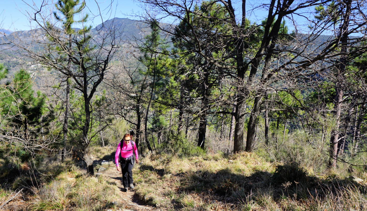
We descended along the same trail. There are many spots on this trail that offer great views to Nice hinterland as well as high peaks in the distance.
Climb: 600 m
Distance: 8.2 km
Duration: 3h 50 active time
Map: 3742 OT Nice Menton Côte d’Azur
This recipe is inspired by a lunch that we recently had in St-Jean-Cap-Ferrat. The sardine fillets were stuffed with a typical Niçoise vegetable mix: mangold or spinach, shallots, garlic, black olives, tomatoes, and basil. All vegetables were chopped into small pieces and sautéed in olive oil before stuffing. The sardine fillets were then roasted in the oven.
They were served with panisses, chickpea flour cakes, and some extra vegetable mix as a side.
The dish was so tasty and healthy that I decided to try it at home. The following recipe is my twist of that terrace lunch.
2 servings
6- 8 sardine fillets
1 tbsp. dried bread crumbs
Olive oil
2 handfuls of baby spinach, chopped
1 shallot, chopped
1 clove garlic, minced
1 large or 2 small tomatoes, chopped
8 black olives, pitted and chopped
About 8 basil leaves, chopped
2 large store- bought panisses
2 tbsp. almond flakes
Wash the spinach and tomato and chop them into small pieces. Peel and chop the shallot and clove of garlic. Warm 2 tbsp. olive oil over medium heat and sauté the vegetables about 5- 10 minutes turning occasionally. Add the chopped olives.
Preheat the oven to 210° C roast. Place the panisses in a large oven- proof dish and sprinkle with the almond flakes and some olive oil. Start roasting the chick-pea cakes; they need about 5-10 minutes longer than the sardine fillets.
Clean and dry the sardine fillets. Fill them wit the vegetable mixture and place them in the same oven- proof dish with the panisses. Sprinkle the sardine fillets with the breadcrumbs and some olive oil, place the dish back to the oven and roast for about 10- 12 minutes. Cover the remaining vegetable mixture and keep warm.
When the sardines are cooked and the almond flakes on the panisses are golden, remove the dish from the oven and divide on the plates. Divide the extra vegetable mixture on the plates and decorate with basil.
For this dish, choose organic carrots that do not need to be peeled. This is a great spring recipe when new carrots arrive and oranges are still in season.
2 servings
6- 8 organic carrots
2 cm piece of fresh ginger, peeled and minced
Olive oil
½ onion, chopped
1 clove garlic, minced
Juice of 1 orange
About 250 g pork fillet, chopped into chunks
100 ml white wine
1/3 chicken stock cube, crumbled
2 tbsp. crème fraîche 15% fat or cream
Freshly ground black pepper
Chopped parsley
Wash the carrots, cut into large chunks and cook in boiling water 15 minutes. Drain the water, add the orange juice and ginger, cover and cook about 20 minutes until the carrots are soft. Add 1 tbsp. olive oil, 2 tbsp. crème fraîche, and some black pepper. Mix and press into a purée.
Meanwhile warm 2 tbsp. olive oil over medium heat in a frying pan. Sauté the pork chunks until golden on all sides. Add the onion and garlic and continue sautéing for 10 minutes stirring occasionally. Add the crumbled chicken stock and pour in the wine. Grind over some black pepper, mix well and let simmer until the pork is cooked.
Divide the carrot purée into bowls and place the pork on top. Decorate with chopped parsley.
 |
| Gourdon and Pic de Courmettes |
We decided to ascend from Bar-sur-Loup to Gourdon via Bois de Gourdon and descend along Chemin du Paradis.
 |
| Bar-sur-Loup mairie |
 |
| Chemin de St-Michel |
 |
| GR51 west of Bar-sur-Loup |
 |
| Towards Bois de Gourdon |
We parked by the D2210 road below Bar-sur-Loup (≈300 m) and climbed to the village square. From there, we headed southwest along Avenue General de Gaulle then Chemin de Saint-Michel. At signpost #21 in front of a small chapel, we forked right and started to climb along Chemin de Bouscarle, passing the last residences. We temporarily merged with the GR51 and followed it to signpost #23. There we forked right, climbed along a forest path to the D3 road and crossed it. We walked past a small parking and signpost #17, and continued along a dirt track 250 m, where signpost #16 guided us to a forest path. We were in Bois de Gourdon which mostly consisted of oak trees.
 |
| Bois de Gourdon |
 |
| Haut Montet seen from trail |
 |
| GR51 under Gourdon |
 |
| Chemin du Paradis below Gourdon |
 |
| Chemin du Paradis GR51 |
 |
| GR51 above signpost#5 |
 |
| Missing bridge over Riou de Gourdon |
We ascended a bit more, now straight north to signpost #15, and merged with the same dirt track. At about 790 m, this marked the highest point of the hike. From here, the itinerary followed the dirt track; we descended along it to signpost #14 where we forked right (east) to a paved road (Chemin du Naouq), and walked to Gourdon (740 m), already visible in front of us.
It was a sunny and warm autumn day, and restaurants and shops in the village seemed busy. After a brief stop, we headed back to Bar-sur-Loup. We descended steeply along the familiar Chemin du Paradis trail, also GR51. At signpost #4, we forked right, still following the GR51 trail. The old narrow iron footbridge over Riou du Gourdon had disappeared, and a new one was under construction. Fortunately, the stream bed was dry and could be crossed.
At signpost #18 we left the GR51, forked left and descended back to Bar-sur-Loup.
It turned out to be a great loop mostly along good trails, dirt tracks and paved roads. The rocky trail down from Gourdon always requires surefootedness and some gymnastics was needed to cross the bridgeless stream bed.
Climb: 540 m (about 30 m less if you start from the main square)
Map: 3643 ET Cannes Grasse Côte d’Azur
 |
| Bar-sur-Loup Gourdon loop |
Small spelt or einkorn wheat, le petit épeautre, is an ancient grain which was popular in Northern Provençe. It has less gluten and more protein than modern red wheats. Its nutty taste makes it a good base for salads. In France, small spelt can be found in organic shops. It cooks in 45 minutes and can be frozen in batches. This is a tasty spring salad when green asparagus is in season.
2 servings
100 ml small spelt
6 organic green asparagus
A handful of baby salad leaves, mesclun
8- 10 radishes, sliced
2 soft-cooked eggs
A handful of organic parsley
A few basil leaves
Olive oil
Freshly ground black pepper
Vinaigrette of olive oil and red wine vinegar
Cook the small spelt in boiling water for 45 minutes. Drain and set aside to cool.
Peel the asparagus stems, discard the tough ends and chop into about 4 cm long pieces. Microwave about 3 minutes until soft. Set aside to cool.
Cook the eggs for 6 minutes, let cool in cold water and peel.
Wash and slice the radishes.
Wash and dry the parsley. Chop it finely and mix with a little olive oil and black pepper into a purée.
Divide the small spelt on the plates. Top with salad leaves and asparagus. Sprinkle with some vinaigrette and parsley purée. Decorate with radish slices and place a soft- cooked egg in the middle. Sprinkle with some chopped basil.
The following hike runs along familiar trails between Menton and Sospel. It basically features the loop around Mont Razet (posted earlier), but with an extension to Col de Cuore on the Italian border.
The proximity of the coast, relatively easy access, and all-year round hiking options make Col de Castillon (706 m) a popular starting point.
 |
| Col de Castillon parking |
 |
| Biatonéa path |
 |
| Trail under Mont Roulabre |
From the vast parking next to the ruined church, we descended a bit to Col de Castillon (signpost #135), then headed straight north towards the Biatonéa neighbourhood, first along a narrow street then a trail, reaching signpost #137 at a crossroads. We took the middle trail, and climbed to Baisse de Scuvion (1154 m; signpost #92) with good views to the west (Mont Ours etc), and to east.
 |
| View from trail before Baisse de Scuvion |
 |
| Mont Ours seen from Baisse de Scuvion |
 |
| Baisse de Scuvion |
 |
| Col de Cuore |
 |
| Near Col du Razet |
 |
| Border post from 1927 |
 |
| La Pierre Pointue |
We descended in the woods along the Northern flank of Mont Razet to Col de Roulabre and Col du Razet (1033 m; signpost #90). Crossing the GR52 trail, we followed the trail northeast then north on the French side of the border. Apart from a few rockslide areas, the trail was good. After a short climb, we reached Col de Cuore with a border post from 1927. We had views down to the Sospel Valley, and Mont Razet while the view to Italy was limited due to the woods and vegetation.
As Col de Cuore marked our turning point today, we returned to Col du Razet, then headed to Pierre Pointue (1168 m; signpost #93a) on the southern side of Mont Razet. We passed remains of several bunkers, then forked left at signpost #93, and descended steeply back to the village via Biatonéa.
Duration: about 5 h active
Map: 3742 OT Nice Menton Côte d’Azur