La Colmiane: Hike to Baus de la Frema


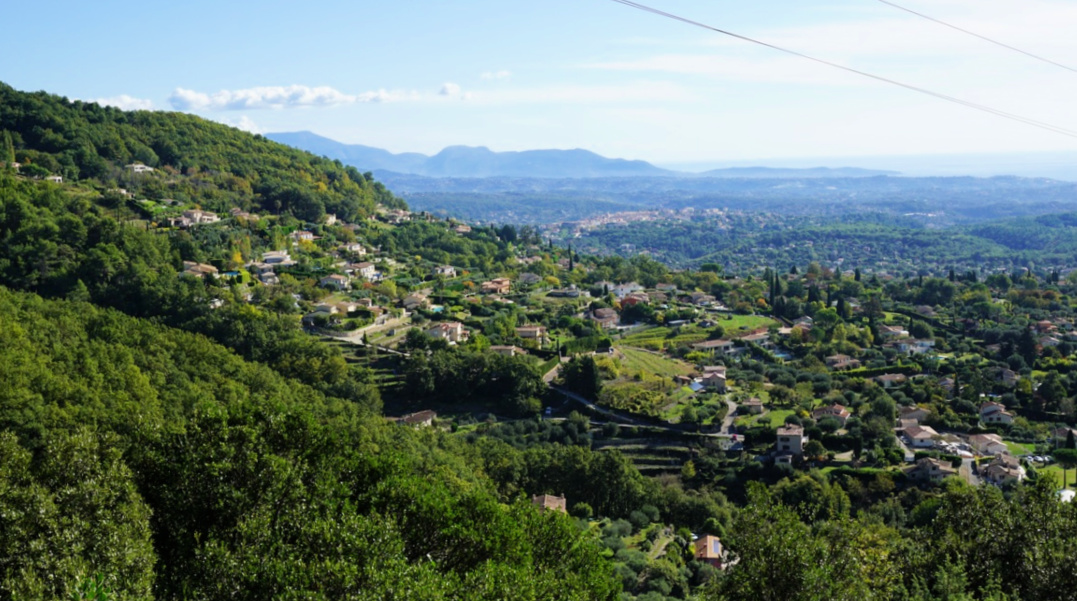
The small ski resort of la Colmiane (1500 m) is not dormant during the summer season. There are activities such as a zip line, toboggan track, rock climbing etc. For hikers, there are lots of options ranging from leisurely walks to strenuous high mountain adventures. Further advantages of the resort are an easy access, large parking area, and cafeterias in peak season.


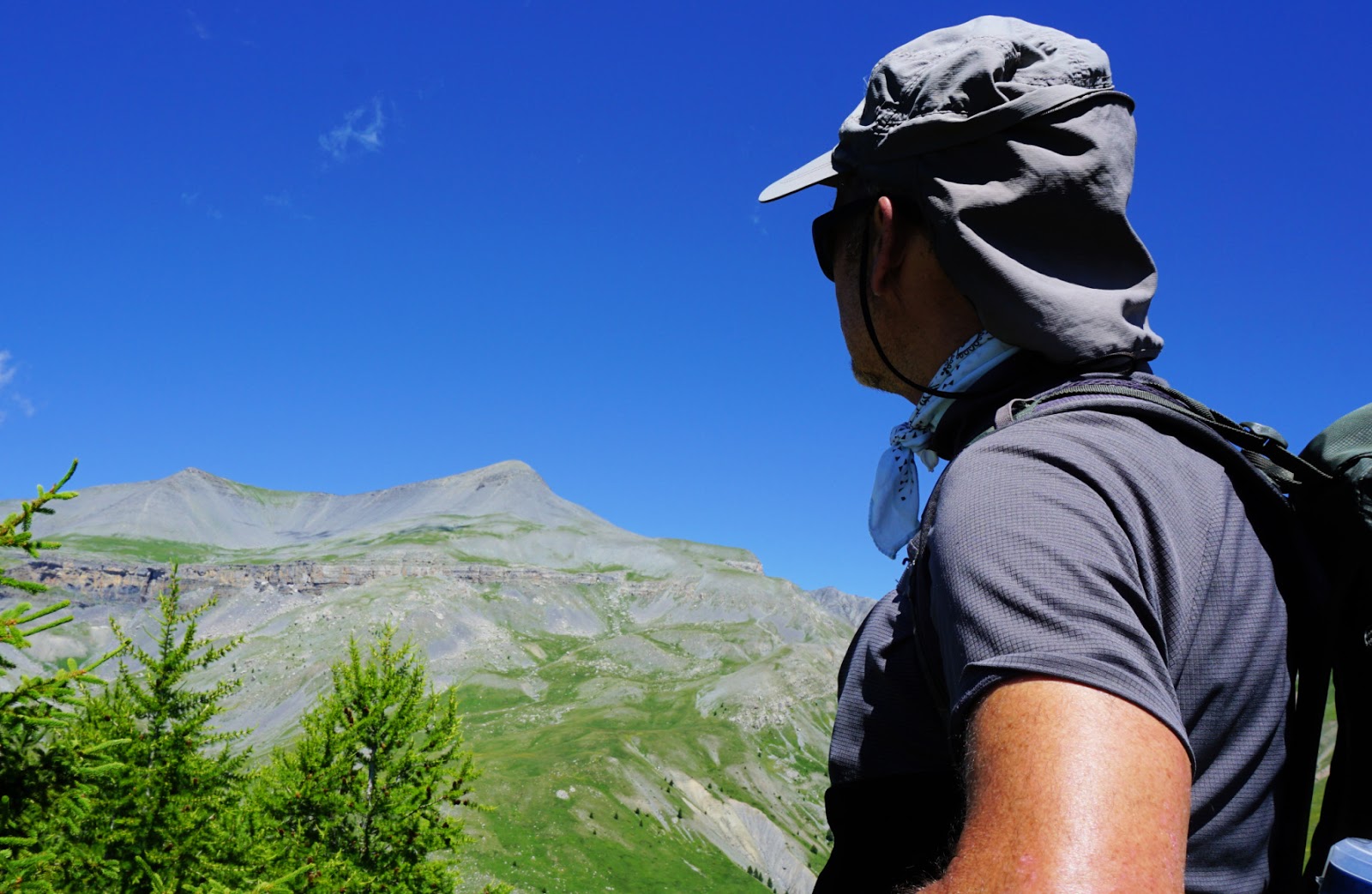
The nearest summit north of the resort is Baus de la Frema (2246 m), above the rock-climbing area. The itinerary to the summit is easy enough.


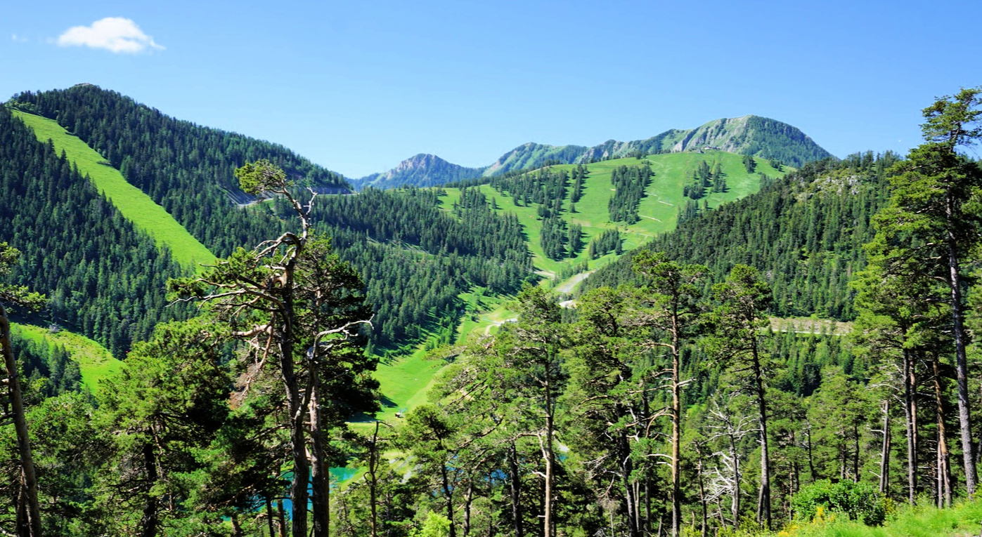
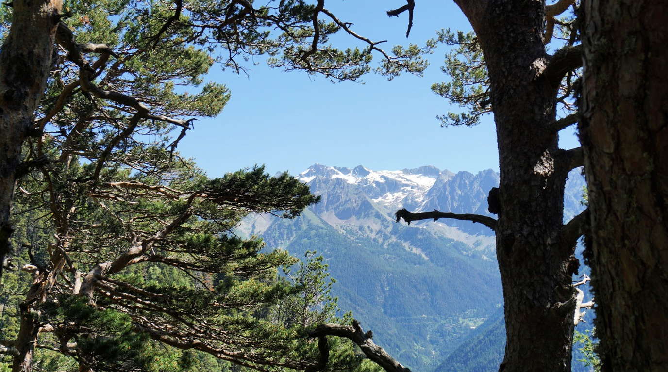
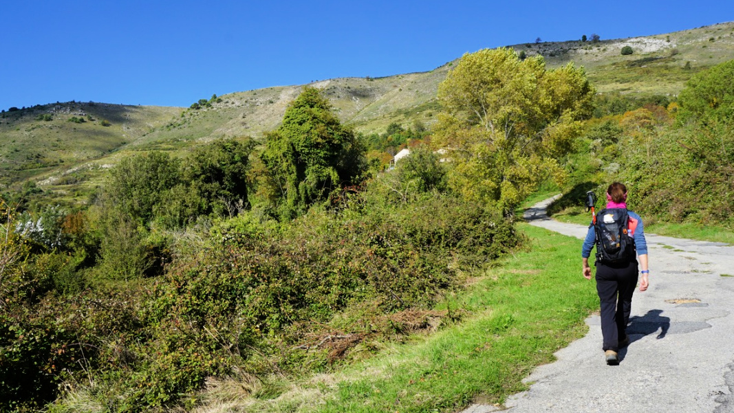
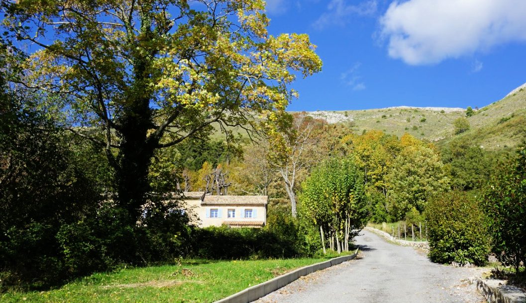
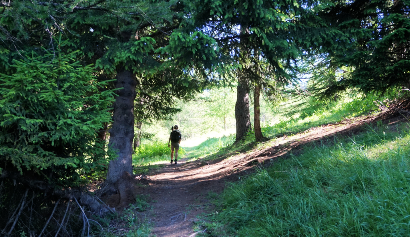
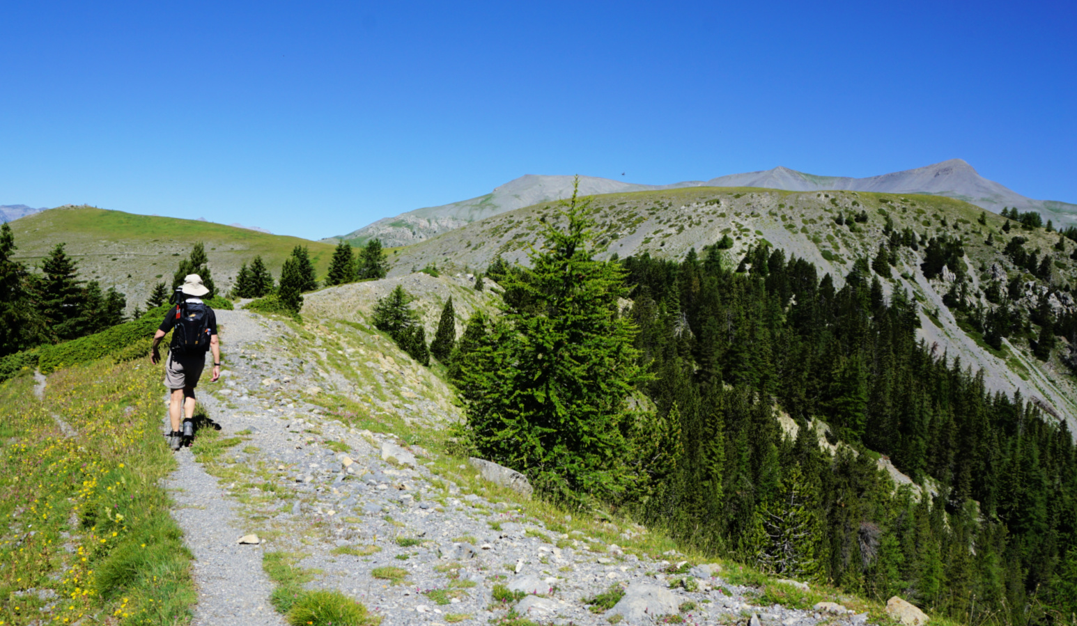
We started from signpost #91 next to the parking. We then walked about 15 min. along the road to signpost #91a where we forked right and ascended along a wide path to #91b where we joined the forest road. At signpost#89, we forked right and started to ascend steeply along a rocky and potholed dirt track.  We came to a crossroads with a cairn and yellow marks (barely visible) where we forked left to a nice soft path. The path ascended in a magnificent pine and fir tree forest. We re-entered the dirt track near the tree line and continued along it, with vast alpine meadows on both sides. The early summer greenery and views were impressive! Flowers such as rhododendrons, gentians and many others were in full blossom.


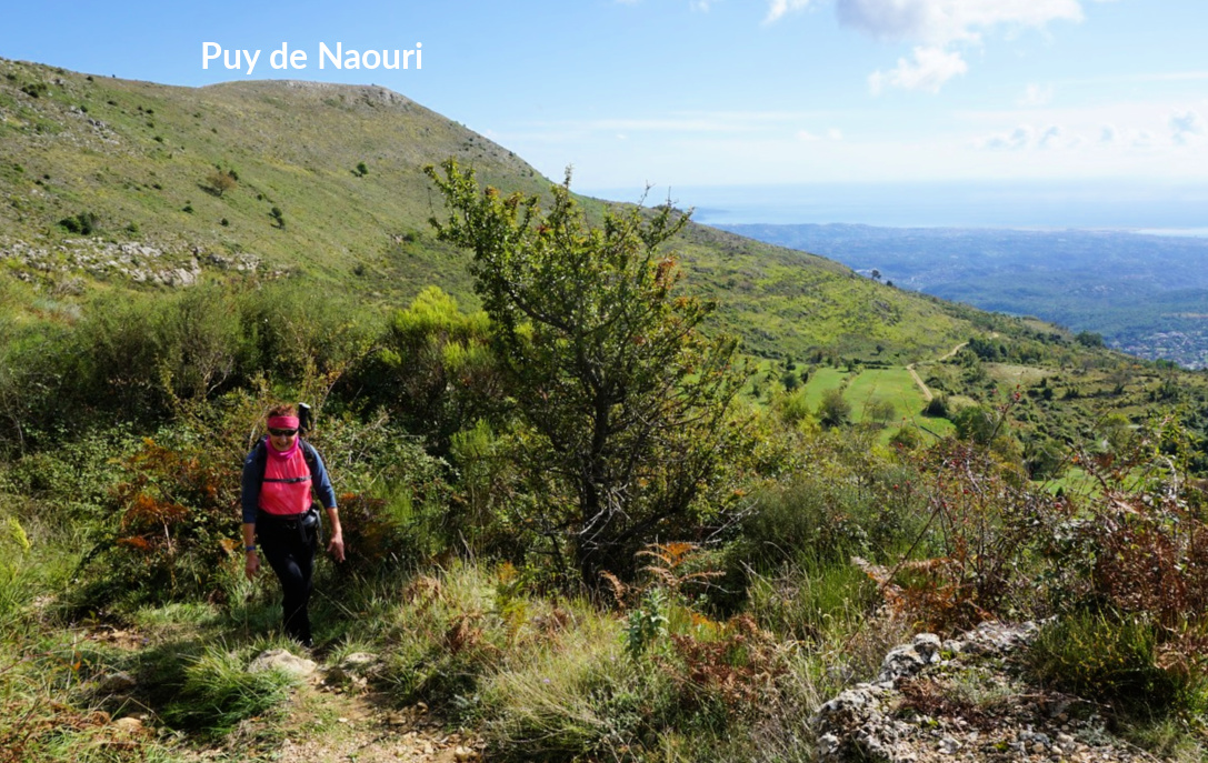
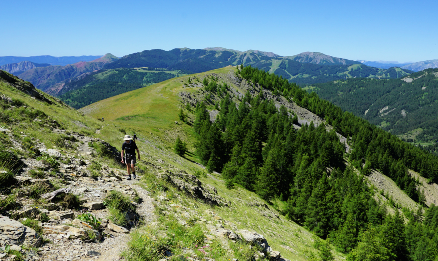
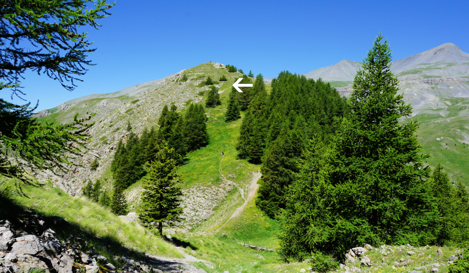
There were some shortcuts to Baus de la Frema but we used the marked trail to signpost#90 where we turned south and climbed to the summit. There was an orientation table showing most of the major peaks in the vicinity.


Descending back to la Colmiane, we took some shortcuts along the mountain’s eastern flank before joining our previous itinerary.


Climb: 740 m


Distance: 10 km


Duration: 4 h


Map: Vallée de la Vésubie 3741 OT


iPhigénie map capture of the itinerary:

Baus de la Frema track


Roasted aubergine and tomato compote


Roasted aubergine and tomato compote


Aubergines and tomatoes are a classic combination. This dish has Eastern Mediterranean flavours from sumac, a delicious dark red spice from red berries of a Mediterranean shrub. In the Easter Mediterranean, sumac is sprinkled on warm pitas, grilled meats, and salads. In Nice, you’ll find sumac in well- stocked supermarkets.

Tomatoes concassées are easy to make: simply dip tomatoes in boiling water for a few minutes so that they are easy to peel.

Use this dish as a centre piece to your salads or serve as a first course.

2 servings


1 aubergine

2 tomatoes concassées

½ clove garlic, minced

Olive oil

1 tbsp. tomato paste

1 tsp. sumac

½ tsp. Piment d’Espelette or another mild chili powder

A pinch of salt (if sumac does not have added salt)


Preheat the oven to 180°C, roast.


Wash and dry the aubergine. Peel it and cut into about 1 cm thick slices. Lightly brush with olive oil and place on a baking tray. Roast 20 minutes until soft. 


Meanwhile make the tomato compote. Warm 1 tbsp. olive oil in a saucepan over medium-low heat. Add the tomatoes concassées cut into chunks and the tomato paste. Add the garlic, sumac, and Piment d’Espelette. Cook until you get a nice compote.


Place the compote in a bowl and mix in the aubergine slices. Keep refrigerated until needed.


Long loop from Tourrettes-sur-Loup

Descending from Puy de Tourrettes


After the devastating storm named Alex in early October 2020, most of the trails in the Mercantour National Park and elsewhere in the northern part of Alpes Maritimes were closed.

On the other hand, many communes nearer the coast saw little or no damage. We designed a new variant from Tourrettes-sur-Loup (400 m), using mostly familiar paths from our previous hikes. We wanted do a circuit which includes the “twin peaks”: Puy de Tourrettes (1268 m) and Pic de Courmettes (1248 m). We have hiked up to them many times, but never ascended to both from Tourrettes-sur-Loup. We have instead used the village of Courmes (630 m) as our starting point.


From Tourrettes-sur-Loup, we started to ascend along the paved Route du Caïre. While not the most authentic route, it enables a rapid access to higher ground, and offers nice views.


We proceeded all the way to the end of the road, walked past le Caïre (850 m) and a guesthouse named Le Mas de la Source. We continued along the trail proper (indicating St Barnabé etc) behind the last houses and reached a crossroads at la Baïsse (1020 m). The marked trail continued north. Our trail to Puy de Tourrettes forked left (west). While not shown on maps, it is well visible and there are cairns here and there. We ascended along it diagonally along the south-eastern flank of the mountain.


We reached the summit plateau, and near the highest point forked left along a descending trail (still unmarked) which led to the saddle between the two peaks. Continuing straight south, we then climbed to Pic de Courmettes. The trail ran close to its the steep western face. Near the summit, we came to a marked trail which was our route back. We descended along the south-eastern flank first in open terrain, then in an oak forest.


We crossed to a dirt track not far from Domaine de Courmettes and turned left (north-east). We followed it about 2 km, as far as to signpost #179 where we forked right and descended to Route du Caïre (at signpost #174). Completing the loop, we followed the road back to Tourrettes-sur-Loup.


Duration: 5h 30 active


Climb: ≈1000 m


Distance: 16 km


Map: Cannes Grasse Côte d’Azur 3643 ET


Long loop above Tourrettes sur Loup track


Sea bass fillets with vegetables


Here in Nice, sea bass is called loup if it is caught in the Mediterranean Sea and bar when caught in the Atlantic Ocean. It is often sold as a while fish so for this recipe you have to fillet it or ask for your fishmonger to do it.

The fillets are roasted and covered with basil oil and raw vegetables, walnuts, and capers. Roasted sweet potato slices compliment this colourful recipe.

Instead of sea bass you can use any tasty white fish fillets in this recipe.

2 servings

2 nice fillets of seabass

Juice of ½ lemon

Olive oil

A small handful of basil leaves

A pinch of salt

Freshly ground black pepper

¼ clove of garlic

About 1 tbsp. walnuts, crushed

About 6 radishes, finely sliced

2 small spring onions, chopped

About 10- 12 small baby spinach leaves

About 6 large capers chopped

1 or 2 sweet potatoes


First make the basil oil with just a hint of garlic. Crush the basil leaves in a mortar with a pestle adding enough olive oil to get a green sauce. Mix in some black pepper, salt, minced garlic, chopped spring onions, and chopped capers. Set aside in the fridge until needed. 


Preheat the oven to 200° C, roast.


Peel and slice the sweet potato. Brush the slices with some olive oil and place in a large ovenproof tray so that you can later add the seabass fillets in the same tray. Sweet potato slices need about 20- 30 minutes of roasting and the seabass about 8- 10 minutes depending on the thickness of the fillets. 


While the sweet potato is roasting, wash and thinly slice the radishes and coarsely crush the walnuts. Set aside the small baby spinach leaves.


When the sweet potato slices are soft, add the seabass fillets in the tray and continue roasting for 8- 10 minutes until the fish is cooked.


Divide the seabass fillets and sweet potato slices on the plates. Sprinkle the lemon juice on the fish. Divide the basil oil on the fillets and decorate with baby spinach leaves, crushed walnuts, and radish slices.


Tête de Pierrous above Beuil


Final push to Tête de Pierrous


The landscape between Mont Mounier (2817 m) and Beuil consists of vast alpine meadows, larch woods and steep ravines. There are several easily reachable summits exceeding 2000 m elev. 

The River Cians has its sources below Col des Moulines and Tête de Pierrous (2046 m). We decided to explore the picturesque area, starting from Col de la Couillole (1673 m; excellent parking by the D30 road).


Signpost #51 at Col de la Couillole showed the path to Col des Moulines. We first ascended along a soft trail in larch woods interrupted in places by alpine meadows, passing signposts #102 and 102a. 


The path became rockier and we hiked past some exposed stretches to signpost #104 where the trail turned to the north following the western flank of Sommet du Countent. 


We reached the border of Mercantour National Park, and had our goal, Tête de Pierrous, in sight. We followed the main trail to the eastern flank of the mountain where we forked right and ascended to the summit along the grassy but steep slope.


Not surprisingly, the Mont Mounier Massif dominated the landscape in the northwest but we had super views of Valberg and Beuil as well as of parts of the still show-capped Mercantour peaks near the Italian border.


We took the same trail back. It is also possible to do a loop from signpost #104 to the south to Cabane d’Ars, then via signpost #103 to the east passing Cruset and Ars to signpost #100 by the D30, near Col de la Couillole.


Climb: 480 m


Duration: 3h 50


Distance: 10,6 km


Map: Haut Cians Valberg 3640 OT


Tête de Pierrous hike track


Chicken marinara


Chicken marinara


Chicken parmesan is a classic American- Italian recipe. Usually, chicken cutlets are beaded and fried first then covered with tomato sauce, mozzarella, and parmesan and baked until the cheese is melted and bubbly. 

I have somewhat simplified this American classic by leaving out the breading and parmesan and at the same time cutting out some calories. As there is no parmesan in my recipe, I prefer to call it chicken marinara.

I have made the tomato sauce from scratch using fresh ripe tomatoes, onions, garlic, dried Provençal herbs and freshly ground black pepper. This makes all the difference compared to even the best canned tomatoes and tomato sauces, and it doesn’t take long to make!

2 servings

2 chicken breasts

Olive oil

3-4 ripe tomatoes, chopped

1 tbsp. tomato paste

½ onion, chopped

1 clove garlic, minced

1 tsp. dried Provençal herbs

Freshly ground black pepper

4 slices Italian mozzarella

Basil leaves to decorate


Start making the tomato sauce. Warm 1 tbsp. olive oil in a frying pan over medium heat and sauté the onion and garlic for about 5 minutes. Add the tomatoes, tomato paste, herbs, and black pepper and continue cooking until the tomatoes are soft and you get a nice marinara sauce.


Preheat the oven to 200°C, roast.


In another frying pan, warm 1 tbsp. olive oil over medium heat. Sauté the chicken breasts 7 minutes on each side.


Transfer the chicken breasts in an oven- proof dish and generously cover with tomato sauce. Place 2 slices of mozzarella on each breast and drizzle with a little olive oil. Roast for 10- 12 minutes until the cheese is melted and bubbly. 


Divide the chicken breasts on the plates, decorate with basil leaves and serve with brown rice, quinoa, or whole wheat pasta.


Roure: Mont Autcellier


Final push to Mont Autcellier


In search of new mid-altitude hiking trails in Alpes-Maritimes, we came across an interesting option above the village of Roure.

Although the trail to Mont Autcellier (2204 m) has been described and recommended by some French rando sites, both the trail and the mountain turned out to be less frequented than many other similar itineraries in the region.

One reason might be the access: The narrow and sinuous road which ascends from St-Sauveur sur Tinée (M30 then M130) first passing near the village of Roure then the Roure Arboretum above the village. There is a parking about 700 m from the Arboretum (La Barre; signpost #241 at 1373 m elev.).

Signpost #254 to Mont Autcellier

View down to Tinée Valley

Forêt de la Fracha Roure

Signpost #251 to Mont Autcellier

Mont St-Sauveur
Mont St-Sauveur


We started along a dirt road (also part of the GR5) as far as to signpost #254 where we forked left, and ascended along a very soft forest trail. Beautiful larch forests in Alpes Maritimes are ubiquitous, but this particular forest -Forêt de la Fracha-exceeded our expectations.

The itinerary was straightforward. We passed signpost #251 showing the way to Autcellier. We reached a forested ridge (Crête de la Clouetta) and ascended along it, still heading northwest. The ridge already offered multiple great views.

View southeast from Crête de la Clouetta

Crête de la Clouetta higher up

Mercantour peaks seen from Autcellier southern flank


Alpine meadow before Mont Autcellier

Tête de Pommier and Roubion ski runs


Gradually, at about 2000 m elev., the forest gave way to alpine meadows, and we had Mont Autcellier in front of us. Its south-eastern flank was very easy to climb. On the grassy summit plateau, a cairn with a stick probably marked the highest point. The panorama had been praised by many hikers and they were right:  From Mont Mounier in the west to the snow-capped Mercantour summits further away in the east. The day was gorgeous but we only met one sole hiker and a few mountain bikers.  Two Canadair fire bombers flew back and forth over us. Apart from these, we were alone in the pristine nature.

We returned along the same trail.

Mounier seen from Mont Autcellier summit

Valberg viewed from Mont Autcellier

Southern Tinée Valley seen from Mont Autcellier

Climb: 830 m

Distance: 11,6 km

Duration: 4h 30 active

Map: « Moyenne Tinée » IGN 3641 ET


Mont Autcellier hike track