In the following recipe, red mullet fillets, filets de rouget, are fried in olive oil with some capers and decorated with parmesan shavings and fresh basil. They are served with roasted panisses topped with sliced almonds and wilted spinach. Panisses can be replaced by rice or lentils.
This makes a perfect end of summer dinner on the terrace with a glass of chilled rosé.
2 servings
About 250 g rouget fillets
Olive oil
2 tsp. capers
Parmesan shavings
About 2 sprigs of basil
3 panisses, chickpea cakes
3 tbsp. sliced almonds
A small bag of baby spinach
1 clove garlic, minced
Preheat the oven to 200° C, roast
Place the panisses in an oven-proof dish and spread 1 tbsp. of sliced almonds on each. Drizzle over a little olive oil and roast for about 10 minutes until the almonds are golden brown.
Wash the basil and let dry on a kitchen paper. Then slice the leaves and set aside for decoration. Shave some parmesan on a plate and set aside.
Clean the rouget fillets. Warm 2- 3 tbsp. olive oil in a frying pan over medium heat and fry the fish on both sides starting with the skin side. Add the capers to the pan.
Meanwhile warm 1 tbsp. olive oil with the minced garlic in a casserole over medium heat. Then quickly cook the spinach until wilted.
Divide the panisses and rouget fillets on the plates and drizzle some olive oil from the pan over the fish. Decorate with parmesan shavings and basil and serve with spinach.
This hike is dedicated to St-Martin Vésubie, the Vésubie Valley and all its villages.
The storm Alex hit the region with catastrophic consequences three days after we did this hike.
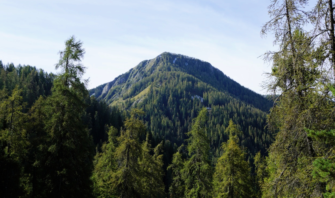
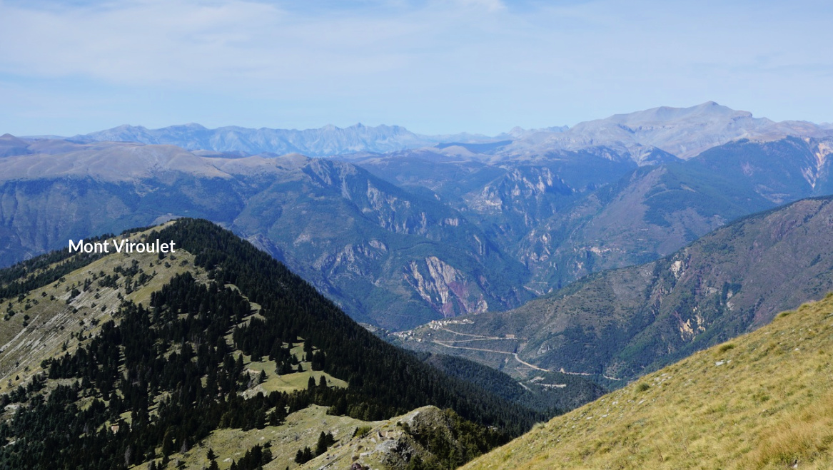
We have previously hiked to Caïre Gros (2087 m) from St-Dalmas Valdeblore (1290 m) using the GR5 trail.
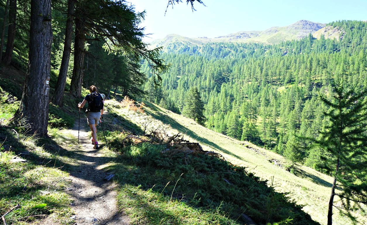
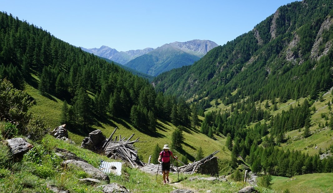
This time we wanted to explore the route from La Colmiane (1500 m) above St-Martin-Vésubie. The starting point is a bit higher. As a small mountain resort, both the access and parking possibilities are excellent.
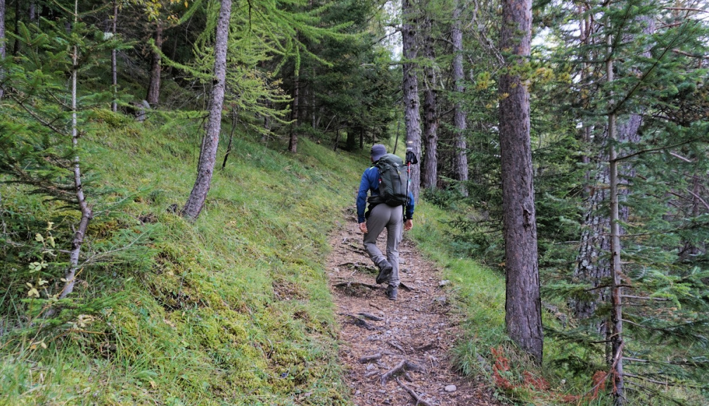
We started from signpost #93 and followed a dirt road which circled along the western flank of a forested hill called le Sucas far as to signpost #94 where we exited the piste and started to ascend diagonally in the woods along a PR (yellow marking) path. Is spite of the proximity of a ski resort, we were in a pristine forest. We crossed one ski run and proceeded to signpost #98 where we merged with the GR5 trail from St-Dalmas Valdeblore.
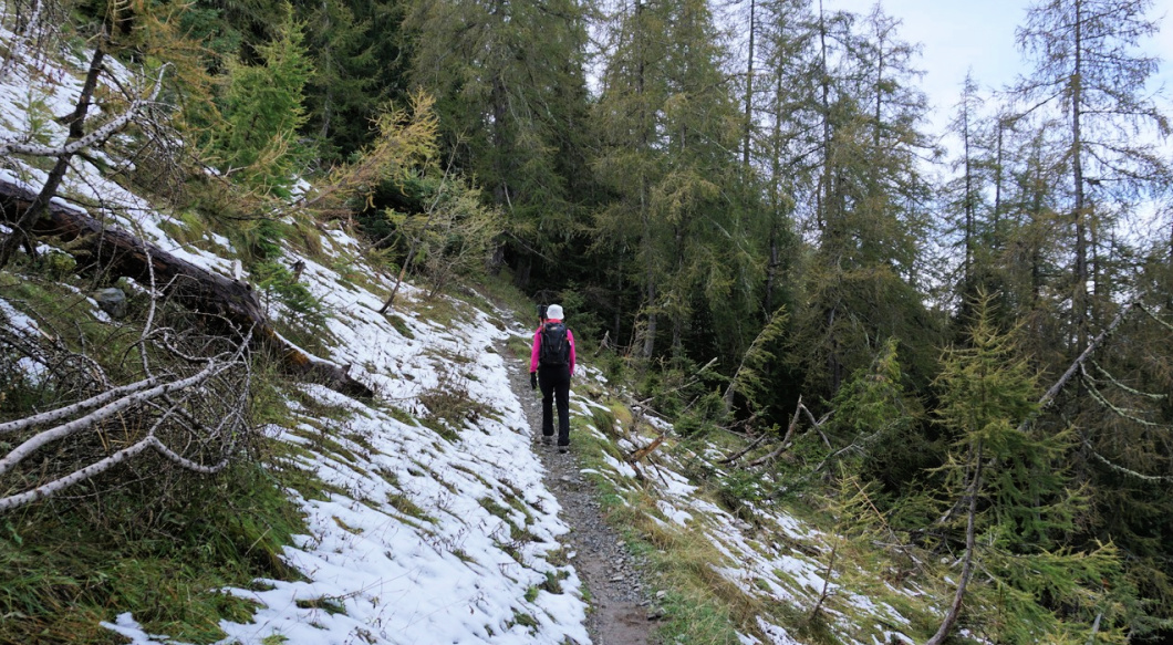
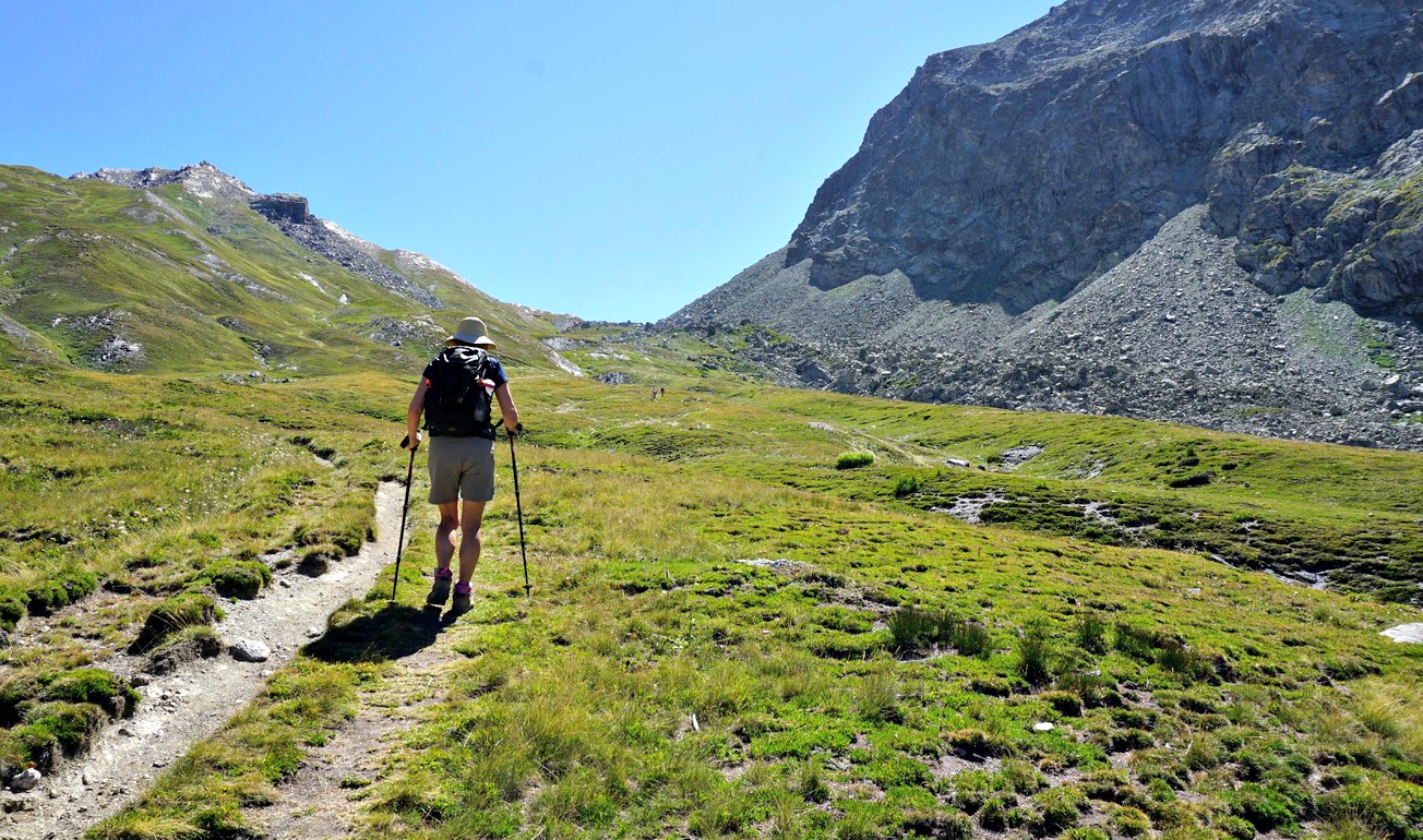
Continuing along GR5, we first reached Col du Varaire (1710 m) then ascended diagonally along the northern flank of Caïre Gros. There were patches of snow by the trail after an early cold front hit the region a few days earlier.
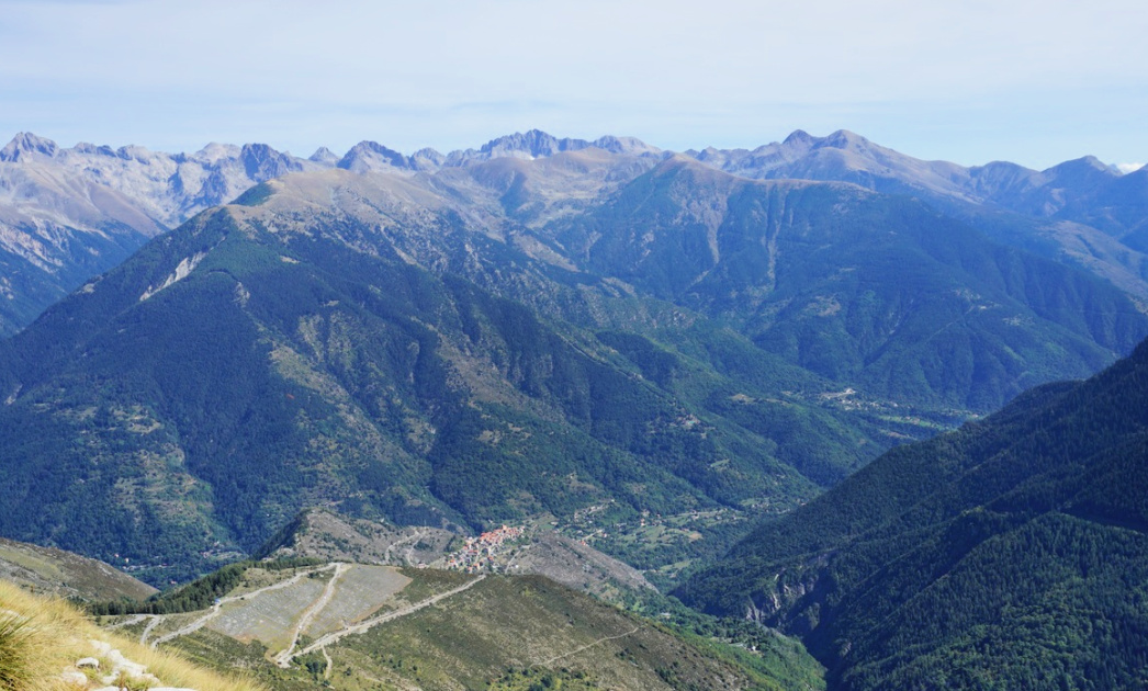
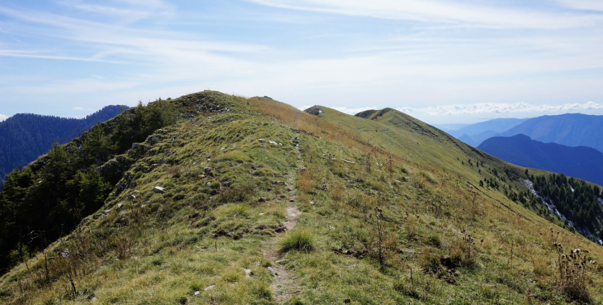
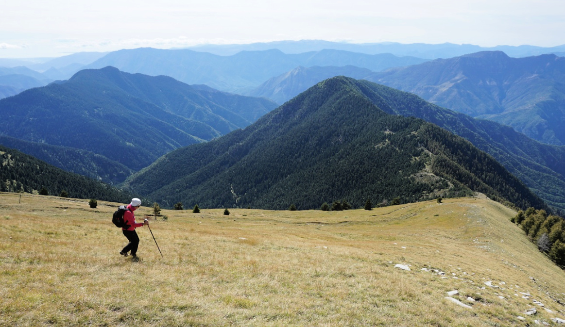
We reached Col de Deux Caïres (1920 m) where we left the GR5, forked left along a trail which zigzagged along the grassy western flank of Caïre Gros to the summit. A beautiful ridge south of the summit comprises a few summits of roughly similar elevation. A clear trail runs along the ridge, although not marked in all maps. We were familiar with it from our previous hikes, and followed the path as far as to Tête de Clans (2081 m) where we stopped for our picnic on the mountain’s western slope.
We descended directly off piste to GR5 below us, reaching signpost #101 where we forked right (north) and hiked back to Col de Deux Caïres.
From the Col, we used the same itinerary back to La Colmiane.
Map: “Moyenne Tinée” 3641 ET or « Vallée de la Vésubie » 3741 OT
 |
Caïre Gros hike track
|
Saint-Martin-Vésubie location La Colmiane marked with asterisk
Mountain passes in the Alps are popular hiking itineraries. Many of them, in particular in the Southern Alps, are ancient trading routes.
The following hike goes to Col d’Urine (2525 m; origin of name not known) at the Franco-Italian border.
We drove to the hamlet of Valpréveyre (1839 m) from Abriès via Le Roux. It’s a paved road albeit narrow after Le Roux.
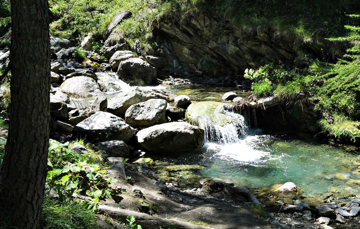
The itinerary is well signposted from Valpréveyre. We crossed Torrent de Bouchet along a wooden bridge and passed a camping ground. The first part was a PR trail (yellow markings). We continued in the woods, crossed another stream (Torrent d’Urine) and ascended steeply. The larch woods gave gradually way to alpine meadows and we passed a sheep flock. The Bergerie sous Roche, a small hut a bit further away on our right-hand side became visible before we merged with the GR58 variant trail which ascended from Abriès and Collette de Gilly.
The scenery became high alpine, but the rate of climb remained pleasant. In front of us, we had the dominating Tête du Pelvas (2929 m). Approaching the mountain pass, the trail circled between huge boulders from a rock slide on the mountain’s northern flank.
The day was clear, no nebbia (fog rising frequently from the Italian side specially in this region) in sight. There was an ancient border marker and a signpost. The trail descended on the Italian side to Rifugio Jervis al Pra.
We descended back along the same trail.
Duration: 3h 20 (active)
Climb: 700 m
Distance: 8,6 km
Map: 3637 OT Mont Viso St-Véran Aguilles PNR du Queyras
Between longer and strenuous hikes, you might need a shorter leisurely walk to let your body recuperate.
If you are in Abriès (Queyras), the following walk serves this purpose perfectly.
We drove up to the village of Le Roux (1760 m) 4 km from Abriès. There are several parking possibilities at the village entrance.
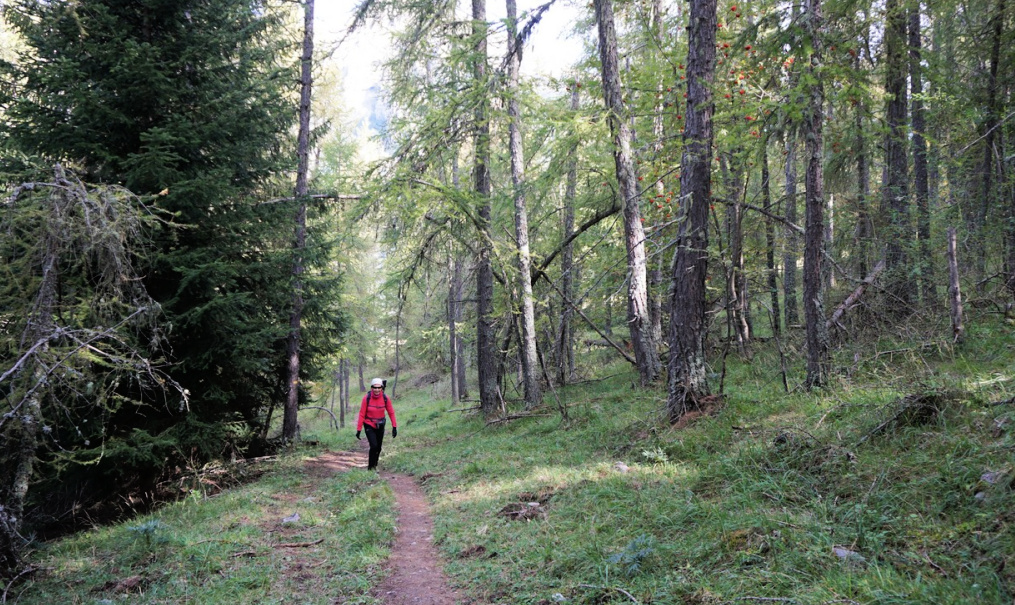
We ascended through the village along a GR58 variant trail. There were a few buildings under reconstruction, whereas some were derelict.
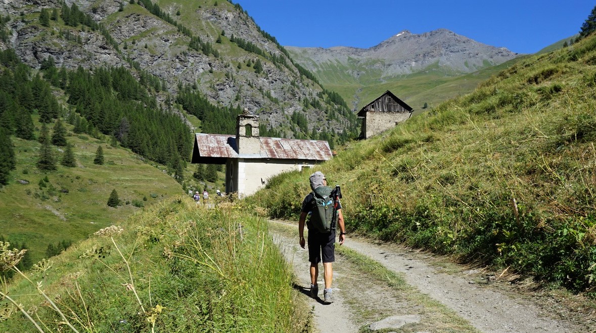
We headed north towards the Montette Chapel. We walked along a dirt track which followed Torrent de la Montette. We reached a bend in the torrent, left the dirt road and crossed the stream along a bridge. Still on a GR58 trail, we now climbed steeply towards la Montette. The hamlet had been abandoned in the late 19th century, only ruins remained below the chapel which had been recently restored.
At the chapel, the GR58 trail forked left (northwest) to Col de Thures. We forked right and continued along a smaller PR path, heading east. Walking along alpine meadows, we passed a crossroads to Col de Mayt. Gradually, we descended towards Torrent du Col St-Martin which we crossed, then forked right (west), and followed a wide dirt track in the woods. The direction soon turned to the south, and we descended back to the same dirt road (GR58) used in the beginning of the walk from Le Roux.
Duration: 2h 20
Climb: 350 m
Distance: 6,6 km
Map: 3637 OT Mont Viso St-Véran Aguilles PNR du Queyras
 |
La Montette hike track
|
This recipe is a raw version of the classic spaghetti puttanesca. The secret of this simple pasta is in the very fresh and tasty ingredients; cherry tomatoes and basil at their best, freshly grated parmesan, organic whole wheat spaghetti, and the very best olive oil.
It is a great recipe to make during a heatwave as you only need to cook the spaghetti!
2 servings
A small tin of anchovy fillets in olive oil
A small shallot, minced
½ clove garlic, minced
2 tbsp. black olives, pitted and sliced
½ tsp. Piment d’Espelette or some other mild chilli
About 12 cherry tomatoes
About 3- 4 sprigs of basil
A handful of freshly grated parmesan
Olive oil
Organic whole wheat spaghetti for 2 servings
Soak the anchovies in water for 5- 10 minutes to remove some of the salt. Then dry with kitchen paper, place in a large bowl and chop.
Wash the cherry tomatoes, chop and place in a colander for 5- 10 minutes to get rid of the excess water.
Bring a casserole of water with a little olive oil to a boil for the spaghetti.
Slice the olives and add to the bowl with anchovies. Mince the shallot and garlic and add to the bowl. Add the Piment d’Espelette, cherry tomatoes, and 1 tbsp. olive oil and mix. Wash the basil leaves, chop and add to the bowl. Mix well.
Meanwhile cook the spaghetti and grate the parmesan.
When the spaghetti is cooked, drain it and divide into two bowls. Fold in the parmesan with a fork and divide the tomato sauce on top. Serve with a green side salad.
Gilly (2467 m) is a mid-altitude mountain above Abriès 1550 m). We are in Queyras Regional National Park, in the upper Guil River Valley.
The hiking trail around the mountain is included in some local guides and with a good reason: The trail offers a highly variable experience and great views. Moreover, the itinerary starts and ends in Abriès.
 |
Abriès centre
|
 |
Initial ascent from Abriès GR58
|
 |
Good signposts by the trail
|
 |
Bois de la Brune Abriès
|
 |
Le Roix and Bric Froid
|
 |
Bric Bouchet
|
From the village centre, we walked about 200 m along the D441 road, then forked right at the signpost indicating GR58, Collette de Gilly etc. We ascended past an oratory, heading northeast. We ignored several other trails which was easy as our trail was a GR itinerary, with the usual white/red markings. The direction turned to the east, and we came to Bois de la Brune, a beautiful larch forest on the northern flank of Gilly. We saw the hamlet of le Roux below us, and further away in the north, the summit of Bric Froid (3302 m). In front of us, we saw the hamlet of Valpréveyre and Bric Bouchet (2997 m).
 |
Bois Noir Abriès
|
 |
Collette de Gilly 2366 m
|
 |
View to west from Gilly summit
|
 |
Descending from Collette de Gilly
|
We continued quasi-horizontally, still heading east, and reached Bois Noir. We crossed Torrent des Estachons, and came to a crossroads where we forked right (south), and started to climb. The trail was very good all the way. We passed a signpost at Clot de Bessey, then continued mostly above the tree line to Collette de Gilly (2366 m). After a break and a detour to the summit of Gilly (100 m vertical climb; 20-25 minutes extra), we started the descent along the southwestern slope which comprised alpine meadows and some ski runs. Our trail zigzagged in the incline, then turned southeast under some ski lifts.
We came to a small pond named Etang du Moussou (1917 m). At this point, we left the GR trail which went down to Ristolas and took a PR (yellow) trail back to Abriès, passing some ruined buildings before reaching the D947 road. We crossed the Guil River along a bridge and took a footpath back to our starting point.
Distance: 14 km
Duration: 5 h
Climb: 920 m (including the summit)
Map: 3637 OT Mont Viso St-Véran Aguilles PNR du Queyras
 |
Gilly loop hike track
|