October hike above Madone de Fenestre

Ascending towards Tete de la Lave


It was a clear late October morning, trees turning bright yellow higher up. The magnificent ridge comprising five peaks between the passes Baisse de Prals and Baisse de Ferisson (2254 m) south of Madone de Fenestre was once again our goal. From Nice, it takes about 1h 30 to reach the sanctuary.


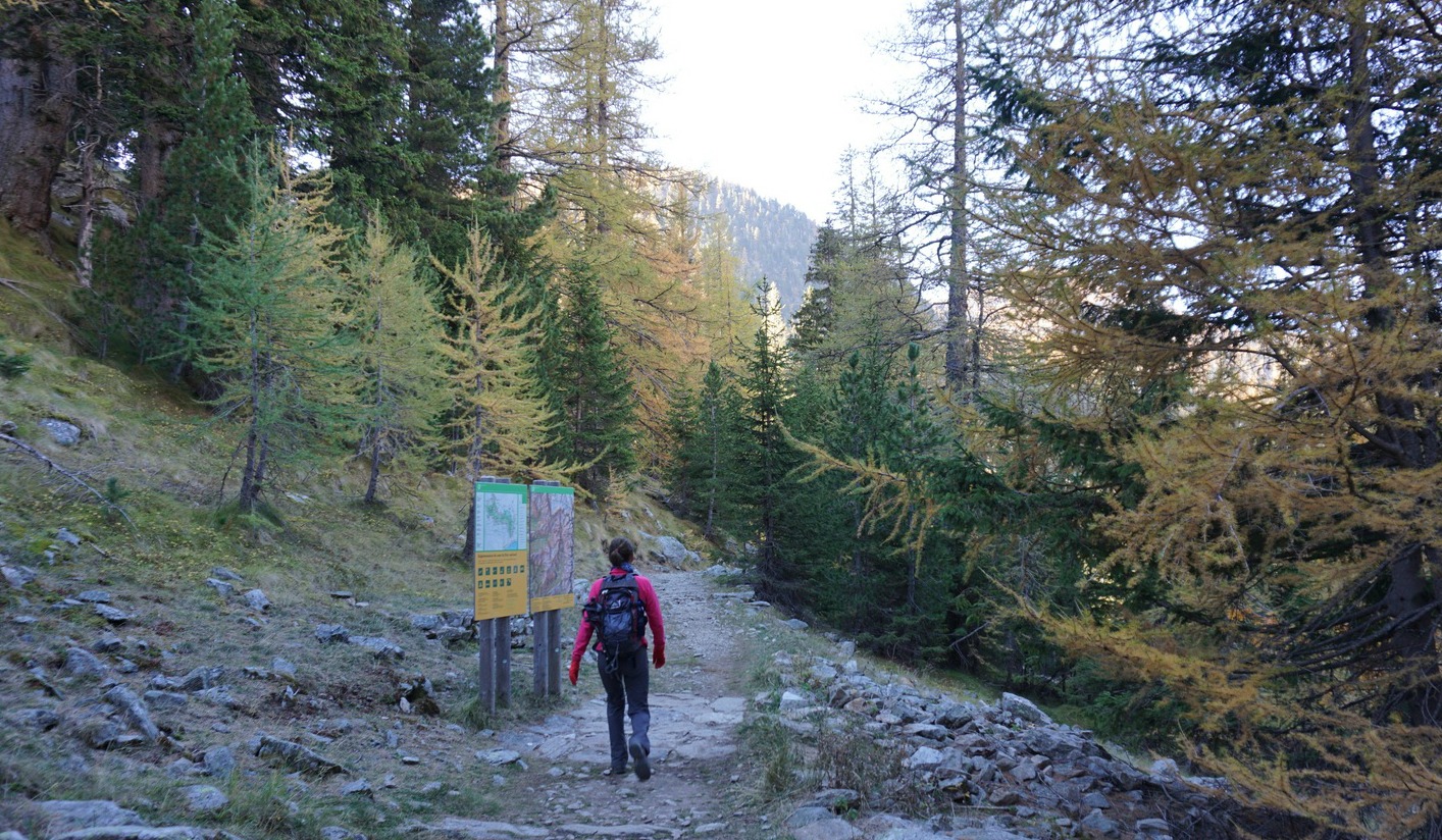
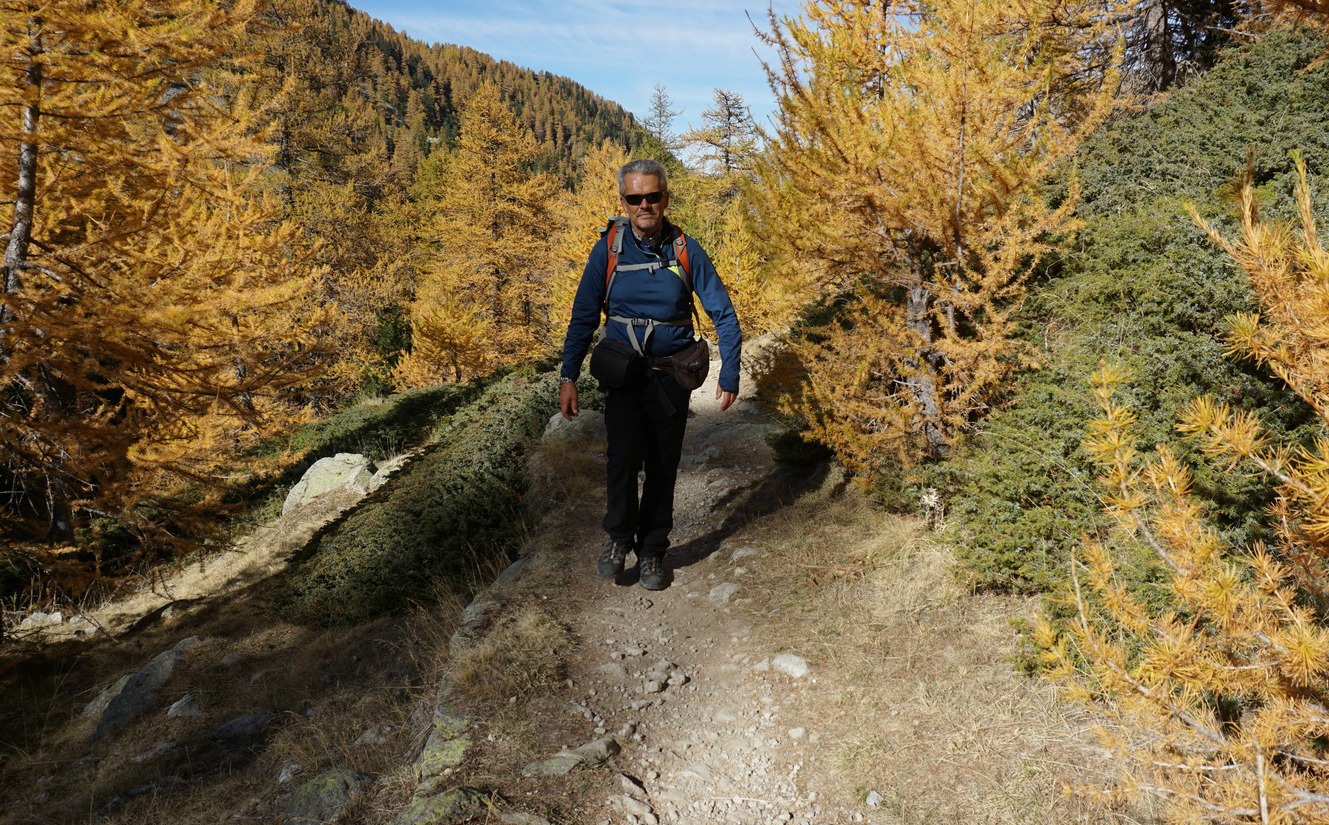
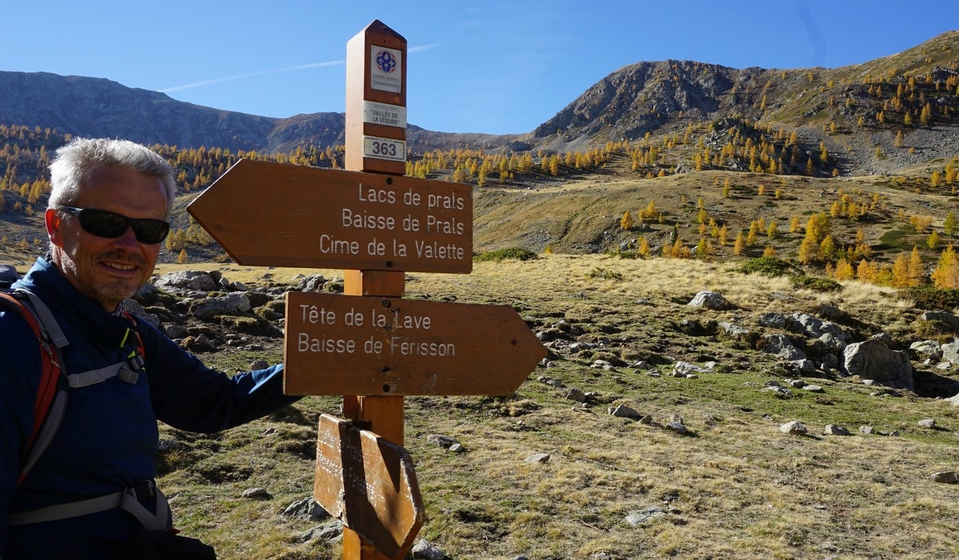
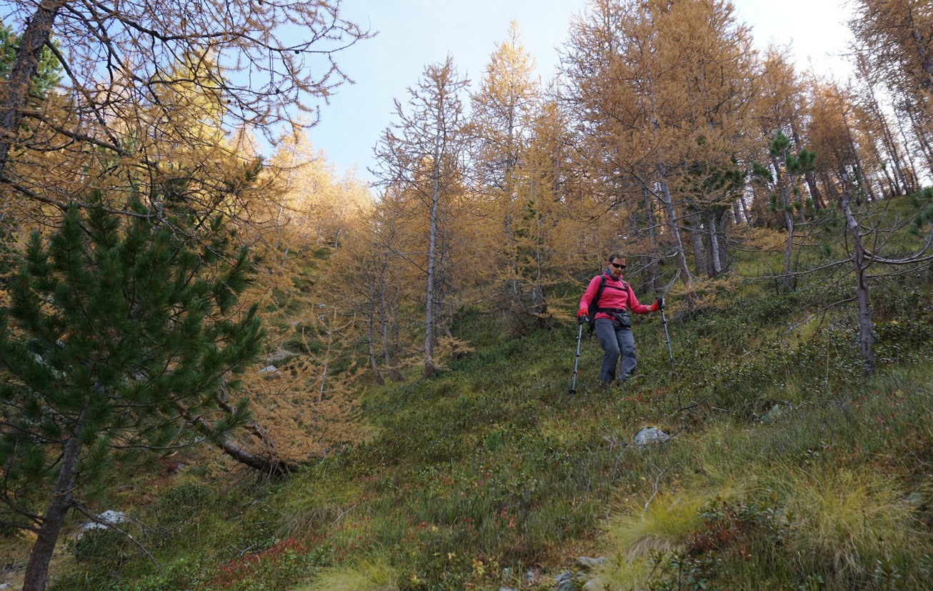
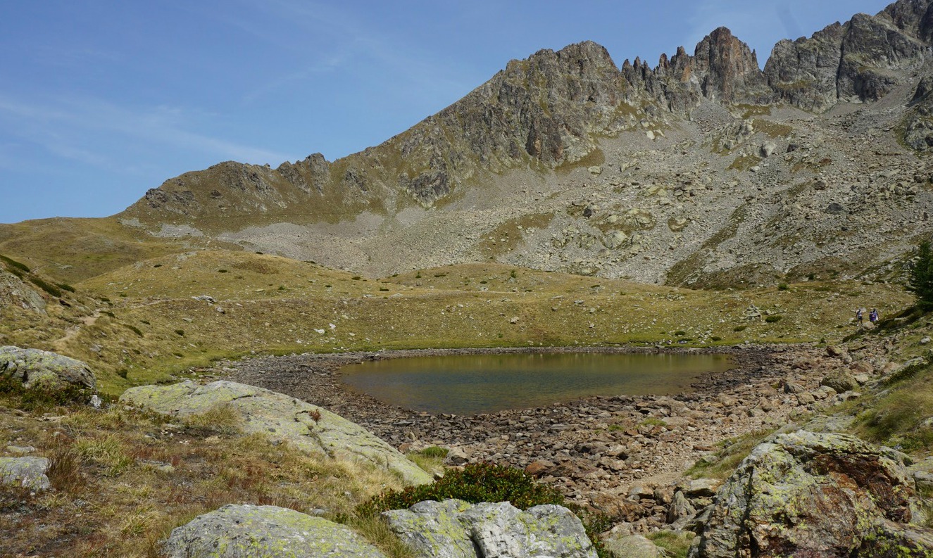
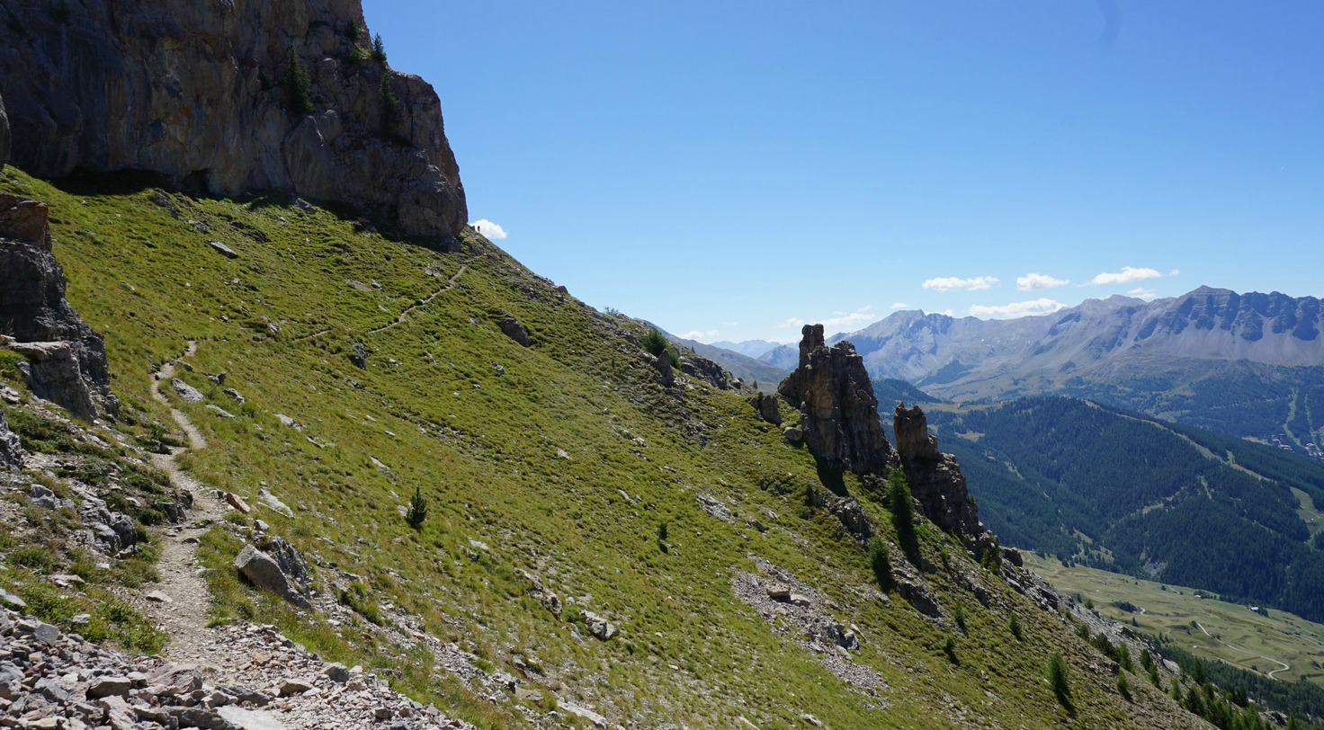
As mentioned before, the network of trails here allows you to design your hike à la carte. This time we wanted to explore the less used trail from signpost #363 at Plan de Prals. We started from Madone de Fenestre, and took the familiar trail from signpost #361 that ascended following the Mercantour Park perimeter. At signpost #363 (4th image above), we forked right, heading southwest towards Tête de la Lave (2375 m), a peak in the middle of the ridge. We have previously hiked the longer version via Cime de la Valette de Prals (2496 m).

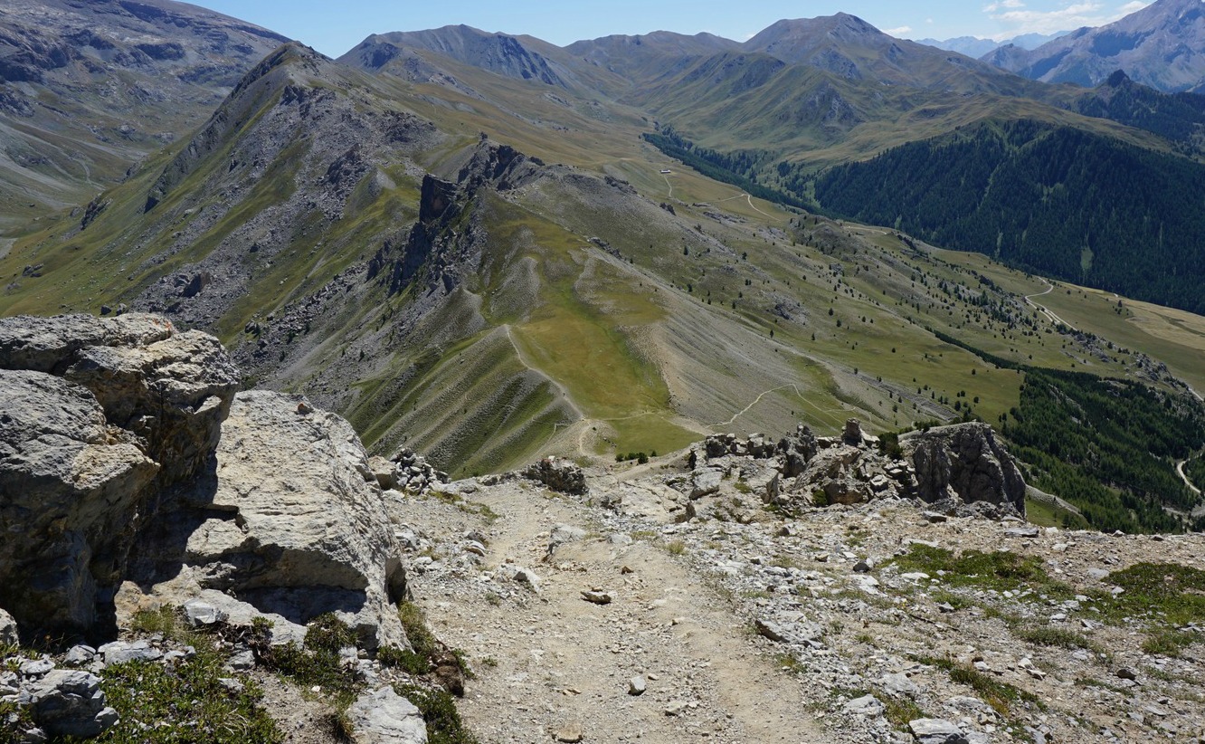
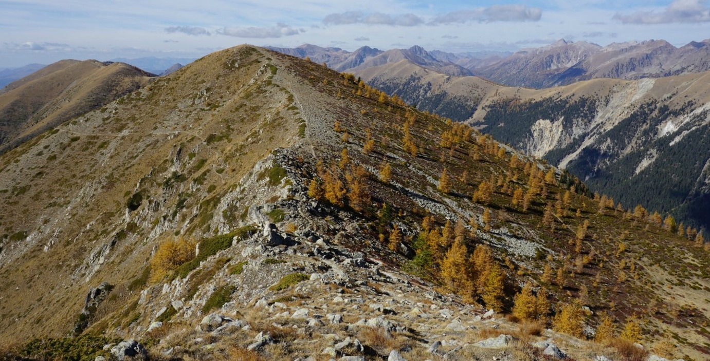
Once on the ridge, we could see the main trail continuing northwest, following its southwestern flank. We, however, continued along the ridge proper where another good trail continued to Tête de Cinant (2314 m), and could actually enjoy better views in all directions. Before Baisse de Ferisson, there was still one unnamed peak on the ridge.

Approaching Baisse de Ferisson, we saw a sheep flock near it, and three large dogs guarding them. One of the dogs was lying on the trail just before Baisse de Ferisson, and the two other dogs started to approach us, barking loudly even though we were several 100 m away. Having had a bad experience with sheep dogs this spring, we decided to make a detour. The only option was to descend “off-piste” along a steep but soft incline, thus avoiding the mountain pass. We knew that the trail back to Madone de Fenestre was somewhere below us, and located it soon enough. Anyway, it was a bit of an adventure!

The shepherds are resorting to more and more desperate measures to protect their flocks from wolves.

The rest of the hike was uneventful, we descended back to signpost #362 and hiked back to our starting point along the trail used in the morning.

Duration: 4h

Elevation gain: 551 m
Tete de la Lave trail

Distance: 10,2 km

Map: IGN Vallée de la Vésubie 3741 OT


Duck legs en cocotte with carrots, potatoes and onions

Duck legs en cocotte with carrots potatoes and onionsDuck legs en cocotte with carrots potatoes and onions


Duck legs en cocotte with carrots potatoes and onions


Preparation time:
Cooking time:
Total time:

The following very tasty recipe is perfect for those dark and rainy winter nights in the South of France. This is slow- cooking as the French have done for centuries. The aromatic scents emerging from the oven are enough to lift your spirits in those nights when you already start dreaming of next summer.

If you cannot find duck legs in your area, you could make this recipe with free- range chicken legs.

2 servings

2 duck legs, cuisses de canette
2 tbsp. olive oil
2 carrots
4- 5 new potatoes
1 onion, coarsely chopped
1 clove garlic, minced
200 ml red wine
100 ml tomato sauce
200 ml chicken stock
1 bouquet garni
Freshly ground black pepper

In a heavy casserole, cocotte, warm the olive oil over medium heat and fry duck legs on both sides until golden.

Preheat the oven to 180° C.

Add the onion and garlic to the casserole and continue cooking for about 5 minutes. Wash and slice the carrots, then add to the casserole. Add the washed new potatoes. Pour in the red wine, tomato sauce, and chicken stock, and bring to a boil. Add the bouquet garni and some black pepper.

Transfer the casserole to the oven and bake for 1,5- 2 hours. Check occasionally. Add some water if needed, and cover if the surface starts browning too much.

Risotto with tomatoes, basil and chicken

Risotto with tomatoes basil and chicken


Risotto with tomatoes basil and chicken


Preparation time:
Cooking time:
Total time:

This is a great variation of classic risotto. I would call this recipe risotto with Provençal twist as it includes roasted tomatoes and Provençal herbs. Chicken adds healthy protein and makes the dish a complete light dinner. The recipe is gluten free.

2 servings

2 organic chicken breasts, cut into about 2x2 cm chunks
2 tasty tomatoes
2 tbsp. olive oil
½ tsp dried Provençal herbs
A small handful of fresh basil
Freshly ground black pepper
2 portions classic risotto

For the classic risotto, I refer to the recipe: Seafood risotto with a twist. Just omit the lemon and replace the dill with basil.

First preheat the oven to 210° C, roast.

Coarsely chop the tomatoes into chunks and place them in an ovenproof dish in one layer. Sprinkle with Provençal herbs and 1 tbsp. olive oil. Roast for about 10 minutes, then remove from the oven and set aside.

Start cooking the risotto in the classic way.

While you are cooking the risotto, fry the chicken pieces at the same time. It is nice if you can have someone to help you at this point by stirring the risotto! Warm 1 tbsp. olive oil in a frying pan over medium heat. Cut the chicken breasts into about 2x2 cm chunks and fry them for about 15- 20 minutes, turning occasionally, until the chicken is well- done but not dry. At this point the risotto should also be done as this takes about 25 minutes.

Remove the risotto from the heat and stir in the parmesan, basil (save some for decoration), and black pepper. Fold in the tomato chunks.

Divide the risotto into bowls and place the chicken pieces on top. Decorate with basil.

Madone de Fenestre: Easy hike to Lacs de Prals

Lacs de Prals above Madone


The Chapelle de Madone de Fenestre (1904 m) is a good starting point for several interesting hikes. The two most popular itineraries comprise the trails to Col de Fenestre at the Italian border, and Lacs de Prals southeast of the sanctuary.

The network of trails around Madone de Fenestre allows you to tailor-make your hike.

The Prals Lakes consist of 5 lakes in a basin at about 2200 m elevation, surrounded by majestic peaks. From Madone, the lakes can be reached from the north, along the trail along Vallon du Ponset, or as we did this time, from signpost #361 (1820 m) below Madone de Fenestre.


We ascended along a good trail familiar to us along Vallon de Prals, passing signpost #362, then 363. We came to a vast alpine meadow called Plan de Prals and continued to signpost #364 and a crossroads. From here, you can head directly to the lakes by taking the left-hand trail. We continued straight towards Baisse de Prals. However, just before reaching this mountain pass, we forked left along a good trail that was marked with a cairn at the crossroads. The direction was straight towards the lakes. In places, we had to negotiate rocky parts of the trail, but reached the upper smaller lake soon enough.

 We felt that for a moderate effort we got great views, and the atmosphere of high mountain summits. It is simply stunning every time! This detour was much less used compared with the main artery to the lakes.

Needless to say, Lacs de Prals was a perfect spot for picnic for us and numerous other mountain lovers.

We headed back along the main trail to signpost #364, thus closing our little extra loop. We then took the same trail back to our starting point.

Duration: 3h 30

Elevation gain: 470 m
Lacs de Prals trail image

Distance : 9.6 km

Map: IGN Vallée de la Vésubie 3471 OT


Corsica: Cliff walk from Bonifacio

Bonifacio seen from the Pertusatu trail


The trail from Bonifacio to the southernmost tip of Corsica, Capu Pertusatu, is characterised as an easy stroll in some guidebooks. We agree with that. Hiking boots are not necessary, good jogging shoes suffice. It is a leisurely cliff walk with fantastic views to Bonifacio and over the strait to Sardinia.

Note that the tower seen from Bonifacio above the cliffs is an observation and radar tower of the French navy. The old lighthouse in Capu Pertusatu is a bit further away, and becomes visible when passing the military area.

We started from the Bonifacio Harbour, and walked around the old town before heading to the trail.


The trail started from Col Saint-Roch just above the harbour and below the old town. We first ascended along a wide cobbled trail. The path soon became narrower, levelling off, and we followed it, heading east. The military tower was visible most of the time, making navigation easy. There were no signposts. We eventually came to the D260 road near an intersection. Here, we forked right (south), following the road downhill for about 3 minutes. At a bend before the road starts climbing again, we forked left along a well visible trail, climbed a bit passing a ruined house before reaching the same road again. In fact, many tourists preferred to drive here, parking near the naval tower, obviously missing the great first part of the trail!

At this point, the old lighthouse was visible. We now followed a nice paved trail (cars not permitted) that took us directly to the lighthouse which was under restoration, and hence closed. We walked past its perimeter to the cliff which was our turning point today. It is possible to descend down to the beaches along trails that start before the lighthouse, or by continuing a bit further east to Cala di Labra, known for its overhanging sandstone cliff. All along the trail, mind the steep cliffs!

We returned to Bonifacio along the same trail.

Duration: 2h 30
Capu Pertusatu trail

Distance: about 9 km

Climb: about 200-250 m


Roasted veal chops with pistou and potato salad

Roasted veal chops with pistou and potato salad


The potato salad in this recipe reflects summer; it includes new potatoes, sliced radishes, and peas. It is much lighter than the classic potato salad made from potatoes and a mayonnaise dressing.

The roasted veal chops are served with pistou, basil purée. Here in Nice, I prefer veal chops which are usually more tender and succulent than pork chops in our local supermarket. The recipe works just as well with tender pork chops.

2 servings

2 thick veal chops (or pork chops)
Olive oil and butter for frying

For the pistou:

A small bunch of basil, chopped
2 tbsp. olive oil
1/3 clove of garlic, minced
Freshly ground black pepper
A pinch of salt

For the potato salad:

3 medium sized new potatoes, microwaved, then sliced
150 ml fresh peas
A small bunch of radishes, sliced
Basil leaves to decorate

For the dressing:

2 tbsp. olive oil
2 tsp red wine vinegar
1 tsp Dijon mustard

In a mortar, make the pistou by crushing the basil leaves and all the other ingredients with a pestle. Mix well, cover, and place in the fridge until needed.

Preheat the oven to 180° C.

Melt some butter and olive oil over medium- high heat in a heavy frying pan and fry the veal chops on both sides until golden brown. Transfer to an ovenproof dish and bake in the oven for 20 minutes. If using pork chops, make sure that they are well- done but not dry.

Meanwhile make the potato salad. Slice the microwaved new potatoes and transfer into a bowl. Peel the fresh peas into the bowl. Wash and slice the radishes and add to the bowl.

Whip together the dressing and add to the potato salad.

Transfer the veal chops on the plates and divide the pistou on top. Divide the potato salad on the plates and decorate with basil leaves.

Chicken breast with Parma ham and crushed tomatoes

Chicken breast with Parma ham and crushed tomatoes


This is a great autumn recipe when tomatoes are still tasty and fresh basil is available.

The sauce is made from fresh crushed tomatoes, tomates concassées. This involves placing the tomatoes in boiling water for three minutes or so, then peeling and roughly chopping them. It is amazing how easy it is to peel the tomatoes after they have been immersed in boiling water for a few minutes! The rest of the sauce ingredients; fresh basil, olive oil, black pepper, and spring onions, reflect Mediterranean flavours.

Covering the chicken breasts with fresh basil leaves, a slice of Parma ham, and olive oil before baking them keeps the chicken succulent and tasty.

2 servings

2 organic chicken breasts, without skin
2 slices of Parma ham
A handful of fresh basil leaves
About 4- 5 tbsp. olive oil
8 black olives, stoned and chopped
2 tasty tomatoes
2 spring onions, cébettes, white parts only
Freshly ground black pepper
Grated parmesan
Whole wheat spaghetti for two servings

Preheat the oven to 200° C.

Cover the chicken breasts with a slice of Parma ham and tuck a lot of fresh basil in between. Save some basil leaves for the crushed tomato sauce. Place the chicken breasts in an oven- proof dish and drizzle a table spoon of olive oil over each breast. Bake in the oven for 20 minutes.

Meanwhile cook the spaghetti and prepare the crushed tomato sauce.

Place the tomatoes in boiling water for about 3 minutes. Remove from the water, place in a bowl and peel them. Then chop roughly. Add the stoned and chopped olives, sliced spring onions, 2- 3 tablespoons olive oil, and black pepper. Carelessly mix the tomato sauce.

Chop the remaining basil and grate some parmesan.

Drain the cooked pasta and divide on the plates. Add the chopped basil in the tomato sauce and mix. Divide the tomato sauce on the pasta and sprinkle with parmesan. Place the chicken breasts on the side with some microwaved broccoli or butternut squash cubes.

Hike from Coursgoules above Vence

The village of Coursegoules

Sometimes, especially on a warm day, you might want to start your hike a bit higher but not drive far from the coast. The medieval perched village of Coursegoules north of Vence could then be your perfect choice. The village is said to be 700-800 years old but the original settlement was built by the Romans. The distance from Nice is 32 km by road, and the village is situated at 1020 m altitude under the eastern part of the Cheiron mountain ridge. The region is part of the Azur Prealps. The river La Cagne has its source southeast of the village. The village itself is certainly worth visiting. It is said to be less touristic. Even so, we saw quite a few visitors on the day of our visit. Some expats have found their home here.

The hike featured here ascends to the Cheiron ridge, follows it west before descending back to Coursegoules. The French guide calls the hike “Circuit de Viériou”. One of the advantages of this hike is that you rapidly reach the mountain crest; the whole walk takes about 3h 30 so you should have ample time to explore the village and even dine there.


From signpost 13 close to the parking, proceed to # 12 from where the well-marked trail starts ascending along the southern face of the mountain in the Foussa Valley. Signpost 145 at Baisse de Viériou (1356 m) on the ridge is reached in about an hour. The trail now heads northwest in an almost treeless landscape, climbing slightly to 1424 m, and the highest point of the hike. Eagles can frequently be spotted here, soaring above the mountain massif.

At signpost 146, there’s a crossroads where our itinerary winds down along a stony and wide path to signpost 147. Coursegoules is visible all the time. Even so, follow the path with yellow marks. There may be several paths, both man –and animal made. The tiny Chapel St-Michel is passed. Flocks of lambs can be on the trail here so be discreet. Just before the village, the trail crosses a small stream in the woods.

Total climb: 480 m

Map: IGN 3642 ET Vallée de l’Estéron

Image of itinerary courtesy of Google Maps


Magnificent ridge above Vars Valley

Trail following northern section of Crête de Vars


The impressive mountain ridge Crête de Vars northeast above the Vars Valley can be reached either from the village of Ste-Catherine or from Refuge Basse Rua in Val d’Escreins.

We chose to start from Ste-Catherine and hike clockwise as we had visited Val d’Escreins the day before. The ca 2.7 km long ridge reaches 2600 m, and the trail runs most of the time at about 2500 m elevation (highest point 2580 m). If you decide to hike anticlockwise, you’ll have the Les Ecrins Massif with its white mountain tops in your sight but either way, the views on the ridge itself and to the neighbouring mountains are remarkable!


We used the parking in front of the local school in Ste-Catherine as described in the local guide booklet. The first part of the itinerary followed a narrow road, passing a saw mill south of the village before turning north.  The signposts showed the direction to Col de la Scie. After having passed a telecom mast, we forked left after a while leaving the dirt road, and continued the ascent heading north along a good trail in a magnificent forest called Bois de la Pinée. We felt that only at this point did the hike really start!

We reached Col de la Scie (2376 m) in about 1h 40 from the start. At the crossroads on the col, our trail along the ridge continued south-southeast while the other trail went down to Refuge Basse Rua. That trail seemed to be a steeper than the one we just had climbed.

After a short and easy scramble from the col, we came to a beautiful part of the ridge with alpine meadows (title picture above) where we slowly ascended further before reaching the rockier part of the trail. The views down to Val d’Escreins in particular were dramatic as that side of the mountain ridge was precipitous, so stay on the trail!

We could have hiked on the picturesque ridge longer, but it came to a rather abrupt end as we saw next mountain pass, Col de la Coulette (2362 m) below us. We descended rapidly, minding the loose gravel on the trail. Col de la Coulette is another hiking trail crossroads. The trail to the left went down to Val d’Escreins while continuing straight would have taken you to Vallon Laugier. We forked right, and descended back towards Ste-Catherine. There were signposts here and there but the trail was marked with yellow, so it was easy to follow. We dove in the woods again, crossed dirt roads a few times, and eventually came to the saw mill again, but this time from a different direction, closing the loop.

Duration: 5 h
Crête de Vars trail

Elevation gain: 750 m


Distance: 12,8 km


Map: IGN 3537 ET Guillestre, Vars, Risoul


View to north from Crête de Vars


Crête de Vars southern end seen from La Selle


Vars: Exploring Val d'Escreins

Crossing Torrent Rif-Bel Val d'Escreins


We had decided to explore Le Val d’Escreins on the first day of our three-day stay in Vars. A natural reserve situated between the Vars Valley and Queyras, it is called “little Canada” in the local guide because of its forests and steep impressive mountain ranges on both sides.

From the main D902 road, the valley can be reached along a paved although narrow road that goes as far as Refuge de Basse Rua (1760 m). The upper valley in the southeast is surrounded by 3000 m+ mountains, such as Pic de la Font Sancte (3385 m).

The Valley offers both easy trails for families and more demanding hikes that go over 3000 m. There are discovery trails where one can become acquainted with the local flora and fauna.

We planned an afternoon hike there, and chose to take the trail that went to the upper valley to an oratory, and to combine it with sentier des arbres remarquables, a path that ran parallel to the main trail for a while (marked as purple in the image).


We started from the parking at the refuge, and followed the trail (also a GR trail) to the oratory following the Rif Bel torrent (signposted and marked with purple signs). At about 2100 m elevation, we forked left (the GR trail continued southeast), and started to ascend more steeply, still mainly in the woods. The oratory came into sight just above the tree line at about 2300 m elevation.

On the way back, we took the right-hand trail a bit below the oratory signposted as arbres remarquables. The forest was beautiful as expected, but not exceptional. However, the path was better than the one we climbed on the way up. We soon joined the main trail again, and headed back to the starting point.


Elevation gain: About 560 m
Val d'Escreins trail

Duration: 2 h to the oratory, 1h 15 back.

Map: IGN 3537 ET Guillestre, Vars, Risoul

Distance: About 10,4 km