When Napoleon in 1815 returned from the Island of Elba, he received a particularly warm welcome in Gap (Hautes-Alpes) on his way back to Paris. In his final exile on St Helena, he wanted in his testament to remember Gap and Hautes-Alpes with private refuges carrying his name.
To satisfy his uncle’s wishes, it was Napoleon III who ordered the construction of eight refuges in Hautes-Alpes. At the end, six were built. Of these, four refuges at Col de Vars, Col de l’Izoard, Col du Noyer and Col de Mans still exist or have been rebuilt.
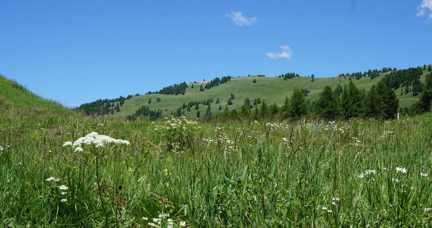
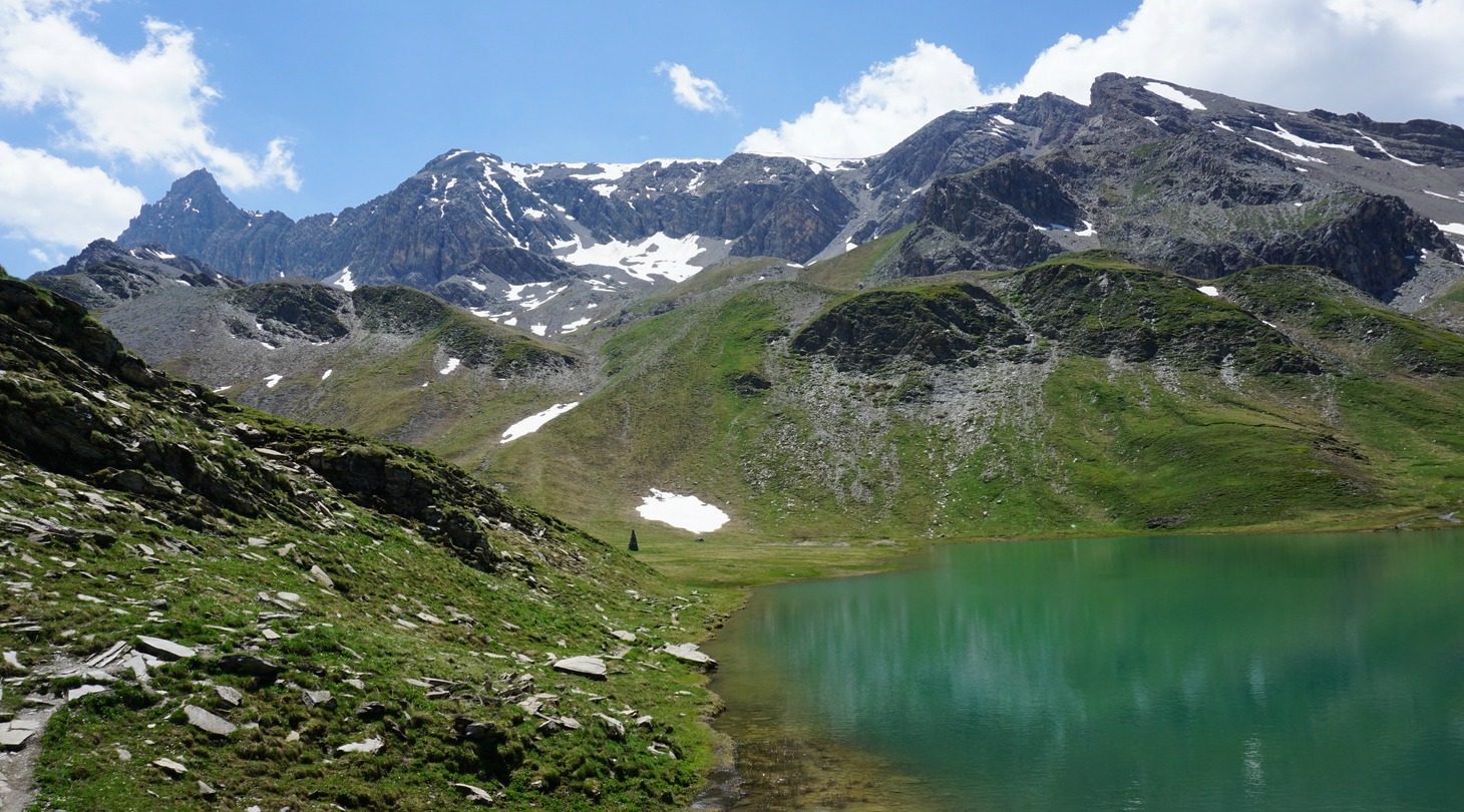
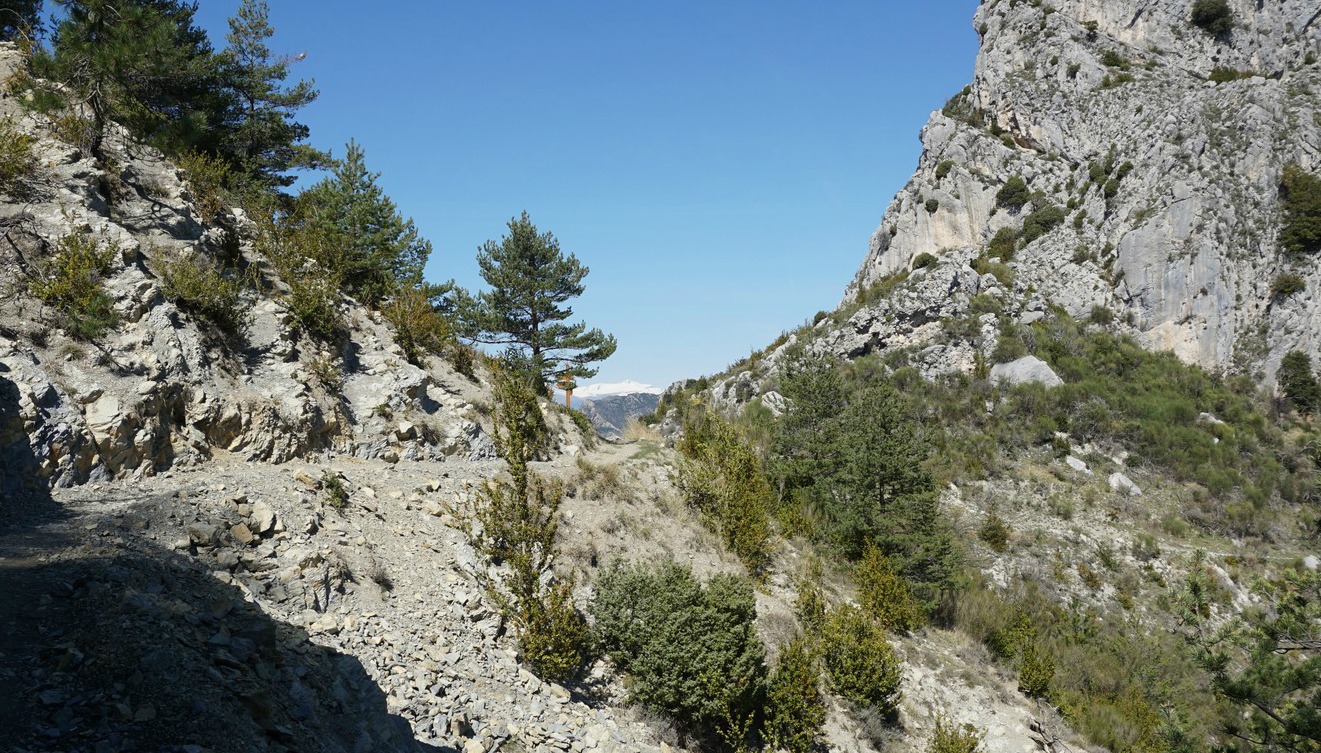
The D902 road over Col de Vars (2108 m) connects the Ubaye and Durance River Valleys. Refuge Napoléon (1987 m) is located about 2 km north of the mountain pass, and the Vars ski resort at Les Claux (1842 m) is further 2 km northwest.
During the summer season, the D902 road is packed with motorcycles, cyclists, camping cars etc. This year (2017), Tour the France will once again go over Col de Vars.
We have had lunch several times at Refuge Napoléon at Col de Vars when heading north. They have a decent plat du jour but service can sometimes be slow. The terrain on both sides of the road seemed to be perfect for walks, and in fact the IGN map shows numerous hiking paths of all grades starting from the Refuge, the Col, or from the ski resort.
After lunch we headed to the summit of Peynier (2273 m), its telecom mast clearly visible. We took the signposted dirt road behind the refuge. Instead of using the road all the way, we opted for a shortcut along the alpine meadows and some larch woods. The scenery was lush and green.
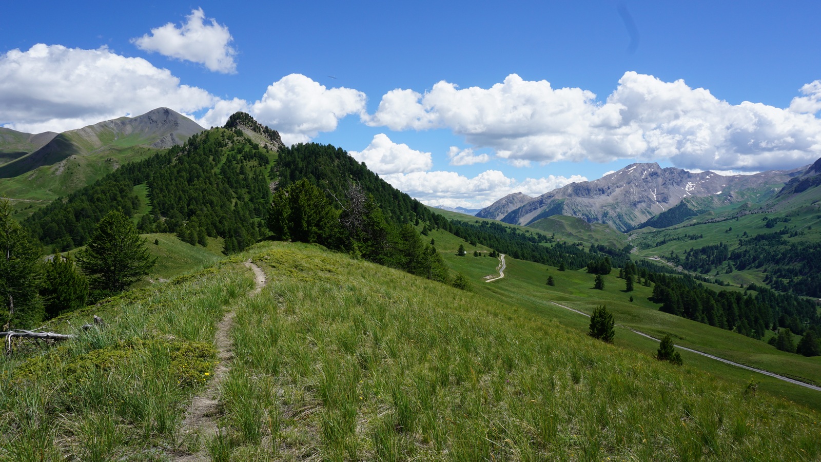
We, however, ended up a bit too much northeast than intended. We turned more sharply northwest and soon sighted the summit of Peynier. We continued towards a ridge slightly east of the summit, crossed the dirt road, and continued ascending a bit steeper in the alpine meadow. After a while we reached the ridge, found a good path and continued the last stretch along the path and the dirt road to the mountain top.
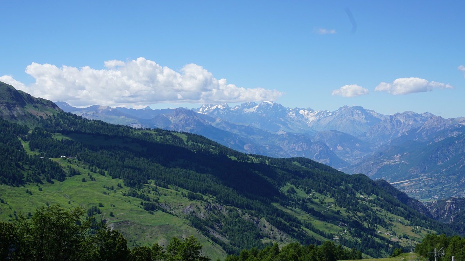
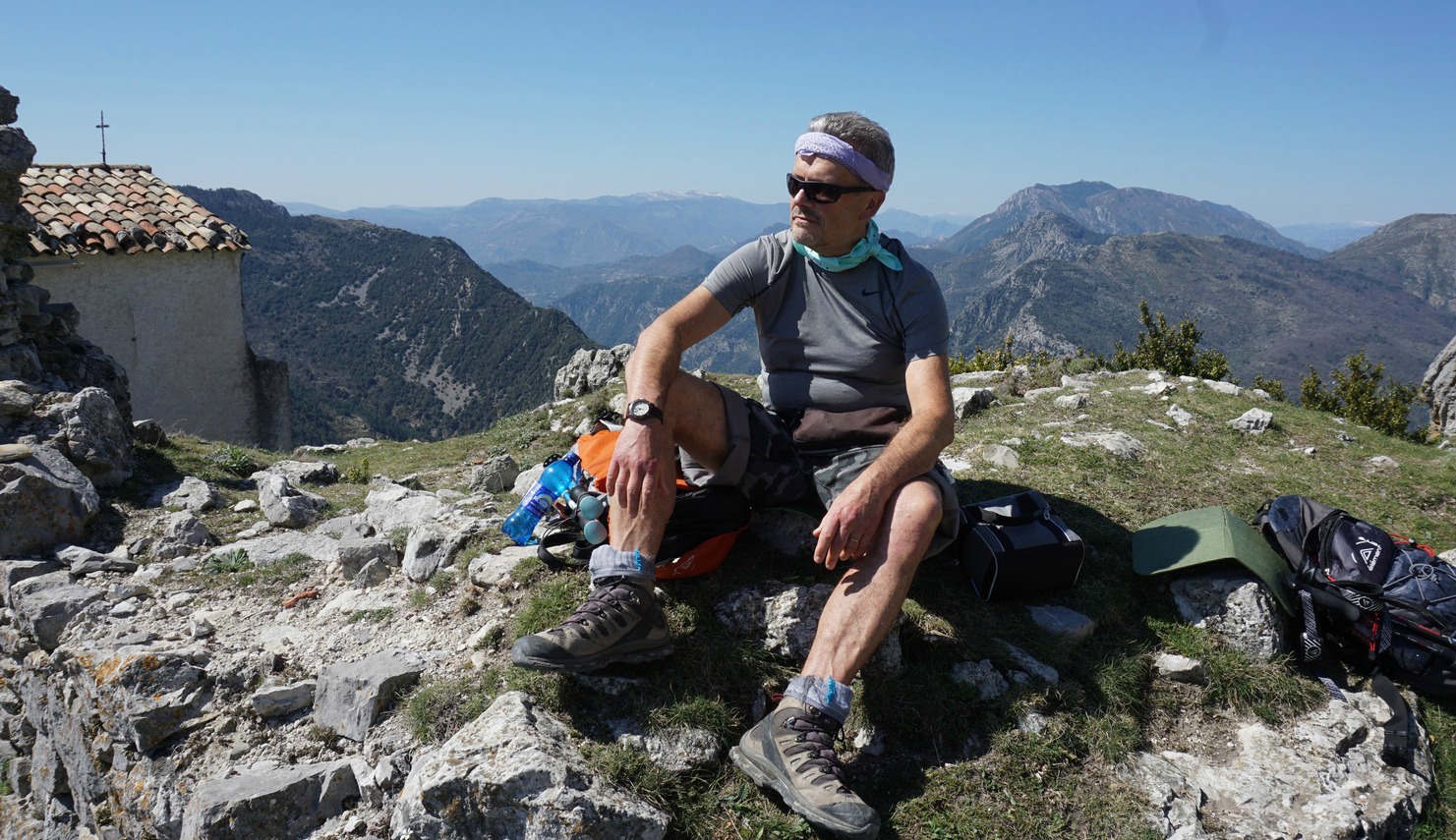
From the summit we had, as expected, a great view down to the Vars Valley, Les Ecrins massif further away in the west, La Mortice and its adjacent peaks in the east.
We took the dirt road back to the Refuge, this time without any shortcuts!
I recently read in the French magazine ELLE about the importance of fresh herbs for a glowing skin. Fresh herbs are packed with antioxidants, vitamins, and minerals which are important for our skin and for our health in general. In California, the new trend is to add more herbs and less fruit in smoothies to reduce the increase in blood sugar.
I have always preferred a light meal to a smoothie. When I saw an interesting recipe with fresh mint and basil on a package of green lentils I had to try it.
I have somewhat modified the recipe on the package by omitting cucumber, which is nutritionally mostly water, by replacing the lobster with shrimp, and by adding baby salad leaves. The recipe makes a tasty and light lunch. By all means serve the salad with lobster tails if you want to make a seriously luxurious salad. The recipe is gluten free.
2 servings
100 ml good quality green lentils, such as Puy lentils
100 ml quinoa
About 250 g cooked and peeled shrimp
1 green bell pepper, finely chopped
1 tasty tomato, finely chopped
Freshly ground black pepper
About 6 mint leaves, finely chopped
About 6 basil leaves, finely chopped plus some extra basil for decoration
2 tbsp. lemon juice
4 tbsp. olive oil
2 small handfuls of baby salad leaves
Cook the lentils for about 20 minutes in about 500 ml water until they are soft but not falling apart. Drain and transfer into a bowl. Do the same with quinoa and add to the bowl. Refrigerate until needed, can be kept in the fridge until next day.
Finely chop the green bell pepper and tomato and add to the lentil- quinoa bowl. Grind over some black pepper and mix.
Finely chop the mint and basil leaves and add to the bowl. Mix well. Save some basil leaves for decoration.
Make the dressing. Press 2 tbsp. lemon juice and mix with 4 tbsp. olive oil. Add the dressing to the lentil-quinoa- vegetable bowl and mix well.
Divide the lentil- quinoa- vegetable mixture on the centre of the plates. Arrange the baby salad leaves and shrimp on the side and decorate with basil leaves.
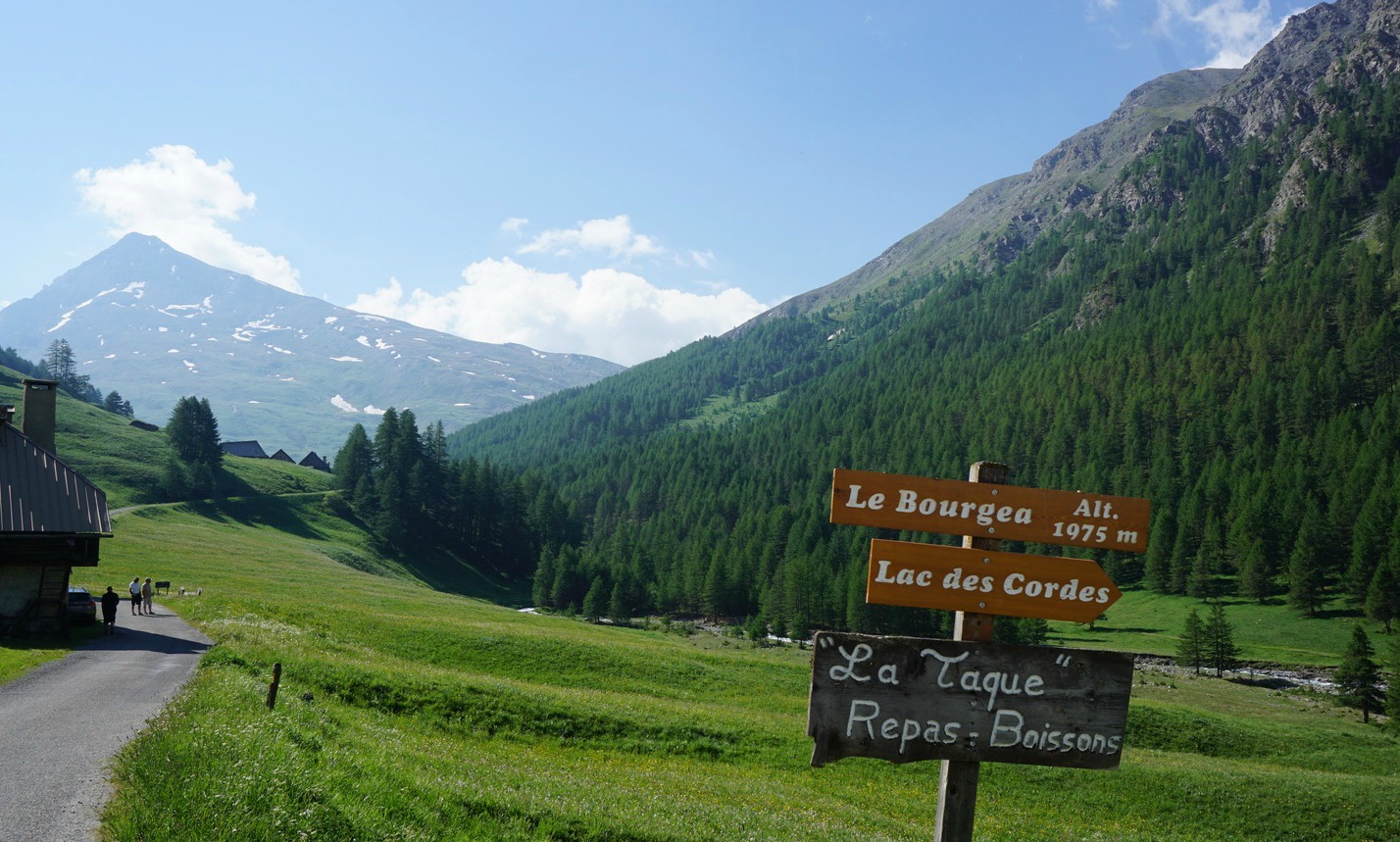
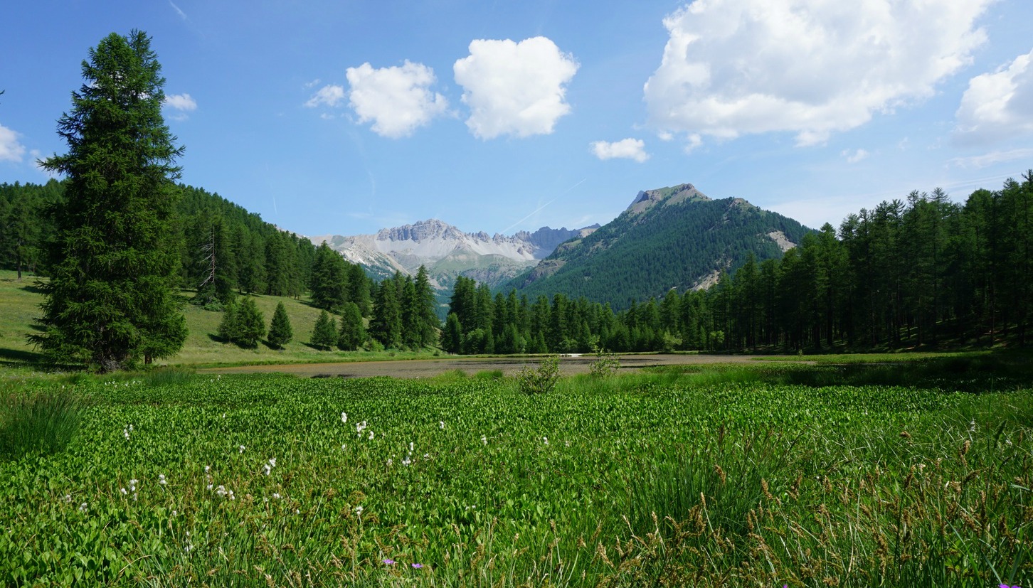
The beautiful Lac des Cordes (2446 m) is a popular summertime hiking destination. Situated above the Cerveyrette Valley, it is walled by majestic peaks such as Pic de Rochebrune (3320 m).
This is a quasi-perfect loop trail offering a lot of variation; vast alpine meadows, some steep ascents and descents, one part even equipped with cable, and on the other hand calm pine and larch forests with easy and soft paths.
The Cerveyrette Valley is quite sauvage. While descending down from the lake, we even thought that we saw a glimpse of a wolf running fast below us in the woods.
To reach the Cerveyrette Valley, you first have to drive through the town of Cervières that can be reached from either Briancon or over the Izoard Pass. The narrow but paved D89T road climbs from Cervières to the valley.
We parked at the limited parking just after the hamlet of Les Chalps (1975 m), and walked along a soft forest road by the River Cerveyrette to the hamlet of LesFonds (2040 m), where the D89T road also ends and where you can find a bigger parking.
From Les Fonds we first followed the main GR58 trail along a stream up to an alpine meadow where our trail forked right at a signpost (marked as a GR58 variant in the IGN map) whereas the main GR58 continued straight south towards Col de Péas. We continued climbing, crossing some streams. We reached another alpine meadow before the trail turned north, now climbing to Col des Marsailles (2601 m; the highest point of the hike) its southern flank still covered with some snow.
From here, the upper and smaller Lac des Maits was visible below us, and we followed the trail straight north, walking over some snow-covered parts and leaving the lake on our left side.
Lac des Cordes could now be seen, and the trail continued descending in a north-westerly direction to the eastern shore of the lake.
The trail back to the valley started right behind the lake descending rapidly in a north-easterly direction in the Gras Valley. Large areas were covered with rhododendrons in blossom. A bit lower, we dove in a larch woods. A short steep section was equipped with a cable for additional security. However, most of the trail was smooth and easy.
On the way back over the Izoard Pass, we stopped at Refuge Napoléon by the D902 road just under the highest point for excellent blueberry pies and coffee.
Duration: 4h15
Elevation gain: 642 m
Distance: 10,3 km
Map: IGN 3536 OT Briançon Serre-Chevalier Montgenèvre
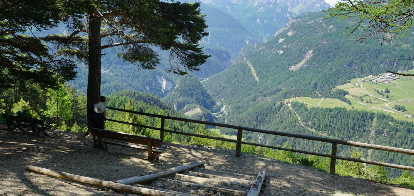
After yesterday’s more demanding loop trail, we just wanted an easy walk to stretch our legs. But we also wanted a nice trail and some great views. The walk from La Chalp Arvieux to the Lac de Roue and the two viewing points nearby ticked all the boxes.
We started the walk straight from our hotel by the D902 road in La Chalp (1685 m). Incidentally, the mythic long-distance trail GR 5 ran right behind La Ferme de l’Izoard, our lodging. We followed the signposts and after a few hundred meters forked left in the woods where the trail proper started to ascend, heading south. We passed the village of Arvieux below us, and came to a hamlet called Les Maisons. We followed the white and red GR signs, and ascended a bit more, now along an open verdant hillside.
A little before Lac de Roue (1847 m), the GR itinerary followed a dirt track. A beautiful larch forest surrounded the lake, and there were picnic tables installed. We continued a bit, heading south in the woods to the viewing points, signposted as Belvédères, and also marked in the IGN map. We reached them after a brief ascent and descent, and had some nice views down to the Guil River Valley. Even Château-Queyras was visible.
We returned to the lake for our picnic, and took the same trail back to our hotel. In spite of the modest elevation differences, there were several ascents and descents, and our log showed 435 m elevation gain at the end of the hike.
Italian parmesan and mozzarella cheeses are well-known all over the world, but burrata was long unknown to me until I came to Nice. Burrata can be seen on local restaurant menus demonstrating well the strong culinary connection between Nice and Italy.
Burrata’s outer shell is of solid mozzarella while the inside is soft and creamy. It goes well with salads sliced open so that the thick cream flows out. Tasty tomatoes, olive oil, and black pepper heighten burratas fresh and buttery flavour.
The following recipe is for a summer salad to be enjoyed with some good country bread. In winter, burrata is nice when opened over roasted vegetables and sprinkled with olive oil for a simple but tasty lunch. 2 servings burrata salad
2 generous handfuls of baby salad leaves
2 tasty tomatoes, chopped
1 burrata, about 200- 250 g
1 small tin of anchovies in olive oil
8- 10 black olives
2 tbsp. French salad dressing
2 tbsp. olive oil
Freshly ground black pepper
Basil leaves and pine nuts to decorate
Soak the anchovies in a small bowl of water for about 10 minutes to reduce saltiness. Then dry on a kitchen paper.
Divide the baby salad leaves and chopped tomatoes on the plates. Drizzle with French dressing.
Slice open the burrata and place one half on the centre of each plate. Drizzle with olive oil and grind over some black pepper. Divide the black olives and anchovies on the plates. Decorate with basil leaves and pine nuts. Serve with a good country bread and enjoy.
This easy, agreeable walk starts from the village of Beuil (1450 m) in the upper Cians Valley near the Valberg ski resort (1680 m). We modified the itinerary described in the Randoxygéneguide a bit by making a somewhat longer loop as described below, and did not go up to the summit this time.
Good paths cross larch woods and alpine meadows. The trail circles Tête du Garnier(1906 m), and it is possible to take a short detour to the summit. This hike is especially great if you wish to experience the start of the summer in an alpine environment with Mont Mounier (2817 m) looming in the background not that far in the north.
At the entrance of Beuil from direction of Valberg we located signpost #31, our starting point. We ascended to a meadow full of spring flowers. There were tracks here and there. Passing a watering trough, we saw signpost #39 partly hidden. We were supposed to continue more or less straight but there was not a clear path. We took a longer route that forked slightly right heading north. We soon came to a forest road that descended quite a bit to signpost #42, then turned west and started to climb. Passing some huts, we came to an intersection where signpost #38a was supposed to be. We did not find it, but saw the yellow-marked trail that ascended through the woods to Col de l’Espaul (1748 m).
Now halfway through the loop trail, near signpost #7, we found a perfect spot for picnic.
The trail continued south, passing Lac de Beuil (signpost #37), and the intersection of the trail to the summit. From here, the trail gradually descended to Col de Ste-Anne at Les Launes by the RD28 road. The last part of the hike back to Beuil followed the GR52A just under the RD28 road.
In spite of the name there’s no pasta in this recipe; the sliced squid replaces the pasta. The Italian word tagliare means to cut.
The recipe is adapted from Julie Andrieu’s TV-programme, Les carnets de Julie avec Thierry Marx, in which an Italian lady cooked her Seiche tagliatelle in France. NB! The dish contains raw eggs like the famous Pasta alla Carbonara. That is why I think that it is important to choose organic eggs from free-range chickens, because these chickens are much healthier than battery chickens. If you wish to have less liquid in the dish you can very well omit the egg.
Like the Italian lady said this dish offers culinary tastes that are pure enjoyment.
2 servings
3- 4 cleaned large squid
50 g pancetta
1 tbsp. olive oil
A generous handful of chopped parsley
1 clove garlic
A small glass of white wine
Black pepper
Grated zest of 1 organic lemon plus about 2 tsp. lemon juice
1- 2 organic eggs
About 4 handfuls of finely grated parmesan
First make the parmesan- egg paste. In a bowl, whip 1- 2 organic eggs and mix with about 4 handfuls of finely grated parmesan to make a paste. Place the bowl in the fridge. If you wish to omit the egg, just grate the parmesan.
Cut the pancetta into small pieces. Warm the olive oil in a large frying pan over medium heat. Add the pancetta and sauté for a few minutes. Wash and dry the squid and cut into rounds. Add the squid and the minced garlic to the pan and sauté a few more minutes. Add the white wine, lots of parsley, and black pepper. Cook gently for about 10 minutes.
Remove the frying pan from the heat and add the egg- parmesan paste from the fridge. Mix well and add the rest of the parsley, lemon zest, and 2 tsp. lemon juice. Mix and divide on the plates.
Serve with good whole wheat bread to mop up the sauce, and a green salad for a simple but tasty lunch or supper.
Mediterranean antioxidant-rich diet has been shown over and over again in several scientific studies to be the best nutritional strategy in preventing chronic diseases.
This tasty lactovegetarian pasta sauce recipe is inspired by a dish cooked by a chef in Antibes on the French TV’s Télé Matin. This is a summer recipe to be made when the tomatoes, bell peppers, and basil are at their best. Use your best olive oil for the dish. Heart healthy olive oil is a vital component of the Mediterranean diet.
The recipe makes two generous servings for main course, four servings if a smaller amount of pasta is served before the main course the Italian way.
2- 4 servings
1 aubergine
1 red bell pepper
1 green bell pepper
2 small tomatoes
1 onion
2 cloves garlic
2 tbsp. olive oil
2 tsp. lavender honey
Freshly ground black pepper
A pinch of salt
Freshly grated parmesan cheese
Fresh basil leaves
Preheat the oven to 180° C.
Wash and dry the aubergine, bell peppers and tomatoes. Peel the onion. Line a large ovenproof tray with baking paper. Cut the vegetables into halves and place on the tray. Peel two cloves of garlic and add on the tray. Sprinkle the vegetables with 1 tbsp. olive oil and 2 tsp. lavender honey. Roast in the oven for 40- 45 minutes.
Remove the tray from the oven and let the vegetables cool for a few minutes. With a spoon scoop out the inside of aubergine. Peel the bell peppers. Transfer the vegetables into a blender, add black pepper, salt and chopped basil leaves. Save a few basil leaves for decoration. Purée the vegetables into a thick consistence.
Meanwhile cook the pasta, preferably whole wheat pasta for added vitamins and fiber. When the pasta is cooked, drain it and pour into a large bowl. Add the vegetable purée and mix. Divide the pasta into individual bowls, decorate with basil leaves and serve with grated parmesan.
Climatically, the village of Roure (1104 m) above Saint-Sauveur-sur-Tinée (500 m) has a beneficial location. The south facing mountain side between the two villages has plenty of sunshine, and terraces have been built during centuries to cultivate figs, olives, walnuts and chestnuts.
Some parts of the GR5 trail from Saint-Sauveur-sur-Tinée to Roure date from Roman times. In 1927 a cable car for agricultural purposes linked the two villages, but it was as late as in 1935 that a road reached Roure.
We started ascending from Saint-Sauveur-sur-Tinée from signpost 170. We crossed the Tinée River along an ancient Roman bridge following the familiar white and red GR markings. We crossed the M30 road several times. Seen from the starting point, the slope between the villages looked rather steep, but the good trail zigzagged nicely making the ascent quite easy. We walked past signposts #232, 234, 235, 237 and 238, respectively. In the old times Roure was famous for its production of dried figs, but nowadays we didn’t see any trace of cultivation except some olive trees. The landscape by the trail certainly proved that there’s a microclimate. In front of one hut, we saw a palm tree at almost 800 m! Approaching the village, we passed the first houses, many of them built with slate roofs, typical of this region.
We walked past the church and climbed to the viewing point (belvedere du Castel; 1104 m) just above the village. From here, we had a great view of the verdant Tinée Valley, the still snow-capped mountains, and Saint-Sauveur-sur-Tinée 600 m below us.
We descended back to our starting point along the same trail. It is also possible to fork right at signpost #235 on the way down and descend to River Vionène, a Tinée tributary, and continue back to Saint-Sauveur-sur-Tinée along this smaller path.
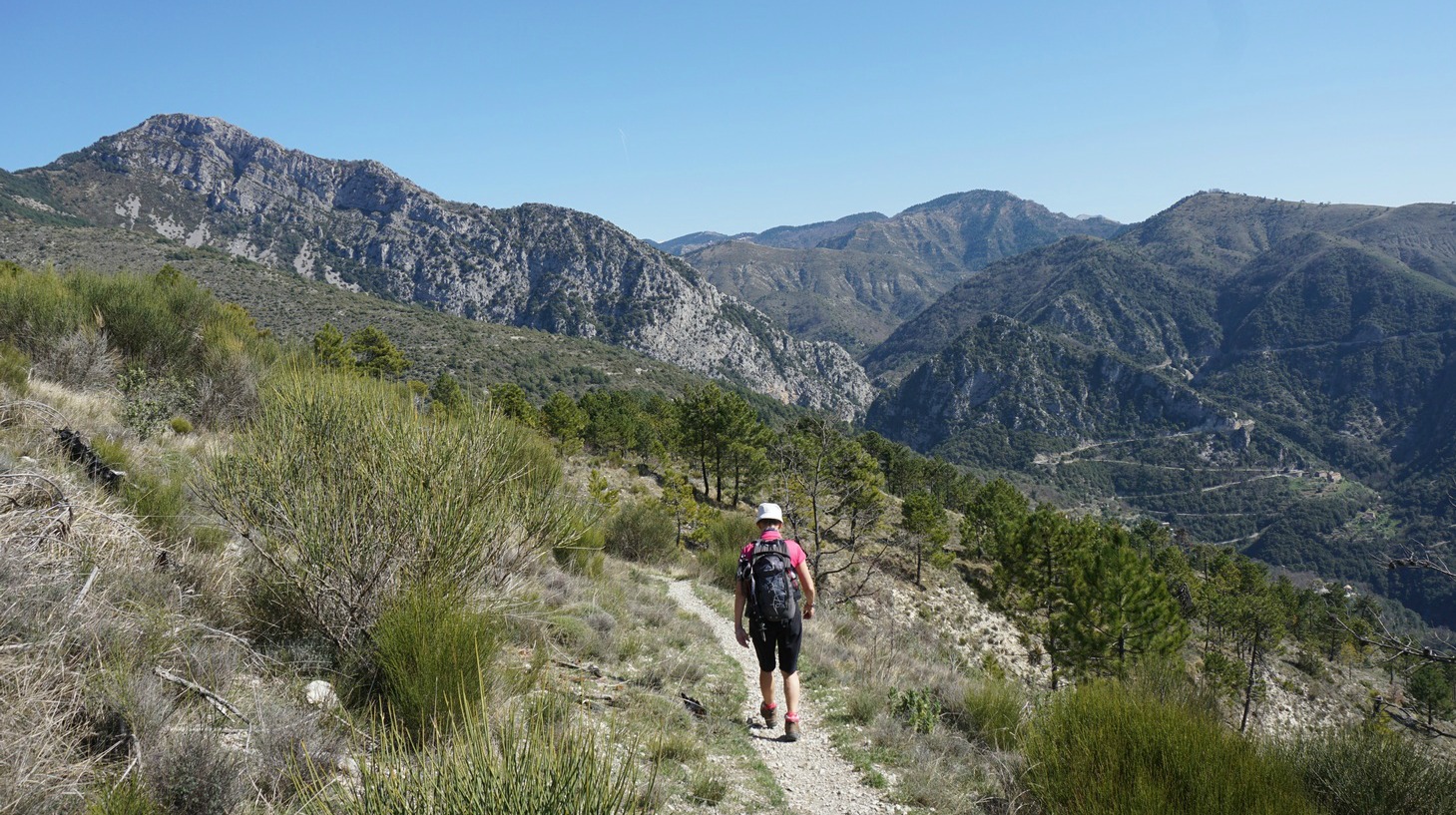
The mountaintop above Coaraze (620 m) in the Nice hinterland has a Nissart name: Rocca Sparvièra (1110 m), or the sparrow hawk rock.
Around the summit, there are ruins of an abandoned village from the 17th century. The medieval village has a dark history; diseases, murders, and a series of earthquakes in the 16th and 17th centuries that preceded the demise of this isolated hamlet. Legend has it that Queen Joanna I of Naples was hiding in the village because she was accused of having her first husband murdered. On Christmas Eve 1357, she went for a mass in Coaraze. Once back, she found her children, nanny and chaplain killed. She cursed the village, burned her castle there, and never returned.
When we tried to hike to Rocca Sparvièra a year ago, the trail was closed for some reason, and we ascended to nearby Mont Férion instead. Maybe there had been a landslide, we did not know. The trail is not recommended during or after heavy rain as a few narrow parts of the trail can become dangerous. In addition, the ruins of the village are fragile, and going under them should be avoided.
It was late March, temperatures soaring over 20°C with clear skies. We parked near the Coaraze entrance and ascended from signpost #200 by the RD15 road passing the blue chapel, then signposts #201 and 202. You can’t get lost on this trail. At signpost #203 we forked right and continued along a path straight north, circling above several gorges. Some parts were narrow, but nevertheless easy to negotiate. We even met some mountain bikers! We could nevertheless understand that on a rainy day the trail would be slippery. On the other hand, on a sunny summer day, it can get very hot during the ascent. We came to Col St-Michel (970 m), signpost #443 and a crossroads. Seen from here, the ruins of Rocca Sparvièra almost merged with the grey rock of the summit. The path to our goal circled the mountain’s steep western flank. It was said to be a bit aérien or precipitous, and some surefootedness was needed, but really nothing special. We reached Chapel Saint-Michel (1089 m) built in the 18th century, and the ruins of Rocca Sparvièra were just above us.
One wonders why people who built the village here in the middle ages chose such an isolated and steep mountain? Obviously one important reason was that it was easy to defend. However, it is not the only ghost village in the region. If you don’t like ruins, as there really isn’t that much to see, you will certainly enjoy the fantastic views from the trail and from the mountain top to Paillon and Vésubie River valleys and beyond.
Alternative routes up here start from Duranus in the Vésubie River Valley or from Engravin by the RD15 road above Coaraze.
We returned to Coaraze along the same trail.
Duration : 3h 50
Climb: 500 m
Map: “Vallées de la Bévéra et des Paillons” 3741 ET
The French Randoxygène guide has a description of this hike