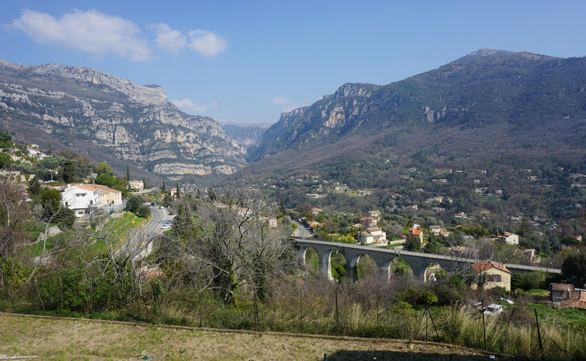
The mountaintop above Coaraze (620 m) in the Nice hinterland has a Nissart name: Rocca Sparvièra (1110 m), or the sparrow hawk rock.
Around the summit, there are ruins of an abandoned village from the 17th century. The medieval village has a dark history; diseases, murders, and a series of earthquakes in the 16th and 17th centuries that preceded the demise of this isolated hamlet. Legend has it that Queen Joanna I of Naples was hiding in the village because she was accused of having her first husband murdered. On Christmas Eve 1357, she went for a mass in Coaraze. Once back, she found her children, nanny and chaplain killed. She cursed the village, burned her castle there, and never returned.
When we tried to hike to Rocca Sparvièra a year ago, the trail was closed for some reason, and we ascended to nearby Mont Férion instead. Maybe there had been a landslide, we did not know. The trail is not recommended during or after heavy rain as a few narrow parts of the trail can become dangerous. In addition, the ruins of the village are fragile, and going under them should be avoided.
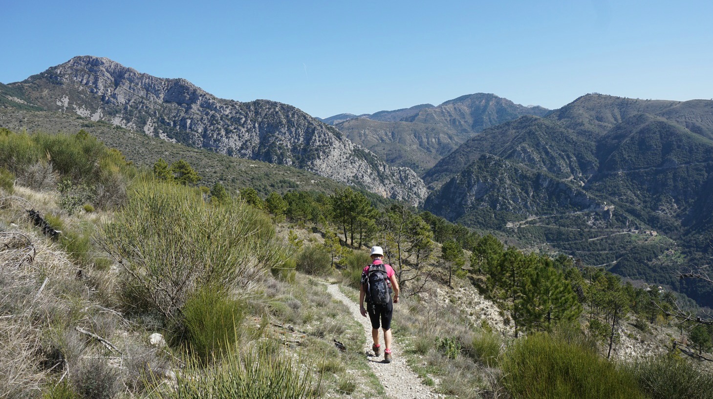
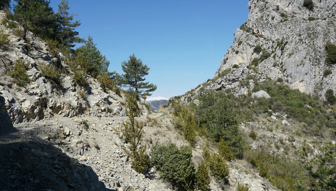
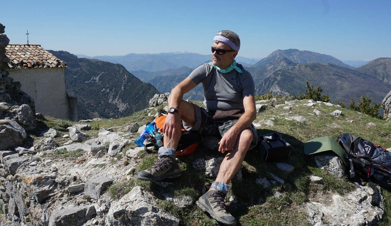
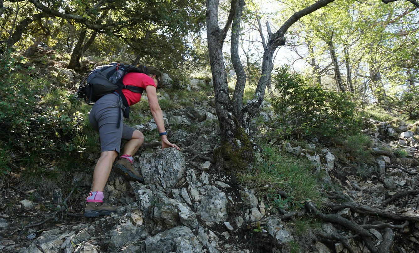
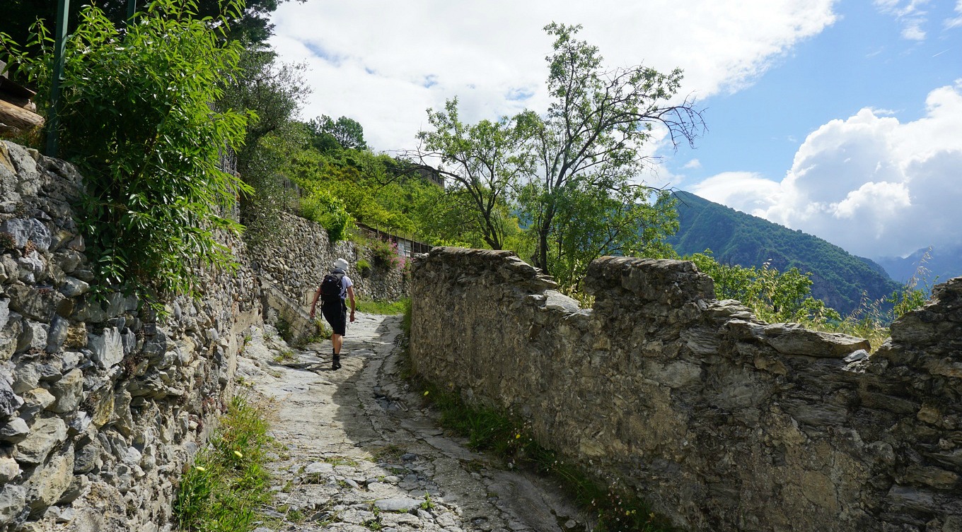
It was late March, temperatures soaring over 20°C with clear skies. We parked near the Coaraze entrance and ascended from signpost #200 by the RD15 road passing the blue chapel, then signposts #201 and 202. You can’t get lost on this trail. At signpost #203 we forked right and continued along a path straight north, circling above several gorges. Some parts were narrow, but nevertheless easy to negotiate. We even met some mountain bikers! We could nevertheless understand that on a rainy day the trail would be slippery. On the other hand, on a sunny summer day, it can get very hot during the ascent. We came to Col St-Michel (970 m), signpost #443 and a crossroads. Seen from here, the ruins of Rocca Sparvièra almost merged with the grey rock of the summit. The path to our goal circled the mountain’s steep western flank. It was said to be a bit aérien or precipitous, and some surefootedness was needed, but really nothing special. We reached Chapel Saint-Michel (1089 m) built in the 18th century, and the ruins of Rocca Sparvièra were just above us.
One wonders why people who built the village here in the middle ages chose such an isolated and steep mountain? Obviously one important reason was that it was easy to defend. However, it is not the only ghost village in the region. If you don’t like ruins, as there really isn’t that much to see, you will certainly enjoy the fantastic views from the trail and from the mountain top to Paillon and Vésubie River valleys and beyond.
Alternative routes up here start from Duranus in the Vésubie River Valley or from Engravin by the RD15 road above Coaraze.
We returned to Coaraze along the same trail.
Duration : 3h 50
Climb: 500 m
Map: “Vallées de la Bévéra et des Paillons” 3741 ET
The French Randoxygène guide has a description of this hike
Spaghetti Bolognese is a classic Italian dish known to everybody. But why not make a modern version of it by replacing the pasta with quinoa?
Quinoa is a gluten free and protein-rich seed. It is good for our hearts to eat as much as possible vegetable protein so that we can reduce animal protein in our diets.
4 servings
About 300- 350 g low-fat minced meat
2 tbsp. olive oil
2 shallots, chopped
2 cloves garlic, minced
50 ml red lentils
200 g good tomato sauce
2 tbsp. tomato purée
400 ml beef stock
2 tsp. provençal herbs
Black pepper
About 2 handfuls of grated parmesan
Parsley to decorate
For the quinoa:
About 200 g quinoa
About 1,2 l water
In a large casserole bring the water to the boil. Add the quinoa, cover and cook 20 minutes. Check the quinoa now and then; you may need to add some more water. When the quinoa is cooked, set aside and keep warm.
Meanwhile warm the olive oil over medium- high heat in a heavy casserole and start frying the minced meat. Reduce the heat to medium and add the shallots and garlic. Stir and cook for a few minutes.
Then add the red lentils, tomato sauce, tomato purée, beef stock, provençal herbs and black pepper. Bring to the boil, then cover and reduce the heat to slowly cooking. Cook for 20 minutes.
Divide the quinoa into bowls and top with Bolognese sauce. Sprinkle with grated parmesan and decorate with chopped parsley.
We call them the twin peaks. Dominating the landscape northwest of Nice, Pic deCourmettes (1248 m) and Puy de Tourrettes (1268 m) are connected by a col. We have climbed to Puy de Tourrettes several times, from Tourrettes-sur-Loup and Courmes.
This time we wanted to hike to Pic de Courmettes, the peak nearer the coast. Its western flank towards the Loup River Valley is very steep, making it more impressive.
The Randoxygène guide has recently added this hike in the guidebook. However, their version comprises the ascent from Courmes (630 m) and taking the same trail back. As we knew the region, we opted for a more interesting loop hike that continued straight north from the first summit to the plateau of Puy de Tourrettes. In addition, the steep section before Pic de Courmettes is always easier to climb than to descend. In other words, we climbed our twin peaks during the same hike!
The narrow but paved D503 road connects Courmes with the D6 road that runs along the Loup River Valley. The village has a surprisingly spacious parking.
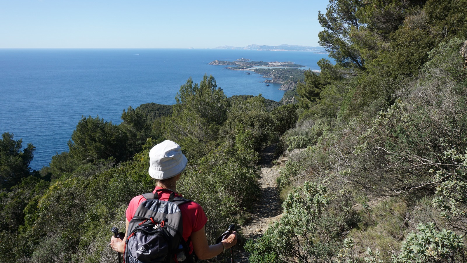
We started from signpost 88 right behind the parking, heading south along the GR51, gradually climbing along the wide trail. We came to a DFCI reservoir and a dirt road, and left the GR51 trail. We continued along the dirt track a bit, ascending to a clearing with nice views at about 940 m alt. Here, at signpost #80, we forked left (east) and climbed along the steep trail with sporadic yellow markings to the summit. In places, easy scramble was necessary. On a clear April day, we had great views down to the coast.
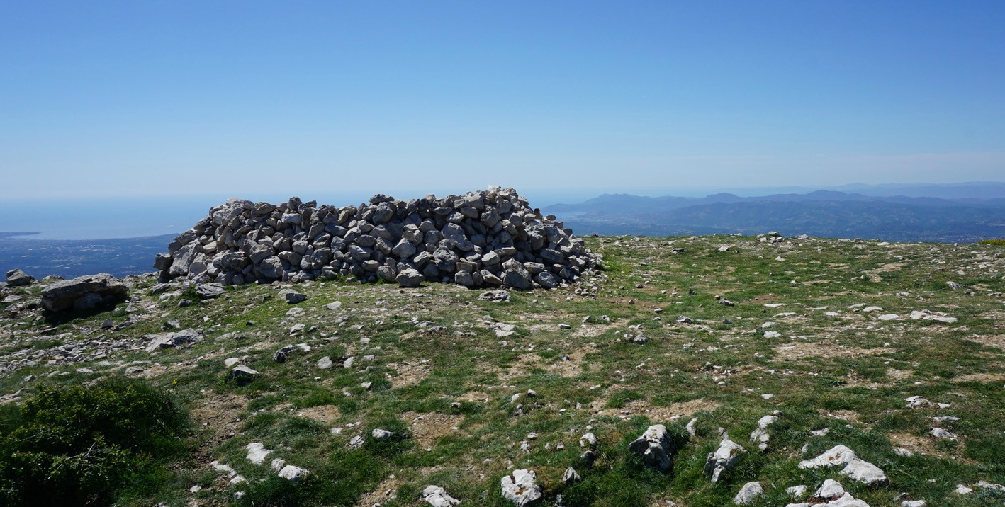
After a break, we continued straight north, with Puy de Tourrettes and its treeless southern face in front of us. We soon came to the saddle between the two mountains, and ascended along the well visible trail. Once on the summit plateau, the trail became less evident but you could walk almost anywhere. The summit was marked with a heap of stones. We did not go there, but headed NNW and soon came to the unmarked but frequently used trail that descended to the GR51 trail.
We continued along the GR51 south, and eventually came to a crossroads where we forked right, taking the signposted shortcut back to Courmes. The shortcut route then merged with the GR51 just before the village.
Duration: 4 h (walking time)
Total climb: 750 m -Note that the French guide claims that the climb to Courmettes alone is 730 m but in fact, as the climb from the village is continuous, the vertical climb to the summit is 620 m.
The eastern side of the Cap Sicié peninsula merges with Toulon’s suburb La Seyne-sur-Mer, while the southern end is in a natural state with high cliffs and forests.
The Chapel Notre-Dame du Mai was built in 1625 on the southern tip of the peninsula, and it is still a pilgrimage site. The 360° panorama from the summit (360 m) it simply stunning.
We started the hike from the little harbour of Le Brusc, ascending along the route to Mont Salva. The small road was first called Chemin de la Gardiole, then route de la Lèque. The trail was marked with yellow and white faded signs. There were sporadic “sentier littoral” signposts. The paved road changed to a dirt road higher up, and finally continued as just a path.
We reached a crossroads: The lower more “sportive” trail, and the higher “familial” trail that forked left. As this was still early March and the beginning of the season for us, we chose the easier trail. Even this one had a short steep section where easy scrambling was needed.
The weather was exceptionally warm with no wind. We stopped and changed into shorts, and the going was much lighter. We reached another crossroads on the ridge with no signposts, just a white sign painted on a rock. We headed east towards the chapel. The big telecom mast next to the chapel was already visible.
At the chapel, we were rewarded with a magnificent panorama. Needless to say, it was a perfect spot for our picnic. We used the same scenic route back to Le Brusc.
There were several ascents and descents during the hike, hence our GPS recorded 480 m total climb. The registered distance was nearly 14 km of which some 6 km comprised paved streets or roads. Total hiking time was about 4 h.
Raie au Câpres, skate with lemon-caper sauce and croutons, is a typical Parisian bistro dish. The following recipe is inspired by a dish cooked on the French TV’s Télé Matin.
As we seldom find skate in our shops in Nice, I have replaced it with pollock or whiting fillets. Any thin white fish fillet, which is not so tasty in itself, is suitable for this recipe. There is plenty of taste in the lemon-caper sauce! Skate wings are normally fried in butter, but I prefer to bake thin white fish fillets gently in the oven. You cannot fail white fish fillets by baking in the oven; about ten minutes in 200° C! 2 servings
2 thin fillets of white fish, such as pollock or whiting
3 tbsp. olive oil
2 tsp. capers
1 lemon, peeled and finely chopped
Freshly ground black pepper
Parsley
Croutons
Butter
Start by making the croutons. Preheat the oven to 200° C. Cut some bread, preferably whole wheat, into cubes and mix these with 1 tbsp. olive oil in a bowl. Line an ovenproof dish with baking paper and arrange the bread cubes in one layer on it. Bake for 5- 10 minutes until the cubes are golden. Set aside.
Generously butter an ovenproof dish and place the fish fillets in it. Transfer to the oven and bake for 10 minutes.
Meanwhile make the lemon- caper sauce. Warm 2 tbsp. olive oil in a small casserole over low heat. Peel the lemon and cut into small cubes. Add to the casserole together with the capers, black pepper and some chopped parsley. Warm gently over low heat.
While the fish is cooking in the oven and the lemon-caper sauce is warming in the casserole, wilt some spinach in a large casserole and microwave new potatoes.
When the fish is done, divide it on the plates and pour over the lemon- caper sauce. Decorate with croutons and serve with the spinach and new potatoes.
The medieval village of Saorge (510 m, 443 inhabitants in 2013) can be reached from Fontan in the Roya Valley. In ancient times, the salt route passed through Saorge. It is said that some 10000 mules travelled each year along this route towards Tende. In 1860, Saorge became French after a referendum, then occupied by Italy during WWII, and finally annexed to France in 1947.
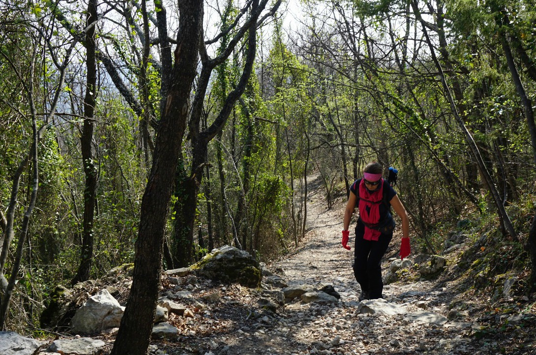
We parked at the entrance and walked through the village. Cars were not allowed here, but some locals used ATVs on the narrow streets. The village certainly has a special atmosphere as much of its medieval past has been preserved. The GR52A trail actually goes through Saorge, and we followed this. We soon reached the Franciscan Monastery Notre-Dame-des-Miracles on the outskirts of the village. The good and partially cobbled trail ascended to signpost #162. Here we forked left following the trail marked with yellow towards Peiremont and signpost #433 as recommended in the guidebook (Circuit de Peiremont). We soon came near some houses, flocks of sheep and dogs that weren’t too happy about our presence. We walked back to #162 and took the GR52A trail instead. The views down to the valley were better from this trail, too. We continued to signpost #163 and a bit further to Chapelle Ste-Croix. It was closed and looked very much abandoned. Here we took a break and assessed the deteriorating weather. We decided to turn back here. Signpost #433 would have been quite near albeit 200 m higher, and the optional Col de Peiremont a bit further at 1070 m altitude.
Based on this short walk, we recommend taking the GR52A trail both ways as the views are better and the trail is good. Doing the loop via Peiremont does not add much.
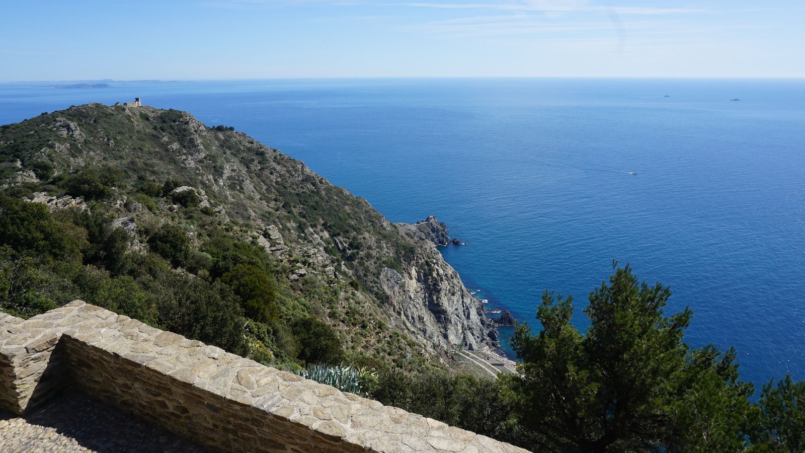
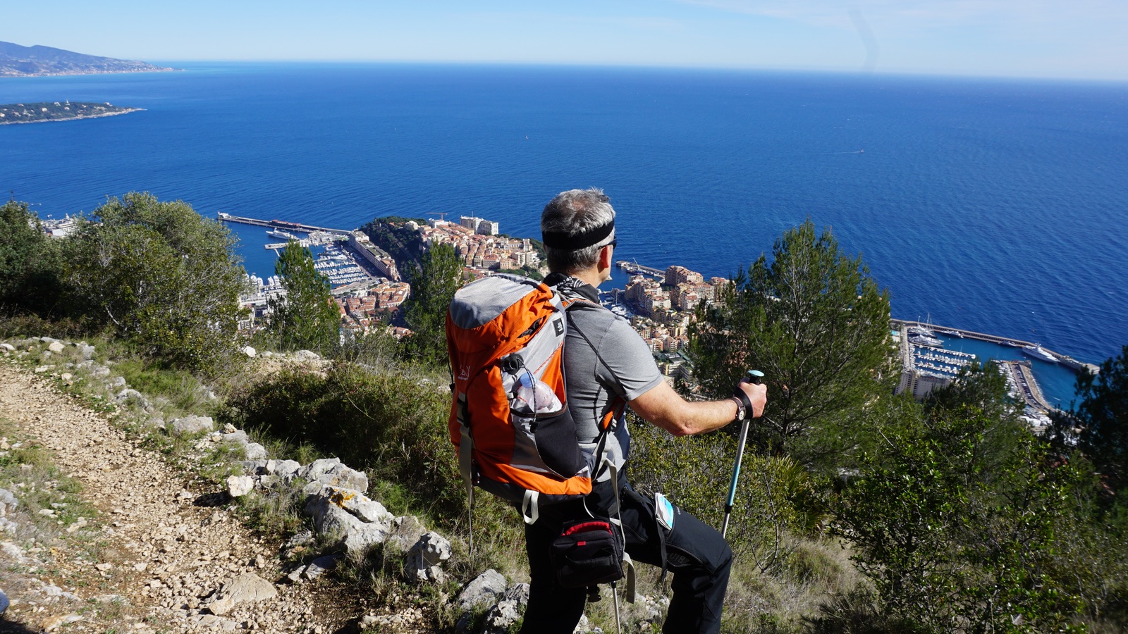
Tête de Chien (550 m) is a well visible landmark above Cap d’Ail and Monaco. From some angles the mountain resembles dog’s head, hence the name. A fortress was built on the summit in the 19th century, today there’s a telecom research centre (CNET).
The previous day’s weather front with rain, wind and low clouds was replaced by clear skies on the morning of our hike, and the night’s breeze had cleaned the air making the visibility unusually good.
The hike called Tour de la Tête de Chienoffers magnificent views towards Cap Ferrat, Cap d’Antibes and even the St Tropez peninsula further away in the west, and Cap Martin, Menton and the Italian coastline in the east. The views down to Monaco and Beausoleil are dramatic as the they are straight below you. We were even lucky enough to see the mirage of Corsica above the horizon.
We parked at the centre of Cap d’Ail (80 m) and started ascending along a narrow street called Chemin des Mimosas. We crossed the RD 6007 road (lamoyenne Corniche) at a pedestrian crossing (traffic lights), and followed a narrow street (chemin romain) before entering the trail proper. The signposts showed the itinerary, and we followed “Tour de la Tête de Chien” signs and yellow markings. On the way up, we had to cross the RD 37 road three times before heading east towards the mountain top. We passed a rock climbing wall and met a few trail runners. The trail was well maintained, climbing steadily but there were no steep or difficult parts.
After a break at the mountaintop, we continued straight north a few hundred meters along a paved road coming from La Turbie. We forked right (east) at the signpost and came to the other side of the ridge from where the trail back started. Signposts here were recently renewed. While descending, we had pretty dramatic views of the Principality below us. Even the high-rises, including the new Tour Odeon looked so small!
We descended rapidly towards Cap d‘Ail, and reached soon the first fancy villas of the Bautugan neighbourhood. We came to RD 6007, crossed it again and continued back to our starting point along the same route.
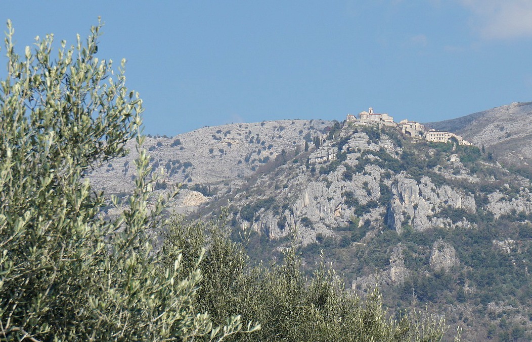
Bar-sur-Loup(310 m), our starting point today is a rather small village on the RD2210 road above Cannes. But Bar-sur-Loup has its festivities; right now they were preparing for the Orange Festival.
Our goal, the hilltop village of Gourdon(760 m) is totally different. We think it is a bit touristic, but it is nevertheless a nice spot for lunch on a warm and sunny day. On a clear day, the views to the coast are remarkable.
We parked in Bar-sur-Loup in the parking (290 m) by the RD2210 road. From there, we climbed through the old village to the Mairie and continued to Chapel St Claude (320 m). The loop hike is called Circuit du Paradis, and we followed the signposts to Gourdon. At the Chapel, the trail forked left (yellow signs) and started to ascend, eventually joining the GR51 trail (red and white signs). We continued north along the GR51, which at this point was wide and well maintained. After a while we crossed a small stream called Riou de Gourdon (a tributary of the Loup River) along a rather narrow iron bridge.
We soon came to the crossroads where we joined the Chemin du Paradis, continued ascending along this, walked over the Aqueduc du Foulon, a water pipe catering for the water supply of Grasse. From here, the ascent is somewhat steep all the way to Gourdon, our turning point today. We have made the ascent along Chemin du Paradis previously starting lower from Pont du Loup (about 200 m).
After lunch we descended along the same trail to the crossroads mentioned above, but now continued all the way down to the paved road near Pont du Loup, turned right (south) and walked back to Bar sur Loup (a small ascent). The signpost said 45 min but in reality it is an about 30-minute walk. You can follow this paved road all the way or fork right about 500 m before the village, following yellow marks. This route passes the graveyard and ends in the village centre.
Duration: 3h 30
Vertical climb: about 550 m from the parking by the RD 2210 road
Lately fast food has become very popular in Paris. When yet another hamburger restaurant was opened in Champs Elysees, there was a line! And a restaurateur from Barcelona has recently opened his fast food restaurant in France- with food made in Barcelona.
It seems to us that the French are forgetting their culinary classics. Steakmarchand de vin is a classic French bistro recipe, and in fact fast food at its very best; fait maison from local quality ingredients!
In this video clip we show how quickly and simply it can be cooked and served with microwaved or steamed new potatoes and green beans. Anyone can cookthis!
For two servings you need two nice fillet steaks, one shallot, one clove garlic, olive oil and butter, new potatoes, and about two handfuls of good quality fresh or frozen green beans. For the wine sauce you need a generous glass of red wine. Freshly ground black pepper and some fresh herbs add the final touch. For the steaks we chose tournedos, which in France come wrapped in a slice of lard. You can of course remove this on your plate. For the red wine we chose Château de Pampelonne.
First sauté the chopped shallot and minced garlic in olive oil in a small frying pan for about 10 minutes until soft. Set aside.
Wash the potatoes, top and tail the green beans if using fresh beans. Place the potatoes and green beans in their separate small microwave dishes with 1- 2 tbsp. water in each dish. Cover and microwave, about 5 minutes for the potatoes and 3-4 minutes for the beans. Set aside and keep warm.
In a heavy frying pan warm olive oil and butter over high heat. Cook the steaks for 3,5 minutes on each side for medium. Take care not to burn the steaks. After 3,5 minutes turn the steaks and pour the red wine in the pan. When the steaks are done, remove them from the frying pan and transfer on the warmed dinner plates. Cover with aluminium foil and keep warm.
Add the shallot and garlic in the bubbling red wine. Continue cooking until the wine is reduced to about half.
Pour the red wine sauce over the steaks and divide the potatoes and green beans on the plates. Grind over black pepper and decorate with fresh herbs.
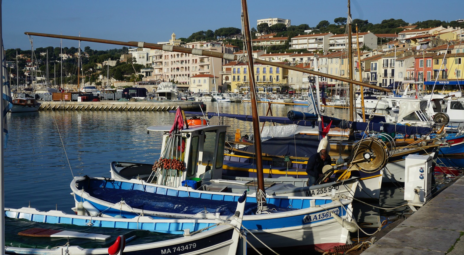
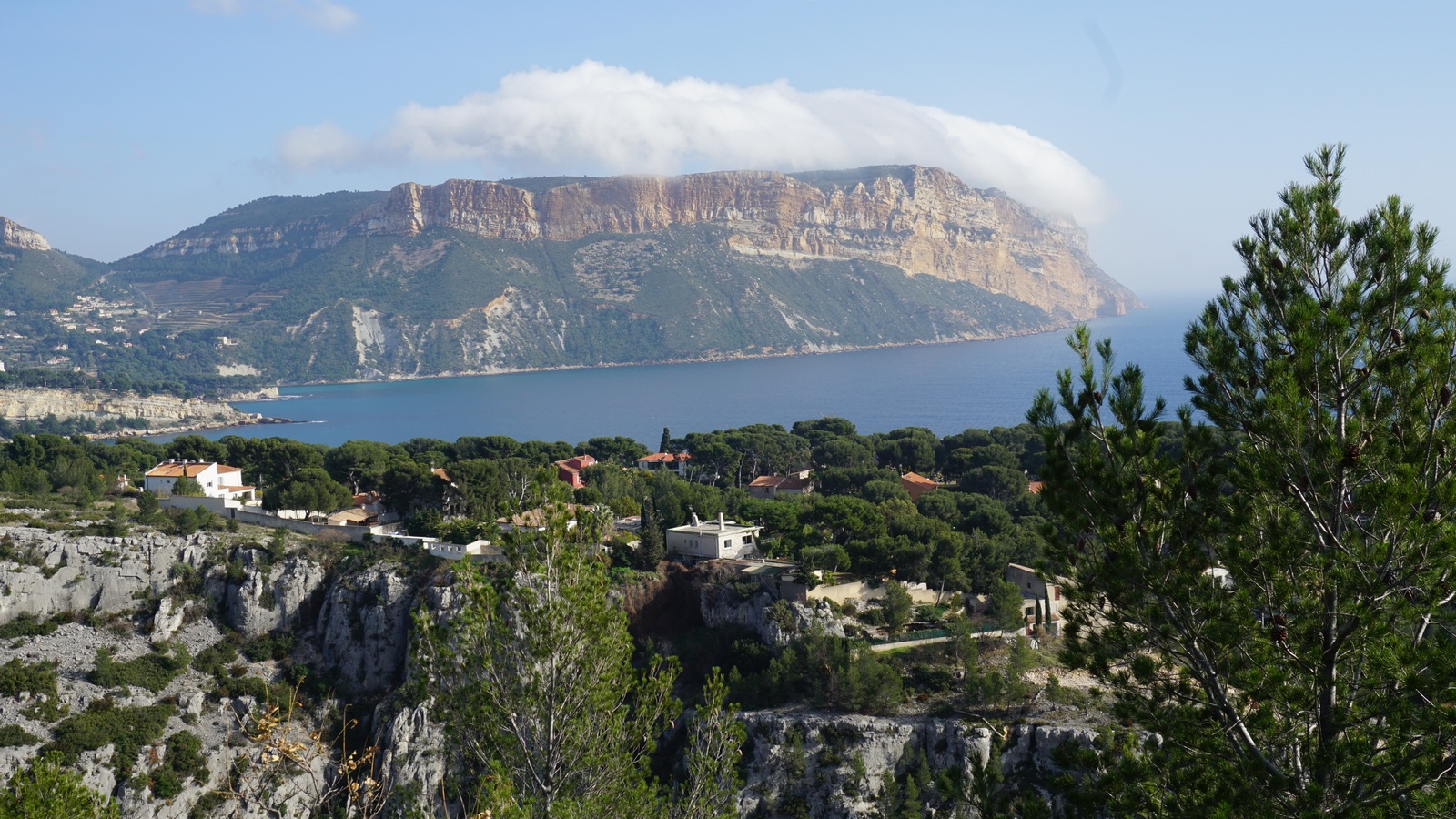
The little fishing port of Cassis about 17 km from Marseille has long lured painters. Dufy and other Fauvist artists painted here, and later Winston Churchill used to come here to paint. Quoting a recent Elle magazine, these days Cassis is said to be popular among chic Parisian media people. FranceTV2 Telematin showed a report of the local cuisine last summer.
Cassis is also famous for its white wines. There are several small wine shops in the centre of the town selling local wines. We visited Cassis in mid-February, and many of the shops were closed. We were lucky to find one which was open, and bought wines produced by Clos d’Albizzi, Domaine des Quatre Vents and CassisBodin 2015.
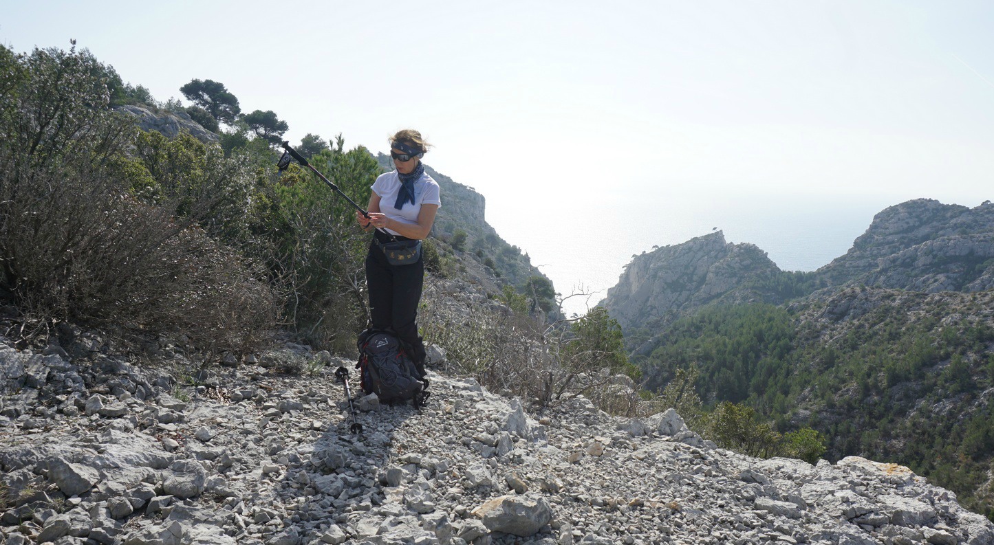
Massif des Calanques is situated between Cassis and Marseille. Now a national park, it is best known for its several calanques, fjord-like inlets with high limestone cliffs. On a glorious and warm day, we headed from the Cassis Port to Belvédère d’En Vau, a renown viewing point. We initially followed the GR98 trail. A trail map is essential even on shorter hikes. The GR trail is marked with the usual white/red, and other trails (that are numerous in the Calanques) with different colours. But signposts are pretty much non-existent.
From the port we followed the GR signs along streets to Port-Miou where the trail proper started. We made a short detour to Point de la Cacau admiring the pine tree covered peninsula. By the trail, we heard a weird breathing sound coming from under the ground. In fact, there was a fissure in the rock as far as to the sea, and incoming swells pressed the air through this opening. It’s even marked in the hiking map and called trou souffleur.
We continued along the GR 51/98 (also a green trail #8 in the map), climbing in the woods to about 180 m altitude. Here, at a clearing we crossed a blue trail #4. We followed the GR trail west. The trail now descended abruptly to Vallon d’En Vau where the GR merged with a dirt track. We forked right (turning left would have taken us directly to the Calanque d’En Vau beach) and followed the track about 800 m before forking left leaving the wider track. The trail -still marked with both white/red and green-took as rapidly to Col de l’Oule.
From the col, a wide trail now marked blue #2 ran south directly to our goal, Belvédère d’En Vau (170 m). Calanque d’En Vau, considered by many the most picturesque of all the Calanques, was right below us.
We headed back to Col de l’Oule, and chose to take a longer inland route back following first a trail marked with brown north. The trail soon merged with a dirt track (red, #7), and we walked along it as far as to Maison Forestière. Now heading back to Cassis, we forked right and followed a red trail #7a southeast to Auberge de jeunesse. From here, we followed an unpaved track down to Port-Miou. The last part of the hike followed the streets back to Cassis Harbour.
Duration: 5h 50
Climb: 528 m (our GPS data)
Length: 17.7 km
Map: IGN Les Calanques de Marseille à Cassis (9€50 at the Tourist Office)