Loop trail above Sigale


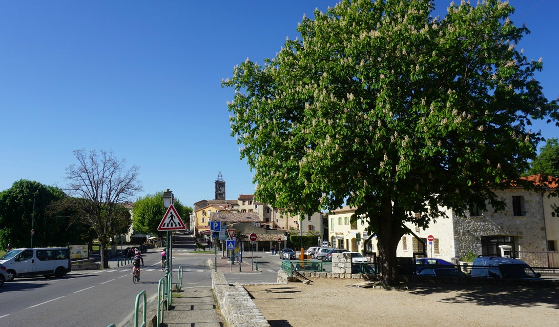
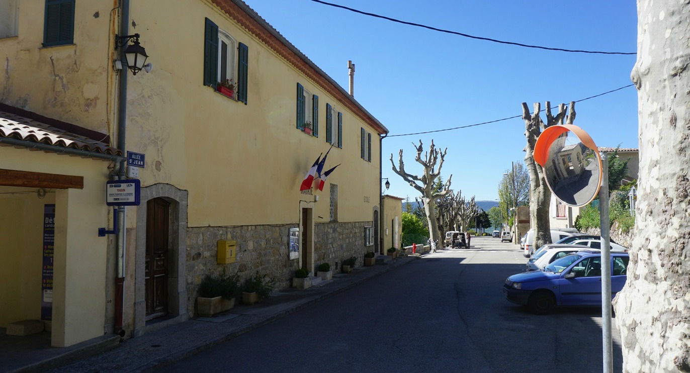
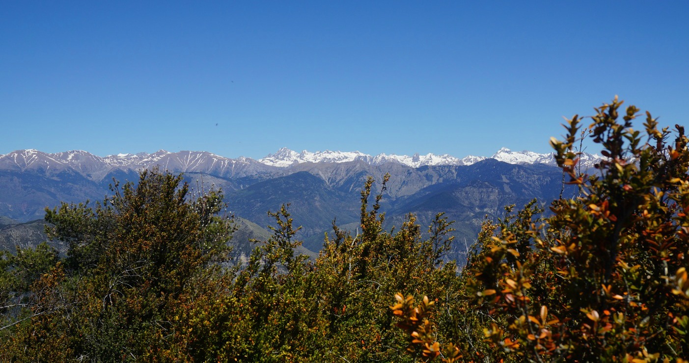
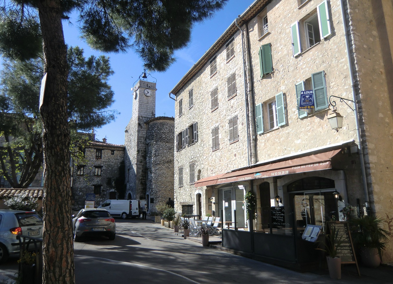
The tiny village of Sigale (630 m) is situated in the heart of the Estéron Valley about 1h 15 min drive from Nice. Sigale has its special charms, notably the clock tower which proudly dominates the valley. From the clock tower you have a nice view towards Cime de la Cacia (1105 m), and the Rivers Estéron and Riolan. But it is the summit of Cime de la Cacia and its super 360° panorama which today is our goal. It is the highest point of the loop called Circuit de la Cacia in the randoxygène guide.


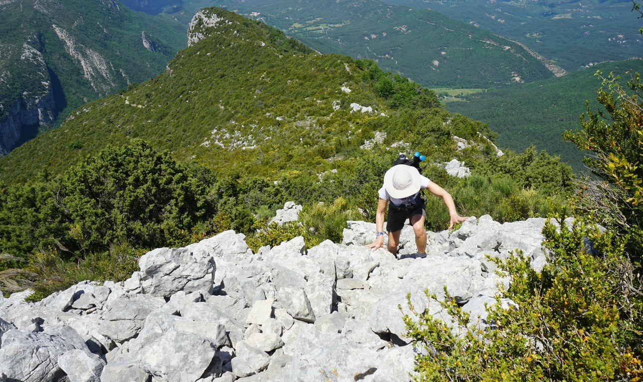
From the parking at the entrance of the village we started ascending from signpost #121. The wide trail that is also GR510 in the beginning goes to signpost #122. Here, our trail forked right (now yellow marks), leaving the GR510, and we ascended rather steeply to collet de la Cacia and signpost #136. From this point, we made a detour climbing straight east along the ridge to the summit of Cime de la Cacia, and reached the mountaintop after about 15 min.

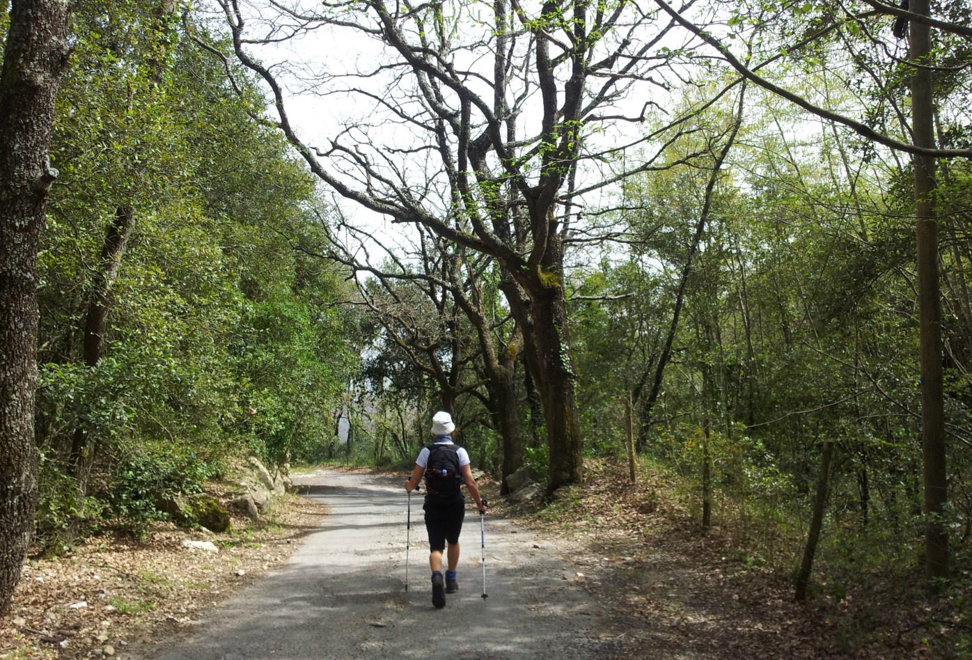
We descended back to signpost #136 and continued the hike by descending to signpost #135 on the northern side of the mountain. We soon dove into a beautiful forest (Bois de la Cacia). Once again, we could see the change in the landscape when coming to the northern side of the mountain ridge in the Estéron Valley.

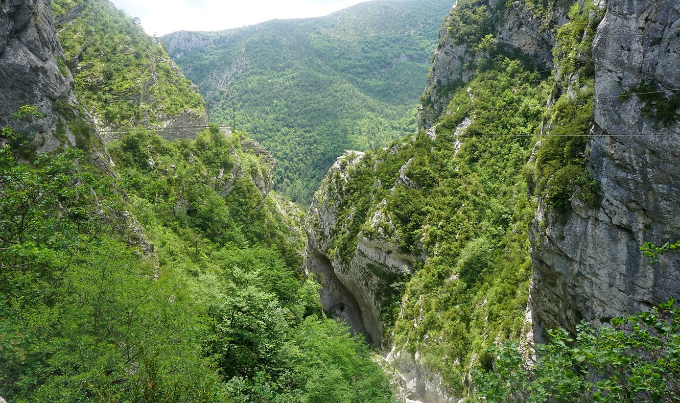
After a break at signpost 135 we continued straight west. Our trail first ran almost horizontally in the woods. Another trail descended to the north down to the Valley of Pali. This was not our itinerary, be aware! Eventually, we came to signpost #140 by the RD17 road above the gorge of the Riolan River(a tributary of the Estéron River). We walked along the road about one km admiring the spectacular views, and minding the traffic which was light. From the RD17 road, we forked right at signpost 139 and descended to the GR510 trail and walked along it back to the village.

Duration: 4h30

Vertical climb: 650 m

Map: IGN 3642 ET Vallée de l’Estéron Vallée du Loup

Provençal cherry bake

Provencal cherry bake


Near the end of April, cherry trees in Provence explode with white blossoms. In May and June dark cherries, cerises noires, are in season. A single cherry tree may produce about 50 kg fruit. Maybe this is the reason why cake recipes in the South of France contain much more fruit and much less flour than Northern European cake recipes.

The following easy recipe is a bake, clafoutis, and not a serious cake recipe. The clafoutis comes from the Limousin region and was traditionally made with dark cherries. The clafoutis can also be made with other seasonal fruit.

I have somewhat modified the original recipe from an old Provencal cookbook by baking it in small individual ramekins and by replacing Beaumes-de-Venise sweet fortified wine by orange juice. I have also replaced the traditional sugar decoration with a few fresh cherries.

For four ramekins

About 400 g dark cherries
2 eggs
4,5 tbsp. brown sugar, cassonade
2,5 tbsp. flour
A pinch of grated nutmeg, muscade
125 ml milk
4 tbsp. orange juice
Butter

Preheat the oven to 200 degrees Celsius.

Butter four ramekins.

Wash and dry the cherries. Save 16 cherries for decoration and remove the stones and stalks from the rest. Divide the pitted cherries in the ramekins.

In a bowl whisk the eggs, sugar and nutmeg. Then add the flour in small amounts and mix well. Add the milk and orange juice and mix again. Divide the batter in the ramekins.

Bake in the oven for 20- 25 minutes until the surface is nicely coloured, and a wooden pick inserted comes out dry.

Serve the ramekins at room temperature or cold. Just before serving decorate each ramekin with four fresh cherries.

The most perfect pasta sauce

The most perfect pasta sauce


In Colman Andrews’ book Flavours of the Riviera, the author describes a casual after-dinner conversation with the owner of Da Puny Restaurant in Portofino. The restaurant was, and still is, catering for well-to-do international guests to Portofino. The author got the busy restaurant owner talking about the real Ligurian cuisine.

During the conversation the restaurant owner revealed his opinion of the most perfect pasta sauce in the world. “You have to cook it on a boat. You catch some sardines, then you grill them right on deck. Then you put olive oil, capers and garlic in a pan-that’s all-and throw in the sardines. Put that on some pasta and you simply don’t need anything else. It’s the best.”

Well, here in Nice we don’t own a boat to catch some sardines, but we do often have very fresh sardine fillets in our local supermarket. So I decided to give this simple recipe a try.

Here is my recipe based on the description of the dish. Is it “the best in the world”? That is for everyone to decide, if you have access to really fresh sardines.

2 servings

About 250- 300 g very fresh sardine fillets
3 tbsp. olive oil
1 clove garlic, minced
4 tsp. tasty Italian capers
Whole wheat spaghetti for 2 servings
Fresh chives to decorate

Preheat the oven to 200 degrees Celsius.

Clean the sardine fillets with kitchen paper and lightly brush with olive oil. Grill them in the oven for 10 minutes.

Meanwhile cook the spaghetti until al dente. Heat the olive oil in a frying pan over medium heat and saute the minced garlic. Add the capers and the grilled sardines.

Drain the pasta and divide in two bowls. Divide the pasta sauce over the spaghetti and decorate with chives.


The ridge above Séranon

View from the summit of Bauroux above Séranon


The 6085 road north from Grasse is called the Route Napoléon. It was built in the 1930s to commemorate the Emperor’s journey in March 1815 after his escape from Elba. St-Vallier-de-Thiey (720 m) is the first small town after Grasse. It makes a nice stop before driving further. The RD 6085 road continues to the rather touristic Castellane and beyond, but we left it after about 30 km and turned right to the Provençal village of Séranon (1100 m).

Séranon is one of the villages in Moyen Pays where you can start your hike at over 1000 m altitude. We found a big parking at the village entrance, just after the roundabout. We then walked about 300 m to the village centre. Today’s hike is called Crête du Bauroux in the Randoxygene booklet. The highest point (1644 m) on this trail is the summit of Bauroux in the easternmost part of the over 3 km long ridge overlooking Séranon.


We found the signpost #192 next to the mairie. The first part of the trail was also GR510 heading west and climbing gently. At signpost #214 we forked right. The trail ascended more steeply directly to signpost #194 and the ruins of the Vieux Séranon (1320 m). After descending about 30 meters at the crossroads of several trails, we took the one heading east in the forest. We walked on the northern side of the ridge on a good path, and had views only to the north. The trail made several short ascents and descents. Only when we approached the summit, we left the forest below us and could enjoy the panorama.

From the summit, we descended steeply in a north-easterly direction. The trail was good all the way but at this stage it was good to have the poles. We came to Col Bas and signpost #182, then #181. We crossed the D80 and 79 roads and followed the trail that ran beside a field to the village of Caille (signpost #180). From the village, we walked along the D79 road about 400 m, then turned right at signpost #197, and followed a wide trail that led back to Séranon.

Duration: about 4 h 30

Climb: about 600 m

Map: IGN 3542 ET Haut Estéron

Asparagus ramekins

Asparagus ramekins


The individual small vegetable ramekins served with your main course are classic Riviera style. The following green asparagus ramekins are great to serve with steaks, chicken or fish and some new potatoes. You can of course choose some other vegetables and herbs for your ramekins.

2 servings

8-10 thin green asparagus spears
A small handful of minced parsley
2 eggs
1 tbsp. flour
2 tbsp. crème fraîche 15 % fat
About 30 g crumbled goat cheese, chèvre
2 tbsp. pine nuts
Freshly ground black pepper
Butter for the ramekins

Preheat the oven to 180 degrees Celsius.

Wash and dry the green asparagus. Cut away the bottom tough parts and peel the spears. Cut them into 3- 4 cm long parts and quickly microwave 2 minutes. Dry on kitchen paper.

Wash and dry the parsley, then mince it.

Butter well 2 ramekins and divide the green asparagus in them. In a bowl whip 2 eggs with 2 tbsp. crème fraîche. Add the black pepper, then slowly the flour and mix well. Add half of the parsley and the crumbled goat cheese and mix well.

Divide the mixture on the asparagus. Divide the rest of the parsley and the pine nuts on top. Bake in the oven for 25 minutes.

Hike above Toudon in the Prealps of Côte d'Azur


The Riviera back country, Moyen Pays, is magnificent hiking terrain in spring. The days are longer, the trail normally dry, the Mercantour high mountain summits still snow-capped, and the nature is awakening with flowers blossoming and birds singing.

Today’s hike started from the tiny and quiet village of Toudon (970 m) overlooking the Estéron River Valley. The mountains here are part of the Côte d’Azur Prealps. The day was beautiful with blue skies in late April. It took about one hour to get there from Nice, first along the RM 6202 road, them RD 17 to Gilette. From here the sinuous RD 227/27 road forked right and ascended rapidly to about 800-900 m.
We drove past the villages of Revest-les-Roches and Tourette-du-Château, and reached Toudon rapidly.


We parked near the mairie. The hike is called Cime des Collettes after the summit along the trail. It is also the highest point (1513 m) of this hike. From the first signpost #61 opposite the mairie the trail ascended steeply passing some houses to signpost #62 in the woods above the village. From here, we forked left ascending gently to signpost #90 and to a plateau called Sebairons. After this, the landscape changed, the trail got narrower and rockier. It was the most adventurous part of the trail. Some sure-footedness was needed before Baisse des Collettes at 1269 m and signpost #91. We continued along a good trail in the forest on the northern flank of the mountain. The scenery and flora there was so different from the dry almost arid southern face of Cime des Collettes.

To reach the summit, we took a short and easy detour from the main trail at signpost #92. The summit was round, with some low maquis vegetation and a 360° panoramic view. Heading back to the village, we re-entered the southern face of the mountain again, and descended in l’adret de la Clappe to signpost #63 then back to #62, and to the village.

Vertical climb: 550 m

Walking time: 3h 30

Map: IGN 3642 ET Vallée de l’Estéron

Villa Ephrussi de Rothschild Gardens

Villa Ephrussi de Rothschild


The Villa Ephrussi de Rothschild was built in 1912 for Baroness Ephrussi-Rothschild who had unlimited wealth and refined tastes. To make the gardens in front of the villa the baroness had a small hill removed and then had tons of earth brought back for the gardens.

We visited the gardens on a quiet Tuesday in early May after the roses were celebrated during the weekend with La Fête des Roses et des Plantes. In May all the gardens were in season.

There are nine gardens with a different theme reflecting the baroness’s travels around the world.

The Spanish and Florentine Gardens in the beginning of the itinerary were truly impressive. The beautiful Japanese Garden was recently renovated by Japanese gardeners.

But I think that the Rose Garden at the farthest end of the area was the most beautiful part of all, especially in May when the roses have their peak flowering season.


There were stunning views towards the Villefranche Bay and towards Beaulieu and the Mediterranean Sea on the other side of the St-Jean-Cap-Ferrat peninsula. After admiring the roses, we wandered to the Exotic Garden with its magnificent cactuses.

The garden tour ended in the French Garden in front of the villa. After waiting a few minutes, we could enjoy musical fountain show.

We had lunch on the terrace of the villa. The plat du jour was a tasty chicken breast served on a bed of ratatouille. It was decorated with an edible flower to continue the garden theme.

After lunch we visited the incredible villa and watched a short film about the building of this marvelous site in the Belle Epoque.

Côte de veau, veal chop, with polenta

Côte de veau, veal chop with polenta


Côte de veau, veal chop with polenta


Preparation time:
Cooking time:
Total time:

It is here in France that I have discovered côtes de veauveal chops. In our supermarket in Nice they are approximately the same size as pork chops, weighing about 150- 180 g each. Veal chops have consistently been tasty and tender.

In the following recipe, which I have somewhat modified from a recipe in a French magazine, the veal chops are first quickly fried in a pan and then baked in the oven. Veal needs to be well done to achieve its tenderness. If you cannot buy veal chops in your area, you might try this recipe with pork chops.

French veal fond helps to make a quick sauce. I usually choose Marmite Fond de Veau and add some crème fraiche 15% fat, minced shallots and white wine for a tasty sauce. Polenta can now be cooked in a few minutes with milk and a pinch of salt, just follow the advice on the package. Serve with frozen microwaved green beans.

2 servings

2 nice veal chops, côtes de veau, about 150-180 g each
A small package Marmite veal fond, fond de veau (or similar)
250 ml water
100 ml white wine
1 shallot, minced
2 tbsp. crème fraiche, 15% fat
Freshly ground black pepper
1 tbsp. butter
1 tbsp. rapeseed oil, huile de colza
Parsley or chives to decorate

Preheat the oven to 180°C

In a heavy frying pan, warm the butter and rapeseed oil over medium-high heat. Fry the veal chops about 2,5 minutes on both sides until golden brown. Transfer to an oven-tray, and continue baking in the oven 15 to 20 minutes. In a small sauce pan warm the water until almost boiling, then reduce the heat. Add one package of Marmite Fond de Veau and whip until completely dissolved. Continue simmering and reducing, mixing now and then.

In a separate small sauce pan, bring the white wine and some black pepper to the boil. Add the minced shallot and reduce the heat to simmering. Continue simmering until the wine is reduced to about half. When the veal chops are done, add about half to ¾ of the reduced veal fond into the wine sauce and mix well. Whip in the crème fraiche and keep warm.

Divide the veal chops, polenta and green beans on the plates. Pour the veal fond-wine sauce over the veal chops and grind over some black pepper. Decorate with chives or parsley.

Airplane wreck above Tourrettes-sur-Loup

Rockwell Commander wreck Puy de Tourrettes in background


We have previously made several good hikes from Tourrettes-sur-Loup such as Circuit de Pié Martin, the ascent to Col de Vence, and to Puy de Naouri.

This time we ascended from the village in search of an airplane wreck.

In July 1980, a Danish registered single-engine plane OY-CAY crashed below the summit of Puy de Tourrettes (1268 m). According to an aviation safety site, the pilot survived the crash. There were no passengers. The plane in question was a three-year old Rockwell Commander 114. What exactly happened is not described. I was certified to fly the Rockwell Commander 112 in the late 70s, hence the additional interest. The plane had very nice handling qualities. The main difference between the two was the engine size: -112 had a 200hp powerplant whereas the -114 had 60hp more.

Based on pictures of the wreck, and some French hiking web sites, I could pinpoint the location. The wreck is also visible in Google Earth.


We started from the centre of Tourrettes-sur-Loup (400 m) along a paved road called Route de Caïre. It ascended steeply passing the last houses. Eventually, a guesthouse Bastide de la Source (820 m) with impressive surroundings was reached. The paved road ended here. The trail now continued ascending steeply, zigzagging in the mountain slope. After about 1h 50 after the start, we came to a crossroads at a plateau (about 1030 m). From here, one marked and signposted trail continued straight(north) to St Barnabé, the second turned right(east) to Puy de Naouri. The third trail that forked left(west, pictured) was unmarked and not shown on the map, but there were cairns. Clearly it continued towards the summit of Puy de Tourrettes.

From the said crossroads, I knew that the heading to the Rockwell wreck was about 250°, and the distance 910 m. The direct route seemed to be a bit rocky. We therefore chose to follow the trail heading west about 400 m, then forked left and started to look for the wreck that was lying at 1085 m elevation.

We first found parts of the tailplane and the fin. The fuselage was a bit higher, about 150 m northwest, lying with the nose downhill. It was surprisingly well preserved after almost 36 years. There were no signs of fire. The engine was long gone and not much was left of the interior.

Needless to say, it was a bit sad to see a great plane ending up here. We descended back to Tourrettes-sur-Loup along the same trail.


Total ascent: 700 m

Duration: 4 h


Trail image courtesy of Google Maps


Short loop above Tourrettes-sur-Loup

Two baous Tourrettes-sur-Loup and the trail


The village of Tourrettes-sur-Loup (400 m) about 6 km from Vence is known as artists’ village, but it has also been known for the cultivation of violets for over a century. The end of the violet harvest is still celebrated every year, in the end of February or early March, by the Fête des Violettes.

It was a grey but warm April day. As we walked past the Bastide aux Violettes, the museum dedicated to violet cultivation, we decided to visit it on the way back.


The walk started from the centre of the village. We first ascended about 2 km along a narrow paved road in the residential area of St-Martin west of the village centre. Signposts and yellow marks along the trail guided us well, the hike is called Circuit de Pié Martin.

The trail forked right where the paved road ended and continued in an evergreen forest, notably comprising chênes verts, holly oaks. We glimpsed a small deer crossing the path and admired a hawk above us. We saw several diggings of wild boars on the path. What a contrast it was viewing the busy Riviera not so far away!

Eventually, at about 800 m altitude, we hit a dirt track running horizontally in the southern flank of Pic de Courmettes (1248 m). We turned right and followed the track about 300 m until we came to the next signpost showing the way back down to Tourrettes-sur-Loup. First the trail was a wide track leading to Pié Martin, a plateau with great views to the Riviera coastline, Tourrettes-sur-Loup, and Vence. After the plateau, a narrower and rockier but still a good path descended rapidly back to the neighbourhood of St-Martin.

In Bastide aux Violettes, we learned the many uses of violets; in perfumes, for medical purposes, in sweets and jams, as decoration of gourmet dishes, and of course bouquets that once used to be very fashionable.

Walking time: 3 hours

Vertical ascent: 450 m

Map: IGN 3643 ET “Cannes Grasse Côte d’Azur”