Picnic in the perfume garden of Grasse

May rose rosa centifolia


Grasse has been the capital of the perfume industry for more than two hundred years. In the centre of Grasse you can visit theVilla-Musée Fragonard. The villa has recently been beautifully restored, and was reopened this April. The International Perfume Museum  gives you a chance to discover perfume’s history.
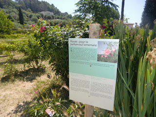
Information along MIP gardens olfactory route


Unfortunately not much perfume flowers are grown in these days in and around Grasse. Some rosa centifolia, May rose, is still grown in Grasse. Also some jasmine, tuberose, violet and mimosa are grown in the region. Grasse grows roses only for Chanel, Dior and Jean Patou.

Jasmine

The International Perfume Museum’s Gardens (The MIP’s Gardens) were created in Mouans- Sartoux to preserve the heritage of perfume flower growing. You can stroll through the gardens at your own pace.


“The Olfactory route” let’s you discover the fragrances and notes used in the perfume industry.You can place you hands on the fragrant foliage and smell the flowers that are near the path.
Scenic view in the MIP gardens

The May rose with its deep pink colour turned out to be my favourite flower in the garden. It was now early June, and the May rose was at the end of its flowering season. The scent of May rose was rich and sweet. It is harvested in May and early June.


Also some jasmine was still flowering and lavender was just starting to flower, but on the whole the garden looked tired and showed signs of the dry period. It seems that May is the best time for a visit when the May rose is in full flower. Its peak flowering season of course varies from year to year.
The MIP gardens picnic area
.


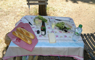
The picnic in the shade of the cypress trees was the highlight of the visit. We had prepared a picnic basket at home before leaving. On the menu we had salmon and scallop paté, duck paté, baby salad leaves, goat’s cheese, freshly baked baguette, chilled Kriter crémat (French sparkling wine) and chocolate mousse. All the tasty products were bought from our local supermarket. It turned out to be a perfect early summer picnic.
Our picnic table in MIP gardens


Opening hours of the MIP’s Gardens: Spring-summer from 10 a.m. to 7 p.m.

Regular price: 3€, during exhibitions 4€. Free parking.

Address: 979 Chemin des Gourettes, Mouans- Sartoux.


NB! If you cannot prepare your own picnic basket, ELLE Magazine recently recommended the restaurant Le Dit- Vin in Grasse
(lunch menu at 15 and 19€).  We can also recommend L’Amandier in Mougins (lunch menu 19€).

Col de Turini


Hôtel des trois Vallées


The most magnificent forests in Alpes-Maritimes are situated around Col de Turini (1604 m), although the mythic mountain pass is better known from the Monte Carlo Rally. The special stage from la Bollène-Vésubie up to Turini is one of the most famous rally stages in the world. Drive the road yourself and you’ll get the feeling.
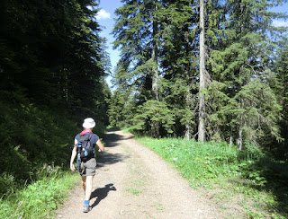
Easy descent from Col de Turini along GR52A

Today, however, we came here to explore the nature. The hike starts from the parking of col de Turini next to the Hôtel des Trois Vallées.


Several fallen trees on the trail created extra challenge
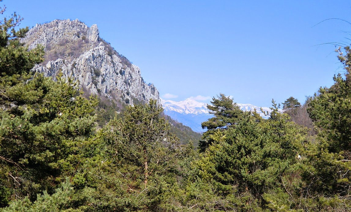
Start descending from signpost 195 along GR52A along a wide forest road. After 45 minutes, the trail leaves GR52A, forks left in the forest and starts ascending. The trail here is good, but was obstructed by several fallen trees. The mountaintop of Cime de Suorcas (1516 m) is reached in about 50 min. In spite of the “modest” altitude the views were great even though the coastline was not visible because of the haze.  After having visited this little summit the trail continues east along a forested ridge passing two mountaintops called Tête de Gaglio (1568 m) and Tête de Francha (1608 m). Near the latter peak, there was a short steep section where metal ladders and a rope had been attached to facilitate the climbing.
Approaching Cime de Suorcas

Hazy view to northwest from Cime de Suorcas


The trail continues east, passes a hut and crosses the D2566 road. The last ascent goes to Cime de la Calmette (1786 m) before descending back to the starting point along a good trail. Follow the path east (yellow marks) after passing an abandoned ski lift, then turn northwest to signpost 32 from where the starting point is reached in a few minutes. Our descent seemed to coincide with the cows’ descent back to col de Turini. They were on their own, and seemed to follow their internal clock!
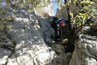
Easy scramble near Tête de Francha


After the hike we enjoyed coffee and blueberry tart at the terrace of the Hôtel des Trois Vallées. Inside, you can find lots of pictures from the famous moments of the Monte Carlo Rally.
Our companions back to Col de Turini


This is a super hike in variable surroundings. In the excellent guidebook published by Rother: “Alpes Maritimes Les 50 plus belles randonnées”(In French) the hike is graded as easy. In fact, most of the trail does not pose any difficulties.  Even so, some parts were a bit steep and some scrambling was needed (pictured). We would classify the hike medium/red because of this. You also have the feeling of having climbed more than the 450 m
Coffee and blueberry tart at Hôtel des trois Vallées
as the trail had several ascents and descents!

Duration:          4 h


Vertical climb: 450 m


Map: IGN TOP 25 Vallée de la Bévéra 3741 ET


Image of the map (Rother Guide)


Map image courtesy of : Rother Guide de randonnées: “Alpes Maritimes Les 50 plus belles randonnées”

Saint-Ser Vineyard and Montagne Sainte-Victoire

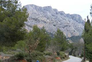
Montagne Sainte-Victoire seen from Relais de Saint-Ser


The massif of Sainte-Victoire comprises different plateaus between 400 and 1000m. It is about 8 km east
Relais de Saint-Ser seen from the southern face of Montagne Ste-Victoire
of Aix-en-Provence and dominates le pays d-Aix. It is famously known as Paul Cézanne’s favourite local subject and he must have painted it over fifty times.


The steep southern face of Mont Sainte-Victoire changes colour from grey to pink according to light and time of day. When driving from Aix-en-Provence east, take the D17 road (also Route Cézanne) which winds in the traditional Mediterranean countryside. We took this route in late March admiring the view of the mythic Sainte-Victoire immortalized in Cézanne’s paintings.
The vineyard Domaine de Saint-Ser


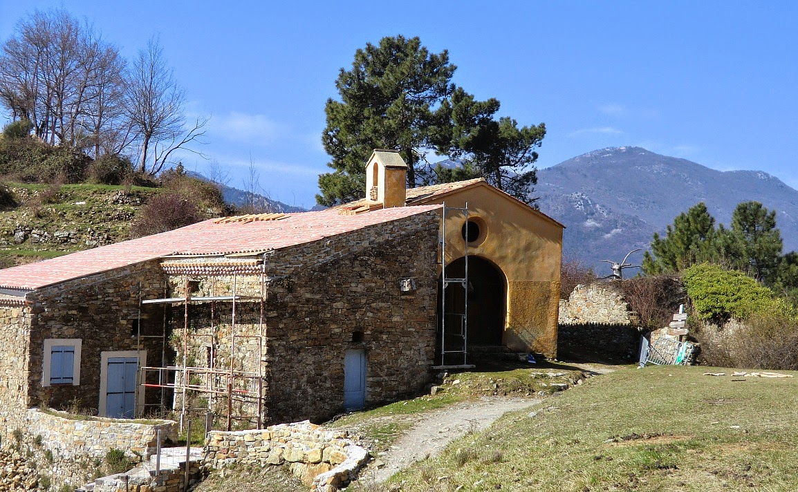
We drove as far as to Le Relais de Saint-Ser, where we had booked two nights. The hiking trail to chapel  Saint-Ser (624 m) and Pic de Mouches (1011 m) goes right behind the parking of the hotel (400 m). This was one of the reasons why we booked here, the other being that this small auberge is known for its excellent restaurant. It was situated in the middle of the beautiful and quiet nature, the rooms were newly renovated and we were happy with the dinners.


The first day turned out to be rainy and cool, in spite of the favourable forecast a week or so earlier. We therefore explored the surroundings by car. Our first stop was the nearby vineyard Domaine de Saint-Ser. This is the highest situated vineyard of the almost thirty vineyards that have obtained the AOC Côtes de Provence Sainte-Victoire. After tasting, we opted for Cuvée Prestige Rouge 2010 (a blend of Grenache, Syrah and Cabernet Sauvignon) and purchased six bottles at 12,50 € each.
Montagne Sainte-Victoire Cezanne's favorite object


After the vineyard, we drove to Puyloubier, then along D10 past Vauvenargues to Aix-en-Provence. The northern face of Montagne Sainte-Victoire is less steep and the D10 road winds in a woody landscape.
Easy path to the chapel St-Ser


The next day we woke to blue sky and warm sunshine. From the parking of our hotel at 400 m, we started following a good path marked with red signs. After just about 40 minutes we reached the chapel of Saint-Ser restored in 2001. Every May the pilgrimage of Saint-Ser honours the memory of the hermit Servius who was said to be living in the small cave nearby. From the chapel, you already have a superb view down to the valley.
The chapel of St-Ser

A steep ascent in a couloir above the chapel St-Ser


It had been an easy walk up to the chapel, but after this the ascent became steep. After some scrambling we arrived at a truly steep part. As we did not have any climbing experience, we did not wish to take any further risks in spite of a chain that was permanently attached to the rocky wall. So we descended back.
At the crossroads of the trails well below the chapel,
we decided to explore the other ascending trail marked with blue and green signs. We ascended to a steep couloir which continued as a steep and narrow ridge. Again, we did not feel comfortable continuing any further. From the map it seemed that we were not far from the summit Pic des Mouches when turning around. Now we understand why ascending along one of the trails from north is much more popular!


In spite of this, we enjoyed the great views and the sunny spring day!


Seafood risotto with a twist

Risotto with scallops

Risotto with scallops recipe


Last September at the Mougins Festival of Gastronomy I had the pleasure of following Emmanuel Lehrer demonstrating his risotto with scampi. During the demonstration he mentioned that the recipe works also with scallops, coquilles St. Jacques.


The following recipe is my twist of Lehrer’s risotto. Mine was less colourful than his risotto because I don’t know anything yet about edible flowers. But it was nevertheless delicious even without the flowers and the Castelmagno cheese.


I coated he scallops with whole almond powder, Vahiné Amandes complètes en poudre, which gives a nice colour and can be bought in our local supermarket in Nice. This powder can easily be made from brown almonds or hazelnuts. A few drops of olive oil sprinkled over the scallops give extra nice appearance because the short baking time does not add any colour to the almond or hazelnut powder.


2 servings
Preparation time:
Cooking time:
Total time:


8- 10 scallops, coquilles St. Jacques
About 10 tsp whole almond or hazelnut powder
Olive oil to sprinkle over the scallops

For the risotto:

120 ml risotto rice
700 ml vegetable stock (you may not need to use it all)
2 tbsp olive oil
1 shallot, minced
1 clove garlic, minced
150 ml white wine
100 ml freshly grated parmesan
Freshly grated black pepper
A generous amount of minced dill and a few sprigs for decoration
½ organic lemon, cut into small pieces and zest for decoration


First make the vegetable stock. Set aside and keep warm. In a heavy casserole warm the olive oil over medium heat and sauté the shallot and garlic for about 5 minutes. Stir in the rice until well coated with oil.


Then start adding the wine in batches and cook, stirring, until the rice has absorbed most of it. Then start adding the vegetable stock, ladle by ladle, stirring constantly and not adding more until the previous addition has been almost absorbed. There should always be a little stock in the casserole. Preheat the oven to 180⁰ C.


Continue cooking and stirring continuously the rice for about 25 minutes. The rice should be now creamy but still a bit al dente. Stir in the pepper, dill, parmesan and lemon pieces, and adjust the consistence. Keep warm.


Place the scallops on an oven tray covered with baking paper. Cover each scallop with 1 tsp almond powder and sprinkle a couple of drops of olive oil over each scallop. Bake in 180⁰ C for 4 minutes.


Divide the risotto in bowls or risotto plates and place the scallops on top. Decorate with sprigs of dill and lemon zests.


NB! It helps if you have someone to help by stirring the risotto in the final phases while you cook the scallops.


Corsica: The coastal trail between Barcaggio and Tollare in Cap Corse


The coastal trail called the Sentier des Douaniers (customs officers’ path) in the northernmost tip of Cap  Corse runs from Macinaggio to Centuri. The trail is quite long and many prefer to walk just one part of it. The section between Barcaggio to Tollare at the very tip of the peninsula is considered the most picturesque by many. It is possible to walk from Macinaggio to Barcaggio and take the boat back.
Goats on the D253 road to Tollare


Cows roaming free on Sentier des Douaniers in Cap Corse


The path from Barcaggio to Tollare

Sentier des Douaniers in Cap Corse


 We drove to Bargaccio and explored the trail to Tollare. The walk takes just 45 min one way. It is an easy coastal footpath with minimal ascent. In April, the sea was still too cold for a dip. The D253 road down to Barcaggio is pretty narrow and winding. The other option, D153 is a bit wider. Both connect with the main road (D80) at Ersa. Animals are omnipresent on small Corsican roads and footpaths, take care!
Spring flowers in Cap Corse


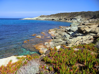
The coast near Tollare in Cap Corse


Fiadone, Corsican cheesecake

Fiadone Corsican flan


On our recent trip to Corsica we had several times fiadone as dessert. It was delightful, light with a distinct lemon taste and never too sweet. Fiadone could be described as a kind of flan without pastry case. The Americans would call it cheesecake without pastry bottom.

At home I found several Corsican fiadone recipes. Some were made with vanilla, some with Corsican eau de vie. In those versions we had in Corsica I only tasted the lemon. But all recipes stressed that authentic fiadone can only be made of Corsican fresh brocciu, although some mentioned that you can use ricotta if you cannot find brocciu in your region.

Here in Nice we can easily find brocciu in supermarkets. The following recipe is my twist of fiadone. I serve it straight from individual ramekins, which makes this simple dessert even easier to make.

4 servings

200 g fresh brocciu
2 large eggs
2 tbsp sugar
½ organic lemon, zest and a little juice
Butter for the ramekins

Preheat the oven to 180⁰ C.

Place the brocciu in a bowl and crush with a fork. Wash the organic lemon and zest half of it. Mince the zests and mix with the brocciu.

In another bowl whisk the eggs, sugar and a little lemon juice until foamy. Add the brocciu and mix everything until well blended. Generously butter the ramekins and divide the egg-brocciu mixture into them.

Bake for 25- 30 minutes until golden brown. Let cool. Cover and refrigerate until ready to eat. Fiadone can be made a day before serving.

Fiadone tastes especially good covered with fresh sliced strawberries.

Monte Stello in Corsica


Monte Stello (1307 m) above Erbalunga is a popular summit in Cap Corse. The ascent is not technically
The hamlet of Pozzo
demanding, but it is very long. The total ascent from the hamlet of Pozzo (277 m) is not negligible at just over 1000 m.


The trail is well marked with orange and also red signs after the Bocca di Santa Maria pass (1097 m). Even on good paths in Corsica it is advisable to wear long trousers because you are in the maquis.

The path from Pozzo ascends in maquis

After passing the last houses of Pozzo, follow a small unpaved road for a few hundred meters. The signpost shows the start of the trail that ascends first steeply sometimes in dense vegetation. You eventually reach the Bocca di Santa Maria pass from where you already have a superb view to the Bay of St Florent in the west, and a small village of Olmeto. From the pass the trail initially descends a little
Is this a wild orchid?
before turning north ascending towards Monte Stello. The summit offers a great panorama over Northern Corsica and even the Island of Elba was visible above the haze.


We descended along the same trail. There is an alternative slightly longer descent via the village of Silgaggia. In that case you have to walk along the road the last 2.4 km to your starting point in Pozzo. This optional route in particular is recommended only in good visibility.

At Bocca di Santa Maria pass with Bay of St Florent in background


Monte Stello in sight


Total hiking time 6.5 h
Corsica's highest snow-capped mountains seen from Monte Stello

Total ascent: 1040 m


Map: IGN Cap Corse 4347 OT

Le Grand Mont -the highest coastal mountain on the Riviera


Ascending on the western side of le Grand Mont


Le Grand Mont (1379 m) or Grammondo as the Italians call it is about 6km from the Mediterranean Sea.
The Chapel of St Bernard
It is situated right at the Franco-Italian border and is considered the highest coastal peak on the Riviera. The descending trail is for the most part on the Italian side. The ascent to this dominating mountain is long but does not require any technical skills.


We have previously began the ascent from the narrow road (310 m) leading to Castellar, but this
time we decided to drive as far as to Castellar (340 m) and start from there. Either way, the first part of the ascent is quite long and strenuous.
Ruins of Morga


From the parking at the entrance of the village, ascend along a steep mostly paved road to Col St-Bernhard. This part of the trail is in fact the same when hiking to Roc d’Ormea.
Mercantour summits seen from Colla Bassa


The chapel of Col St-Bernhard has got a new roof recently, but otherwise the restoration is still continuing. Just before the chapel turn right and ascend to the nearby ruins of Morga. From this point, continue ascending along the GR52 trail which later joins a forest track north to Colla Bassa at 1110 m.
Easy scramble to Le Grand Mont


At Colla Bassa turn right and start ascending to Le Grand Mont. Follow closely the yellow signs from this point. Just before the summit, the trail gets steeper and requires some easy scrambling. Some patches of snow were still present in late March.


You suddenly meet the summit on the Franco-Italian
The very last push to the summit of Le Grand Mont
border. There’s an iron cross. On a clear day, you have a great panorama, but on our day there was so much haze that you could barely see the coast. It has to be noted that one should not do this hike in poor visibility.


Continue to the summit on the Italian side, also marked with a cross. From there, descend along a crest to a third cross. The clearly visible trail
The summit of Le Grand Mont on the Italian border
eventually turns west then south descending gently on the Italian side under the mountain ridge and the border.


You will soon come to Pas de la Corne where you’ll cross the border back to France. The trail from here is clear and well marked passing the ruins of Vieux Castellar. Soon after the ruins you reach the same road used on the way up.
Descending on the Italian side of Le Grand Mont


Total ascent from Castellar: 1040 m

Duration: 6 h

Map: IGN 3742OT Nice-Menton Côte d'Azur


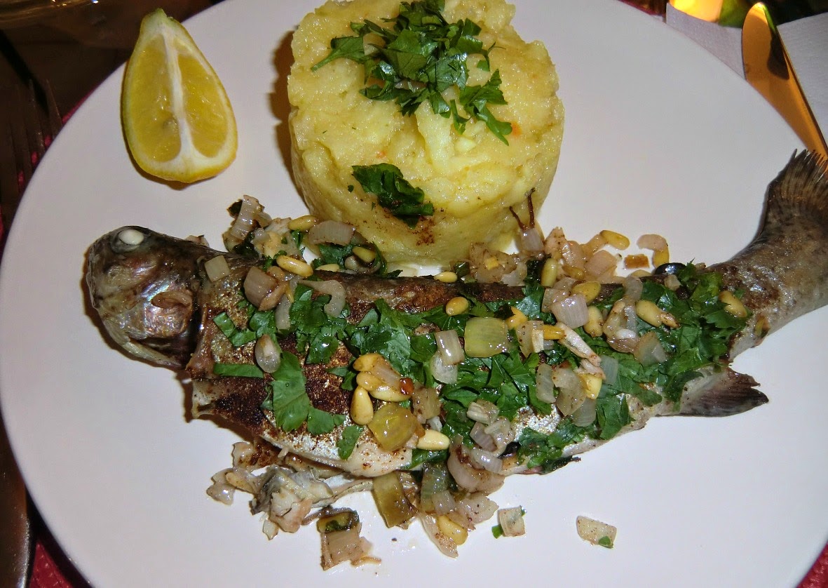
Spicy trout with parsnip pure

Spicy trout with parsnip pure


The French spice mixture quatre-épices was developed in Saint-Malo. It is a mixture of ground cinnamon, ginger, clove and nutmeg so it is easy to create if you don’t find it in your shop. Here in France it is sold in all supermarkets.

As Saint-Malo is famous for its fish and seafood one would think that quatre-épices goes very well with them. However it is not that often one can see fish and seafood recipes with quatre-épices.  So when I came across a trout recipe using quatre-épices I was eager to try it.

The following recipe is my adaptation of that recipe. Saint-Malo is a “butter and milk” region, but I have replaced them with olive oil and vegetable stock according to the Mediterranean tradition. Quatre-épices gives an unexpected twist to this very tasty dish.

2 servings

For the parsnip pure
500 g parsnips
500 ml vegetable stock
2 tbsp olive oil

For the fish
2 small trouts in portion size
2 tbsp rapeseed oil
A handful of chopped parsley
2 small shallots, chopped
½ tsp quatre-épices
2 tbsp pine nuts
50 ml white wine
Lemon wedges to serve

Peel the parsnips and chop them coarsely. Cook them in vegetable stock until soft. This takes about 45 minutes. Keep covered and warm.

In a large frying pan warm 2 tbsp rapeseed oil over medium heat. Fry the trouts for about 5 minutes on one side until golden brown. Turn the trouts and add the pine nuts and chopped shallots in the pan. Sprinkle the quatre-épices over the trouts and cover them with chopped parsley. Continue frying for 5 minutes.

Pour the white wine in the pan. Reduce the heat a little, cover the pan and simmer for 10 minutes. Meanwhile add 2 tbsp olive oil to the parsnips and mash them into a nice pure.
Arrange the trout and pure on the plates and serve with lemon wedges.


Island of Sainte-Marguerite outside Cannes

Leaving Cannes to Ste-Marguerite


Northern shore of Ste-Marguerite

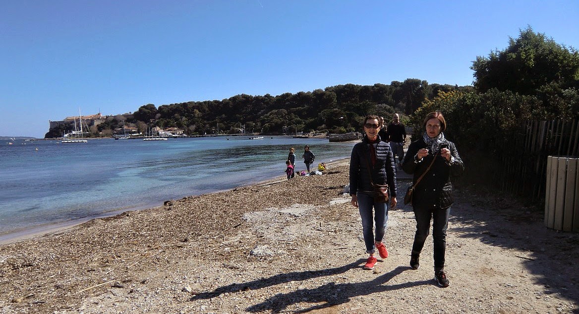
The two islands Ste-Marguerite and St-Honorat, known as Îles de Lérins, are at only 15 and 30 min ferry rides away from Cannes, respectively. Ferries leave from quai Laubeuf in the Old Port. The smaller and quieter St-Honorat has been owned by monks since the foundation of the monastery in 410 AD. Today we visited the larger island Ste-Marguerite (Ferry 13,50 €) and made a two-hour walk also described in the French Randoxygène
Aleppo pines in Ste-Marguerite
guide.


There are some restaurants and snack-bars at the picturesque harbour of Ste-Marguerite. We were informed already when purchasing the ferry tickets that all of them were still closed in early March.  We were prepared for this with some refreshments and opted for a late lunch in Cannes after the visit. This turned out to be a good choice as we found a small
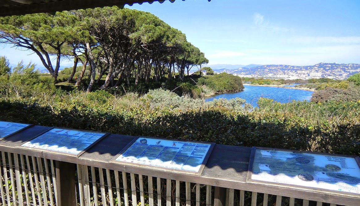
Étang du Batéguier Cannes in background
bistro in the old port. They had an excellent three course lunch menu for just under 19 €! In Cannes, you can apparently  have a Sunday lunch as late as 3 pm.


Many French people seemed to bring their picnic to Ste-Marguerite, and there were tables along the path. That would have been another nice option on this sunny albeit a bit windy day.
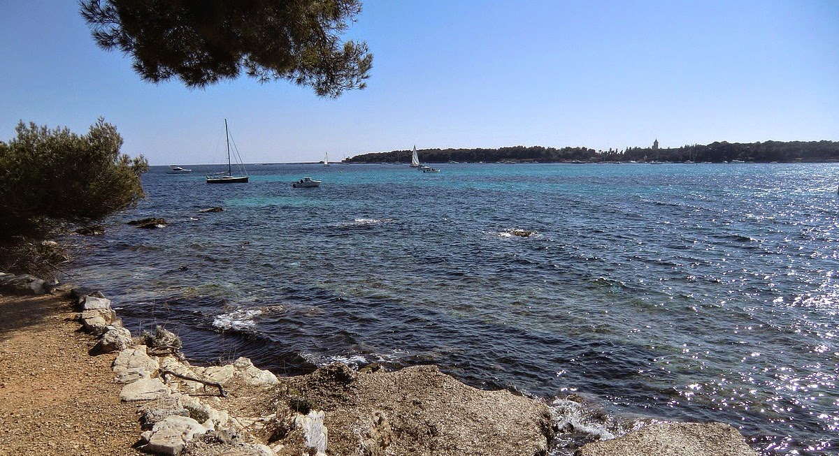
Ile St-Honorat seen from the southern shore of Ste-Marguerite


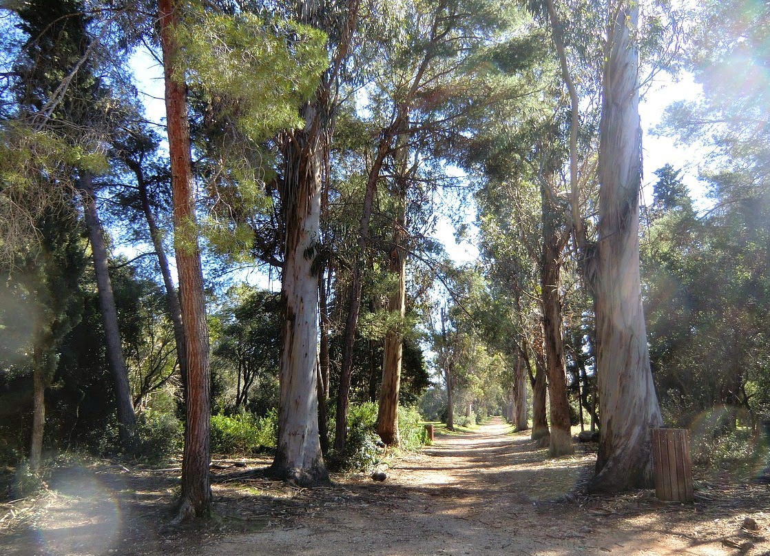
The walk starts from the harbour following the unpaved road to the western tip of the island. The trail goes around Étang de Batéguier, a brackish water pond surrounded by a wood of Aleppo pines. Continue along the southern shoreline to Maison Forestière. At this intersection, turn left and walk along the allée des Eucalyptus back to the harbour.
Southwstern shore of Ile Ste-Margueirte
The walk is pretty short, but you could continue as far as the eastern point of the island and back along the good network of trails.


The main tourist spot on the island must be the Fort Royal. This is yet another fort improved by Vauban during the reign of Louis XIV. The main attraction here is the maritime museum and the prison cell said to have held the mythical Man in the Iron Mask.
The eucalyptus alley in Ile Ste-Marguerite